
Toulouse Audio Tour: A Stroll through Amidonniers Jewel Box
Under Toulouse’s candy-pink rooftops lie secrets as intricate as the city’s labyrinthine alleys—a place where samurai gardens bloom beside sites of whispered rebellion. This is your invitation to uncover Toulouse through a self-guided audio tour, finding hidden stories and places even lifelong locals overlook. What storm of controversy once shook the banks at Quai Saint-Pierre? Which ancient codes linger among the cherry trees in the tranquil Japanese Garden? Why did rival students once turn TBS Education into a stage for a scandal few dared to repeat? Feel history ripple beneath your feet as you walk vibrant riverbanks, wander through hushed Zen oases, and unravel conspiracies buried within grand facades. Discover a Toulouse alive with drama and unexpected beauty—every corner awaits with untold surprises. Unlock these layers for yourself. Begin your journey now and explore the secret side of Toulouse that only those who dare to look beneath the surface ever find.
Tour preview
About this tour
- scheduleDuration 80–100 minsGo at your own pace
- straighten3.5 km walking routeFollow the guided path
- location_on
- wifi_offWorks offlineDownload once, use anywhere
- all_inclusiveLifetime accessReplay anytime, forever
- location_onStarts at André-Brouat Sports Palace
Stops on this tour
lock_open 3 free previews · 9 unlock with purchase
In front of you is a low glass-and-metal ellipse, its broad curved facade sweeping in one unbroken arc beneath a planted roof that softens the whole building into the…Read moreShow less
Open dedicated page →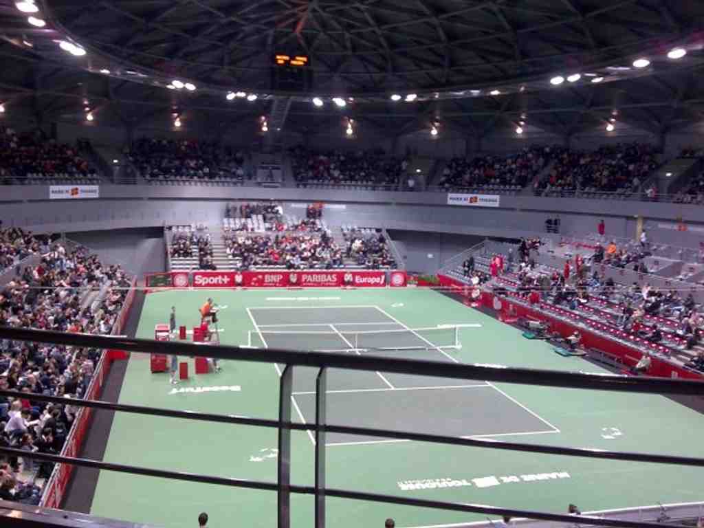
André-Brouat Sports PalacePhoto: Bgstar81, Wikimedia Commons, Public domain. Cropped & resized. In front of you is a low glass-and-metal ellipse, its broad curved facade sweeping in one unbroken arc beneath a planted roof that softens the whole building into the landscape.
Stand here for a moment and let that smooth curve do its work, because this calm exterior sits on unsettled ground. Toulouse often practices urban reinvention not with grand speeches, but with places like this one: a useful building, a public room, a patch carefully repaired after a blow. That matters here, because this sports palace occupies the site of an earlier palace from nineteen eighty-three, and that older hall disappeared in the aftermath of the A-Z-F explosion. So our walk begins with a fact you can feel under your feet: memory, damage, and rebuilding layered in the same plot of land.
The current hall opened in two thousand and six. It carries the name André Brouat, and he was exactly the sort of local figure French cities like to remember when they name a public building. He played at centre for Stade Toulousain and won the French championship in nineteen forty-seven. Later he led the club as president, then served Toulouse as deputy mayor for sport. He was also a doctor, a civic leader, and even a poet. The local press once painted him as athletic, literary, and worldly all at once. Rather a full life, you might say, for one name above one door.
What stood here before had a far sharper personality. Architect Bernard Bachelot gave the nineteen eighty-three palace a dramatic “diamond point” form. Some admirers loved its boldness; critics said it looked like a spiked helmet. When the city decided it had to go after A-Z-F, people argued not only about safety and loss, but about whether Toulouse was erasing a piece of its recent face.
The replacement chose another language entirely. Architect Jean Guervilly aimed for discretion: an ellipse of glass with almost nothing to snag the eye. Even so, this quiet building hides a very noisy story of compromise. Most visitors never realise the budget first announced at thirteen million euros climbed to twenty million. Better sound insulation, the connection to the smaller sports hall beside it, and a long list of technical finishing choices pushed the cost upward. That is how rebuilding often works in real life: not only cranes and concrete, but negotiations over acoustics, safety, and details nobody applauds.
Look upward in your mind, because the roof tells another chapter. It is planted with vegetation, conceived as a garden to be seen from neighbouring buildings, and it counted as a pioneer in France when the hall opened. Reaching it is hardly graceful: a stair under the structure, a vertical ladder, a hatch, then a careful walk across the dome clipped to a safety line. Elegant from afar, rather stubborn up close.
Inside, the hall now serves mostly handball and volleyball, with room for thousands. On the first handball match here, the atmosphere became so stifling that people compared the building to a municipal greenhouse, and staff had to open several doors just to get the air moving. Even a new beginning, it seems, needs a little time to learn how to breathe.
And perhaps that is the question this place leaves with you: when a city repairs a wound, should it recreate what vanished, or choose a different shape and live with the arguments? Keep that thought as we continue toward the Compans-Caffarelli Garden, about three minutes away. In this district, even the newer walls stand on deep layers of remembrance.
On your left, look for a broad landscaped park shaped by straight paths, a large water basin, and a distinctly Japanese-inspired composition set within the…Read moreShow less
Open dedicated page →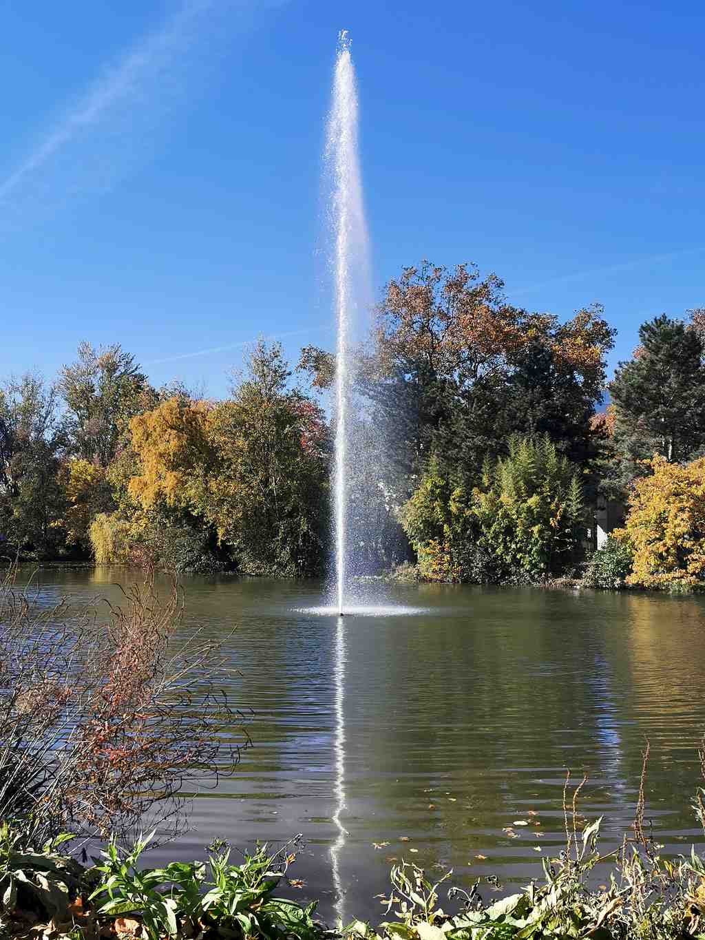
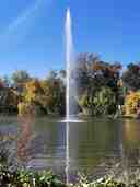
Compans-Caffarelli GardenPhoto: Didier Descouens, Wikimedia Commons, CC BY-SA 4.0. Cropped & resized. On your left, look for a broad landscaped park shaped by straight paths, a large water basin, and a distinctly Japanese-inspired composition set within the greenery.
Compans-Caffarelli Garden is not simply a patch of calm in the district; it is a deliberate act of reconversion, a planning word that means giving old land a completely new civic purpose. Here, that change was dramatic. The army had abandoned the Compans and Caffarelli artillery barracks, and from the early nineteen seventies the city folded this ground into a coordinated redevelopment district, turning a closed military enclosure into the public heart of a new business quarter.
If you glance at the image on your screen, the elevated view makes that strategy easier to grasp: this is a large urban composition, not an accidental park. And another image helps you imagine the site’s layered past, where barracks once stood where people now stroll. Names matter here. Cities often store memory in labels long after walls disappear, and “Compans-Caffarelli” kept the old military names attached to the land even as its function changed completely. Later, the Japanese garden inside took on the name Pierre Baudis, the mayor who pushed this project forward. He admired Japanese gardens on his travels, especially in Dublin, and that private taste quietly shaped a new public identity for Toulouse.
An elevated view of the garden’s layout, useful for showing the contrast between the former barracks site and today’s large urban park.Photo: Shishirdasika, Wikimedia Commons, CC BY-SA 4.0. Cropped & resized. The city’s own gardens department designed this place in nineteen eighty-one, and a Toulouse company built it, so this was a local creation, not an imported stage set. Opened in nineteen eighty-three and spread across ten hectares, it includes the Japanese garden, a large pond with a fountain near the Canal du Midi, and spaces honouring Toulouse’s twin cities, from Elche to Kyiv to Atlanta. One path also remembers Francisco Ponzán Vidal, the anti-Franco resistance organiser who ran escape networks from Toulouse before the Nazis executed him in nineteen forty-four.
So this peaceful district signature grew from intensely strategic ground: a garden planted where artillery once ruled. In a moment, we’ll head to its most serene expression, the Japanese Garden of Toulouse, about a three-minute walk away. The garden is generally open every day from eight in the morning until eight in the evening.
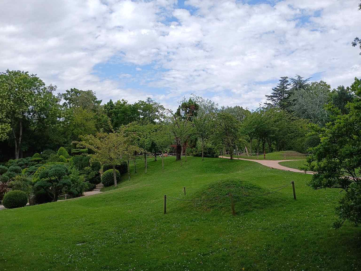
A broad view of Compans-Caffarelli Garden, the Toulouse park created on the site of former military barracks as part of a major urban redevelopment.Photo: Shishirdasika, Wikimedia Commons, CC BY-SA 4.0. Cropped & resized. 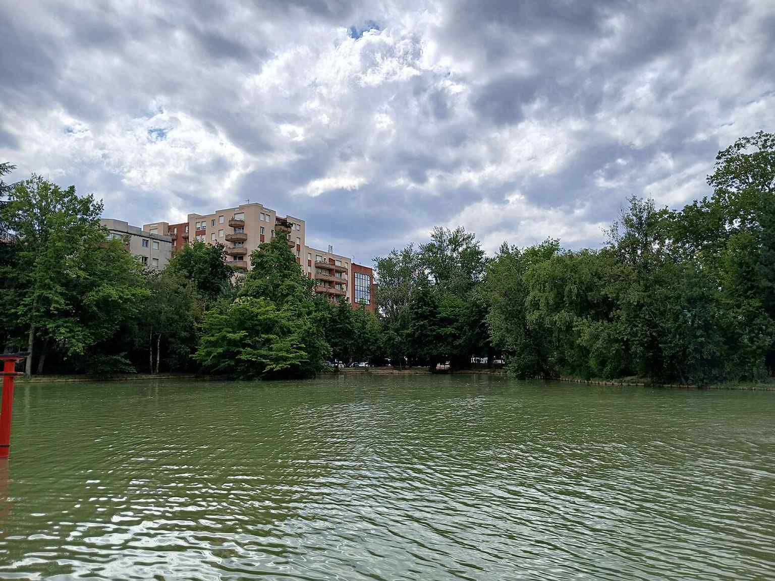
Another overall view of the Japanese-style garden, showing how the public park became one of Toulouse’s signature green spaces.Photo: Shishirdasika, Wikimedia Commons, CC BY-SA 4.0. Cropped & resized. 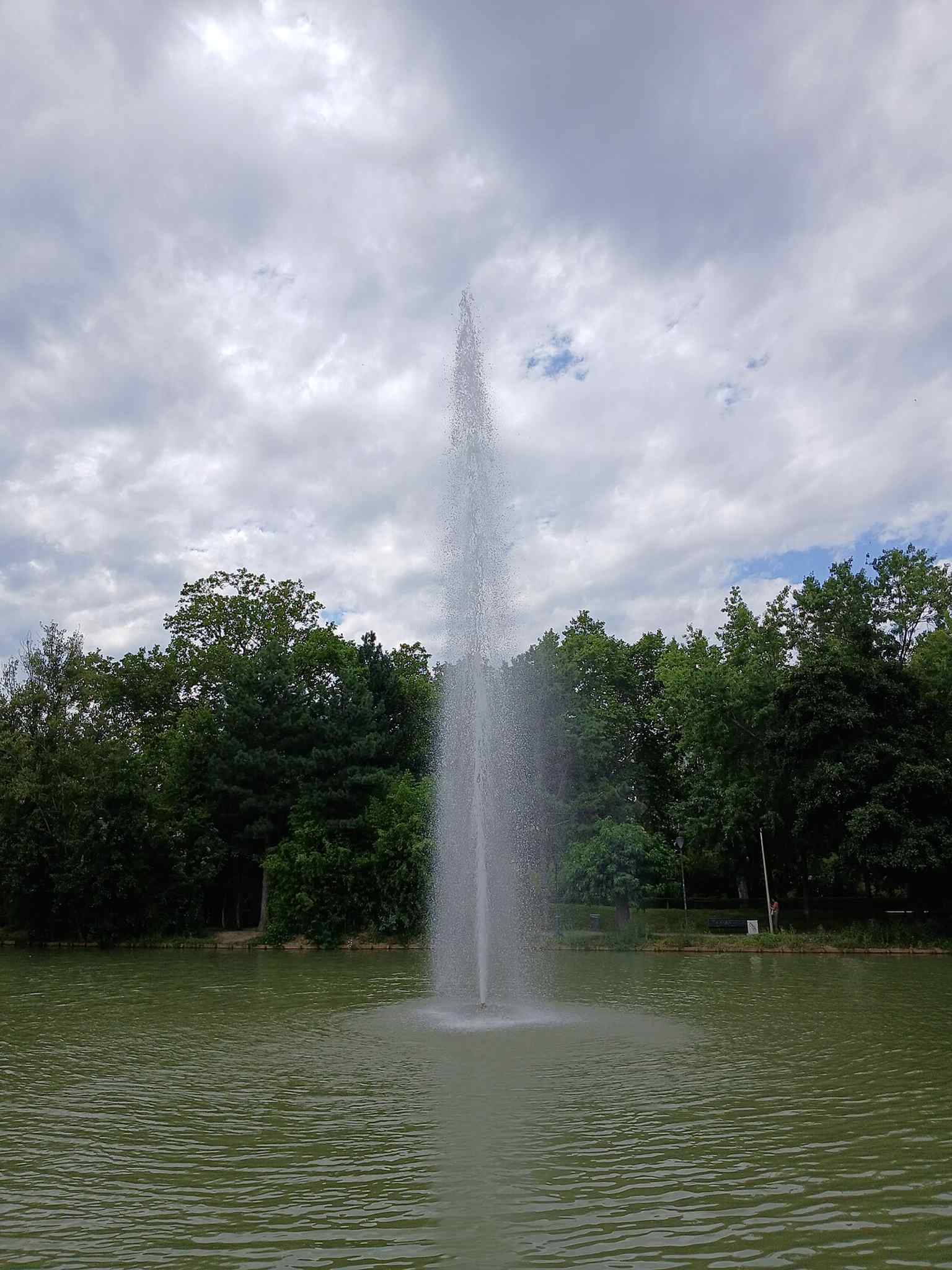
A closer look at the garden’s landscaped paths and water features, echoing the Japanese garden design inspired by Pierre Baudis.Photo: Shishirdasika, Wikimedia Commons, CC BY-SA 4.0. Cropped & resized. 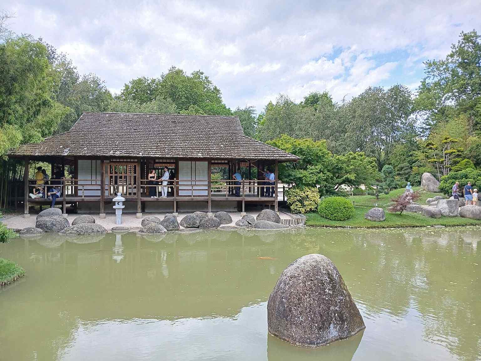
A detail from the park’s plantings and open lawns, reflecting the 10-hectare landscaped space created in the early 1980s.Photo: Shishirdasika, Wikimedia Commons, CC BY-SA 4.0. Cropped & resized. 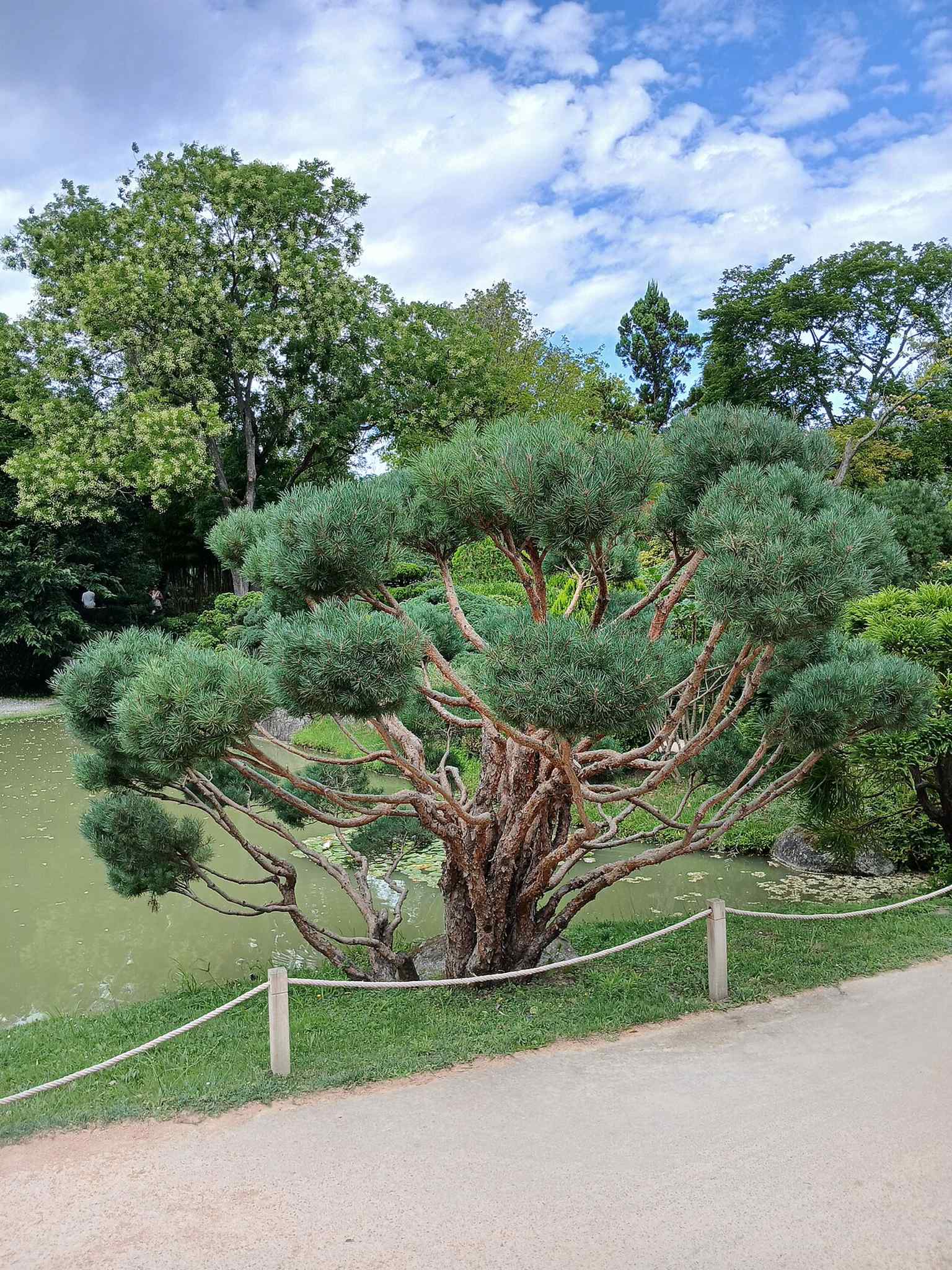
A garden scene that highlights one of the park’s sculptural elements, part of the public artworks scattered through Compans-Caffarelli.Photo: Shishirdasika, Wikimedia Commons, CC BY-SA 4.0. Cropped & resized. 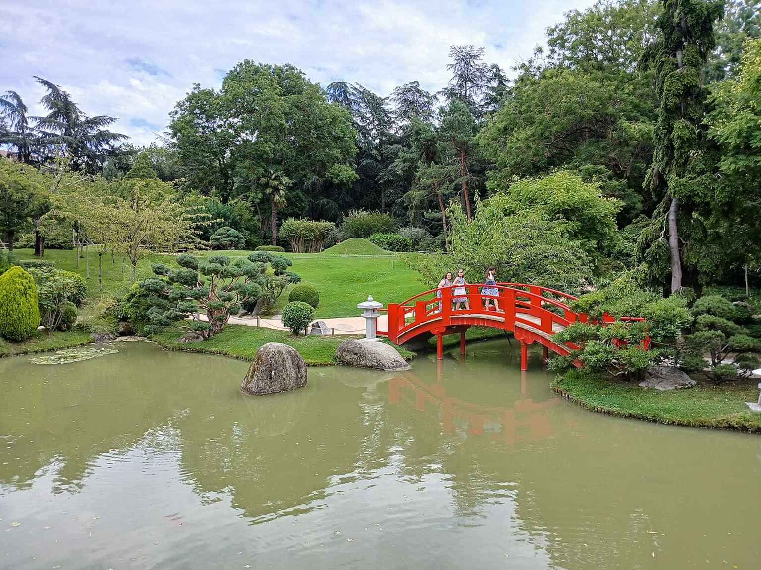
A wide exterior view of the garden’s pathways and greenery, capturing the peaceful setting now occupying the old Compans and Caffarelli barracks area.Photo: Shishirdasika, Wikimedia Commons, CC BY-SA 4.0. Cropped & resized. 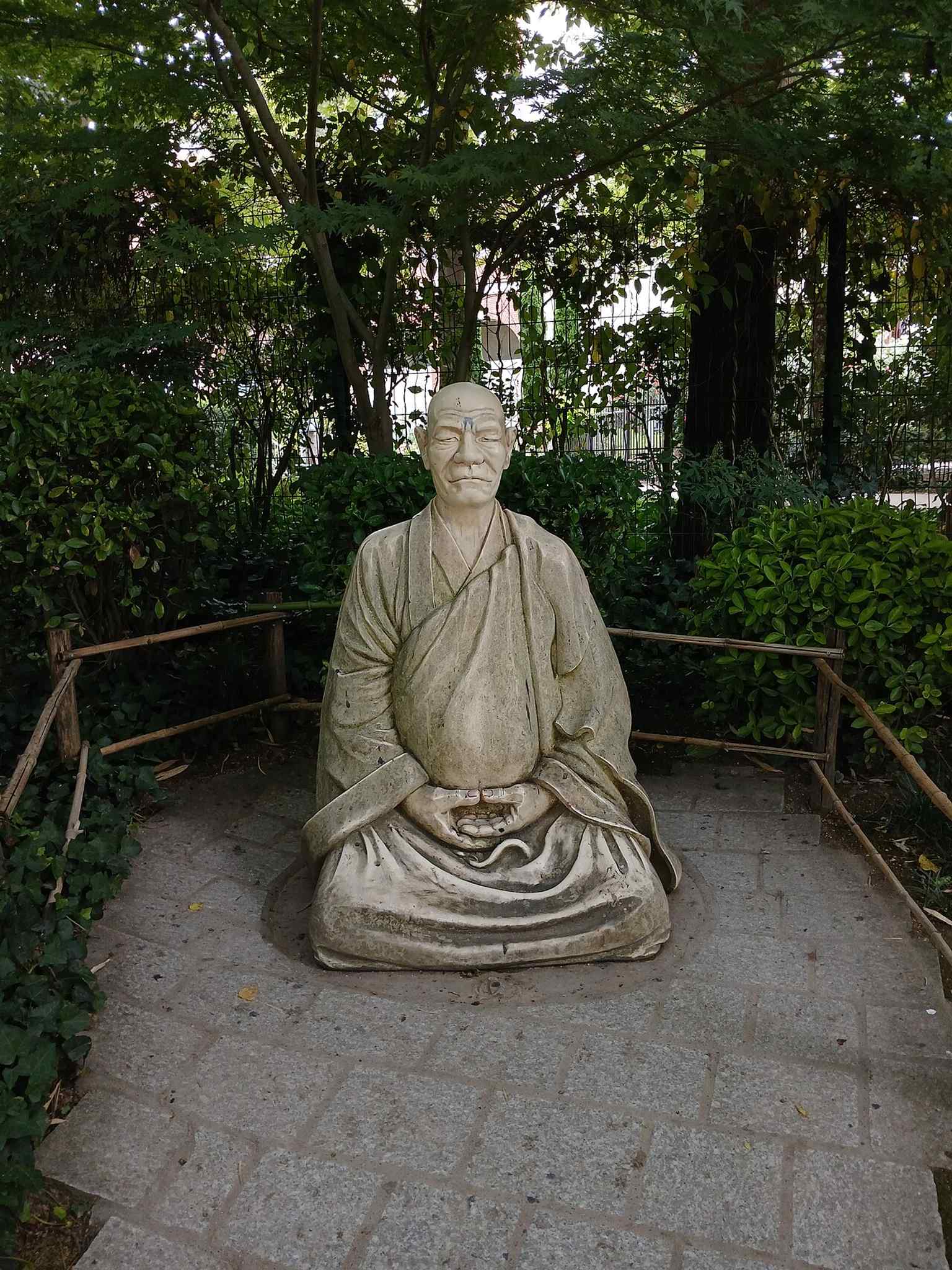
A close-up that helps illustrate the park’s Japanese-inspired landscaping, one of the key ideas behind the garden’s creation.Photo: Shishirdasika, Wikimedia Commons, CC BY-SA 4.0. Cropped & resized. 
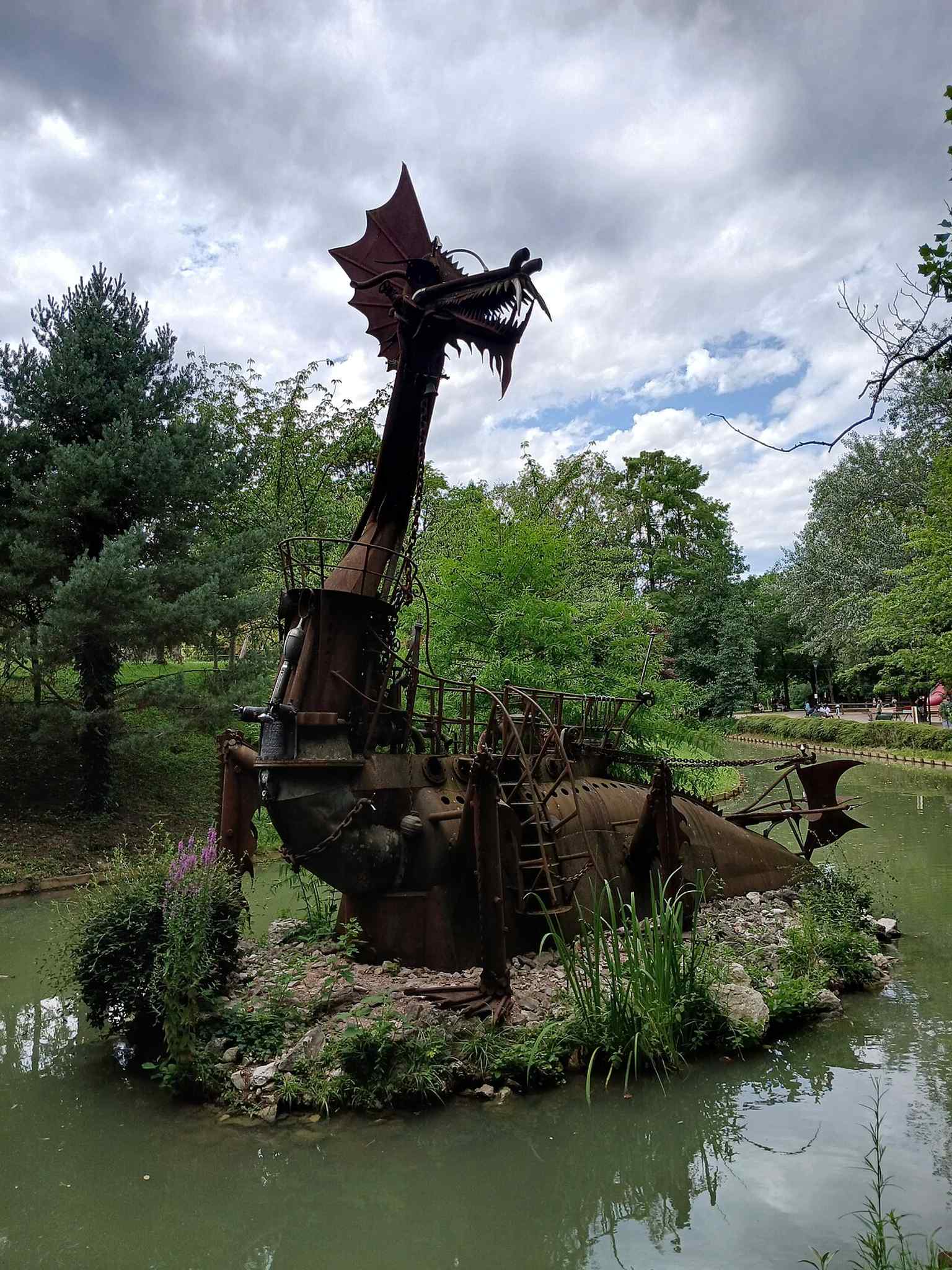
One of the garden’s public artworks, part of the memorial and artistic pieces that give the park its distinctive identity.Photo: Shishirdasika, Wikimedia Commons, CC BY-SA 4.0. Cropped & resized. 
A view that recalls the site’s layered history, from military use to the public garden that replaced the former barracks.Photo: Shishirdasika, Wikimedia Commons, CC BY-SA 4.0. Cropped & resized. Look for the red wooden bridge arcing over still water, a low island-like composition of stone and planting, and a screen of dense greenery that encloses the garden like a quiet…Read moreShow less
Open dedicated page →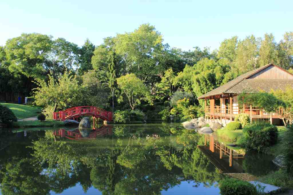
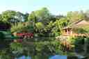
Japanese Garden of ToulousePhoto: PierreSelim, Wikimedia Commons, CC BY 3.0. Cropped & resized. Look for the red wooden bridge arcing over still water, a low island-like composition of stone and planting, and a screen of dense greenery that encloses the garden like a quiet wall.
This is the Japanese Garden of Toulouse, though that simple name hides a rather clever act of civic imagination. In nineteen seventy-two, Mayor Pierre Baudis began pushing a vast redevelopment here at Compans-Caffarelli, on land occupied by former barracks. When the army finally withdrew, it freed nearly twenty hectares of military ground. Toulouse could have filled it with nothing but roads, offices, and hard geometry. Instead, in nineteen eighty-one, Baudis chose to place a landscape of reflection right in the middle of that upheaval.
That contrast matters. Behind this composed calm lies an older logic of enclosure, discipline, and controlled space. The city did not erase that history so much as answer it with another kind of order: water, stone, planting, and carefully measured emptiness.
Baudis was personally invested in the idea. He had admired Japanese gardens on his travels, especially in Tokyo, Kyoto, and even Dublin. He came back with photographs of the Katsura Imperial Villa, and with a book by Günter Nitschke, and asked Toulouse to make something inspired by those models. Not a stage-set version of Japan, and not a strict copy either, but a local interpretation.
Pause for a moment and scan the composition: the water, the rock groupings, the enclosed greenery, the bridge. Ask yourself which parts seem natural, and which parts reveal the firm hand of design.
Most visitors miss the detail locals rather like to point out: the garden’s authority comes partly from the fact that Toulouse made it itself. The city’s own parks and green-spaces study office designed it, and a local company, Espaces Verts du Languedoc, built it while demolition of the old barracks continued between nineteen eighty-one and nineteen eighty-three. So this serene little world is not an imported artefact. It is Toulouse proving it can translate another tradition with care.
If you glance at the app, the wider image shows how this secluded garden sits within the larger former military site. And the close view of the bridge reveals its symbolic role: it leads to an island that represents paradise. Beyond that, the garden layers in a dry landscape with Crane and Turtle islands, nine rocks, a tea pavilion, lanterns, stepping stones, a dry waterfall, even a small Mount Fuji. Later, in twenty sixteen, the city added a tsukubai, a ritual ablution stone for washing, and renamed the place for Pierre Baudis, turning it into a memorial as well as a garden.

A broader view of the Pierre-Baudis Japanese Garden shows how the site sits inside the larger Compans-Caffarelli park, created on former military land.Photo: Shishirdasika, Wikimedia Commons, CC BY-SA 4.0. Cropped & resized. Beauty here is not accidental; it is a public story, carefully arranged. When you’re ready, continue to Lascrosses Boulevard, about four minutes away; if you wish to return later, the garden generally opens daily from eight in the morning until eight in the evening.
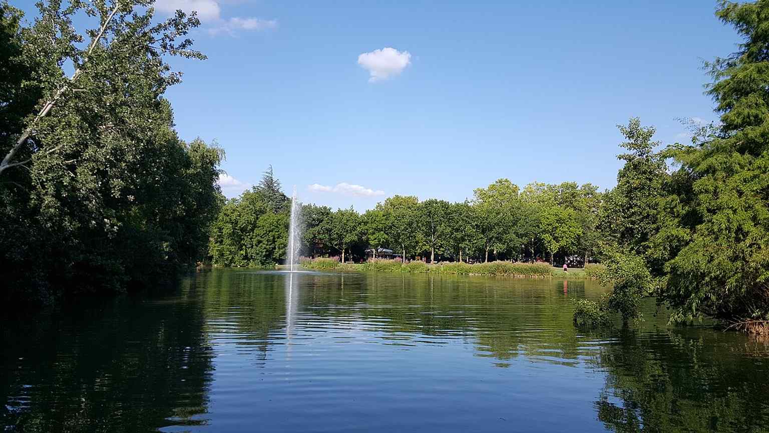
The lake is one of the garden’s key features, part of the carefully composed Japanese landscape created in Compans-Caffarelli in 1981.Photo: Mathieu BROSSAIS, Wikimedia Commons, CC BY-SA 4.0. Cropped & resized. 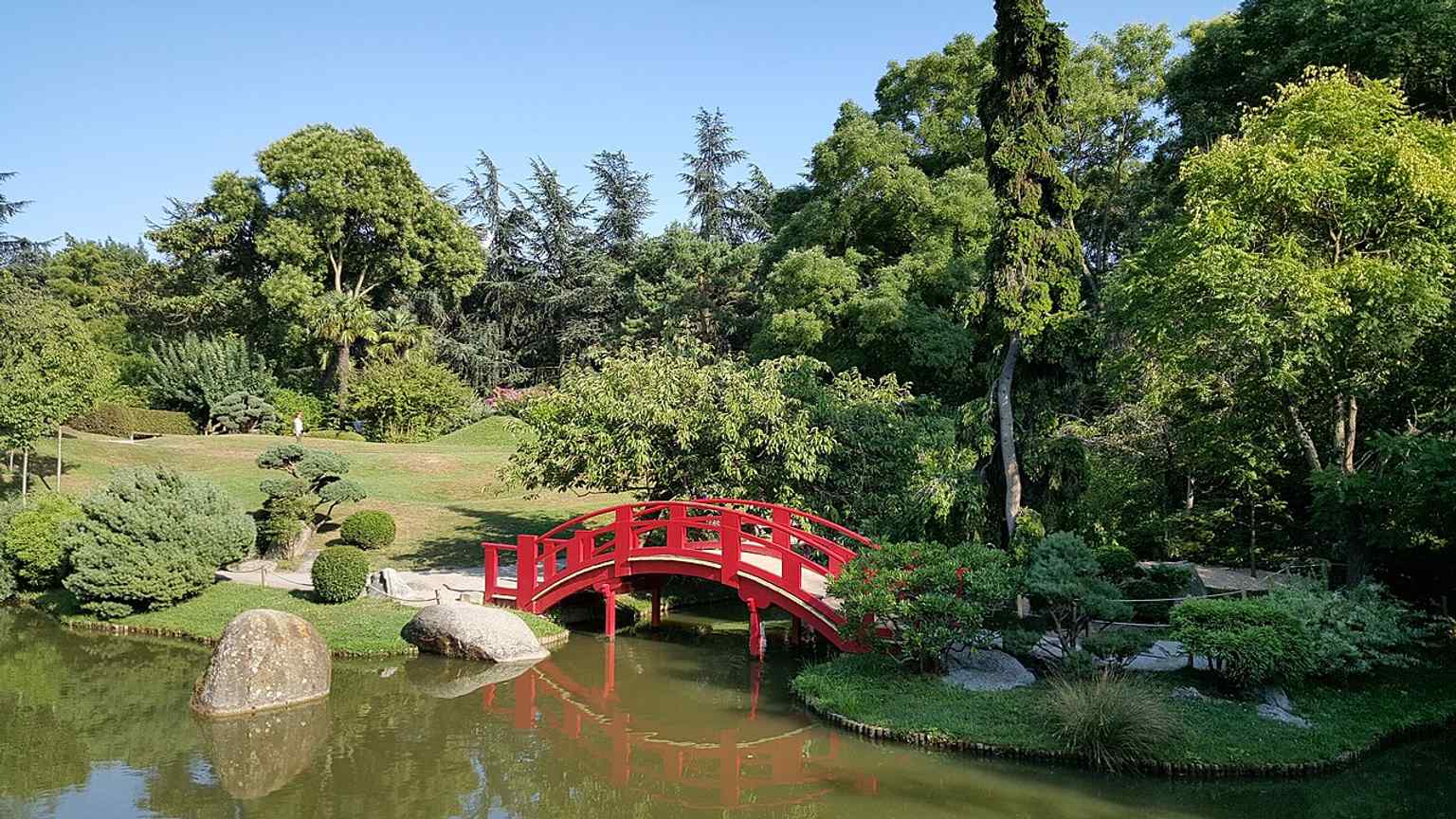
The red wooden bridge is a signature element of the park, linking the island that symbolizes the garden’s serene, meditative design.Photo: Mathieu BROSSAIS, Wikimedia Commons, CC BY-SA 4.0. Cropped & resized. 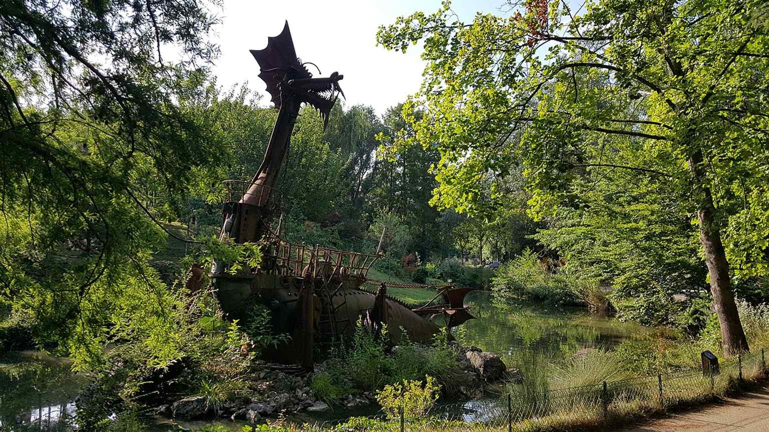
This decorative boat sculpture reflects the garden’s symbolic landscaping, where every object is placed as part of a stylized Japanese composition.Photo: Mathieu BROSSAIS, Wikimedia Commons, CC BY-SA 4.0. Cropped & resized. 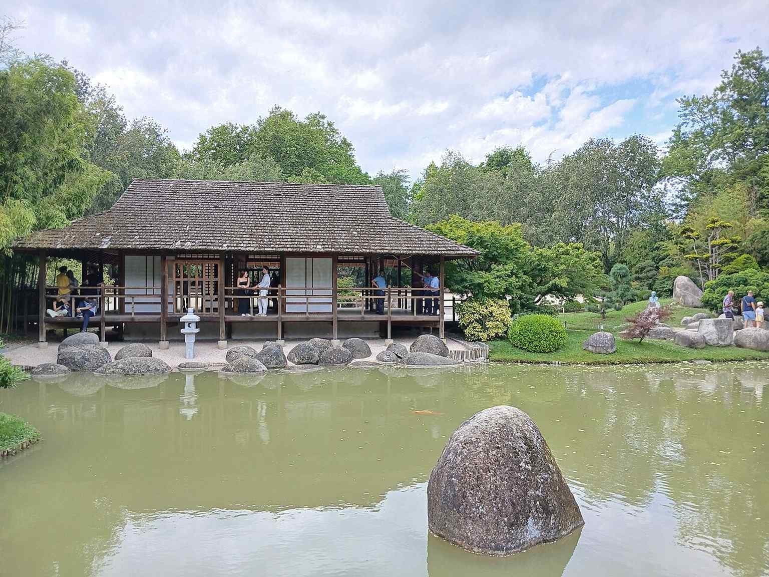
A wide garden view highlighting the layered planting and peaceful atmosphere that distinguish this Toulouse-made interpretation of a Japanese garden.Photo: Shishirdasika, Wikimedia Commons, CC BY-SA 4.0. Cropped & resized. 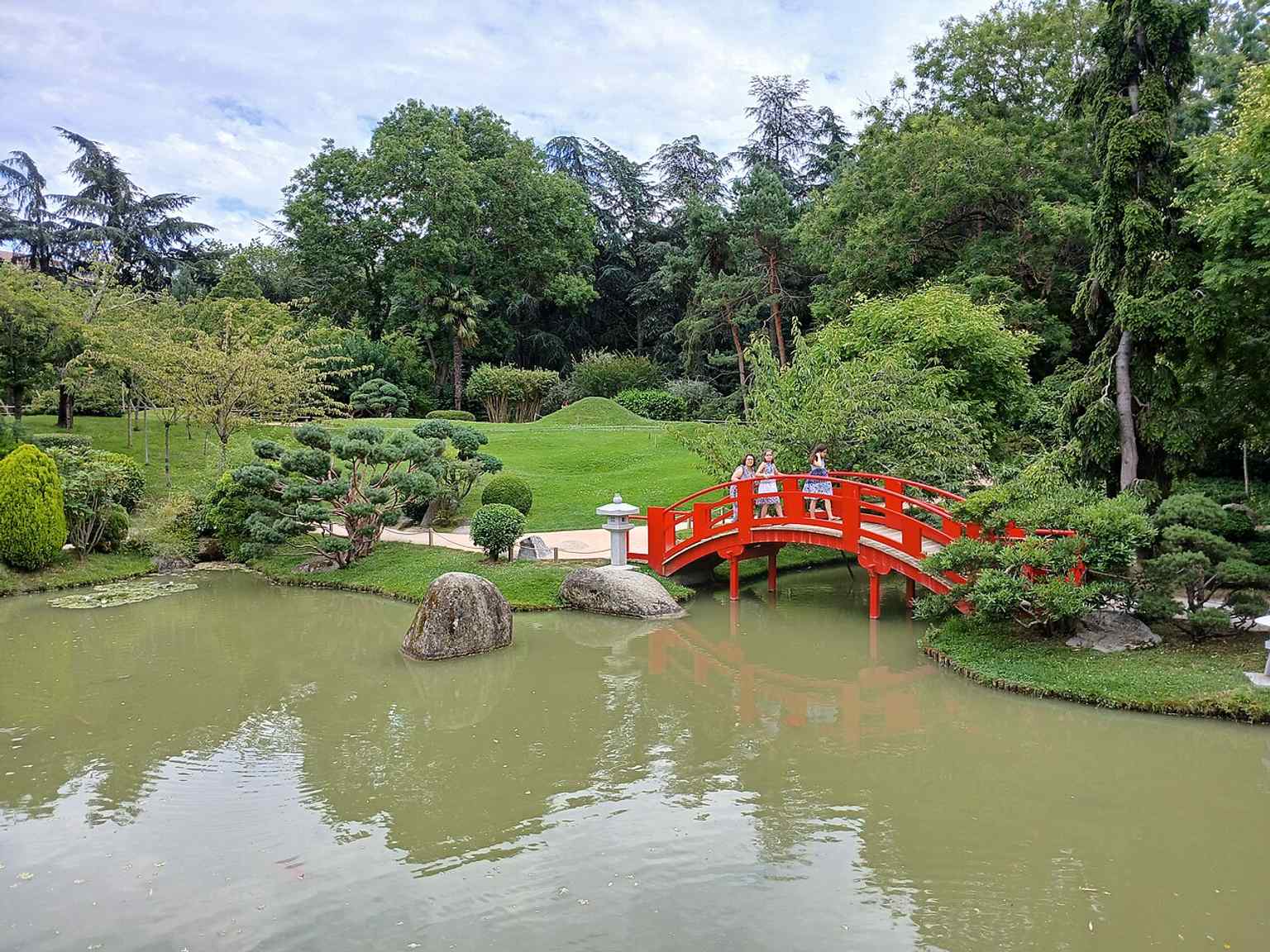
This scene captures the garden’s secluded character, with greenery and water creating the quiet, enclosed setting described as a place for meditation.Photo: Shishirdasika, Wikimedia Commons, CC BY-SA 4.0. Cropped & resized. 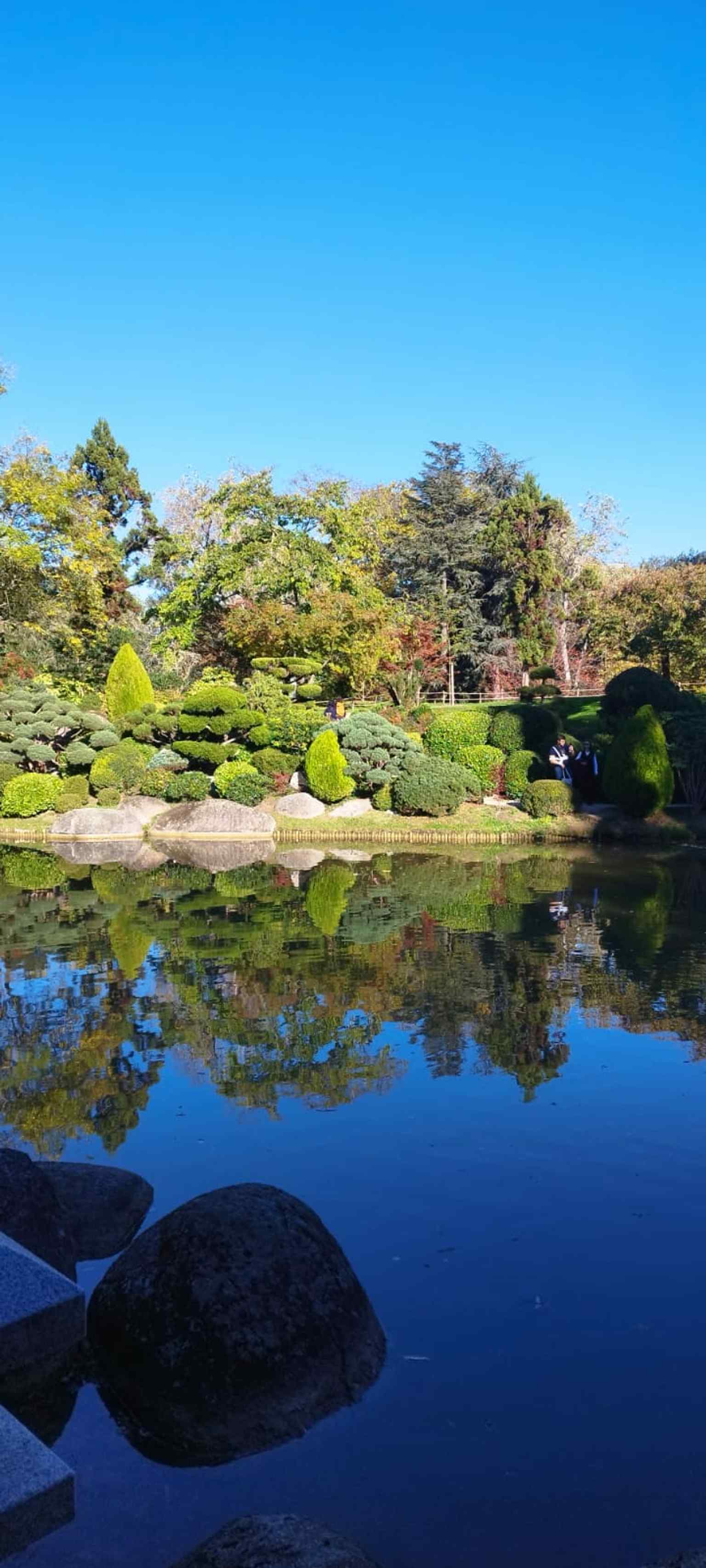
A recent view of the Pierre-Baudis Japanese Garden, whose modern name commemorates the former mayor who launched the Compans-Caffarelli redevelopment.Photo: Suricate acrobate, Wikimedia Commons, CC0. Cropped & resized. 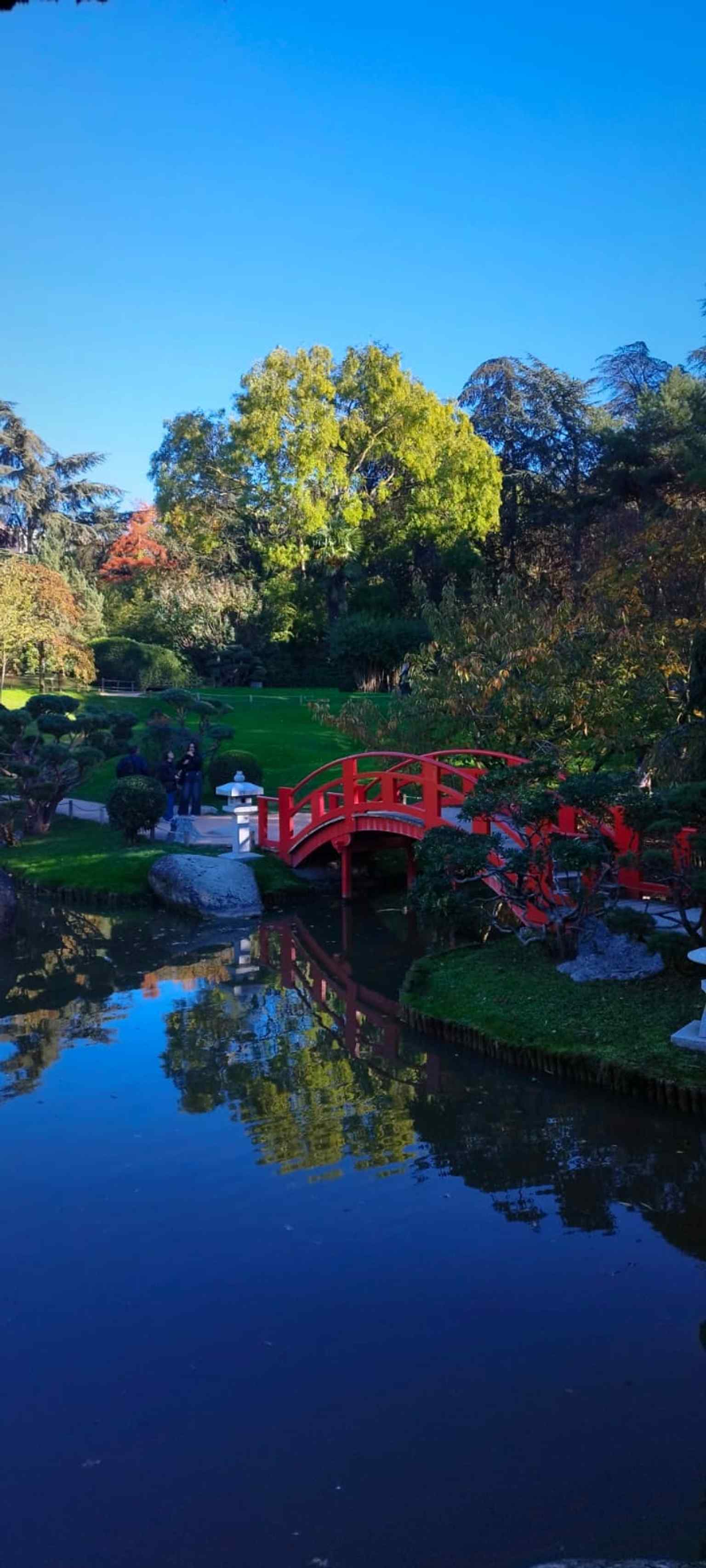
A close view of the red bridge, one of the garden’s most recognizable features and a strong visual symbol of its Kyoto-inspired design.Photo: Suricate acrobate, Wikimedia Commons, CC0. Cropped & resized.
Show 9 more stopsShow fewer stopsexpand_moreexpand_less
On your left, Lascrosses Boulevard shows itself as a broad straight band of asphalt, edged with wide pavements and a parallel side lane that gives the street its unusually…Read moreShow less
Open dedicated page →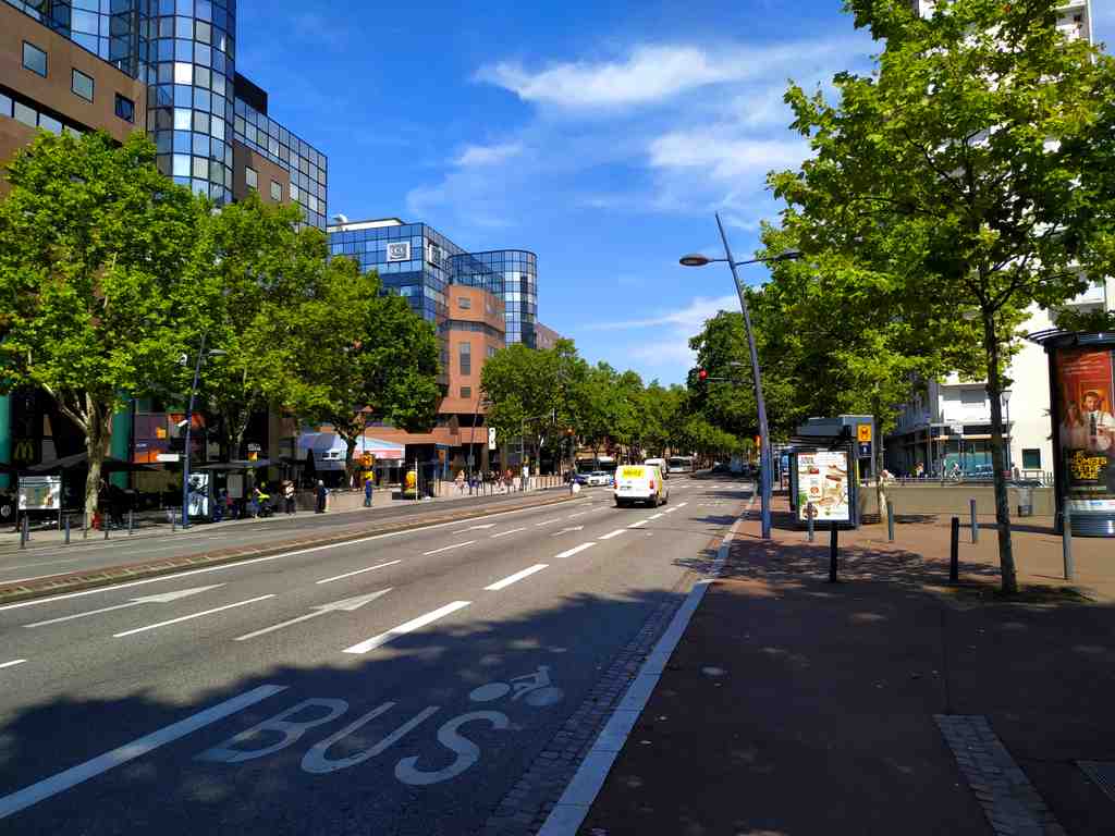
Lascrosses BoulevardPhoto: Kuremu Sakura, Wikimedia Commons, CC BY-SA 4.0. Cropped & resized. On your left, Lascrosses Boulevard shows itself as a broad straight band of asphalt, edged with wide pavements and a parallel side lane that gives the street its unusually generous width.
This is one of those places that looks like pure circulation until you realise it is also a line of argument. Boulevard Lascrosses forms a seam between the older city to the south and the redeveloped Compans-Caffarelli district to the north. It does not simply carry people through Toulouse; it tells you how Toulouse chose to open itself, extend itself, and reorganise land that once stood under much tighter control.
The boulevard runs north of the historic centre, starting near Place Arnaud-Bernard and stretching in a long, rectilinear sweep toward Allée de Barcelone and the Square de l’Héraclès. At roughly forty-five metres wide, it was conceived on a grand scale. In its eastern section, traffic spreads across multiple lanes, with space reserved for buses and cyclists; farther west, near Héraclès, the road tightens. Even that change in width feels revealing. This is not one simple street. It is a sequence of urban decisions.
The turning point came after the French Revolution. Religious houses were dissolved, and military authorities took over large nearby sites: the Carthusian convent, the Capuchin convent, Saint-Pierre-des-Cuisines, and the arsenal. Then, in eighteen oh eight, city officials used Napoleon’s visit cleverly. They asked for the old ramparts to come down. He agreed, and after that, architect Jacques-Pascal Virebent drew a new boulevard along the line where fortification had once stood. That matters. A defensive edge became a public axis.
At first, people called it the Boulevard de l’Artillerie because it ran beside the artillery school. The current name, adopted in eighteen forty-seven, reaches further back, to the old district of Las Cròsas. Scholars still argue over that name. One historian linked it to crosses marking graves in the main cemetery outside Saint-Sernin. Another believed it referred to hollows or broken ground. Either way, memory here clings to the terrain.
And the road kept pressing westward. That did not happen neatly. After the Revolution recognised freedom of worship, the city assigned land near Rue du Béarnais for Protestant and Jewish cemeteries. When planners later extended the boulevard, they cut across those burial grounds. Work stalled until eighteen eighty-four, when the bodies moved to Terre-Cabade. It is a sobering reminder that boulevards can join neighbourhoods, but they can also overrule older maps of belonging.
By the nineteenth century, barracks rose here: first Lascrosses, then Caffarelli, named for General Maximilien de Caffarelli du Falga, and later Compans. In the twentieth century, the military grip loosened. Administrative buildings, housing, a shopping centre, gardens, a metro station, and business schools took over. The traffic still looks practical, even blunt, but it traces a deeper conversion: controlled ground becoming civic ground.
One more thread to keep in mind: near here, at Rue du Canon-d’Arcole, a plaque marks the childhood home of Carlos Gardel before he left for Argentina and became the voice of tango. Even on a boulevard built for movement, certain lives leave a fixed point.
In about a minute, T-B-S Education will show you another face of this same ambition: not artillery now, but training, commerce, and the city imagining its future.
Look for a modern glass-and-metal building with broad rectangular lines and the TBS name set clearly on the façade. This is TBS Education, and it tells you something important…Read moreShow less
Open dedicated page →
TBS EducationPhoto: Toulouse Business School, Wikimedia Commons, Public domain. Cropped & resized. Look for a modern glass-and-metal building with broad rectangular lines and the TBS name set clearly on the façade.
This is TBS Education, and it tells you something important about Toulouse: the city does not only rebuild itself with roads, canals, and gardens. It also builds futures by shaping institutions.
The school began in nineteen oh three, when the Toulouse Chamber of Commerce and Industry created what was then the École Supérieure de Commerce de Toulouse. Its purpose was practical and rather ambitious: train the sort of business leaders a growing city needed. In France, that made it a grande école, a highly selective school that runs alongside the public university system and often sends graduates into senior roles in business and government.
What gives that origin story a distinctly local pulse is a detail most visitors never hear. TBS keeps a founding photograph, and the school’s own records identify two faces in it by name: Maurice Houques-Fourcades and Franck Courtois-de-Vicose. That small act of naming matters. It turns an institution from an abstract idea into a Toulouse story with actual people standing in the frame.
And then, quite early, the story widened. In nineteen fifteen, Renée Cède and Antoinette Subsol became the first two women to graduate here. That may sound straightforward now; at the time, it marked this school as unusually open-minded in French business education. A city does not modernise only by laying out new districts. Sometimes it modernises by deciding who gets to enter the room.
If you glance at the image on your phone showing the Capitole area, remember that the school started there as a civic project, tied to the commercial life of Toulouse rather than sealed off from it.
Student life mattered here too. In the nineteen twenties and thirties, the Commerce Ball and the school’s associations became part of its social glue. During the Second World War, the mood darkened. Director Jean Pradès kept teaching going and, according to the school, protected students and resistance members. After the war, the student association created in nineteen forty-nine gave those shared customs a more formal shape.
The move to Compans-Caffarelli in nineteen eighty-six changed the school’s physical identity, just as this district itself was being recast. Later came marketing, junior enterprise projects, and a much broader horizon: Barcelona in nineteen ninety-five, then Paris and Casablanca, with courses in French, English, and Spanish for more than seven thousand students. It also earned the rare triple crown of business-school accreditation, which fits a city that likes to pair international reach with a strong local identity.
Even the name has been carefully adjusted over time: ESC Toulouse, then Toulouse Business School, then TBS Education in twenty twenty-one. In twenty twenty-four, it refreshed its look and made Toulouse pink central again, a quiet nod to local roots beneath international polish.
So here, classrooms, student associations, and district planning all do similar work: they give a city ways to imagine the people it wants to become. In about four minutes, at Compans-Caffarelli, that same idea will appear at the scale of the neighbourhood itself.
If you need the practical detail, the campus is generally open on weekdays from eight in the morning to half past six, and closed on Saturdays and Sundays.
On your right, look for a broad paved esplanade framed by pale stone and glass blocks, with long straight facades and the open sweep of Place de l’Europe marking the heart of the…Read moreShow less
Open dedicated page →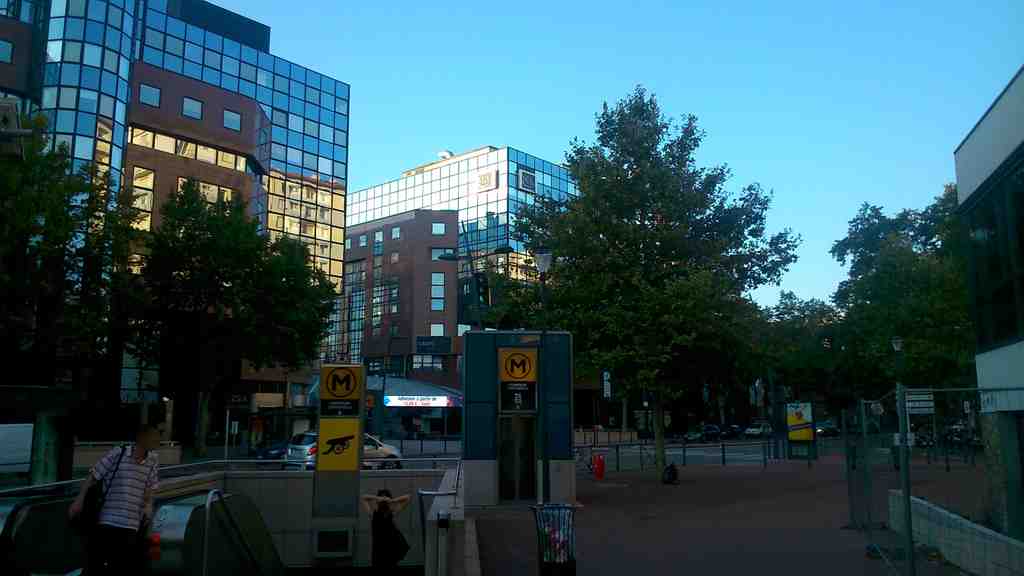
Compans-CaffarelliPhoto: Kuremu Sakura, Wikimedia Commons, CC BY-SA 4.0. Cropped & resized. On your right, look for a broad paved esplanade framed by pale stone and glass blocks, with long straight facades and the open sweep of Place de l’Europe marking the heart of the district.
Compans-Caffarelli is not a single building so much as a carefully rewritten piece of Toulouse. What stands here now began with military order. The first Compans barracks rose beside the old city ramparts and became the seed for a much larger military complex. Then, in eighteen forty-six, work began on the Caffarelli barracks; builders finished it in eighteen fifty-one. For well over a century, this was a place of drills, regiments, and ceremony. Place de l’Europe nearby kept that memory alive, because military ceremonies continued there until nineteen seventy-seven.
The real turning point came through politics and paperwork, not bricks. In nineteen seventy-two, Pierre Baudis launched a plan for a twenty-hectare Z-A-C - that means a specially planned development zone - to convert the barracks site into a mixed urban quarter. But the idea could not fully breathe until the state released the land. In nineteen seventy-seven, Toulouse signed an agreement with the Ministry of Defence, and the transfer of the former barracks lands finally freed roughly nineteen hectares for the city. That is the key to everything around you. Without that handover, there would be no business district, no park, no Japanese garden, no congress centre, and certainly no neat coexistence of offices, flats, schools, and public space.
Pierre Baudis is the human figure to keep in mind here. He did not simply inherit an empty site; he pushed Toulouse to imagine one. He also backed the green spaces that now thread through the district. That curious decision matters. It announced that this quarter would not remain a stern memorial to military land. It would become a civilian landscape, one that could host contemplation as easily as commerce.
If you glance at the image on your screen, the broad esplanade makes that planning logic easy to read: generous space, large buildings, and a deliberate sense of arrival. To the east, the district grew taller, busier, and more commercial, filling with offices, hotels, shops, and major institutions. To the west, it settles into quieter residential streets. Even the landmarks we have already met fit that pattern. The sports palace was the first completed building of the new development in the early nineteen eighties, at first marooned among vast car parks. Toulouse Business School later took over the former Sud Radio premises, turning a media building into a school of management. Reuse, here, is almost a local reflex.
Even the metro remembers the old ground. Since two thousand and seventeen, the Compans-Caffarelli station has carried a small cannon symbol, a nod to the artillery regiments that once occupied these barracks.
As you continue toward Barcelona Alley, notice how the district begins to speak less about parade and command, and more about circulation, exchange, and arrival. That next street carries the story forward.
Look for a broad asphalt avenue stretched beside the stone-lined Canal de Brienne, with a parallel service lane and long, straight edges that make it read more like an old road…Read moreShow less
Open dedicated page →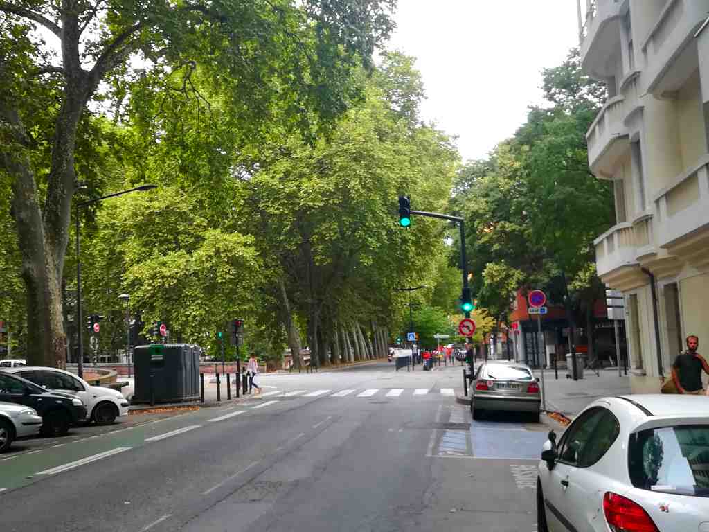
Barcelona AlleyPhoto: Kuremu Sakura, Wikimedia Commons, CC BY-SA 4.0. Cropped & resized. Look for a broad asphalt avenue stretched beside the stone-lined Canal de Brienne, with a parallel service lane and long, straight edges that make it read more like an old road than a local street.
This is Allée de Barcelone, and its first secret is that it is not really just a street. It is an old road axis folded into the modern city, a route that once carried people and goods in and out of Toulouse and still marks the edge between Compans-Caffarelli and the Amidonniers. Even the name hints that this edge was asked to mean something larger than itself.
Its deeper story begins with the engineer Joseph-Marie de Saget. In the late eighteenth century, he chose a practical route for the Canal de Brienne: he ran it through the city’s old defensive ditches near Saint-Pierre, then led it to the Port de l’Embouchure so boats could join the Canal du Midi network without risking the difficult passage at the Bazacle. A former line of defence became a line of connection. That is the sort of decision that quietly reshapes a city for centuries.
The road beside it kept changing identity as Toulouse expanded. In eighteen thirteen, officials classified this stretch as part of departmental road seven between Lectoure and Toulouse. In nineteen thirty-eight, they turned it into departmental road one, linking villages such as Séguenville and Cabanac-Séguenville to Toulouse and onward to Revel. Then, in twenty seventeen, Toulouse Métropole took over the section inside the city and renamed it metropolitan road one. Those bureaucratic labels may sound dry, but they reveal something important: what feels like an ordinary avenue is really the latest version of a much older route.
Then came the most revealing change of all. In nineteen thirteen, Toulouse renamed the north-side canal walk Barcelone to celebrate friendship with Barcelona after a mayoral visit from the city in nineteen oh nine. The south side kept the older name Brienne, and nearby the newly finished bridge by engineer Paul Séjourné became the Pont des Catalans. That was not accidental. The city used names to declare affinity, to point south, and to turn infrastructure into a little piece of diplomacy.
And yet the older truth never disappeared. Beneath the gracious name, this remains a hard-working traffic corridor. Part of it now operates as a shared zone, meaning pedestrians, bicycles, and cars are supposed to share space carefully, with speeds held to twenty kilometres an hour. Residents still asked for noise and speed radars in twenty twenty-one, especially near the Ponts-Jumeaux, after nights disturbed by loud engines and dangerous bursts of acceleration. Others pressed for better lighting between Place Héraclès and the Ponts-Jumeaux, asking for a safer walk home. In twenty twenty-four, major works on high-voltage lines blocked sections of the allée for months. So this street tells two truths at once: civic elegance in the name, pressure and negotiation in daily life.
There is even a gentler human trace here. At number one hundred and fifty, Louis Castille ran the Café Castille from around eighteen ninety-five, and later the address became a cinema. Earlier still, the Eldorado hosted skating concerts around nineteen ten, and a postcard from nineteen twelve shows Professor Gueden teaching roller skating there. On a road now measured in lanes and limits, people once came to glide for pleasure.
Ahead, a figure from myth will make this business of naming and memory feel more personal: Hercules the Archer, about four minutes away. If you want a break later, a nearby place linked to this stop is moderately priced and usually open from nine in the morning until ten at night, except on Sundays.
On your left, look for a dark bronze archer stretched into a powerful lunge, set on a pale stone and concrete monument with plain columns and carved reliefs at its base. At first…Read moreShow less
Open dedicated page →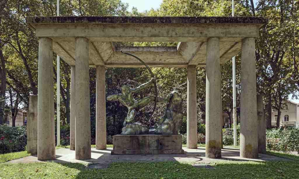
Hercules the ArcherPhoto: Didier Descouens, Wikimedia Commons, CC BY-SA 4.0. Cropped & resized. On your left, look for a dark bronze archer stretched into a powerful lunge, set on a pale stone and concrete monument with plain columns and carved reliefs at its base.
At first glance, this seems to be a hero from myth: Herakles, bow drawn, every muscle tightened to the point of release. And it is that. Antoine Bourdelle shaped the figure in nineteen oh nine, using his friend, Captain Paul Gustave André Doyen-Parigot, as a model in the studio, even photographing him from different angles so he could study how the body twists under strain. When Bourdelle showed the bronze in nineteen ten at the Salon in Paris, it caused a sensation. Critics saw something new in it: not the polished obedience of academic sculpture, and not the language of Rodin either, but a sharper, more modern kind of force.
But here in Toulouse, Herakles does not stand alone. Here, Herakles, Mayssonnié, and rugby remembrance are bound together in one act of public memory.
Take a moment to study the tension in the back, the shoulders, the pulled arm. Does this body feel to you like a god, an athlete, a mourner, or someone refusing to yield?
Most visitors miss the twist. This tribute did not begin as a broad memorial to all fallen rugby players. It began with one man: Alfred Mayssonnié, known as Maysso, a Stade Toulousain player, a French international, and part of the team that won the club’s first national title in nineteen twelve, the unbeaten side nicknamed the Red Virgin. He died in combat in nineteen fourteen, one of the first international rugby players killed in the Great War. Paul Voivenel, who led the campaign, first wanted to honor Mayssonnié. Then the project widened, carrying the grief of an entire sporting community.
Bourdelle, born in Montauban and trained in Toulouse, did more than send an already famous statue. He designed this sober architectural frame as well, with eight stripped-back columns, and he added reliefs of Herakles fighting the Nemean lion and the Hydra, plus a portrait of Mayssonnié on the south face. If you glance at the before-and-after image in the app, you can see how the setting later gained the more legible Voivenel stele beside it, telling a fuller story than the early views did. When they inaugurated the monument on the twenty-sixth of April, nineteen twenty-five, it honored five hundred and seventy-five rugby players dead in the war. During the Occupation, it even narrowly escaped being melted down for metal in nineteen forty-three.
That is the quiet shock of this place: the city took a famous work of art and made it answer grief. This is not decoration. It is Toulouse deciding what courage should look like. When you are ready, Brienne Alley is about a three-minute walk away, and this monument remains open to view at any hour.
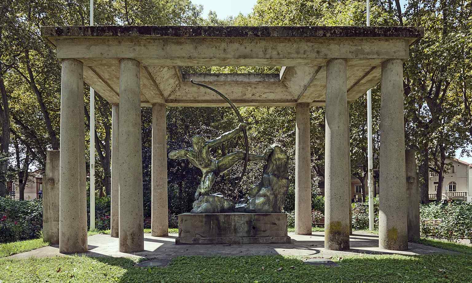
The Toulouse monument in full context: Bourdelle’s Hercules the Archer was dedicated here in 1925 as a memorial to fallen athletes from the First World War.Photo: Didier Descouens, Wikimedia Commons, CC BY-SA 4.0. Cropped & resized. 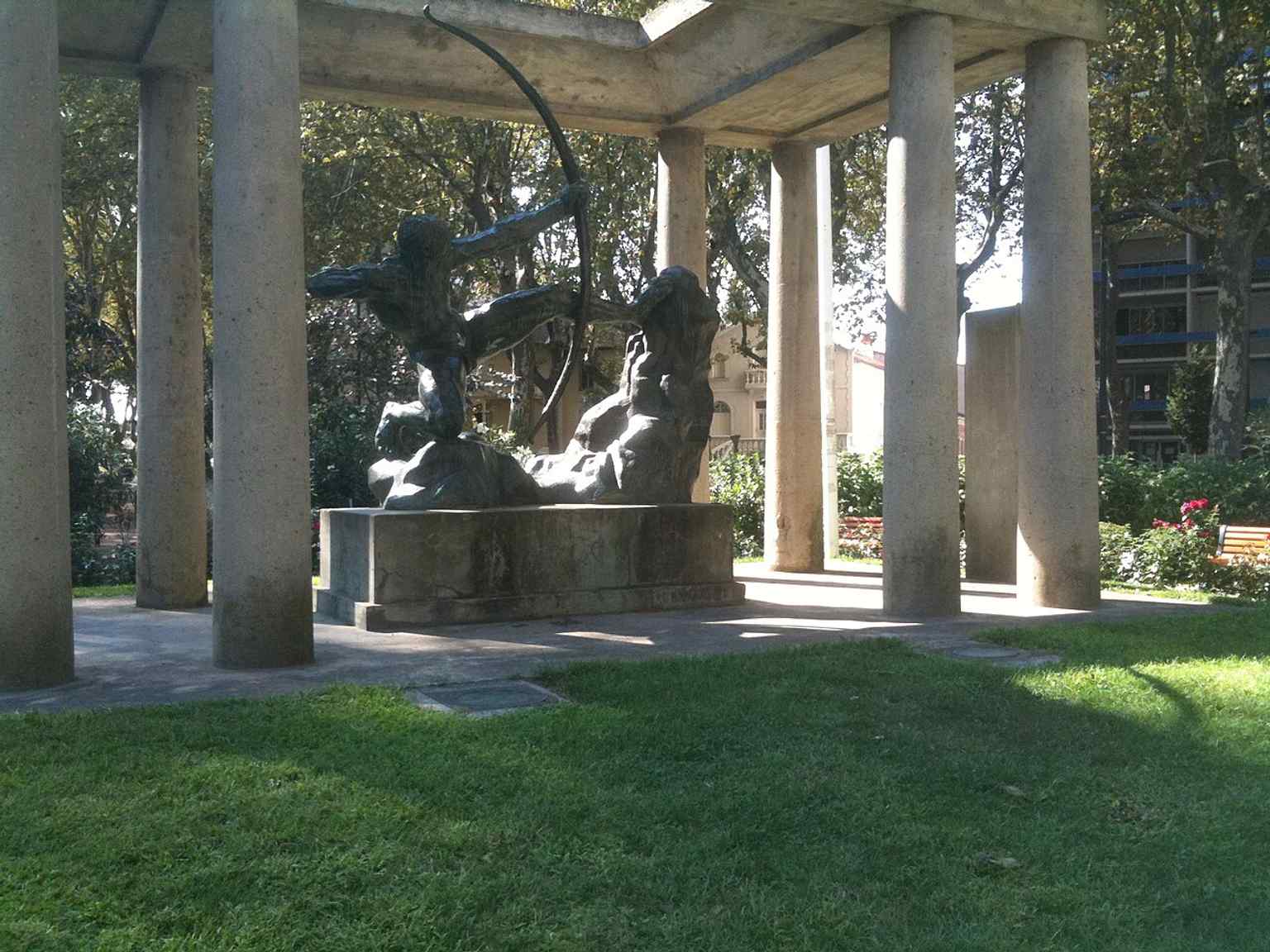
A clear view of the bronze sculpture in Toulouse, where Bourdelle’s modern Hercules became a civic monument at the heart of the city.Photo: Langladure, Wikimedia Commons, CC BY-SA 3.0. Cropped & resized. 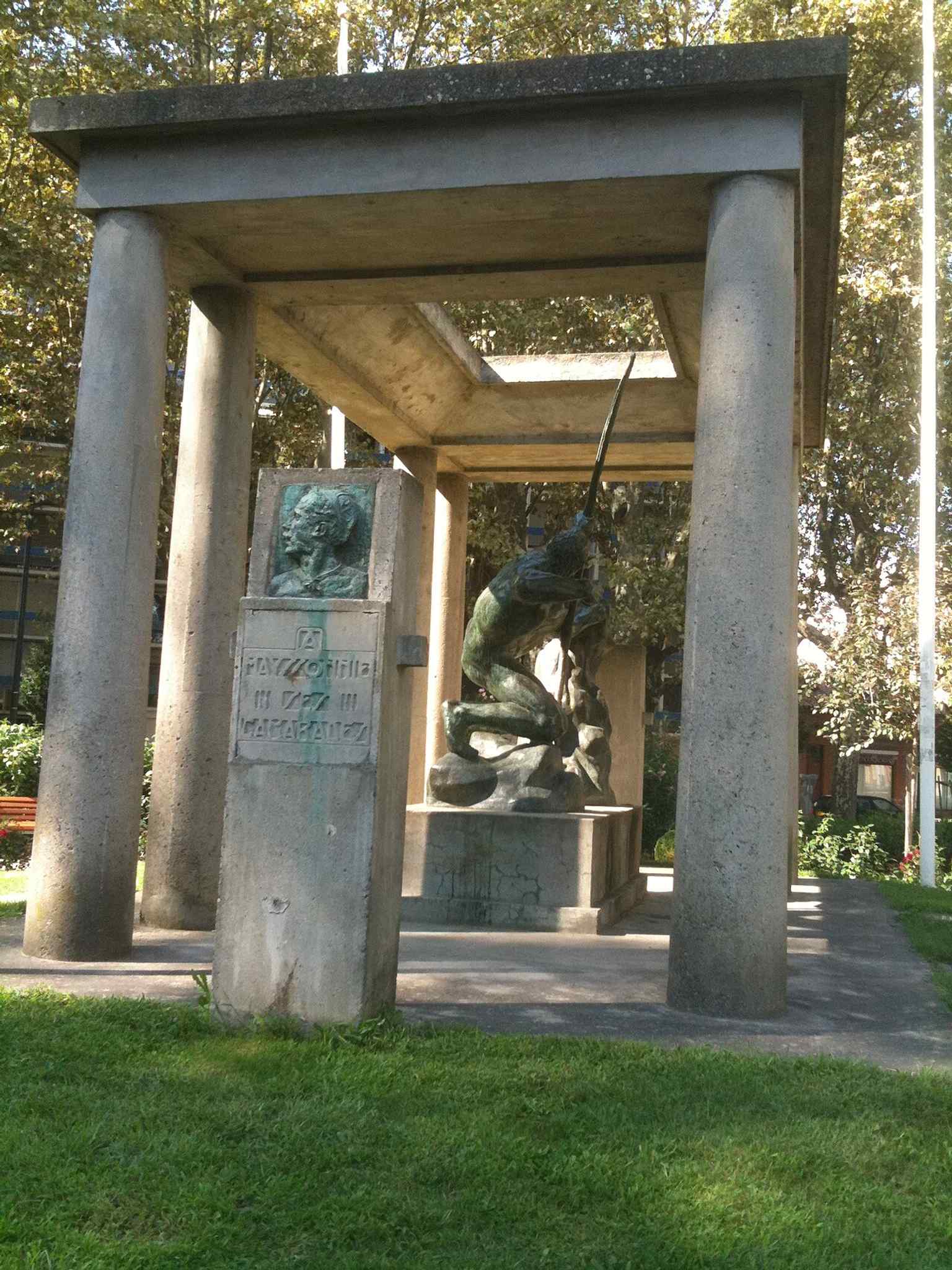
Another full-body angle of the bronze archer, useful for showing the dynamic pose that made the work such a sensation in 1910.Photo: Langladure, Wikimedia Commons, CC BY-SA 3.0. Cropped & resized. 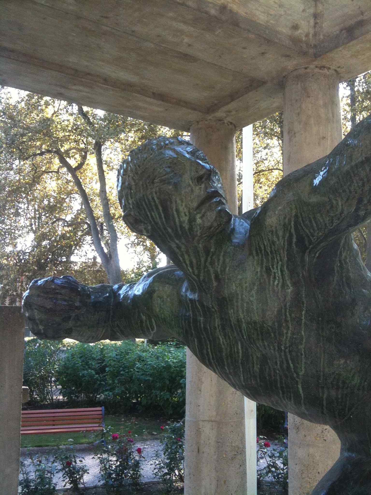
The monument as a war memorial for Toulouse sportsmen, linking Hercules directly to the city’s rugby history and the memory of Alfred Mayssonnié.Photo: Guallendra, Wikimedia Commons, CC BY-SA 3.0. Cropped & resized. 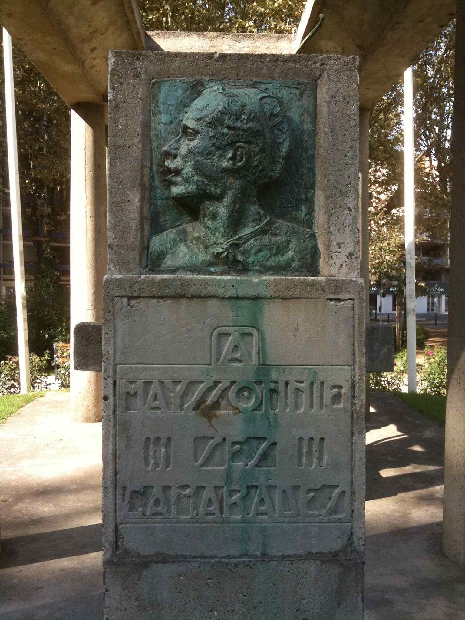
A closer view of the monument’s figure and setting, emphasizing the heroic tension that turned a mythic hero into a modern sports emblem.Photo: Langladure, Wikimedia Commons, CC BY-SA 3.0. Cropped & resized. 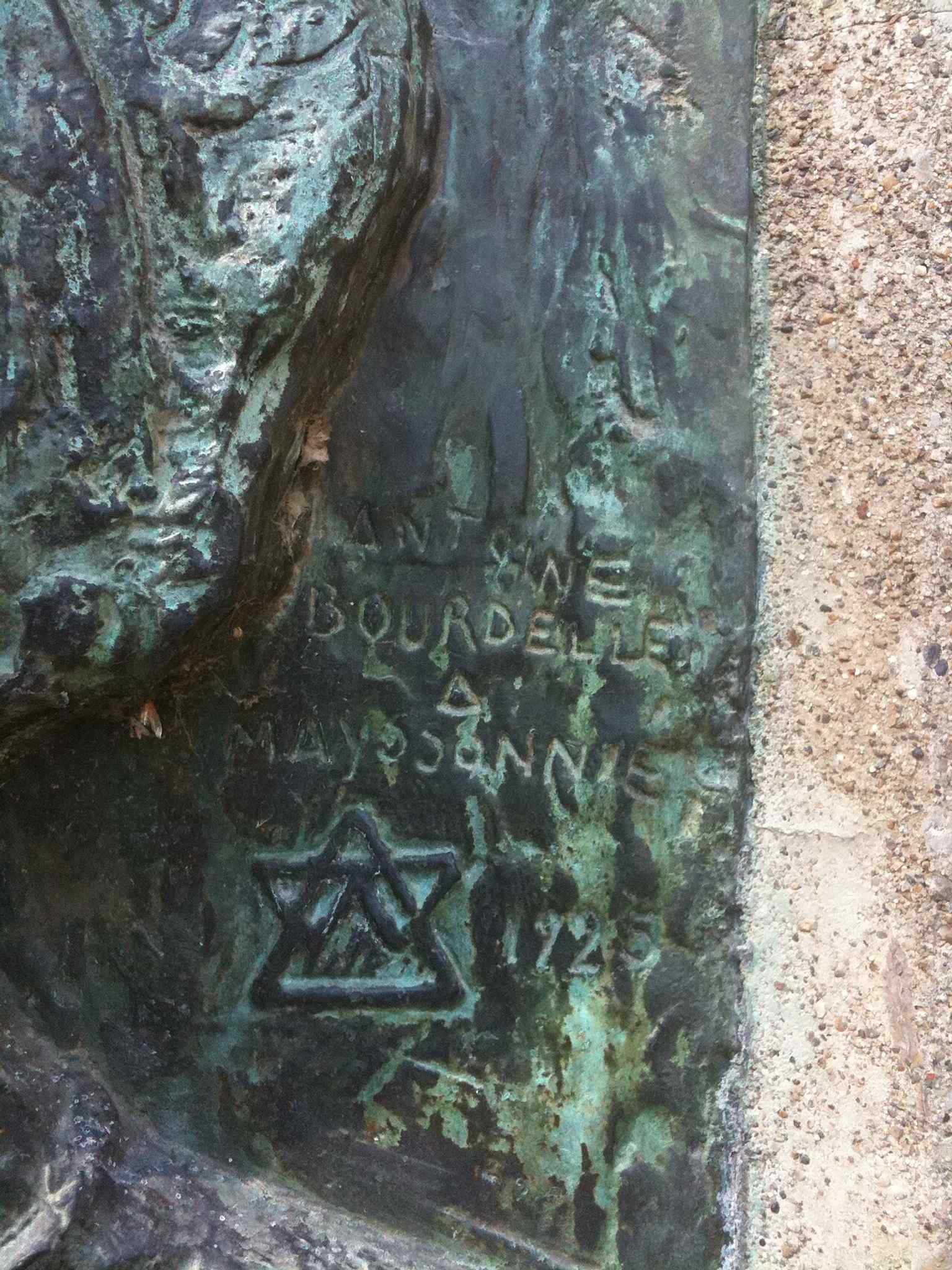
A detail shot that can help highlight Bourdelle’s bronze surface and signature, tying the work to the sculptor himself.Photo: Langladure, Wikimedia Commons, CC BY-SA 3.0. Cropped & resized. 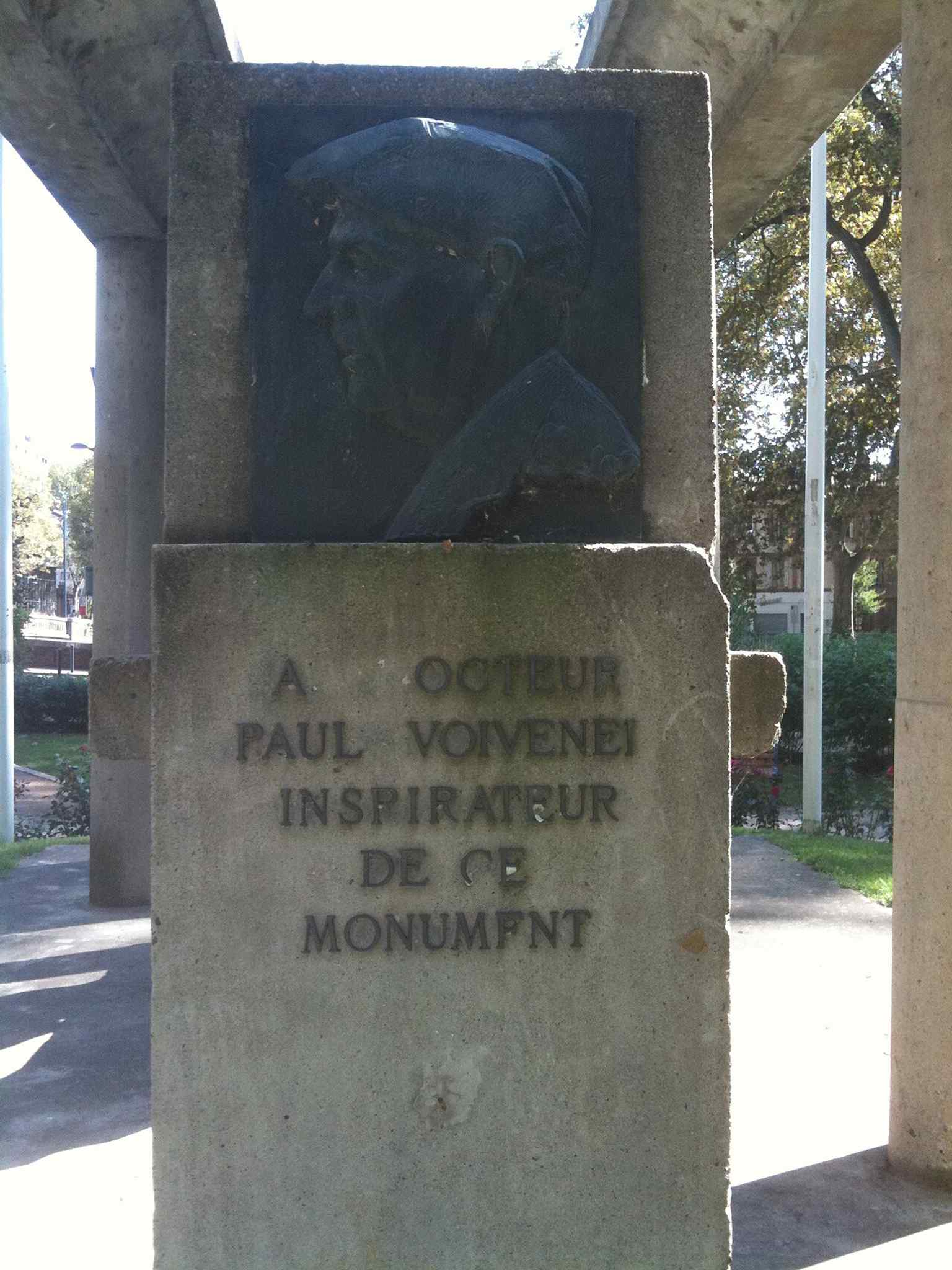
This view connects the sculpture to Paul Voivenel, the driving force behind Toulouse’s memorial project.Photo: Langladure, Wikimedia Commons, CC BY-SA 3.0. Cropped & resized. 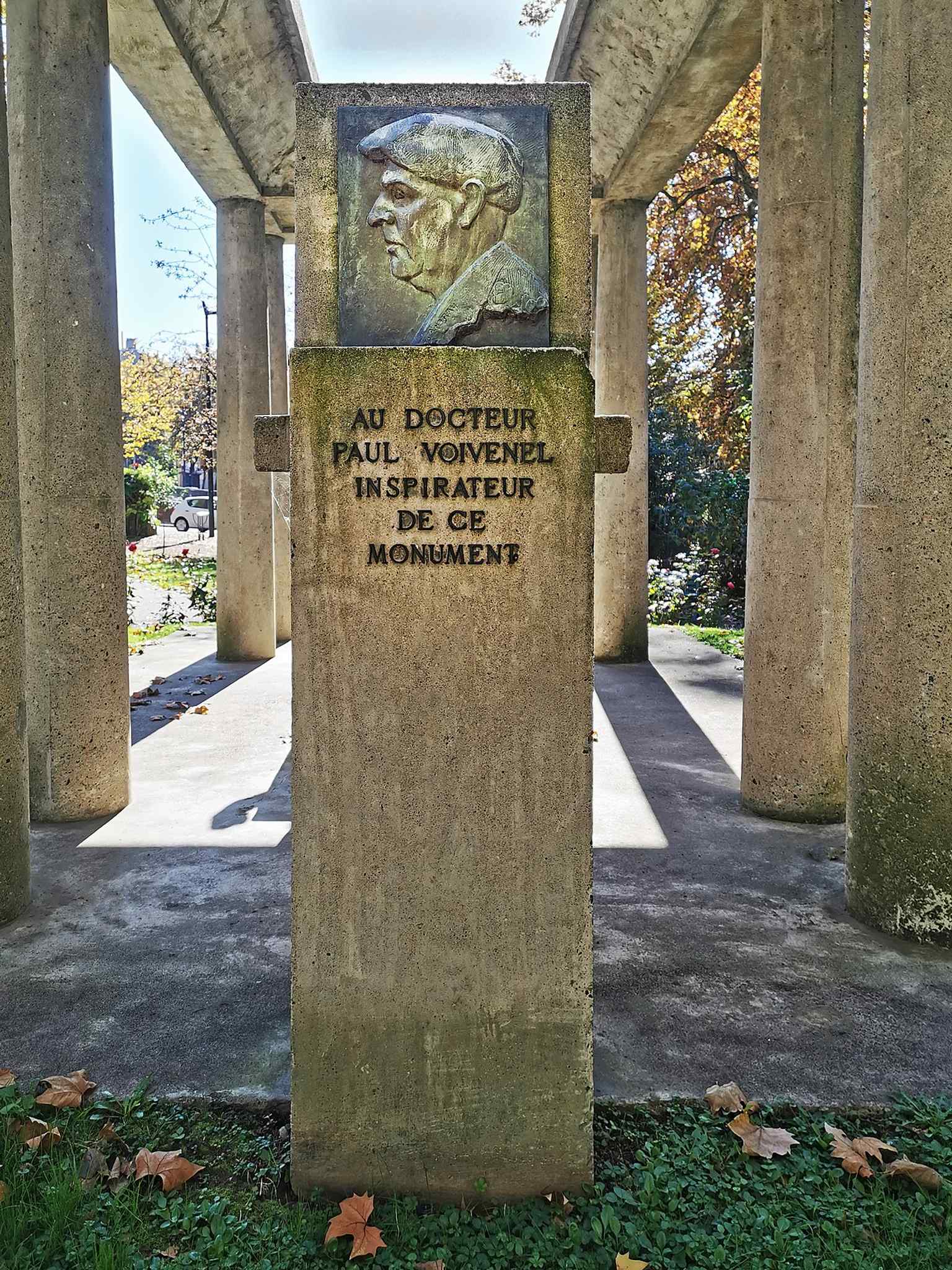
The stèle for Paul Voivenel beside Hercules the Archer, showing how the monument evolved into a broader tribute to the people behind the memorial.Photo: Didier Descouens, Wikimedia Commons, CC BY-SA 4.0. Cropped & resized. Look to your left for a long, straight canal-side roadway, framed by brick-and-stone embankments and running in a precise parallel line beside the narrow Canal de Brienne. Allée…Read moreShow less
Open dedicated page →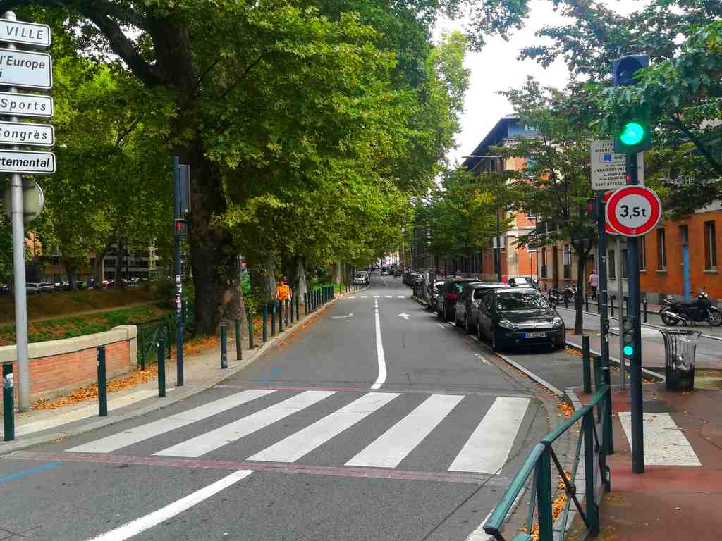
Brienne AlleyPhoto: Kuremu Sakura, Wikimedia Commons, CC BY-SA 4.0. Cropped & resized. Look to your left for a long, straight canal-side roadway, framed by brick-and-stone embankments and running in a precise parallel line beside the narrow Canal de Brienne.
Allée de Brienne and canal edge form one of Toulouse’s most revealing urban corridors: a place where transport history and ordinary neighbourhood life have shared the same strip of ground for centuries. It does not ask to be admired as a single grand monument. It asks to be read, slowly.
The man who gave this route its name, Étienne-Charles Loménie de Brienne, was the Archbishop of Toulouse and a senior political figure in the old Languedoc estates. He backed the canal project in the eighteenth century, but here the more important thing is the pairing of canal and road, which together linked Toulouse’s interior to the river edge.
If you glance at the image on your screen, you can see how the allée still behaves like a long urban seam, road and canal moving together in one deliberate line. That pairing is the whole point. Water moved cargo. The road beside it moved people, carts, and later buses, bicycles, and daily errands.
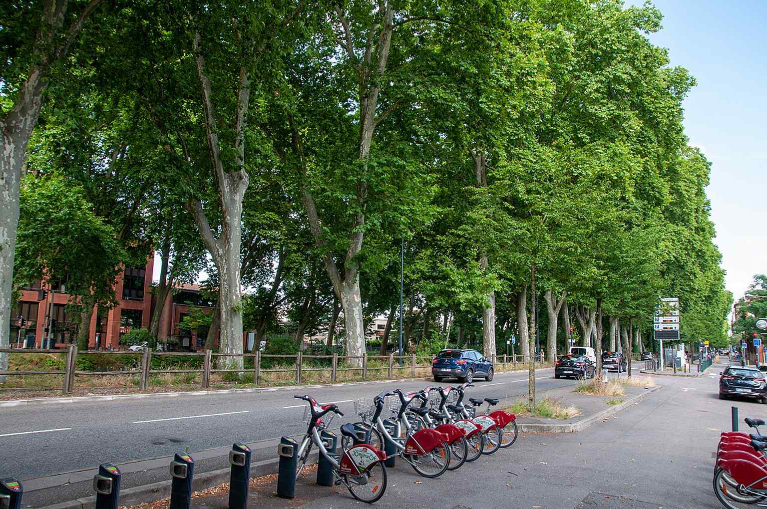
A contemporary view of Allée de Brienne in Toulouse, the canal-side boulevard named for Cardinal Loménie de Brienne and now part of a 30 km/h urban corridor.Photo: Don-vip, Wikimedia Commons, CC BY-SA 4.0. Cropped & resized. By the nineteenth century, Toulouse began to treat this edge as more than infrastructure. Local newspapers in eighteen forty-one praised the widening and straightening here because it created broad planted walks and gave new life to the quarter. So this route became both corridor and promenade, useful and civilised at once. Even now, you can sense that compromise. What used to belong to a departmental road has been softened into city pace: one-way traffic, bus priority in parts, cycle lanes, a zone where speed drops to thirty kilometres an hour, and nearer the river an even slower shared street at twenty. The city has not erased movement here; it has taught movement better manners.
And then there is the human traffic that filled it. Along this same allée stood the great tobacco manufacture, which grew into the second largest in France after Paris. At its height, it employed up to two thousand people, mostly women known as the tabataires, or tobacco workers. Imagine that current of working lives flowing along this road: clogs on paving, voices at the gates, children left at the crèche opened in nineteen twelve for the workers’ babies and young children. Industry here was never only about production. It organised meals, childcare, and the rhythm of a whole district.
So Brienne is not simply a road beside a canal. It is a record of Toulouse learning, again and again, how to turn engineered necessity into shared urban life.
Follow this line onward and you will feel the geometry begin to open out. The canal’s disciplined logic is giving way to the wider pull of the river. In about nine minutes, at Quai Saint-Pierre, Toulouse steps fully from canal space into Garonne space.
Look for a long brick-and-stone embankment running in a clear line beside the Garonne, framed by orderly neoclassical houses and marked by tall rounded arches at ground…Read moreShow less
Open dedicated page →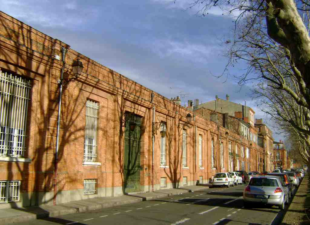
Quai Saint-PierrePhoto: Serein, Wikimedia Commons, CC BY-SA 3.0. Cropped & resized. Look for a long brick-and-stone embankment running in a clear line beside the Garonne, framed by orderly neoclassical houses and marked by tall rounded arches at ground level.
Quai Saint-Pierre is Toulouse at a threshold. Here, the city stops being only streets and begins to behave like a river city: a route for movement, a worked edge of water, and a public place where several versions of Toulouse meet at once.
Long before the elegant quay existed, this stretch near the Bazacle mattered because people could cross the Garonne here. That crossing point was already in use before the Roman city. It made this bank useful, vulnerable, and valuable all at once. In the Middle Ages, the Bazacle nearby was both passage and workplace, watched over by the old Bazacle castle and driven by mills that ground grain, sawed wood, beat cloth, and crushed oak bark for tanning leather. Even more remarkable, the mill company already behaved like a shared business: its ownership shares circulated on the Toulouse market, rising and falling with the profits of the mills. A modern financial instinct, you might say, in thoroughly medieval boots.
The quay you see took shape much later, in the eighteenth century, when Toulouse decided to discipline the river without turning its back on it. The engineer Joseph-Marie de Saget drew the plans in the seventeen seventies, and his crew built the retaining wall. They filled and levelled the bank with rubble, then laid out a proper roadway for carts and a pavement for pedestrians. That practical order still underpins the calmness of the place.
If you glance at the image on your screen, you can see the quay stretching along the river as a deliberate urban edge rather than a natural bank. De Saget never saw the whole work completed. He died in seventeen eighty-two during an epidemic, and his brother Charles-François took over until the quay was finished in seventeen eighty-six. That handover gives the place a more human texture. Grand plans often survive because someone quieter carries them through.
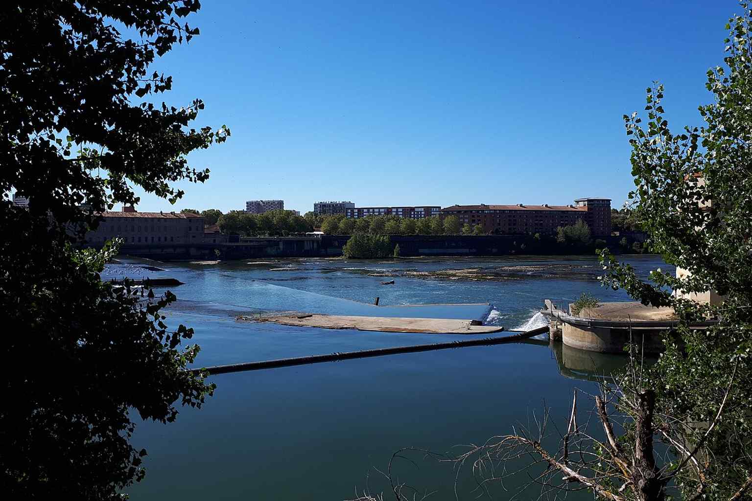
A broad view of Quai Saint-Pierre along the Garonne, showing the riverside walkway that stretches from the Bazacle to Place Saint-Pierre.Photo: Abdoucondorcet, Wikimedia Commons, CC BY-SA 4.0. Cropped & resized. Names changed with politics. First it honoured Archbishop Arthur Richard Dillon, who inaugurated the nearby Brienne canal. During the Revolution, it briefly became Quai Brutus, after the Roman founder of the republic. By eighteen oh six, it settled into Saint-Pierre, linking itself to the place and the old church of Saint-Pierre-des-Cuisines.
And this quay kept changing. Nearby industrial buildings passed from the old Bazacle company into Électricité de France, or E-D-F. In two thousand and thirteen, one former E-D-F building sheltered around one hundred and fifty people through homeless aid collectives. Soon after, the Toulouse Institute of Political Studies hoped to move here for more space and a river view, but residents and heritage authorities resisted. Later, developers proposed a senior residence instead. So even in recent memory, this stretch has kept negotiating what the city needs most.
One small detail says a great deal. On your phone, have a look at the carved chained captives near Rue de la Boule. It is a bas-relief, meaning a shallow sculpture cut to project slightly from the stone. That fragment once belonged elsewhere and was reset here in seventeen eighty, turning an entrance into a statement. Even decoration on this quay has been reused, carried over, given a second life.
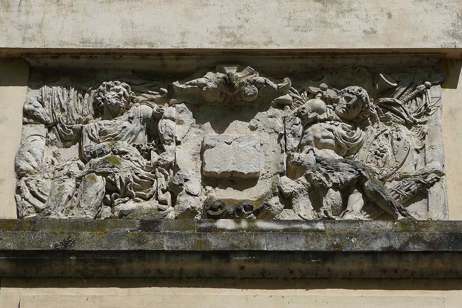
The chained captives bas-relief near Rue de la Boule, a sculpted remnant linked to the quay’s 18th-century monumental entrance.Photo: Abdoucondorcet, Wikimedia Commons, CC0. Cropped & resized. In a moment, continue toward Avenue of the Old Velodrome. The next views begin to gather all these currents together: water, engineering, memory, and the symbols a city chooses to place above them.
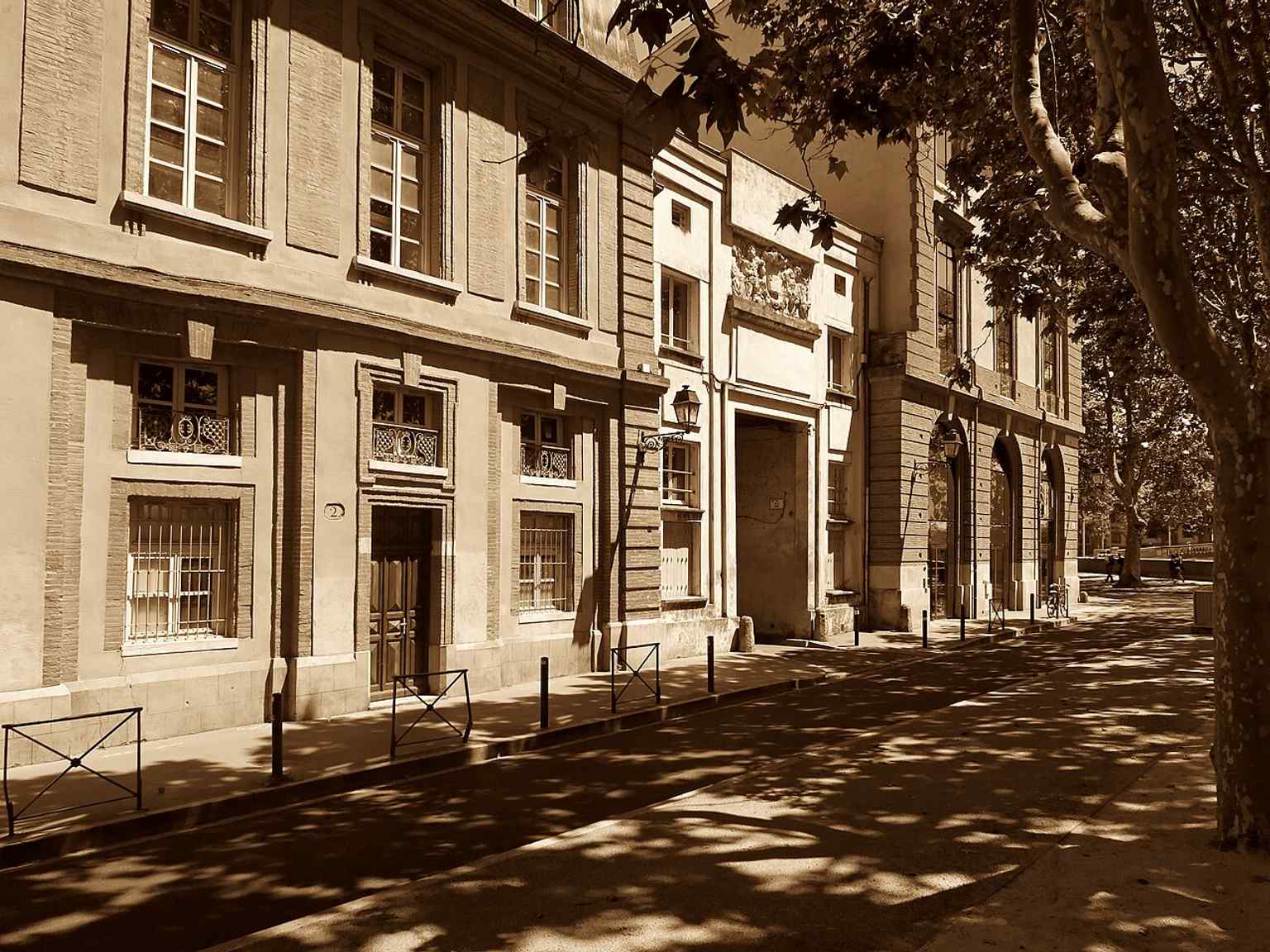
The Quai Saint-Pierre meeting Rue de la Boule — a key junction in the historic route toward Saint-Pierre-des-Cuisines.Photo: Olybrius, Wikimedia Commons, CC BY-SA 4.0. Cropped & resized. On your left, look for the oval sweep of dark asphalt curving around modern apartment blocks, with one distinctive section slipping under the concrete span of the Pont des…Read moreShow less
Open dedicated page →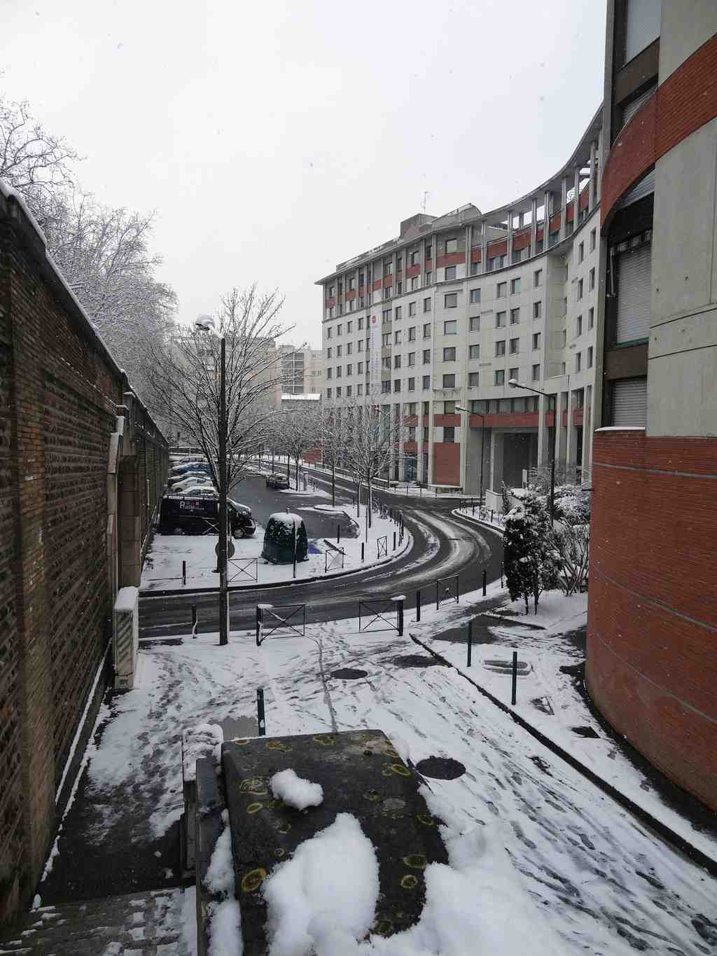
Avenue of the Old VelodromePhoto: Don-vip, Wikimedia Commons, CC BY-SA 3.0. Cropped & resized. On your left, look for the oval sweep of dark asphalt curving around modern apartment blocks, with one distinctive section slipping under the concrete span of the Pont des Catalans.
This is Avenue of the Old Velodrome, and its shape is the clue. Most streets in Toulouse behave sensibly: they connect one place to another, branch, continue, disappear into a grid. This one loops. It meets only Avenue Paul-Séjourné, serves two short dead ends, and even ducks partly into a tunnel beneath the bridge. That unusual oval is not an urban whim. It is a footprint.
In nineteen thirteen, the city laid out this access road for a destination that no longer stands: the Bazacle velodrome. The track had arrived earlier, in eighteen ninety, and from eighteen ninety-five the company Le Cycle-Sud Toulousain turned it into one of the city’s sporting stages. For decades, people came here not for parking spaces or student residences, but for speed, rivalry, and the strange theatre of men riding in circles at astonishing pace.
One moment gave the place a permanent claim on cycling history. On the eighth of July, nineteen oh three, during the very first Tour de France, the Bazacle velodrome served as the arrival control in Toulouse. Hippolyte Aucouturier recorded the best time here. Think of it this way: before this became a quiet residential address, it briefly touched the birth of the most famous cycle race in the world.
Local riders gave the place its own texture too. In nineteen oh eight, Marcaillou and Sérès won the Twelve Hours of Toulouse here, along with an American race, a relay style that traded exhaustion for teamwork. And in the track’s final years, the romance wore thin. Accounts remember Sylvain Marcaillou, Senseby, and Bouche repairing holes in the surface themselves before they could ride. That detail tells you almost everything. The glory had not vanished, exactly, but it had become hand-to-mouth, patched together lap by lap.
If you glance at the image in the app, you can see the present result: ordinary residential buildings occupying ground once given to spectacle. Another view makes the loop easier to grasp, this short road folding back on itself instead of joining the city in a straight line.
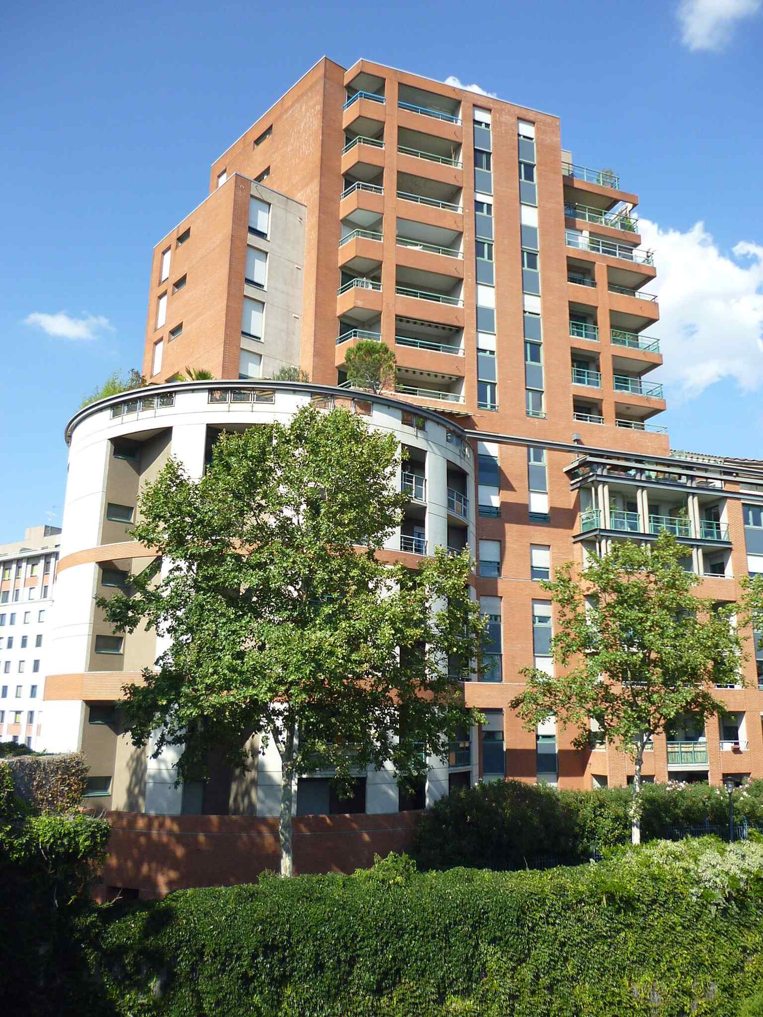
Residential buildings along Avenue de l'Ancien-Vélodrome, showing the quiet urban setting that replaced the old velodrome site near the Bazacle and the Pont des Catalans.Photo: Don-vip, Wikimedia Commons, CC BY-SA 3.0. Cropped & resized. The velodrome disappeared gradually, probably between the late nineteen forties and the nineteen fifties, and in nineteen sixty the avenue took its current name. So here is the quiet question this place leaves behind: when an old purpose dies, but its curve still directs your steps, has it really gone?
Toulouse often keeps memory not only in statues and plaques, but in stubborn lines on the map. Follow that thought toward the Catalan Bridge, where the city’s traces become impossible to miss.
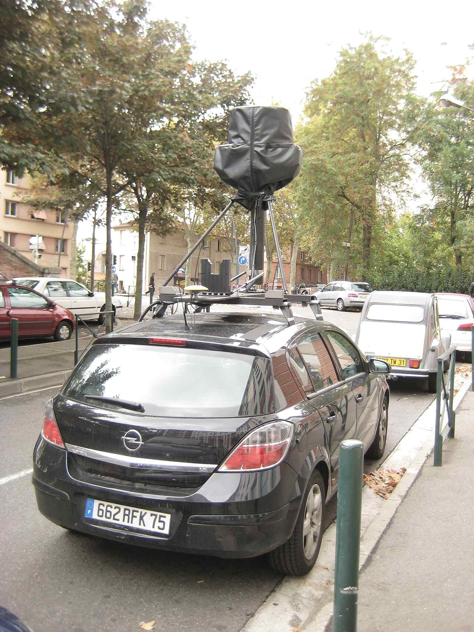
A Google Street View car on Avenue de l'Ancien-Vélodrome — a useful snapshot of this short residential avenue that links only to Avenue Paul-Séjourné.Photo: Don-vip, Wikimedia Commons, CC BY-SA 3.0. Cropped & resized. 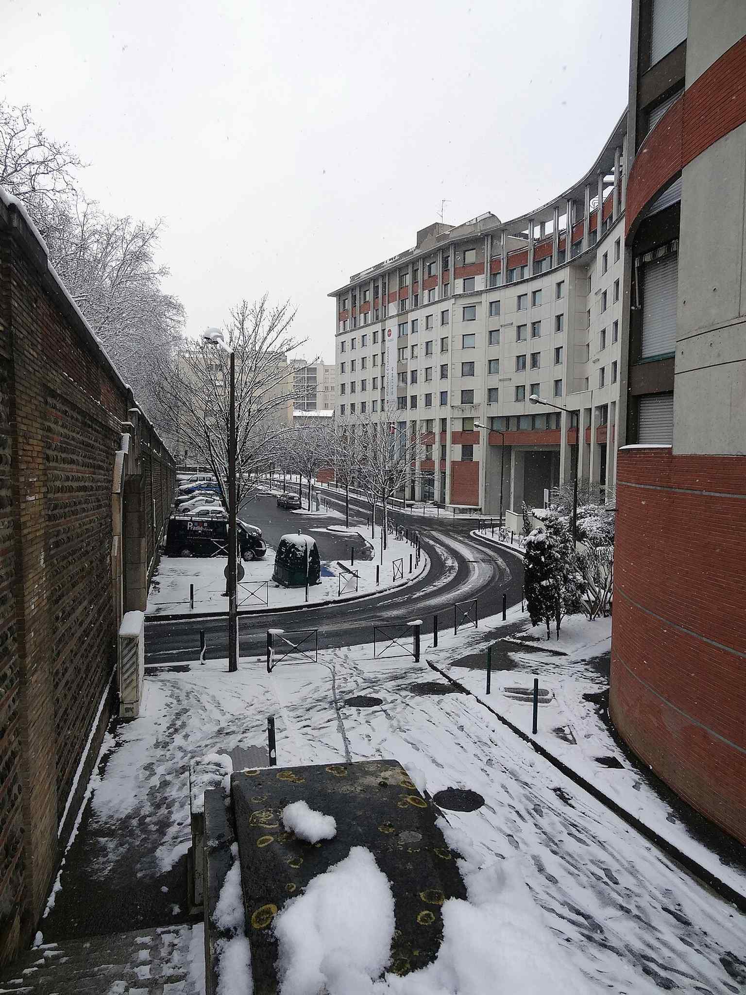
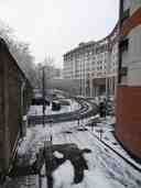
The avenue under winter snow, giving a clear view of the modern street that grew out of the former access road to Toulouse's Bazacle velodrome.Photo: Don-vip, Wikimedia Commons, CC BY-SA 3.0. Cropped & resized. Look for a long stone and reinforced concrete arch bridge, lined with red brick side panels and pierced by shell-shaped openings, stretching broad and pale across the…Read moreShow less
Open dedicated page →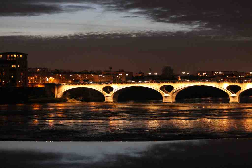
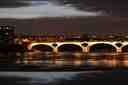
Catalan BridgePhoto: Maxime Lafage, Wikimedia Commons, CC BY-SA 3.0. Cropped & resized. Look for a long stone and reinforced concrete arch bridge, lined with red brick side panels and pierced by shell-shaped openings, stretching broad and pale across the Garonne.
This is the Pont des Catalans, opened in nineteen oh eight, and it makes a fitting final note for Toulouse. It is a working bridge first of all: traffic, pavements, cycle lanes, the steady business of crossing. But under that ordinary duty lies a rather deliberate piece of civic theatre.
The engineer and architect Paul Séjourné shaped it. He had already made his name with the Adolphe Bridge in Luxembourg, and here he refined that idea with the patience of a craftsman. Instead of cluttering the river with many supports, he set two narrow masonry arch rings apart from one another, then let a broad reinforced concrete roadway span between and beyond them. In plain terms, the road you see above is much wider than the stone arches that carry it below. It was bold, elegant, and efficient all at once.
Toulouse had not chosen the easiest answer. In the competition of nineteen oh one, the cheapest proposal was a metal bridge with seven spans. The jury, led by Jean Résal, thought it too poor in appearance for this part of the city and urged Toulouse to aim higher. The city did. Séjourné answered with stone, concrete, and those red brick side walls, so the bridge would sit naturally in a brick-built city. If you look closely at the openings, you may notice their scallop-shell shape. That was no whim. They nod to the Hôtel-Dieu Saint-Jacques nearby, quietly tying engineering to local memory.
And then there is the name. Most people crossing it never suspect that this bridge first belonged, on paper, to the Amidonniers district. It only became the Pont des Catalans after the official visit from Barcelona’s municipal council on the fourth of June, nineteen oh seven, led by Mayor Domènec Sanllehy i Alrich. Toulouse chose the new name to make friendship visible in stone. That matters. Cities do not only build roads; they also choose what their roads mean.
Even the lamps carry memory. Some came from the old suspended Pont Saint-Pierre, reused here rather than discarded, as if one crossing lent its light to another.
In twenty eighteen, the bridge was listed as a historic monument, praised for both its technical invention and the elegance of its line. Quite right too.
So here, at the edge of the river, Toulouse leaves you with its clearest habit: it takes force, traffic, rivalry, old materials, new ideas, and even diplomacy, and turns them into a path people simply use. A bridge, in the end, is never only a bridge. It is a decision to keep the city connected.

Frequently asked questions
How do I start the tour?
After purchase, download the AudaTours app and enter your redemption code. The tour will be ready to start immediately - just tap play and follow the GPS-guided route.
Do I need internet during the tour?
No! Download the tour before you start and enjoy it fully offline. Only the chat feature requires internet. We recommend downloading on WiFi to save mobile data.
Is this a guided group tour?
No - this is a self-guided audio tour. You explore independently at your own pace, with audio narration playing through your phone. No tour guide, no group, no schedule.
How long does the tour take?
Most tours take 60–90 minutes to complete, but you control the pace entirely. Pause, skip stops, or take breaks whenever you want.
What if I can't finish the tour today?
No problem! Tours have lifetime access. Pause and resume whenever you like - tomorrow, next week, or next year. Your progress is saved.
What languages are available?
All tours are available in 50+ languages. Select your preferred language when redeeming your code. Note: language cannot be changed after tour generation.
Where do I access the tour after purchase?
Download the free AudaTours app from the App Store or Google Play. Enter your redemption code (sent via email) and the tour will appear in your library, ready to download and start.
If you don't enjoy the tour, we'll refund your purchase. Contact us at [email protected]
Checkout securely with 






.jpg)
.jpg)
.jpg)


