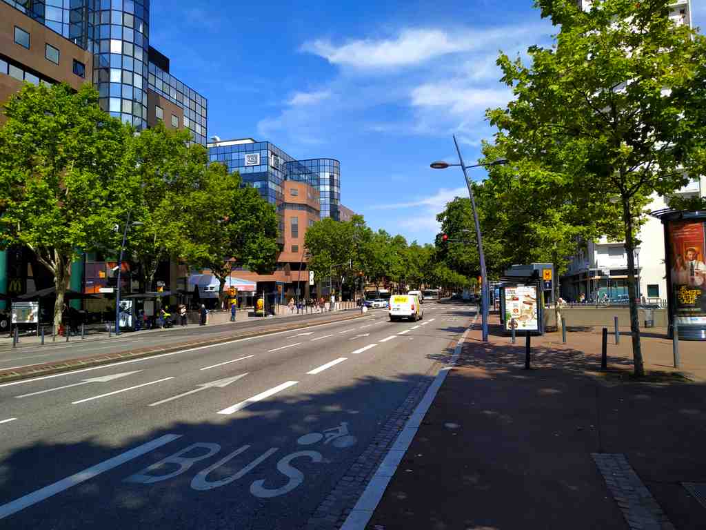
On your left, Lascrosses Boulevard shows itself as a broad straight band of asphalt, edged with wide pavements and a parallel side lane that gives the street its unusually generous width.
This is one of those places that looks like pure circulation until you realise it is also a line of argument. Boulevard Lascrosses forms a seam between the older city to the south and the redeveloped Compans-Caffarelli district to the north. It does not simply carry people through Toulouse; it tells you how Toulouse chose to open itself, extend itself, and reorganise land that once stood under much tighter control.
The boulevard runs north of the historic centre, starting near Place Arnaud-Bernard and stretching in a long, rectilinear sweep toward Allée de Barcelone and the Square de l’Héraclès. At roughly forty-five metres wide, it was conceived on a grand scale. In its eastern section, traffic spreads across multiple lanes, with space reserved for buses and cyclists; farther west, near Héraclès, the road tightens. Even that change in width feels revealing. This is not one simple street. It is a sequence of urban decisions.
The turning point came after the French Revolution. Religious houses were dissolved, and military authorities took over large nearby sites: the Carthusian convent, the Capuchin convent, Saint-Pierre-des-Cuisines, and the arsenal. Then, in eighteen oh eight, city officials used Napoleon’s visit cleverly. They asked for the old ramparts to come down. He agreed, and after that, architect Jacques-Pascal Virebent drew a new boulevard along the line where fortification had once stood. That matters. A defensive edge became a public axis.
At first, people called it the Boulevard de l’Artillerie because it ran beside the artillery school. The current name, adopted in eighteen forty-seven, reaches further back, to the old district of Las Cròsas. Scholars still argue over that name. One historian linked it to crosses marking graves in the main cemetery outside Saint-Sernin. Another believed it referred to hollows or broken ground. Either way, memory here clings to the terrain.
And the road kept pressing westward. That did not happen neatly. After the Revolution recognised freedom of worship, the city assigned land near Rue du Béarnais for Protestant and Jewish cemeteries. When planners later extended the boulevard, they cut across those burial grounds. Work stalled until eighteen eighty-four, when the bodies moved to Terre-Cabade. It is a sobering reminder that boulevards can join neighbourhoods, but they can also overrule older maps of belonging.
By the nineteenth century, barracks rose here: first Lascrosses, then Caffarelli, named for General Maximilien de Caffarelli du Falga, and later Compans. In the twentieth century, the military grip loosened. Administrative buildings, housing, a shopping centre, gardens, a metro station, and business schools took over. The traffic still looks practical, even blunt, but it traces a deeper conversion: controlled ground becoming civic ground.
One more thread to keep in mind: near here, at Rue du Canon-d’Arcole, a plaque marks the childhood home of Carlos Gardel before he left for Argentina and became the voice of tango. Even on a boulevard built for movement, certain lives leave a fixed point.
In about a minute, T-B-S Education will show you another face of this same ambition: not artillery now, but training, commerce, and the city imagining its future.