
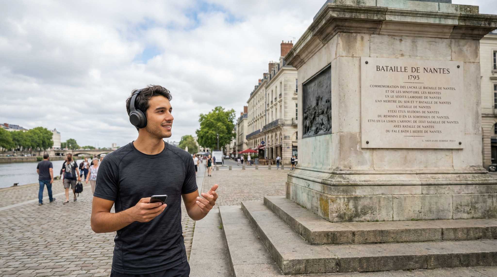
Nantes Audio Tour: Unveiling Nantes' Nooks and Narratives
Stone dragons perch atop Nantes Cathedral while secret tunnels lace beneath your feet—echoes of battles and betrayals still shiver through these ancient streets. Set out on a self-guided audio adventure through Decré-Cathédrale. Uncover hidden stories, lost legends, and striking corners most travelers overlook. This is the other side of Nantes. Whose desperate cry rang through the shadows of Bouffay Castle as cannons tore the night? What vanished artifact still haunts the site of the 1793 Battle of Nantes? Why did cathedral bells fall silent one chilling afternoon, leaving rumors swirling for centuries? Trace the swirl of revolution and resistance. Cross old stones where rebels plotted and ghosts linger. Feel each turn reveal new layers, from stormy conflicts to quiet mysteries—Nantes comes alive with each step you take. The secrets are waiting in the shadows. Press play and bring them into the light.
Tour preview
About this tour
- scheduleDuration 70–90 minsGo at your own pace
- straighten1.9 km walking routeFollow the guided path
- location_on
- wifi_offWorks offlineDownload once, use anywhere
- all_inclusiveLifetime accessReplay anytime, forever
- location_onStarts at Rue du Roi-Albert
Stops on this tour
lock_open 3 free previews · 12 unlock with purchase
Look for a broad, straight street paved in dark asphalt, lined with pale tuffeau-and-granite townhouses in orderly rows, with the massive stone body of the cathedral marking one…Read moreShow less
Open dedicated page →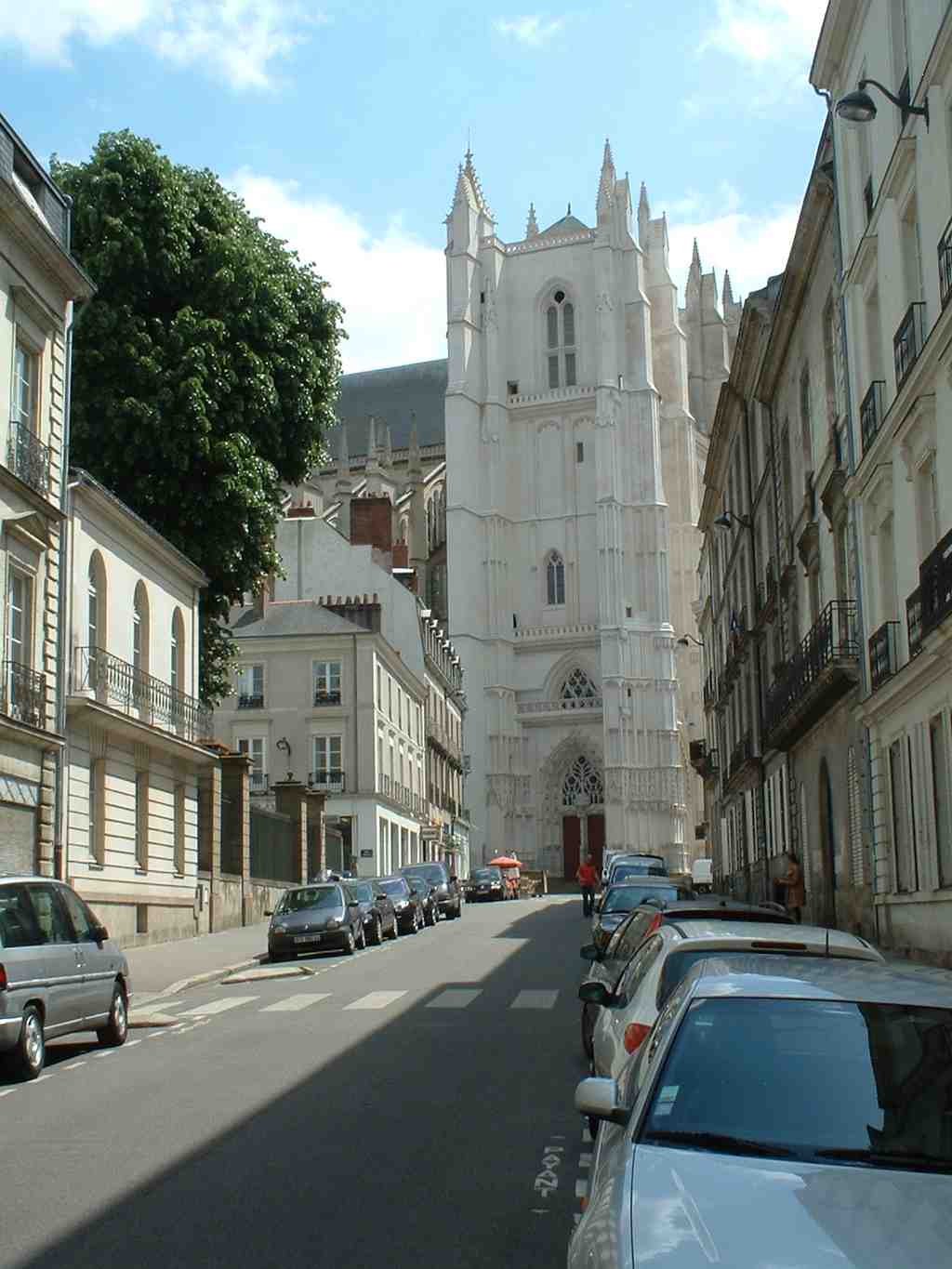
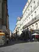
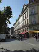
Rue du Roi-AlbertPhoto: Rehtse, Wikimedia Commons, CC BY-SA 4.0. Cropped & resized. Look for a broad, straight street paved in dark asphalt, lined with pale tuffeau-and-granite townhouses in orderly rows, with the massive stone body of the cathedral marking one end.
This is Rue du Roi-Albert, and at first glance it feels almost ceremonial... a clean line drawn between the cathedral and the prefecture, church at one end, state at the other. In the late eighteenth century, the architect Jean-Baptiste Ceineray helped give Nantes this rational face. He traced this street through ground left open after the old medieval walls began to come down, and he made it unusually wide for its time, about twelve meters across, as if the city wanted to present itself with confidence.
But Nantes is what some people call a palimpsest city... a city rewritten over itself like old parchment used again and again. This street is a first lesson in that. Workers carving out this neat passage uncovered older layers: the crumbling medieval rampart leaned on part of an even older Gallo-Roman wall. So before this became a formal urban axis, it was already a place of buried boundaries, erased defenses, and stubborn remains.
Pause a moment and look along the slope of the street. Notice how much authority is created by straightness alone... by the way one important building answers another, and by the calm discipline of the façades.
Even the name teaches the same lesson. Ceineray’s street first carried the royal title Rue Royale. The Revolution stripped that away and called it Rue du Peuple-Français, the Street of the French People. Later it became Rue du Département, then turned back to Rue Royale, and in nineteen sixteen Nantes renamed it again for King Albert the First of Belgium. That choice was not decorative. The city wanted to honor the Belgian ruler admired across Europe for resisting the German invasion in the First World War. A street name, here, acts like a public monument. Power changes, grief arrives, loyalties shift... and the map itself gets rewritten.
The most painful rewriting came in the Second World War. On the twentieth of October, nineteen forty-one, at about seven-thirty in the morning, Gilbert Brustlein and two other Resistance fighters waited near number one. Brustlein shot Karl Hotz, the German military commander in Nantes, in the back. Hotz died at once. What makes the story harder is that he had already spent time in Nantes before the occupation, working as an engineer on civil projects. After his death, the German authorities took hostages. Forty-eight men were executed in Nantes, Châteaubriant, and near Paris in retaliation.
So this elegant street, with its composed stone fronts and careful proportions, carries more than good manners. It carries planning, protest, renaming, occupation, and mourning. Later, even Jacques Demy chose it for Une chambre en ville because this tidy, bourgeois setting could hold a charged confrontation so well.
Ahead, the city opens into formal walks and squares where power liked to display itself in public. We’ll follow that thread next toward the Saint-Pierre and Saint-André courses, about a four-minute walk from here.
On your left, look for a long formal promenade of pale gravel and stone terraces, framed by straight rows of trees and marked by statues and broad stairways at its ends. This is…Read moreShow less
Open dedicated page →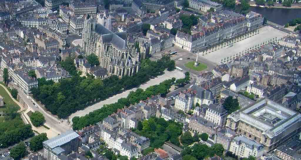
Saint-Pierre and Saint-André coursesPhoto: Jibi44, Wikimedia Commons, CC BY-SA 3.0. Cropped & resized. On your left, look for a long formal promenade of pale gravel and stone terraces, framed by straight rows of trees and marked by statues and broad stairways at its ends.
This is the pair of promenades called the cours Saint-Pierre and cours Saint-André. In French, a cours is a broad public walk, designed not just for getting somewhere, but for being seen, meeting others, and letting the city present itself with a little grace. These were the first spaces like that in Nantes. Before that, this ground lay outside the old walls... rough, open, and defensive, kept bare so enemies could be spotted.
That is part of what makes this place so moving. A neat promenade came to life on land shaped first by fear. In Roman times, a road crossed here toward Angers, and funerary stones stood nearby. Later, Merovingian burials filled parts of this area. In the Middle Ages, the two raised mounds here, Saint-Pierre to the south and Saint-André to the north, helped protect the eastern edge of the city, where there was no river to shield Nantes. A belouard stood between them, a fortified bulge in the wall defending the gate; that old word, belouard, is one of the roots of our word boulevard.
Then, in the late eighteenth and early nineteenth centuries, city leaders helped Nantes imagine something gentler. He pushed to level the southern mound, cover it with sand, plant hundreds of elm trees, and open it as a promenade. Later, the city architect Jean-Baptiste Ceineray straightened the whole composition, linked the two cours with the square ahead, and turned military ground into civic theater.
And theater it became. On the fourteenth of June, seventeen eighty-four, around eighty thousand people packed these walks to watch the balloon called the Suffren rise into the sky. Father Mouchet and Coustard de Massy guided it upward after local residents funded the project by public subscription. Imagine the gasp that must have rippled through the crowd as a gas balloon lifted above the roofs of Nantes. For a moment, this promenade stopped being a city path and became a stage for wonder.
If you ever want a local’s way of seeing the place, notice the monuments as carefully as the trees. Down on the Saint-Pierre side, the memorial to the dead of the war of eighteen seventy stands between Anne of Brittany and Arthur the Third. Those statues have had their own wandering lives. Dominique Molknecht carved them in the eighteen twenties, then time wore them down so badly that sculptors removed and recut them in harder stone before returning them here in nineteen hundred. They make this promenade feel like a quiet museum of memory that has been lifted, altered, and set back in place.
The mood deepens at the far north end of Saint-André, where a First World War memorial lists the names of Nantes dead. Even that solemn wall became the center of fierce argument in the nineteen twenties, when the city placed Émile Guillaume’s bronze figure La Délivrance before it, and opponents attacked the statue with axes. Here, public space never stayed simple for long.
So as you stand here, hold both truths together: a place for strolling, and a place laid over old lines of defense, burial, ceremony, and collective emotion. In a moment, we’ll step into Maréchal-Foch Square, where that formal civic staging comes fully into view. And if you return later, these promenades are always open.
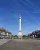
In front of you lies a broad paved square centered on a tall pale stone column, its straight shaft crowned by the unmistakable statue of King Louis the Sixteenth. This is…Read moreShow less
Open dedicated page →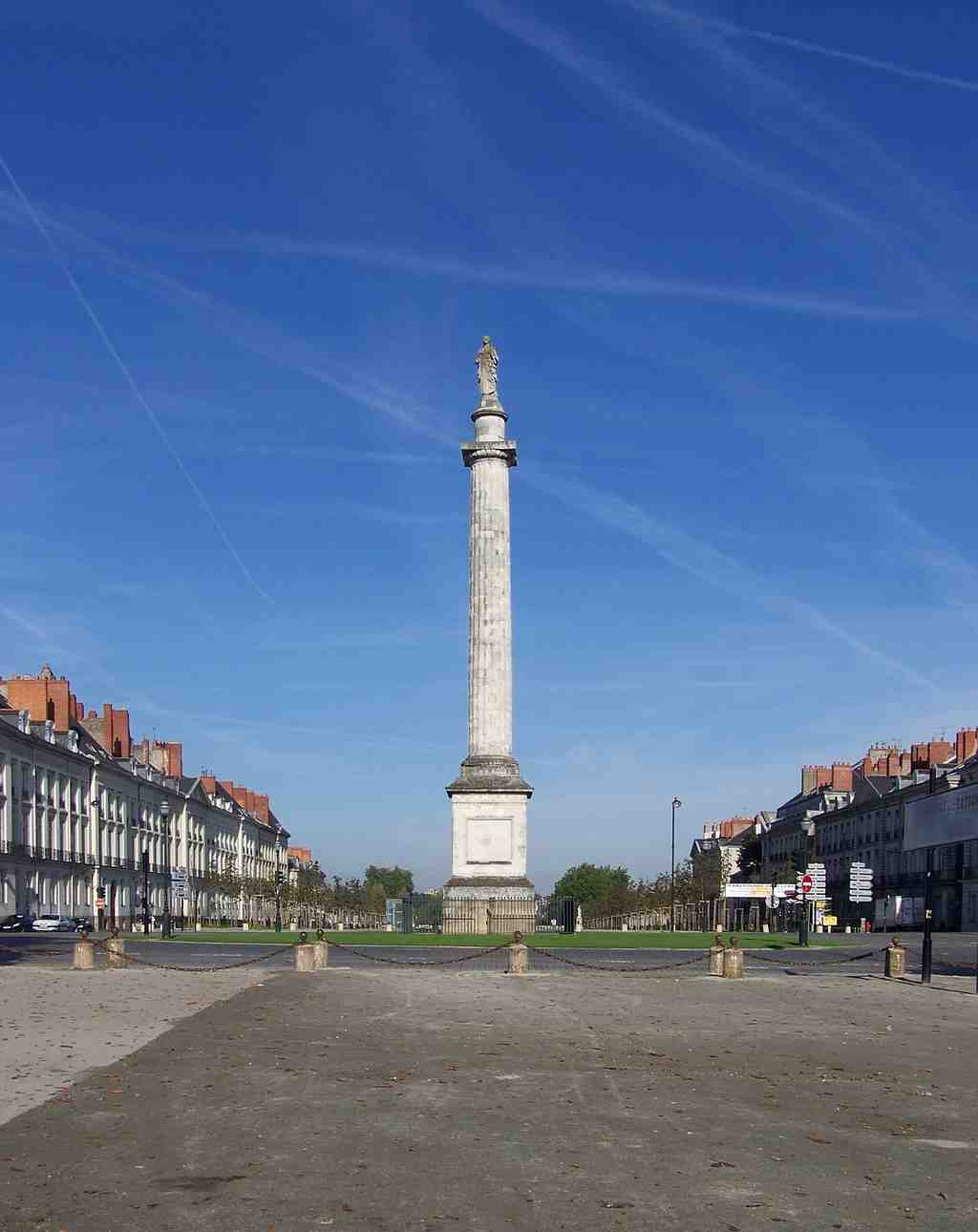
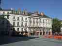
Maréchal-Foch SquarePhoto: Florestan, Wikimedia Commons, CC BY 3.0. Cropped & resized. In front of you lies a broad paved square centered on a tall pale stone column, its straight shaft crowned by the unmistakable statue of King Louis the Sixteenth.
This is Maréchal-Foch Square, one of Nantes’ best-known open spaces... but it began as something much harder. You are standing on former defensive ground, the Saint-Pierre bastion - a bastion being a jutting part of a city wall designed to watch, defend, and fire outward. In the late eighteenth century, Nantes tamed that military edge and turned it into a link between the old city and the neighborhoods growing beyond it. So this elegant square is really a piece of fortification taught to behave like a salon.
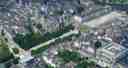
If you glance at your phone, the aerial view makes that easier to feel: the square sits like a stitched seam between older Nantes and its expansion beyond the walls.
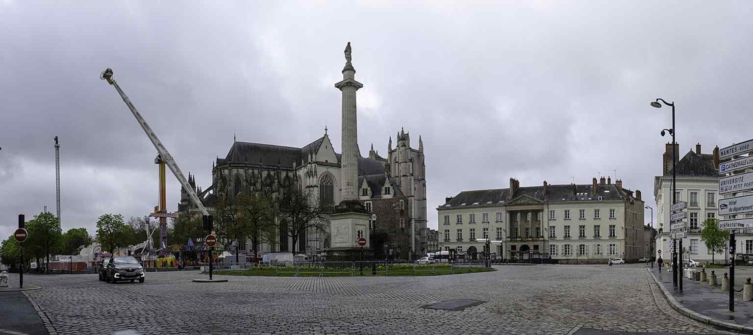
A wide panorama of Maréchal-Foch Square in Nantes, showing the urban space that links the old city to its former fortifications and the Cathedral district.Photo: Romain D C, Wikimedia Commons, CC BY-SA 4.0. Cropped & resized. Its names tell an even sharper story. For years, people called it Place d’Armes - literally the parade ground, a military square. Under the Restoration, when the monarchy returned after Napoleon, it became Place Louis the Sixteenth. Then, in nineteen twenty-nine, the city council officially renamed it for Ferdinand Foch, the French marshal. But official names do not always win the heart. Many Nantais, especially older families rooted here for generations, still say Place Louis the Sixteenth without even thinking. Maps change faster than memory.
That tension rises right in the middle of the square, at the column before you. It began in seventeen ninety as a Column of Liberty. Think about that for a moment: a revolutionary monument, planted at the end of the eighteenth century. Then politics turned, and in eighteen twenty-three, under Mayor Louis-Hyacinthe Levesque, the sculptor Dominique Molknecht placed Louis the Sixteenth on top. The same stone stayed put, but its meaning changed completely. One historian called it a kind of palimpsest - a page scraped and written over again. In simpler words, the old message never vanished; a new one was forced on top of it.
People kept fighting over that meaning. Every twenty-first of January, monarchists gathered here to mark the king’s execution. In nineteen ninety-three, royalists and free-thinkers came one after the other to this same spot, almost taking turns in a small war of remembrance.
And the square has known real blood as well as symbolic battles. During the July Revolution of eighteen thirty, ten people from Nantes died here at the foot of the column on the thirtieth of July. A doctor in Paris, Monsieur Martin, felt their loss strongly enough to send the mayor a bronze memorial plaque. He made one strange error in the inscription: instead of honoring workers, it honored ploughmen. It is a tiny mistake, but a human one. Even grief, sent from a distance, can arrive slightly altered.
Look around the edges and the square keeps changing masks. The Hôtel d’Aux began as a private mansion for René-Louis d’Aux, then sheltered the National Institute, then welcomed Napoleon and Josephine in eighteen oh eight, and later served the army. Nearby, the Hôtel de Charette carried a darker burden during the Second World War, when locals knew it as the Gestapo headquarters. Aristocratic facades... terrible memories.
That is what this place does so well: it smooths over rupture without ever quite erasing it.
When you are ready, walk toward Nantes Cathedral, just ahead. There, stone grandeur and human violence meet even more openly than they do here.
Show 12 more stopsShow fewer stopsexpand_moreexpand_less
On your left rises a pale stone façade with twin square towers, a pointed central portal, and a small exterior pulpit projecting from the front like a balcony for preaching. It…Read moreShow less
Open dedicated page →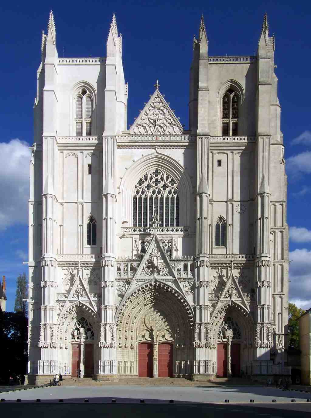
Nantes CathedralPhoto: Eusebius, Wikimedia Commons, Public domain. Cropped & resized. On your left rises a pale stone façade with twin square towers, a pointed central portal, and a small exterior pulpit projecting from the front like a balcony for preaching.
It is easy to read a cathedral like this as pure calm... but Nantes earned this calm the hard way. Before these Gothic walls climbed into the sky, another church stood here. In the year eight hundred forty-three, during Mass on the Feast of Saint John the Baptist, Viking raiders burst inside. They slaughtered the congregation, beheaded Bishop Gohard at the altar, and set the church on fire. Beneath this cathedral, in the crypt, his memory still lingers like a wound the city never quite agreed to forget. If you want a glimpse of that deeper layer, the crypt image in the app is worth a look.
The building you see now began when John the Fifth, Duke of Brittany, and Bishop Jean de Malestroit laid the foundation stone in fourteen thirty-four. That sounds tidy... but this cathedral took four hundred fifty-seven years to finish. Generations began it, financed it, revised it, and died long before they could see the end. Guillaume de Dammartin started the work, Mathurin Rodier continued it, and others carried it onward until eighteen ninety-one. Even the eastern end had to wait until old defensive walls nearby came down. So this place was never simply dropped into the city as a finished act of faith; it had to negotiate with war, walls, money, and time.
Look up for a moment at the sheer Gothic mass of it... the towers, the disciplined symmetry, the carved doors. Ask yourself whether this feels like a place built only for prayer, or also for survival.
That little stone pulpit on the outside tells part of the story. Priests used it to preach directly into the square when crowds overflowed the church, or when gathering indoors turned dangerous during outbreaks of disease. Even worship had to adapt here.
And power gathered here too. In sixteen sixty-one, right outside in the square, D’Artagnan - yes, the captain of the king’s musketeers - arrested Nicolas Fouquet, the king’s powerful finance minister. Fouquet thought he still stood in royal favor. Instead, beneath these towers, Louis the Fourteenth began stripping away one of the last great obstacles to his personal rule. This cathedral has watched prayer and ambition step out onto the same stones.
It has also kept surviving. Allied bombs damaged it in nineteen forty-four. A worker’s blowtorch sparked a huge roof fire in nineteen seventy-two. Restorers replaced the old timber frame with concrete, and that choice helped save the roof from total collapse during the arson fire of twenty twenty, though the great organ - a survivor since sixteen twenty-one - was finally lost. You can compare the façade before and after that fire in the app’s historic slider.
So when you stand here, you’re not looking at untouched holiness. You’re looking at endurance... stone laid over ash, memory laid over violence.
And yet not all sacred memory in Nantes survived in stone at all. At our next stop, the vanished Collégiale Notre-Dame, we’ll meet one of the city’s important churches that disappeared almost entirely. If you want to go inside here later, the cathedral generally opens from nine to seven, and until eight on Sunday.
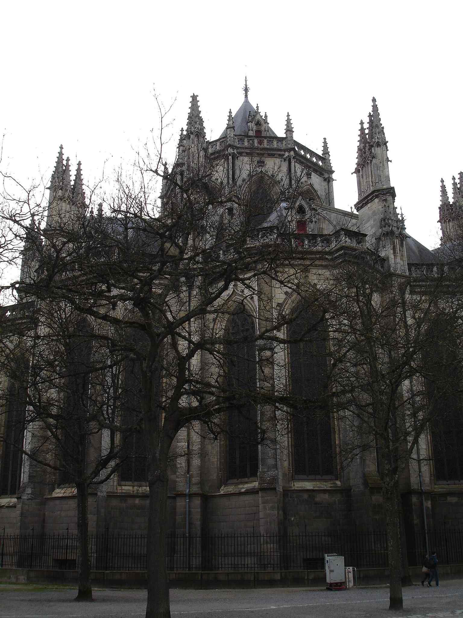
The main west front of Nantes Cathedral, where the twin towers dominate the square and the building’s long Gothic reconstruction became a city landmark.Photo: GoEThe, Wikimedia Commons, CC BY-SA 3.0. Cropped & resized. 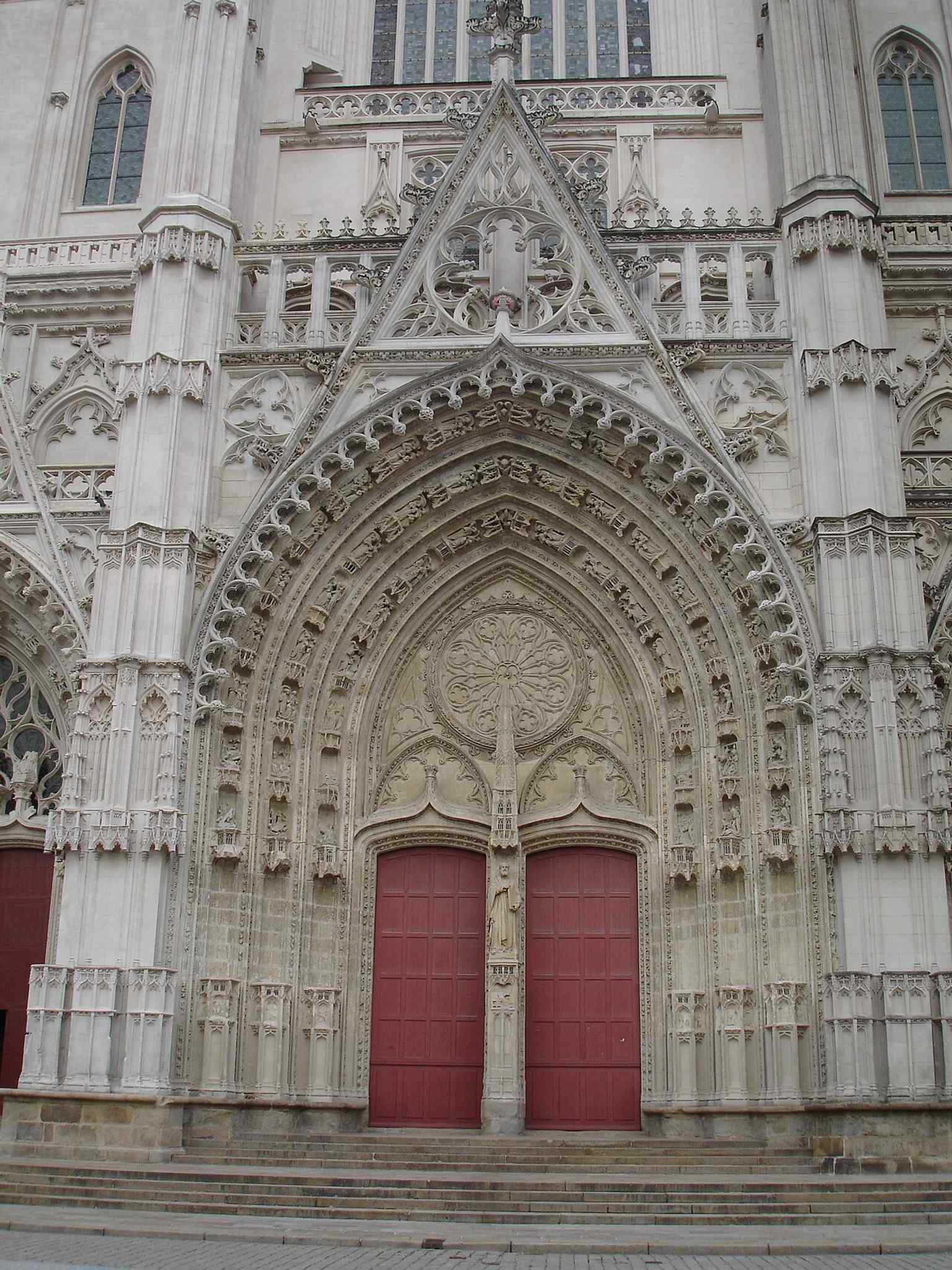
One of the cathedral’s richly carved doors — the façade is known for its five decorated portals and the rare external pulpit beside the entrance.Photo: GoEThe, Wikimedia Commons, CC BY-SA 3.0. Cropped & resized. 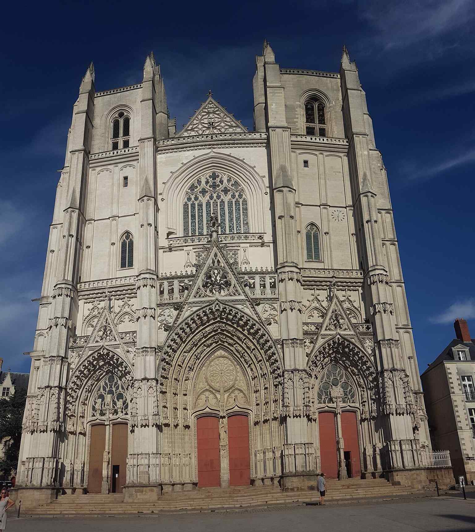
A clear frontal view of the façade, useful for showing the cathedral’s scale and the regular French-Gothic symmetry of the west front.Photo: Irma conseil, Wikimedia Commons, CC BY-SA 4.0. Cropped & resized. 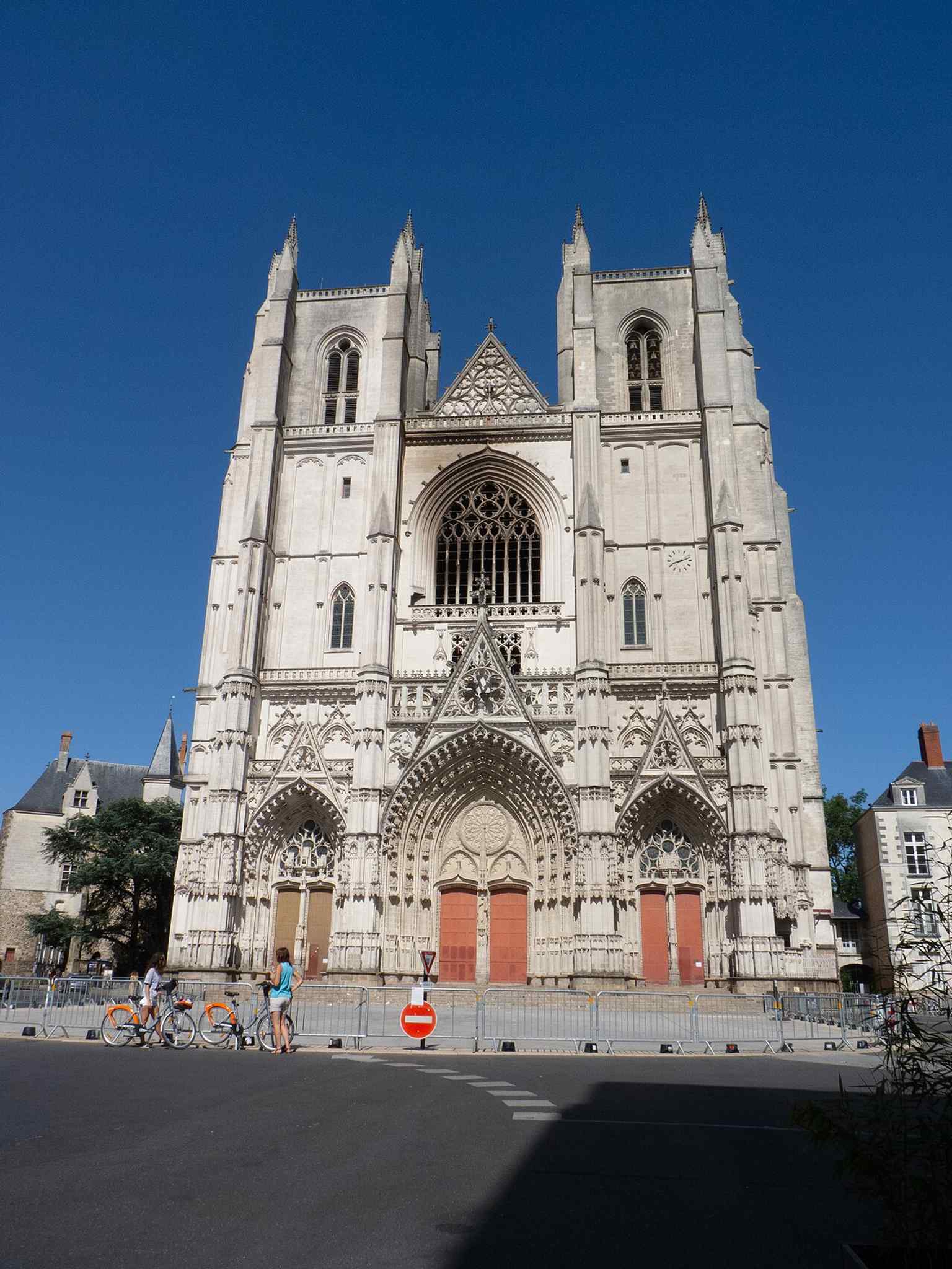
The cathedral after the 2020 fire, a reminder of how the building has repeatedly survived damage, from wartime bombing to modern arson.Photo: Romain D C, Wikimedia Commons, CC BY-SA 4.0. Cropped & resized. 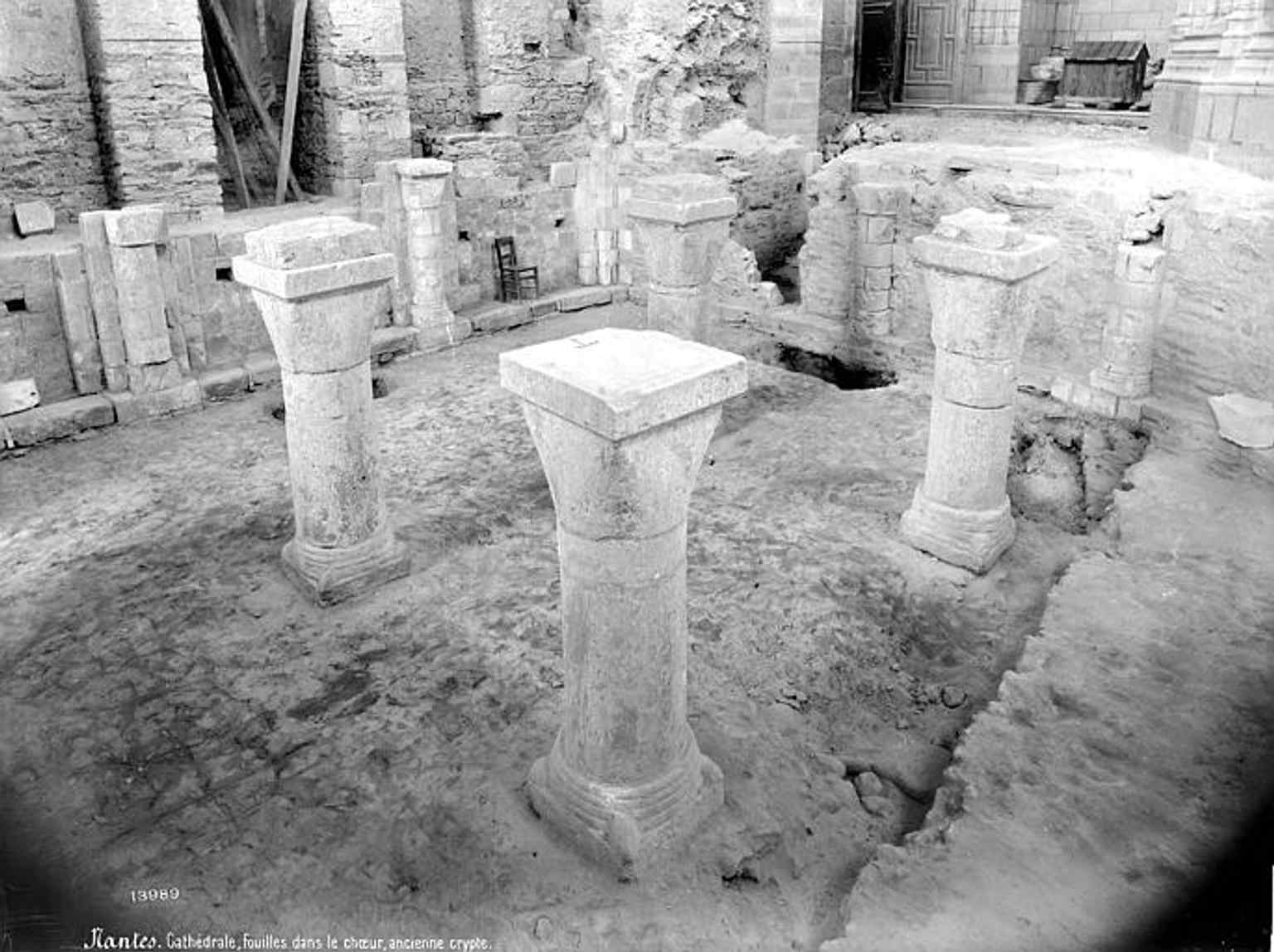
The crypt under excavation in 1905, evoking the site’s deep history and the memory of St. Gohard’s martyrdom preserved below the cathedral.Photo: Séraphin-Médéric Mieusement, Wikimedia Commons, CC BY-SA 4.0. Cropped & resized. 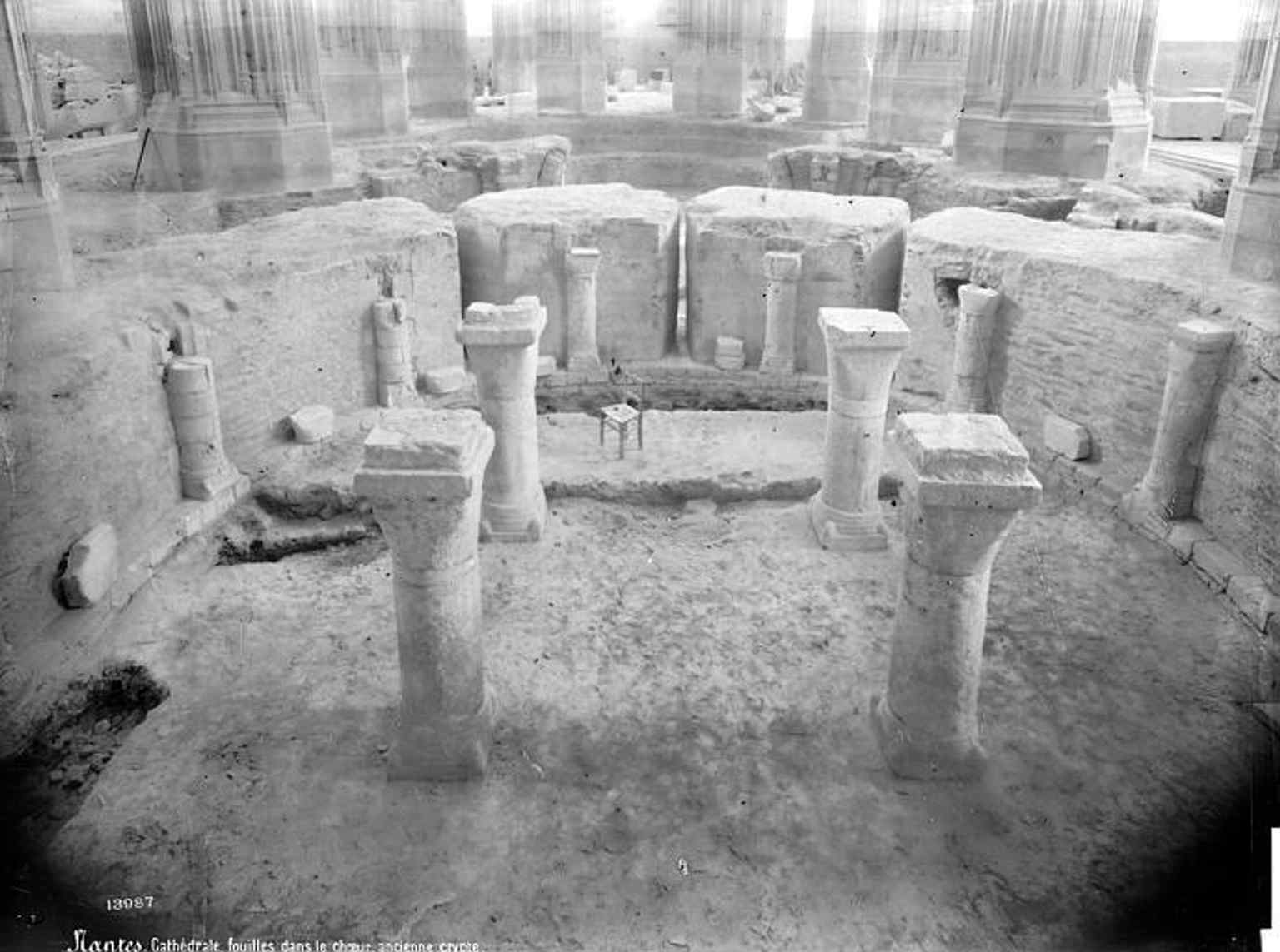
Another early-20th-century view of the crypt, linking the present Gothic cathedral to the older sacred ground that stood here before it.Photo: Séraphin-Médéric Mieusement, Wikimedia Commons, CC BY-SA 4.0. Cropped & resized. 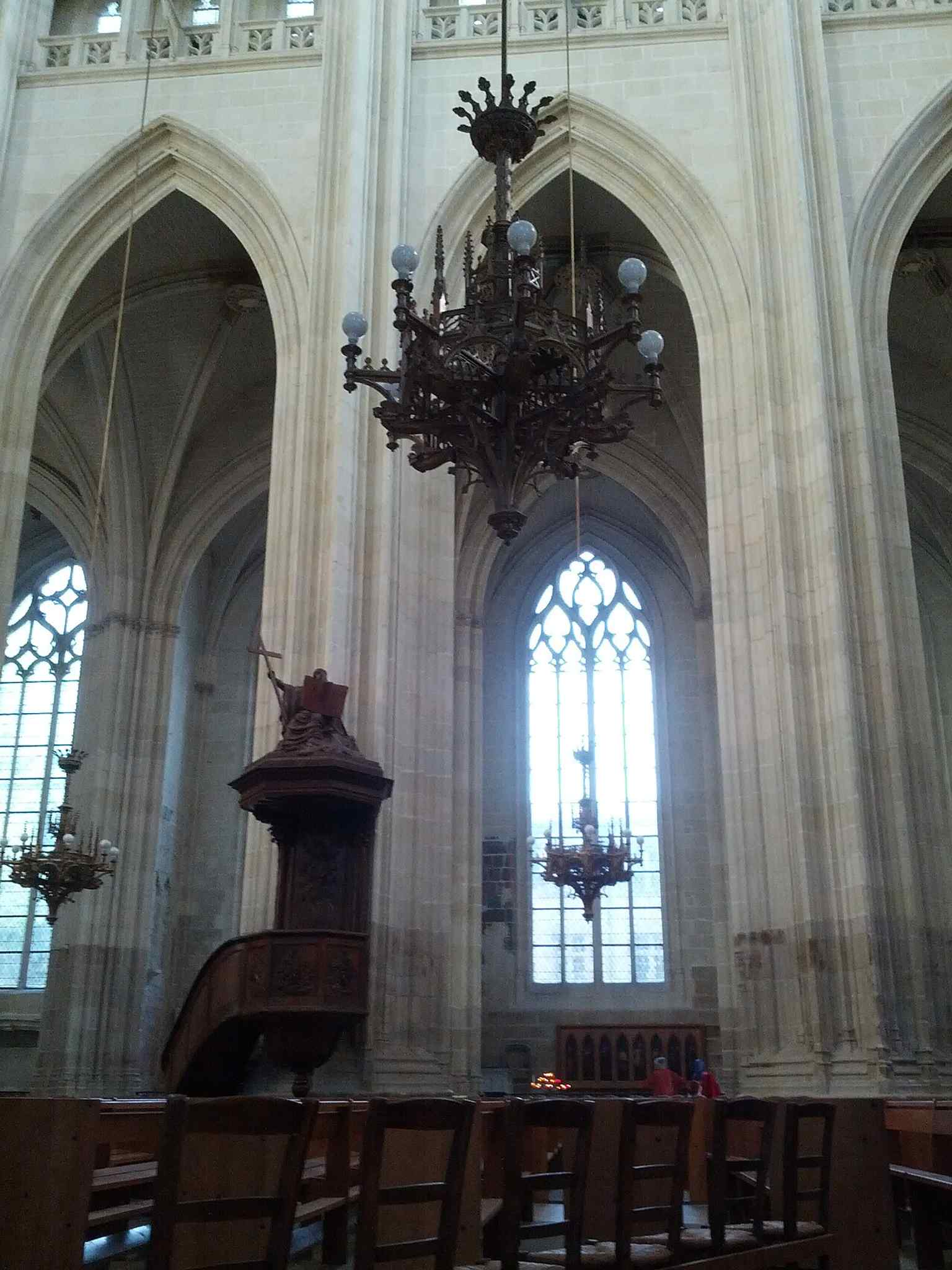
The cathedral pulpit inside, a useful match for the building’s unusual tradition of preaching to large crowds gathered outside on the square.Photo: Hashar, Wikimedia Commons, CC BY-SA 3.0. Cropped & resized. 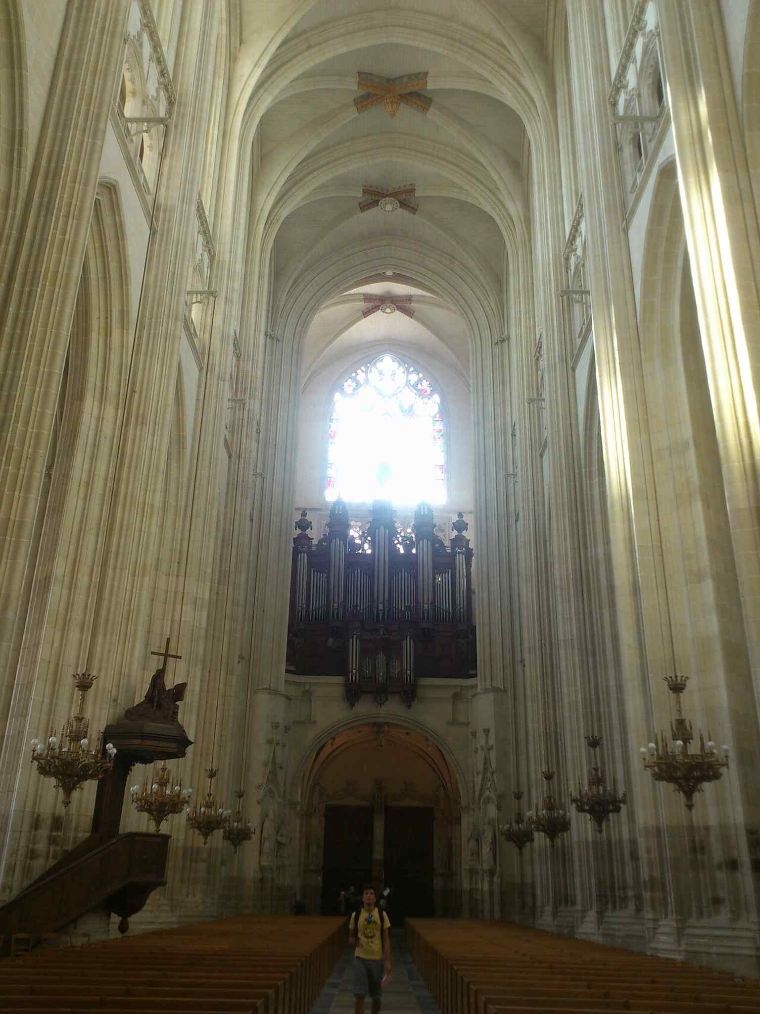
The great organ, originally built in 1621 and famous as a survivor before its destruction in the 2020 fire.Photo: Anoop Ebey, Wikimedia Commons, CC BY-SA 3.0. Cropped & resized. Look for pale stone fragments set into old masonry: a pointed Gothic arch, a slim column remnant, and a blocked opening preserved in the surrounding walls. This is the vanished…Read moreShow less
Open dedicated page →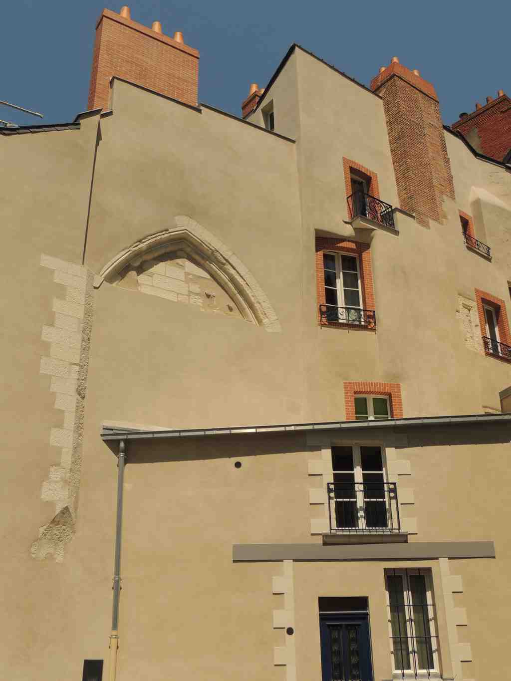
Collegiate Church of Notre-Dame de NantesPhoto: Rehtse, Wikimedia Commons, CC BY-SA 4.0. Cropped & resized. Look for pale stone fragments set into old masonry: a pointed Gothic arch, a slim column remnant, and a blocked opening preserved in the surrounding walls.
This is the vanished Collégiale Notre-Dame... a church so important to Breton memory that dukes chose it for burial, even though almost nothing of it stands in plain sight now.
That is the strange tenderness of this place. You can stand here, hear footsteps and city traffic, and never guess that this ground once helped tell Brittany who it was. Most people pass through without realizing they are crossing a patch of Nantes loaded with old sovereignty, prayer, grief, and ambition.
The story begins with Alain Barbetorte. In nine hundred thirty-seven, after he drove the Normans out of Nantes, he settled inside the early fortress nearby and rebuilt a chapel here, Sainte-Marie, to mark that victory. It rose on older sacred ground, and after Alain died in nine hundred fifty-two, his body eventually came here too. So from the beginning, this was not just a neighborhood church. It held memory like a seal pressed into wax.
Centuries later, in thirteen twenty-five, Bishop Daniel Vigier raised Sainte-Marie into a collegiate church, meaning a church served by a chapter of canons, a formal body of clergy who maintained worship. Nineteen of them belonged here. But what truly fixed this place in Breton history was Duke Pierre the Second. Even before he wore the ducal crown, he chose Notre-Dame for his tomb. That choice mattered. He was saying, very quietly and very clearly, this is where my dynasty belongs.
Pierre renewed the church, added the apse, the rounded eastern end, and planned a striking spire with six sides and six little turrets. His wife, Françoise d'Amboise, gives this place its most human note. After Pierre died, she came here to pray at his tomb. Later she turned toward religious life and founded the first Carmelite convent for women in France, at Vannes. I love that detail... a duchess, a widow, returning again and again to this spot in private devotion while the church around her carried all the public weight of power.
Other Breton rulers kept shaping the building. Arthur the Third continued the work. François the Second restored Alain Barbetorte's tomb. Anne of Brittany added another part of the choir in fifteen oh six. Piece by piece, one generation laid itself beside another.
And then, the long unmaking. During the Revolution, people turned the church into a stable. After it closed, even grooms slept inside, almost as if the old holiness had been pushed aside overnight. New owners split the building into two parcels. A street cut beneath the bell tower. Lightning struck in eighteen oh one and destroyed the spire. In eighteen oh three, the engineer Pierre Fournier opened Pierre the Second's tomb and found not ducal remains, but a mannequin. That discovery sparked a romantic legend that the duke had escaped to live in secret, though later historians thought the tomb had already been disturbed.
By the nineteenth century, demolition had nearly finished the work of forgetting. And yet not completely. Those surviving bits in the walls... that broken arch, that fragment of column... they are Nantes speaking under its breath.
In a moment, we leave this slow disappearance and head toward something far more sudden: a revolutionary clash when Nantes once again became a city under immediate threat. The Battle of Nantes is just ahead.
Look for a pale stone plaque, rectangular and set into the wall, with engraved French lettering and Cathelineau’s name marking the spot. This small marker holds a huge rupture.…Read moreShow less
Open dedicated page →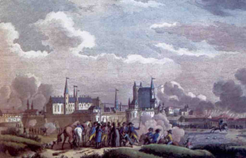
Battle of NantesPhoto: Unknown author, Wikimedia Commons, Public domain. Cropped & resized. Look for a pale stone plaque, rectangular and set into the wall, with engraved French lettering and Cathelineau’s name marking the spot.
This small marker holds a huge rupture. The Battle of Nantes in seventeen ninety-three became one of the Revolution’s great crises: a rebel army from the Vendée tried to seize the city, failed, and their leader, Jacques Cathelineau, took the wound that would kill him days later. That failure helped decide far more than one day’s fighting... it helped decide who would control western France.
Nantes mattered because it was not just a city. It was a port, a road junction, and the last major crossing of the Loire before the estuary. Whoever held Nantes could open the coast to foreign allies, supplies, and perhaps a new capital for the insurgent cause. The countryside around it was poor, angry, and deeply attached to priests and local loyalties. The city, enriched by maritime trade, leaned revolutionary. Here, those two Frances met face to face.
The plan almost worked. In late June, Vendéen forces attacked from north and south. But the timing broke apart. Near Nort-sur-Erdre, a republican officer named Aimable Joseph Meuris held up thousands of attackers for crucial hours with only a few hundred men. That delay meant the assault never struck Nantes all at once. General Canclaux, defending the city, could meet one blow, then the next.
Still, the rebels came frighteningly close. They pushed in from the north, fought through the road to Rennes, then toward the road to Vannes. Cathelineau himself advanced on foot, leading men who called him the Saint of Anjou. They reached Place Viarme. For a moment, the line bent. Then everything changed. Cathelineau fell, hit by gunfire, later said to have come from an attic window. If you glance at your screen, you can see the plaque that remembers that turning point.
And inside Nantes, others fought with the same desperate force. Mayor René Gaston Baco de la Chapelle went to the front line and took a wound in the leg near a wagon of ammunition. Legend says he refused rescue and told the men to save the city first. That is what this battle felt like on both sides: not a clean story of heroes and villains, but fear, conviction, and survival tangled together.
The cost was terrible, with hundreds dead on each side and bodies left outside the city for days. Worse still, victory did not bring peace. Fear of another attack settled over Nantes, and later that fear would feed even darker reprisals.
If you had stood here in seventeen ninety-three, would you have believed Nantes was defending liberty... defending privilege... or simply trying not to be swallowed? On your phone, the old print of Cathelineau’s collapse shows how quickly hope turned into retreat.
From here, we’ll head toward Pillory Square, where the drama changes shape and the old street pattern begins to tell a slower, harsher story. If you plan to return later, this venue is closed on Mondays and otherwise opens from the afternoon or evening into the night.
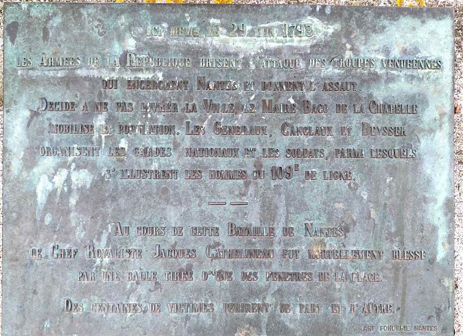
The plaque at Place Viarme marks the spot where Cathelineau was wounded during the Battle of Nantes on 29 June 1793, the turning point that broke the Vendée assault.Photo: Kalepom, Wikimedia Commons, CC0. Cropped & resized. On your right, look for a small triangular paved square framed by pale stone façades, with two sweetgum trees marking its center. This little triangle can seem modest... but for…Read moreShow less
Open dedicated page →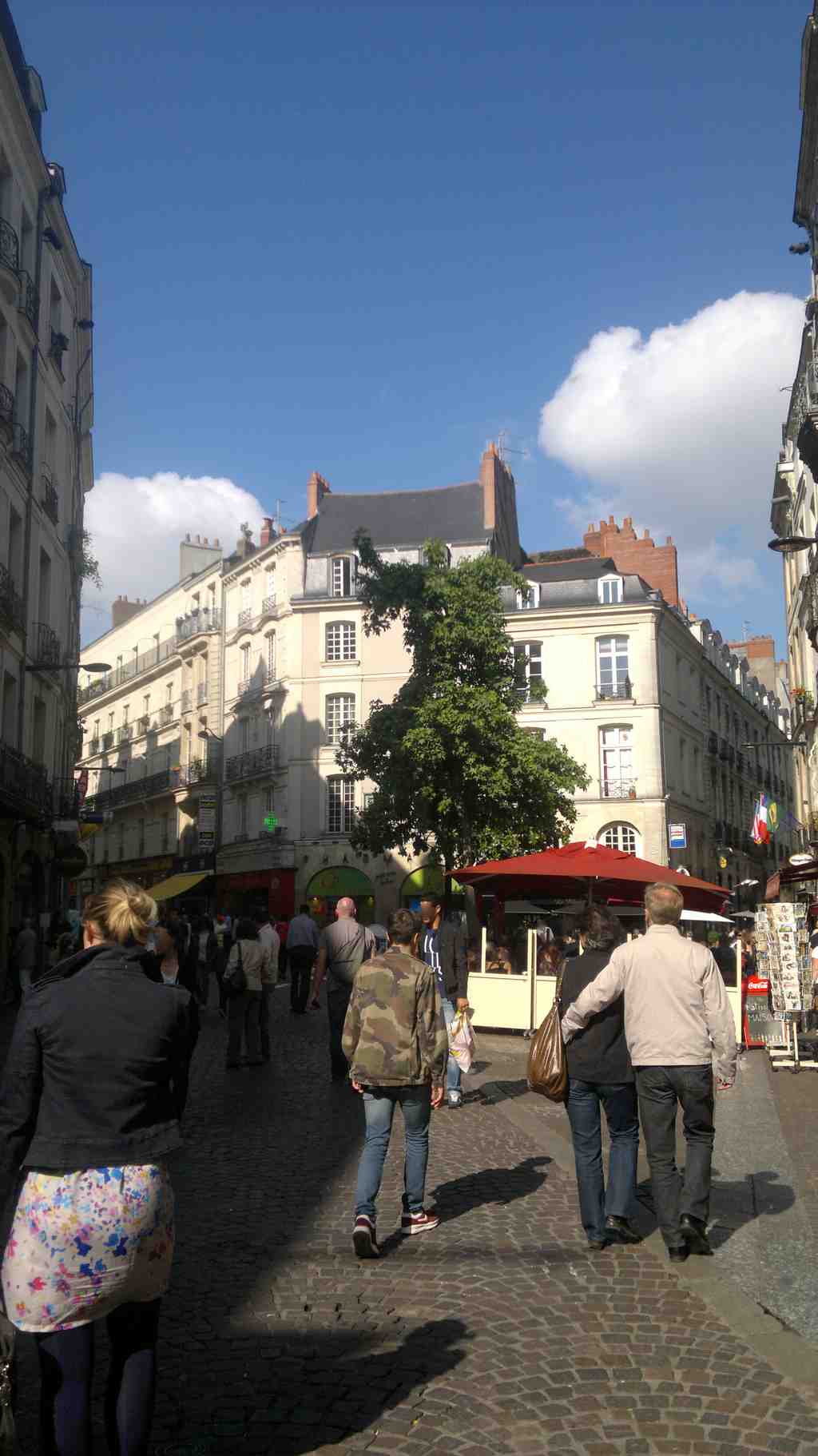
Pillory SquarePhoto: Llann Wé², Wikimedia Commons, CC BY-SA 3.0. Cropped & resized. On your right, look for a small triangular paved square framed by pale stone façades, with two sweetgum trees marking its center.
This little triangle can seem modest... but for centuries, Nantes funneled itself through here. In a medieval city, the busiest streets did not stay important forever. Trade routes shifted, bridges changed the flow, river traffic pulled people one way and then another, and the city quietly rewrote its own map. Squares like this rose to the center, then slipped to the side, even while their stones kept the memory.
For a long stretch, this was one of the great crossing points of Nantes. The north-to-south route linked Port-Communeau on the Erdre to Port-Maillard on the Loire, carrying people, goods, gossip, and authority through streets that still survive under other names. Right here, that current met the road coming in from Paris through Saint-Pierre. So if you want to feel the old city breathing, this is a good place to do it. Beneath today’s pedestrian calm, another traffic pattern still hums.
Most visitors hear the name Pilori and think only of punishment... but locals will sometimes lean in and tell you not to trust the name too quickly. Around fifteen fifteen or fifteen sixteen, workers cut a triangular well here, the Grand puits salé, the Great Salt Well. They decorated it with five sculpted animal heads. Later, people shrank it to win back space, then closed it in seventeen twenty-one and finally filled it in during eighteen sixty-one. Some people think “Pilori” grew out of an older name, “Puy Lory,” tied to that lost well rather than a punishment post. A city name can mislead you just as easily as it guides you.
And yet punishment belonged here too. In fifteen fifty-five, officials moved the pillory here from Place Saint-Pierre. A pillory, if you picture it, was a public post for displaying and humiliating those condemned by the bishop’s or the count’s justice. It stayed here until sixteen thirty-two, when they carried it on to Place du Bouffay. So the square held both water and shame, necessity and spectacle... a very Nantes sort of overlap.
Then the city’s main current shifted westward in the late Middle Ages, toward the line that later ran through Place du Change and Rue de la Paix. When the bridge route over the Loire gained importance, this square lost its crown.
But people stayed. Gabriel Mellinet kept an apothecary shop here, at the corner of Rue des Chapeliers. He honored his father, a candle merchant, by placing a bee and honeycombs on his emblem. Later, the Mellinet family filled the square with print as well as medicine. Their printing house settled here, and by seventeen ninety-four it ran five presses with eight workers. One young student even came here, drawn to Father Ratier’s bookshop, feeding a taste for stories that Nantes has always encouraged.
If you glance toward number six, you may catch another local whisper: two carved faces, Jean qui rit and Jean qui pleure, laughing and crying from the façade... as if the square itself remembers both.
In a moment, we’ll leave this crossroads of changing routes and step into a narrower memory: the Street of the Juiverie, where the city still keeps a community’s trace in its name.
Look for a straight cobbled lane lined with narrow stone-and-timber facades, with the discreet opening of the covered Passage Bouchaud set into the row of old buildings. Rue de…Read moreShow less
Open dedicated page →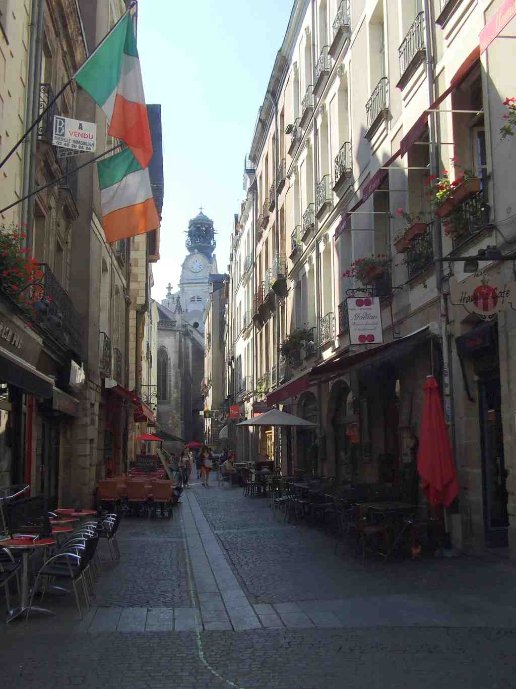
Street of the JuiveriePhoto: Pj44300, Wikimedia Commons, CC BY-SA 4.0. Cropped & resized. Look for a straight cobbled lane lined with narrow stone-and-timber facades, with the discreet opening of the covered Passage Bouchaud set into the row of old buildings.
Rue de la Juiverie can feel almost modest at first glance... just a rectilinear street in the old Bouffay quarter, paved underfoot, hemmed in by houses that have watched centuries pass. But this name carries far more than direction. In the Middle Ages, a “juiverie” meant the part of a city where Jewish residents lived, and the medieval Jewish community of Nantes belonged to the daily life of this neighborhood. They were not a rumor at the edge of town. They lived, traded, prayed, argued, raised children, and kept a synagogue here on this very street.
They also lived under rules that marked them as separate. The community had its own seneschal, a local judicial officer, and judges who could apply Jewish law. Yet the authorities fixed the hours when people could leave and return, and each evening two chains closed this street. The community even paid the count of Nantes for protection... a heartbreaking detail, because protection is never a simple gift when power can withdraw it.
Then the story turns hard. After the sixth crusade, some Breton nobles owed money to Jewish lenders. In twelve thirty-five, Pope Gregory the Ninth preached a new crusade, and before some crusaders left for the Holy Land, they murdered several Jews in Nantes. The next year, the duke of Brittany expelled the Jews from the city and canceled the debts Christians owed them; the expulsion came with more killings.
In twelve thirty-nine to twelve forty, an edict signed at Ploërmel pushed even further: it drove Jews out of Brittany, erased debts, returned pledged goods to their former owners, and even pardoned people who had killed a Jew before the decree. So this quiet street name preserves the outline of a community that violence, debt, and political convenience tried to erase.
And yet the name survived. That matters.
Later, Jewish lives touched Nantes again, though never securely. Henri the Fourth tolerated Portuguese and Spanish crypto-Jews here for a time - people forced to convert outwardly while keeping Jewish practice in secret - because he wanted commerce to grow. Then Louis the Thirteenth expelled them again in sixteen fifteen. In sixteen thirty-six, Jewish refugees from Bayonne arrived and suffered looting and street violence until a royal prosecutor wrote, in effect, that people abused them daily without any legitimate cause.
This street kept changing around those absences. In eighteen thirty-one, Jean-Baptiste Bouchaud opened the covered passage nearby, threading private commerce into the old lane. In eighteen sixty-nine, a young locksmith named Joseph Paris began his working life here, forging grilles, doors, and light iron frames in a modest workshop before moving on to something larger. Even the street name became contested in the twentieth century: officials renamed it rue de l’Emery, restored Juiverie, then changed it again under the German Occupation before bringing the old name back at the Liberation. A plaque can become a battleground for memory.
When you’re ready, continue to Decré, about a minute away, where local trade begins to open into a newer, more theatrical kind of shopping street. If you plan to pause nearby, note that one local venue closes on Monday and Sunday, then opens at midday and again in the evening on most other days.
Look for the broad stone-and-glass corner block, rounded at the angle of rue de la Marne and rue du Moulin, with the old Decré name still preserved on the façade. This corner…Read moreShow less
Open dedicated page →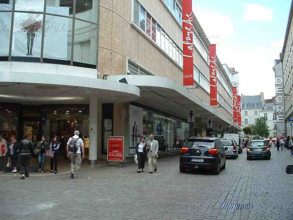
DecreePhoto: Rehtse, Wikimedia Commons, CC BY-SA 4.0. Cropped & resized. Look for the broad stone-and-glass corner block, rounded at the angle of rue de la Marne and rue du Moulin, with the old Decré name still preserved on the façade.
This corner changed the meaning of shopping in Nantes. Before Decré, trade here followed older rhythms: smaller shops, direct exchange, the pull of port streets and passageways. Then Jules-César Decré arrived in eighteen fifty-seven, a twenty-three-year-old from Jublains in Mayenne with almost nothing except nerve and experience from the Grand Bazar de Motté. His family roots stretched even farther back, to the Aosta Valley in Italy, where earlier generations worked as traveling merchants. You can feel that inheritance here: motion, ambition, the instinct to turn a street corner into a destination.
In eighteen sixty-seven, Jules-César opened his own shop right here, at number six on what is now rue de la Marne. Over the years he bought neighboring businesses and kept expanding, until a family store began to behave like a stage set for modern desire. After his wife, Eugénie, died in nineteen oh seven, his sons and then his grandsons carried the business forward. They printed catalogues, offered home delivery, and added a food department. Shopping stopped being only a practical errand. It became display... anticipation... a little performance of longing.
Then came the leap that made Nantes stare. In nineteen thirty-one, the Decré family opened what people called the largest department store in Europe. Seven floors of glass and steel rose here in only ninety-seven days, using prefabricated parts, meaning sections prepared in advance and assembled at astonishing speed. Inside, customers found not just goods but a whole miniature city: two restaurants, a terrace, a hair salon, a cinema with three hundred seats, a puppet theater, a travel agency, even a post office. Architect Henri Sauvage even devised a moving platform on rails to wash the vast glass façade, so the building could remain transparent by day and brilliant after dark.
If you glance at the before-and-after image in the app, you can watch this address reinvent itself from the older Decré Frères storefront into the bold modern landmark Nantes came to know.
But this glittering story carries a scar. During the bombing of the sixteenth of September, nineteen forty-three, the store was destroyed, and the great glass palace fell into a charred metal skeleton. Jean-Philippe Decré never forgot the sound of the squadrons overhead; he compared it to a steam train rushing through a station, followed by a hurricane of steel. That memory turns the whole place inside out. The proud theater of consumption became a wreck almost overnight.
And still, Nantes rebuilt. By nineteen fifty-one, Louis-Marie Charpentier, Charles Friesé, and Victoire Durand-Gasselin had drawn this site back into the city’s life. The family later tried to grow without hollowing out the center, even keeping one suburban hypermarket deliberately smaller so it would not damage downtown trade. It was an honorable choice... and a costly one. Competitors built bigger, the family grip weakened, and by nineteen seventy-nine the business passed to Nouvelles Galeries, then to Galeries Lafayette.
In a moment, we’ll leave this theater of goods and head toward Holy Cross Church, where modern Nantes begins to open into the imaginative world that also shaped Jules Verne. If you want to return later, the venue currently keeps daily hours from noon to three, then from six to ten.
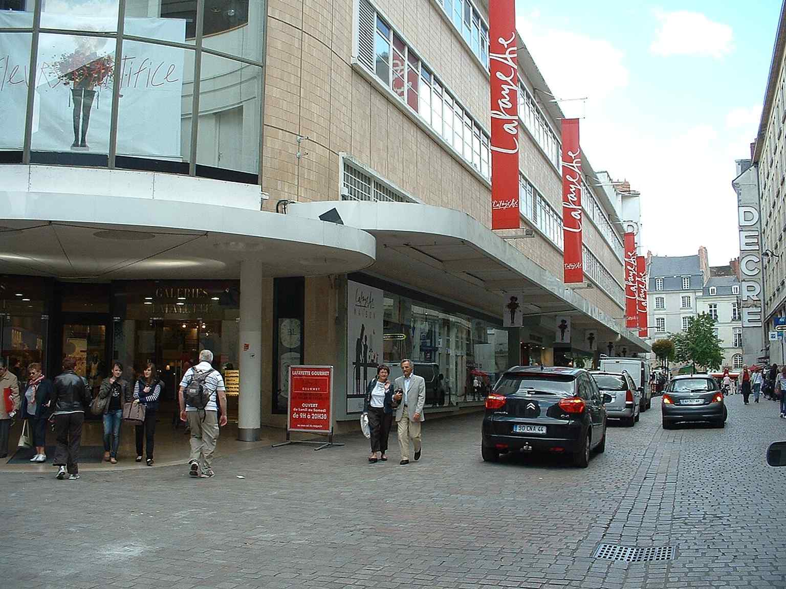
The Rue de la Marne façade of Decré, now part of Galeries Lafayette, marks the historic shopping address that made the store a landmark of central Nantes.Photo: Rehtse, Wikimedia Commons, CC BY-SA 4.0. Cropped & resized. 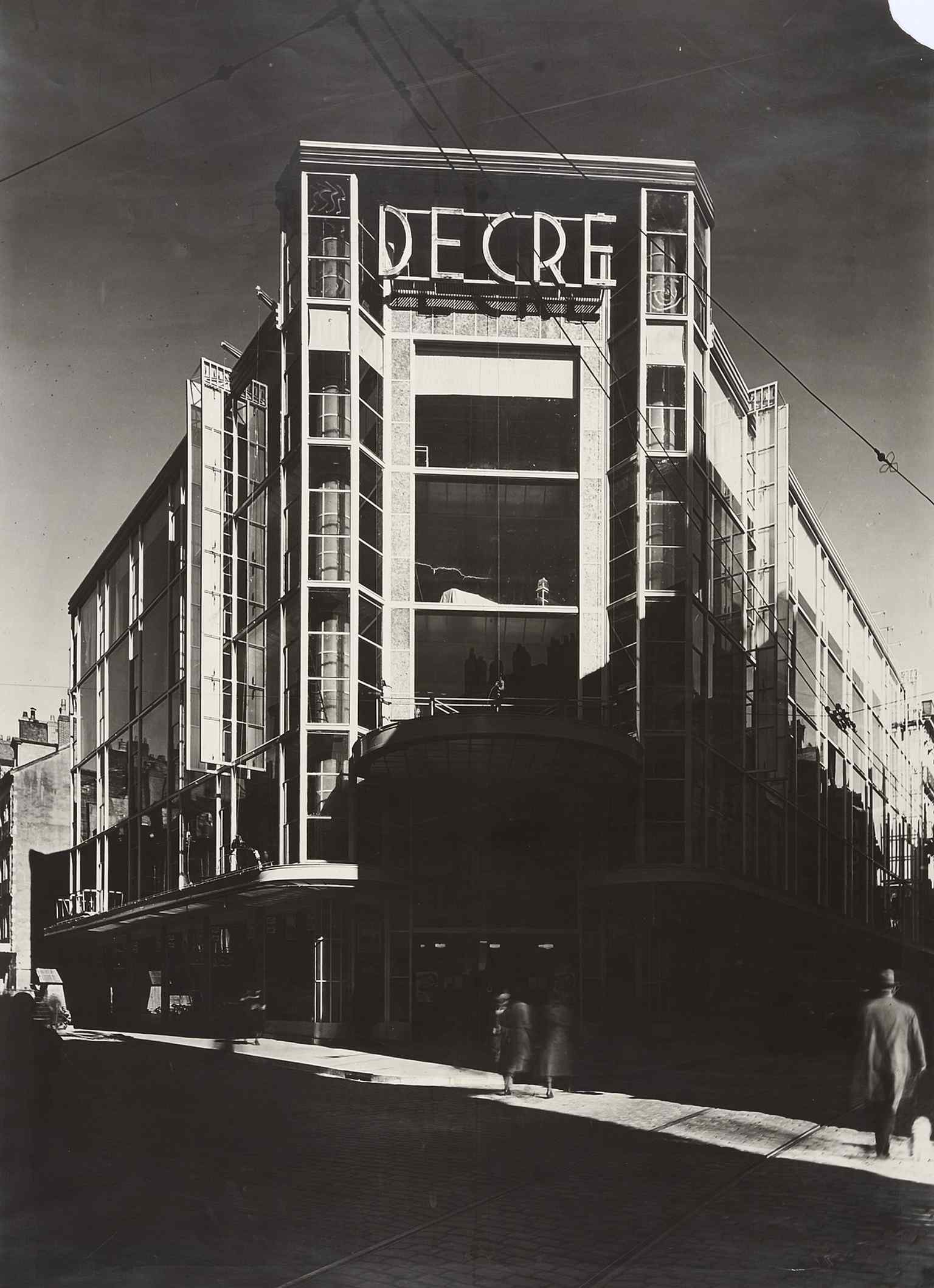
A 1931 view of the original Decré department store, opened as one of Europe’s most important grand magasins and famed for its glass-and-steel architecture.Photo: Unknown authorUnknown author, Wikimedia Commons, Public domain. Cropped & resized. 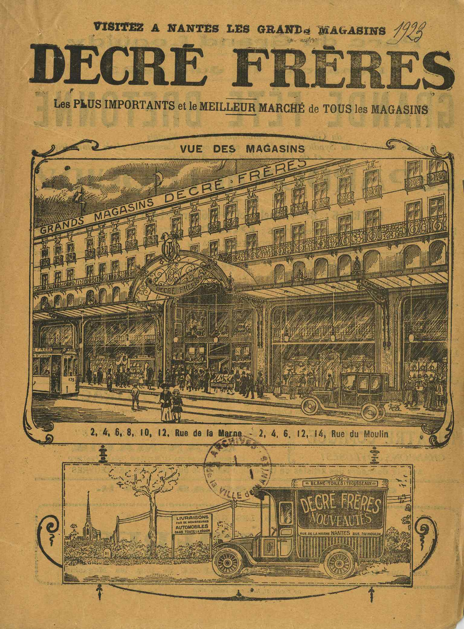
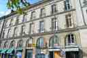
The Decré Frères storefront in 1923 shows the family business before the famous 1931 rebuild that turned it into a true department-store giant.Photo: inconnu, Wikimedia Commons, Public domain. Cropped & resized. On your left, look for a pale stone façade shaped like a small classical temple, with a triangular pediment and, high above it, a lantern-like belfry carrying an old clock and…Read moreShow less
Open dedicated page →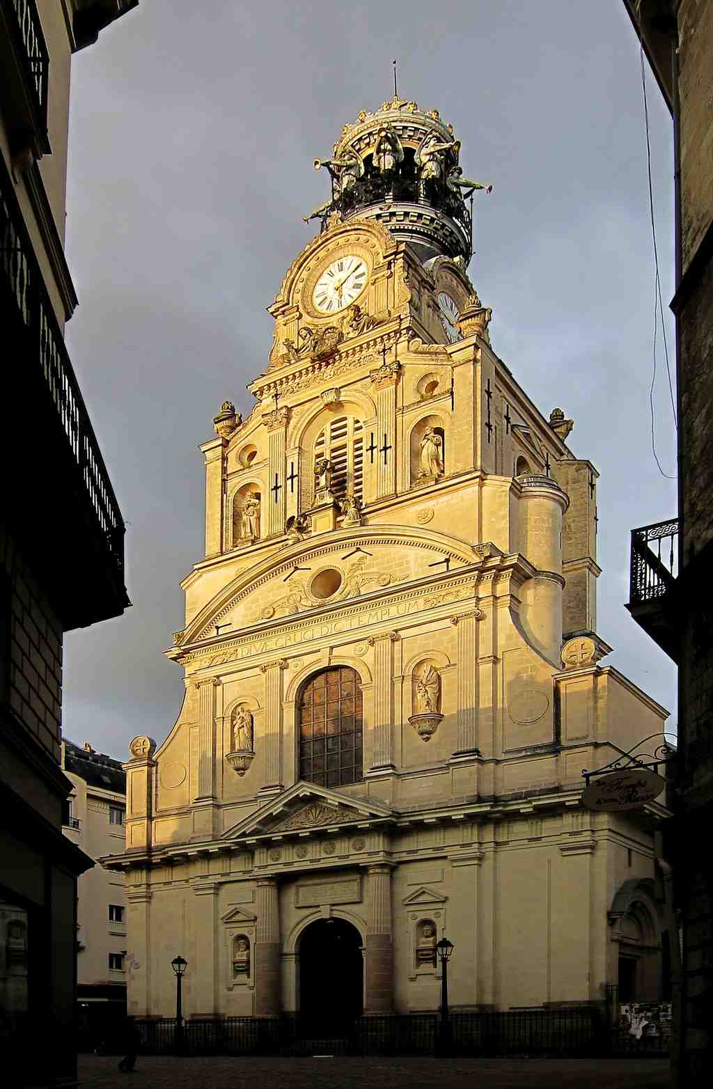
Holy Cross Church of NantesPhoto: Velvet, Wikimedia Commons, CC BY-SA 3.0. Cropped & resized. On your left, look for a pale stone façade shaped like a small classical temple, with a triangular pediment and, high above it, a lantern-like belfry carrying an old clock and trumpet-blowing angels.
Sainte-Croix can feel almost modest at first... and then you notice how many lives have been folded into it. This has been the parish church of the Bouffay quarter since eleven thirty-eight. Long before this façade took shape, Benedictine monks from Marmoutier held a priory here, and their Saint-Martin chapel stood roughly where the choir - the space around the altar - stands now. For a time, the building even served the neighboring Bouffay castle.
The church you see today grew in layers. Seventeenth-century builders raised the nave, the long central hall of the church, and gave the square a classical front with columns and a pediment borrowed from ancient temples. In the nineteenth century, the architect Théodore Nau reshaped the choir in a more flamboyant Gothic style, with pointed lines and ribbed vaults. If you glance at your screen, you can see that meeting of styles inside: one church, speaking in more than one historical voice.
And then there is the little line in a parish register that changes the whole mood of the place. Sainte-Croix preserves the record of the birth and baptism of Jules Verne. I love that detail. Not a monument yet, not the author of submarines and moon voyages, just a baby entered into the careful handwriting of a local church. But what a city to begin in... a port city of crossings, vanished places, ruined towers, and stories hidden under newer streets. Nantes taught people that the solid world could shift. For a child like Verne, that kind of city could turn stone into possibility.
But Sainte-Croix also carries a harder truth. During the Terror, revolutionaries turned this church into a prison and a political club. Jean-Baptiste Carrier stood here and spoke from the pulpit - the raised platform meant for preaching - while prisoners were still locked inside. One official wrote that the place had become so foul that no one dared enter.
It is one of those moments when a city shows how easily a place of prayer can be twisted by power.
And yet people kept bringing their hopes here. In fourteen forty-three, Alain Resmond helped found the sanctuary of Notre-Dame de Bon-Secours for neighbors who did not want to cross the Poissonnerie bridge just to attend Mass. Later, when that separate chapel was destroyed in seventeen ninety-three, parishioners saved the Virgin’s statue and kept it in a family home until nineteen twenty, when they returned it to the parish. Even war could not finish the story: bombing in nineteen forty-three damaged the church, and the statue itself suffered before restoration. Another image on your phone shows the ex-votos - small offerings of thanks - that still cover the walls with private gratitude.
Before you leave, lift your eyes to the top again. In eighteen sixty, Henri-Théodore Driollet set the old civic belfry above the church front, using the city clock from the lost Bouffay tower and a lantern for the bell called la Bouffay, cast in sixteen sixty-three. It was a compromise, almost an argument in stone: city and parish sharing one skyline.
In a moment, head toward Rue de la Paix. The streets ahead were shaped by bridges, routes, and the constant movement of people, goods, and ideas - the traffic that taught Nantes to imagine worlds beyond itself. If you want to return later, Sainte-Croix is generally open from about eight thirty to seven, and from ten on Sundays.
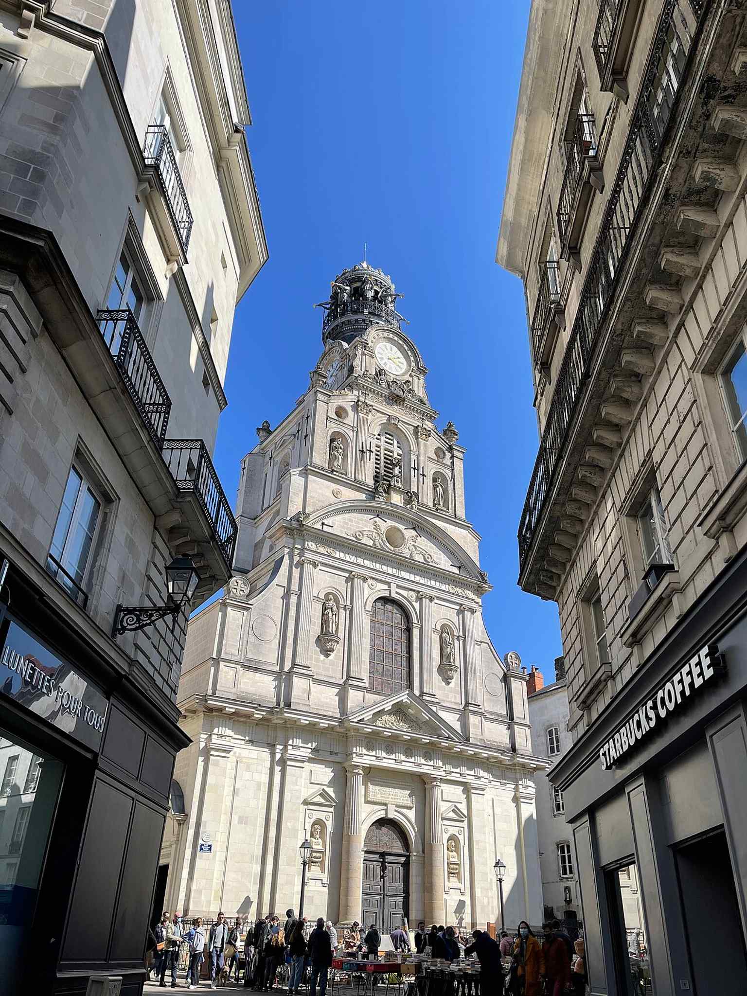
A clear street view of Holy Cross Church on Rue de la Marne, showing the church as a living part of Nantes’ Bouffay district.Photo: Tgllyn, Wikimedia Commons, CC BY-SA 4.0. Cropped & resized. 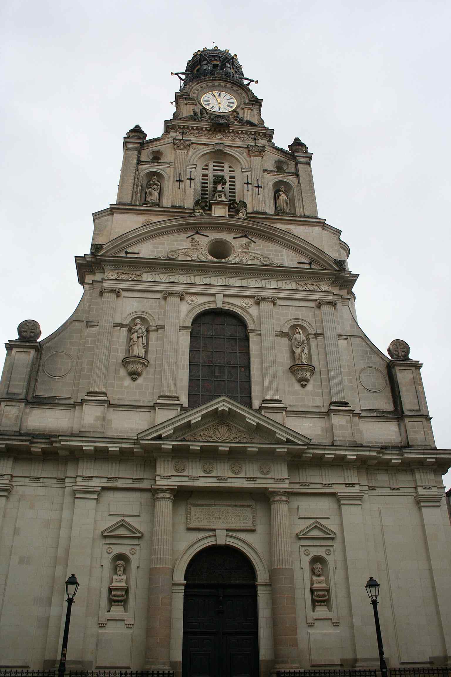
A wide exterior view that helps establish the church’s overall silhouette and its prominent place in the city center.Photo: Crochet.david (talk), Wikimedia Commons, CC BY-SA 3.0. Cropped & resized. 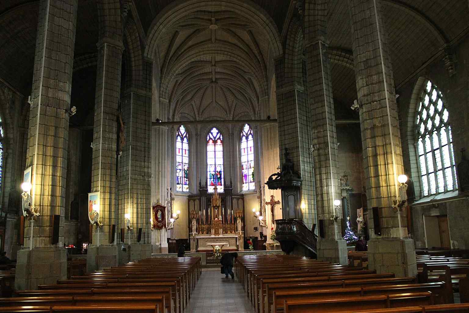
A wide interior view of the nave, useful for showing the church’s blend of Renaissance, Gothic, and later restoration styles.Photo: John Samuel, Wikimedia Commons, CC BY-SA 4.0. Cropped & resized. 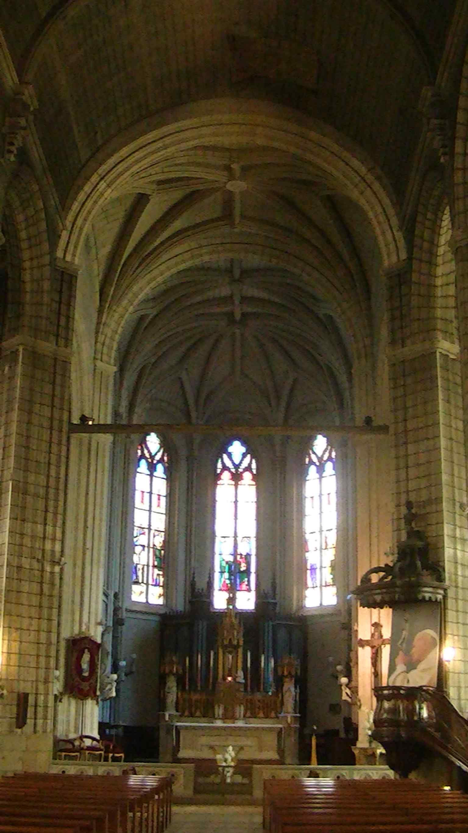
Looking toward the altar, this shot highlights the church’s long nave and the liturgical focus of the interior.Photo: Adam Bishop, Wikimedia Commons, CC BY-SA 3.0. Cropped & resized. 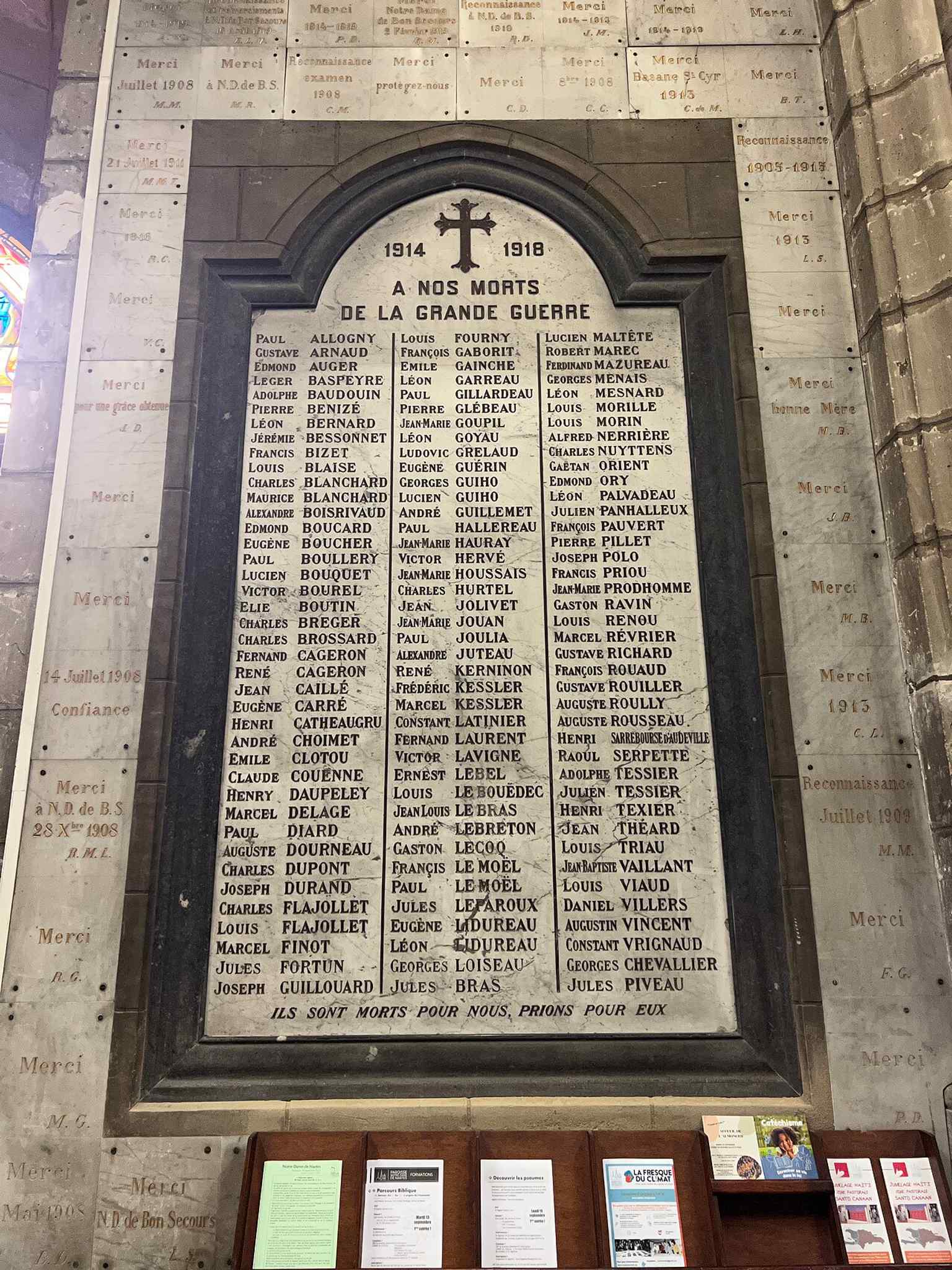
Ex-voto offerings inside the church, reflecting the enduring devotion to Notre-Dame de Bon-Secours described in the source.Photo: Chabe01, Wikimedia Commons, CC BY-SA 4.0. Cropped & resized. 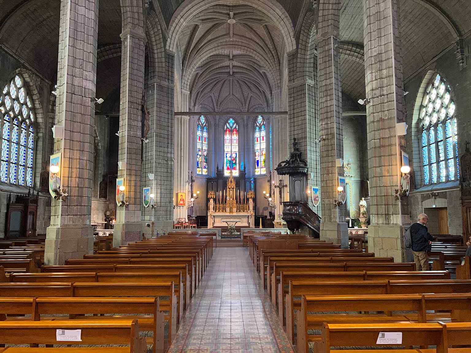
A contemporary interior view that captures the active devotional atmosphere of the church today.Photo: Chabe01, Wikimedia Commons, CC BY-SA 4.0. Cropped & resized. 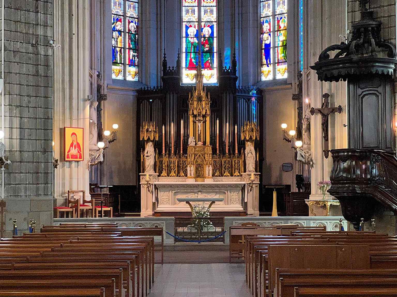
Another recent interior angle, useful for covering the sanctuary and side chapels without repeating the same viewpoint.Photo: Chabe01, Wikimedia Commons, CC BY-SA 4.0. Cropped & resized. 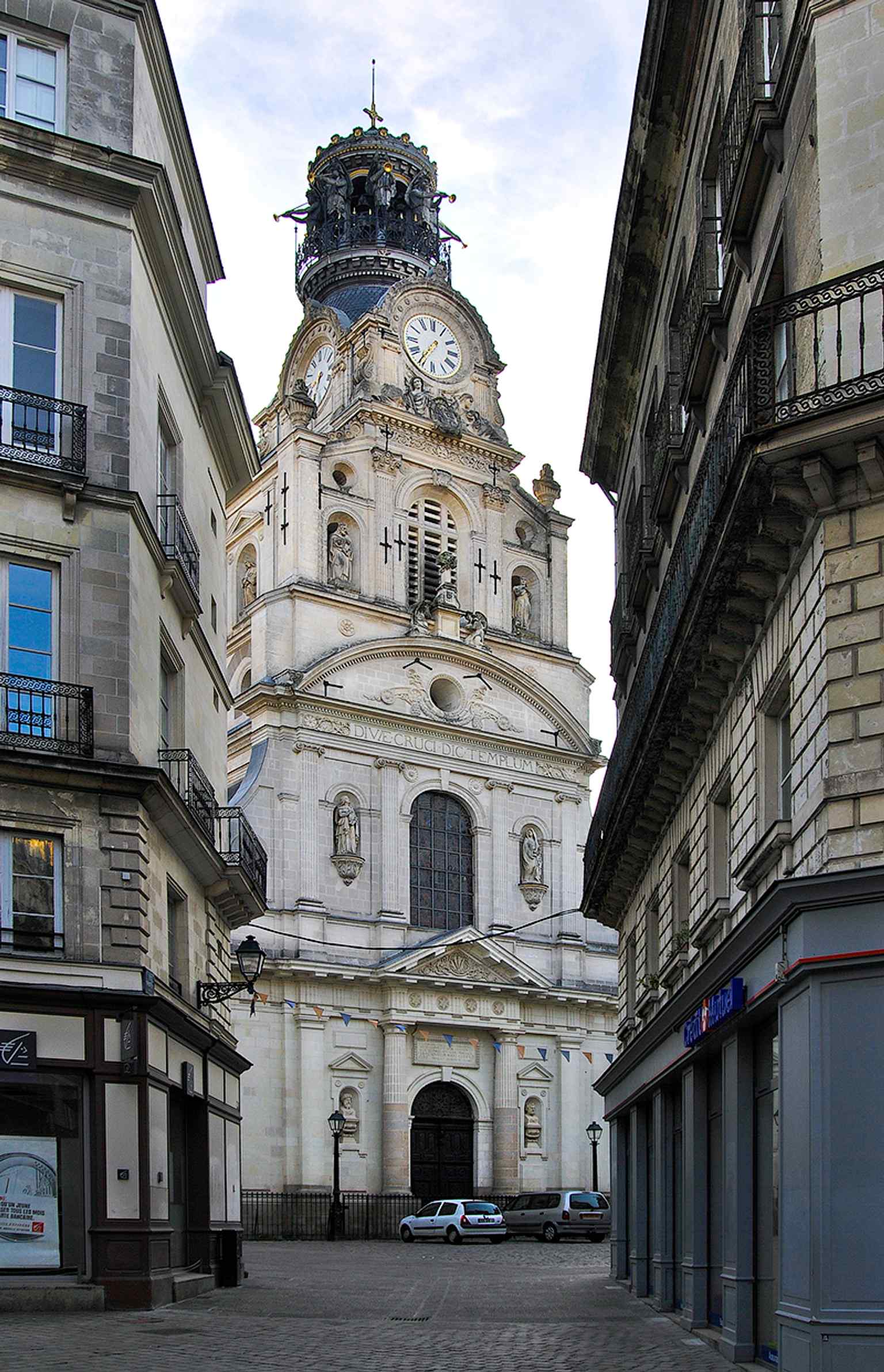
This image ties the church to the Bouffay quarter and its origins as the parish church since 1138.Photo: Olga.Mach, Wikimedia Commons, CC BY-SA 4.0. Cropped & resized. Look for a straight street lined with pale stone facades, its surface shifting from asphalt to cobbles, and marked by the blue enamel Rue de la Paix street plaque. Rue de la…Read moreShow less
Open dedicated page →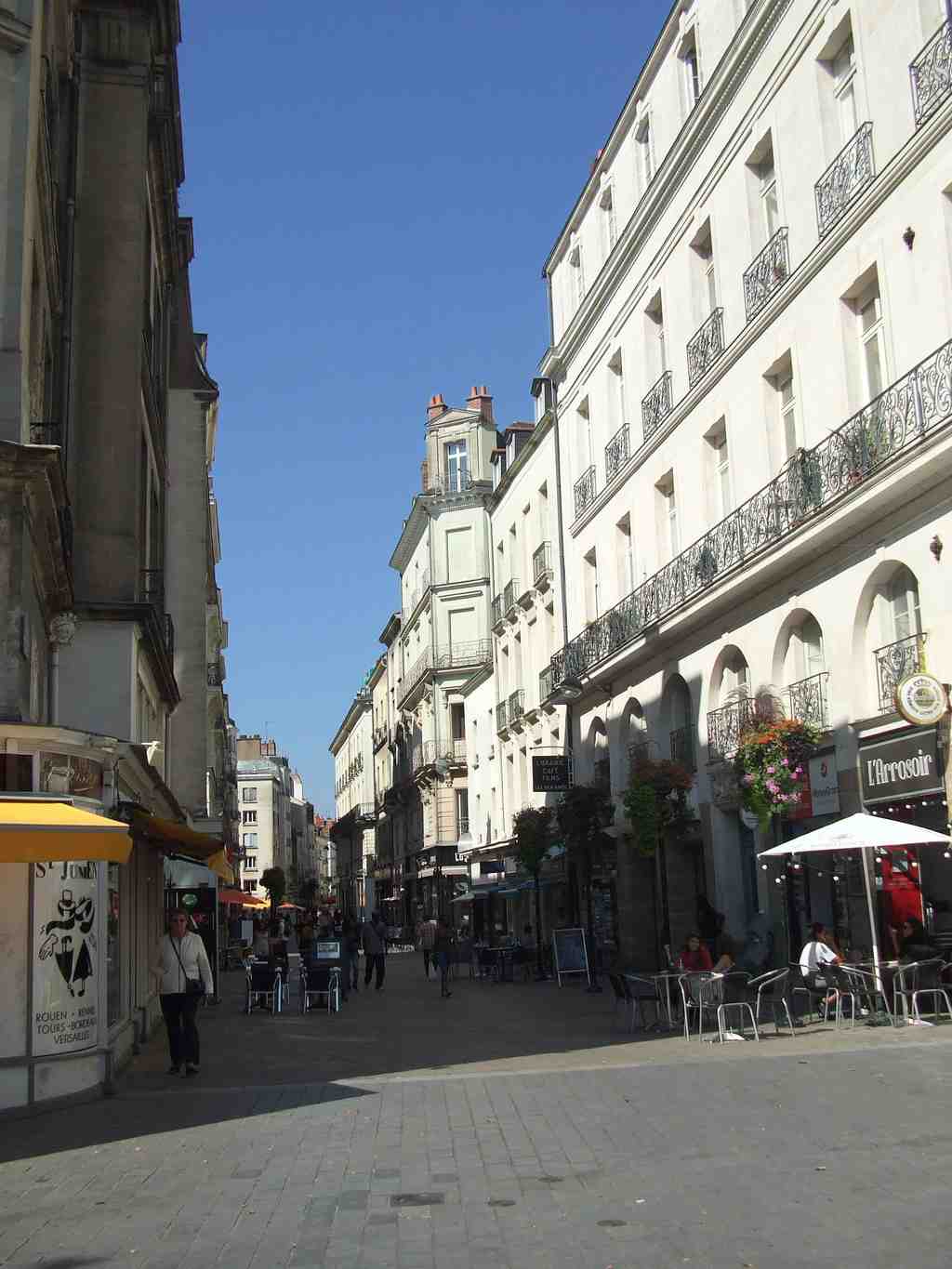
Rue de la PaixPhoto: Pj44300, Wikimedia Commons, CC BY-SA 4.0. Cropped & resized. Look for a straight street lined with pale stone facades, its surface shifting from asphalt to cobbles, and marked by the blue enamel Rue de la Paix street plaque.
Rue de la Paix sounds gentle... almost restful. But this street carries one of Nantes's sharpest little ironies. It took its present name in nineteen nineteen, on the day the Treaty of Versailles sealed the end of the First World War. Peace entered the map here not as a mood, but as a decision, a public act of memory. If you glance at the plaque on your screen, you can feel how ordinary that memory now looks in daily life.
And yet locals know something most visitors miss: this was, for centuries, the city's essential line of bridge, the route that let people cross the Loire between the old heart of Nantes and the southern bank at Pirmil. So this quiet name sits on top of an old strategic spine. In times of trade, everything pressed through here. In times of danger, control of passages like this mattered just as much as walls or cannons. By the time of the fighting we touched on in seventeen ninety-three, routes through Nantes were never innocent.
Before it became Rue de la Paix, this was Rue de la Poissonnerie, the Fishmongers' Street. The name came from the municipal fish market on the eastern tip of the old Île de la Saulzaie, today's Île Feydeau. To reach it, people crossed the Pont de la Poissonnerie, first in wood, then rebuilt in stone in sixteen seventy. Imagine the crush here: carts jamming wheel to wheel, merchants shouting prices, passersby squeezed against low wooden houses, and the smell of fresh fish hanging stubbornly over everything. The city eventually pushed to widen the crossing, not for beauty, but because the bottleneck had become dangerous.
In the eighteenth century, Nantes tried to discipline that old chaos. Officials began straightening the street from seventeen forty-one onward, replacing a crooked, noisy medieval passage with the cleaner line you see now. But the old street still peeks through in strange details. At the corner with Rue Belle-Image, architect Louis Chesniau designed a building in eighteen forty-three with upper windows blocked from the start. Why? A tax on doors and windows. To save money, he gave the facade blind openings and left tenants with less light and air. It is such a Nantes story, really: policy shaping stone, and stone quietly shaping lives.
Commerce kept rewriting the street too. At numbers one through eight stood the Première Maison, opened in eighteen forty-five by Pierre Ganuchaud and later driven forward by Georges Ganuchaud. He turned clothing into a local empire and became a force in civic life, though the prosperity had harder edges: young girls worked there in the nineteen thirties for meager wages. Then, on the sixteenth of September, nineteen forty-three, American bombing destroyed the store in minutes. A century of family ambition vanished into rubble.
That is Rue de la Paix in a single breath: peace named after war, commerce built on an ancient crossing, memory surviving in a line of stone and traffic. And behind these practical routes stood an older seat of power, much of it rubbed almost invisible. Walk about two minutes to Bouffay Square, and we will step into that missing political heart.
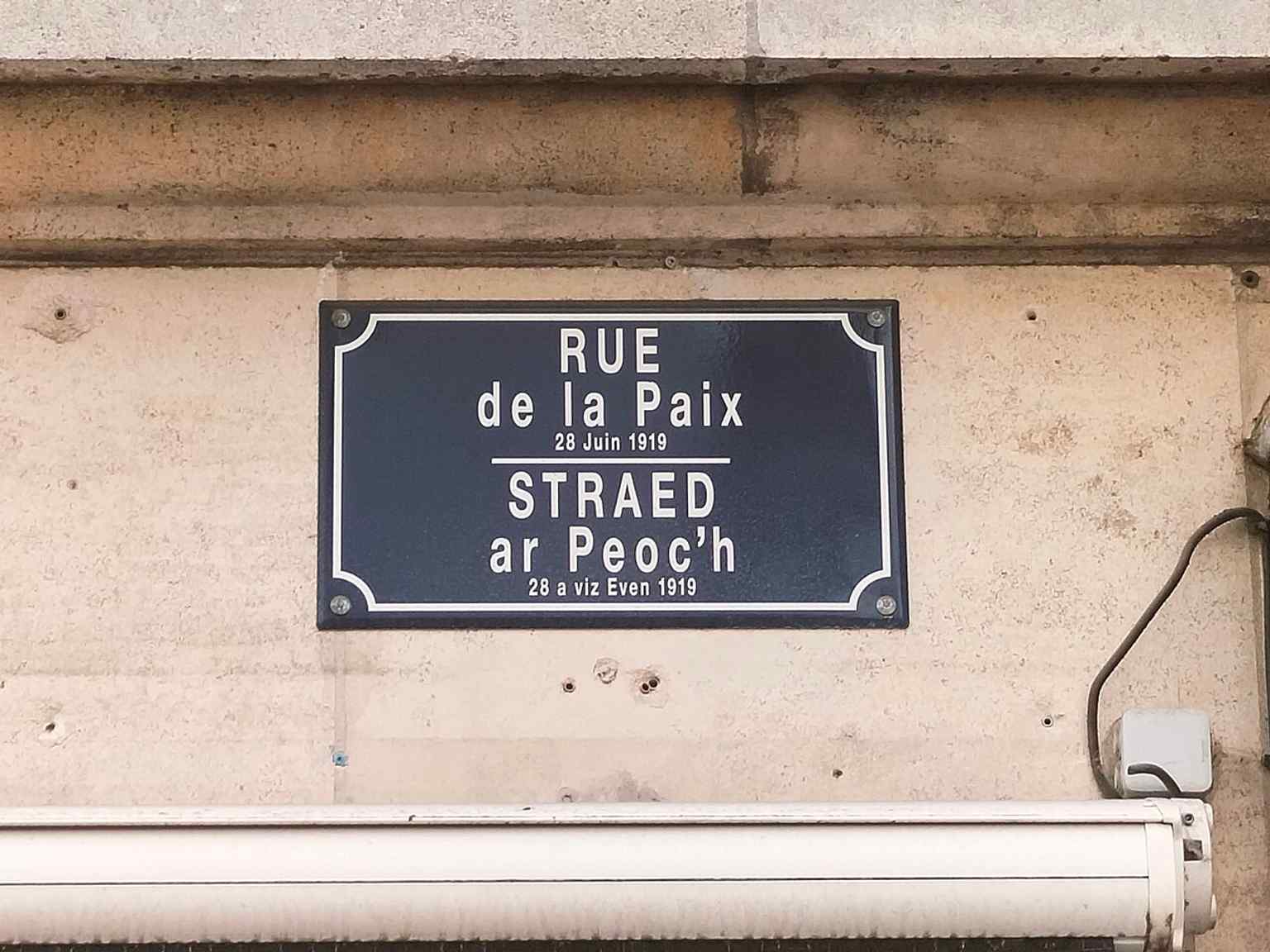
Street plaque for Rue de la Paix in Nantes — a simple marker for the road renamed in 1919 after the Treaty of Versailles.Photo: Kalepom, Wikimedia Commons, CC BY-SA 4.0. Cropped & resized. This is a broad paved square, almost rectangular, framed by pale stone facades with neat rows of windows and dark slate roofs, a calm classical shell around a much older center.…Read moreShow less
Open dedicated page →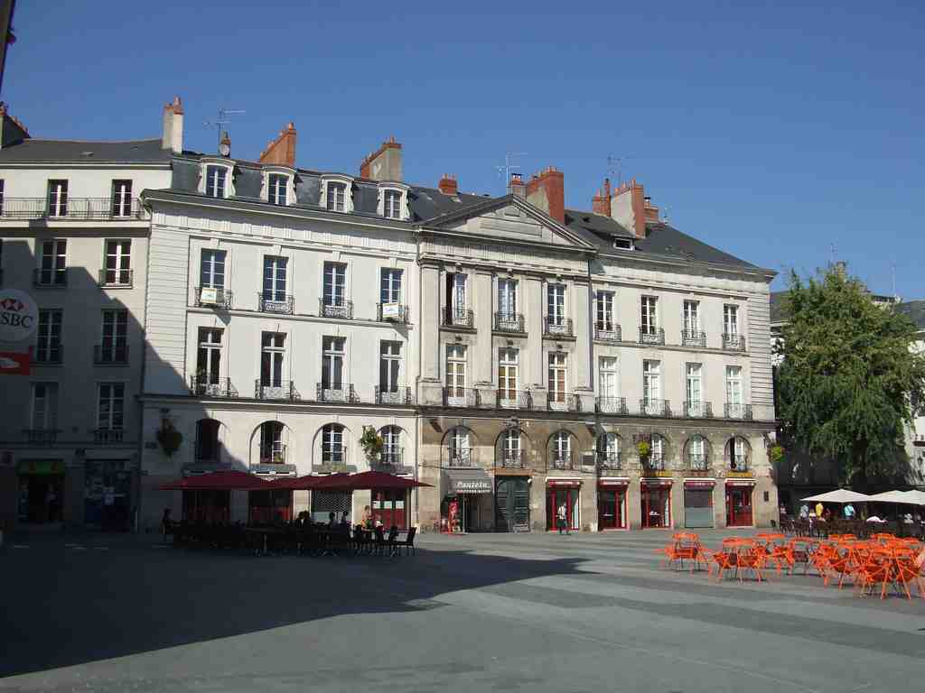
Bouffay SquarePhoto: Chabe01, Wikimedia Commons, CC BY-SA 4.0. Cropped & resized. This is a broad paved square, almost rectangular, framed by pale stone facades with neat rows of windows and dark slate roofs, a calm classical shell around a much older center.
The memory of the Château du Bouffay still holds this place together. The fortress once stood on the west side, and this square began as its court. Even after the dukes raised their newer castle, the old Bouffay kept its grip on Nantes through law, prison, and city government, so its disappearance hides just how much power once radiated from right here.
By the Middle Ages, this was the city’s main square. The south side leaned against the old medieval wall above the Loire, and people reached the river by a quay where the allée de la Tremperie lies now. In fifteen fifty-two, the old château became a presidial, a royal court: prisoners waited on the ground floor, judges sat above, and small shops traded under the staircase that opened onto the square. Justice, punishment, and everyday buying and selling all shared one address.
Standing in a lively square like this, what happens to a city when the center of life is not a church or a market alone, but a fortress yard turned public stage?
That stage could turn brutal. Here, executions took place until the Revolution. In sixteen twenty-six, Henri de Talleyrand-Périgord died here by beheading. In seventeen twenty, the crown made an example of four Breton noblemen linked to the Pontcallec conspiracy: Pontcallec, Montlouis, Talhouet, and du Couëdic. Their deaths warned Brittany’s nobility that royal power could reach the very heart of Nantes. Then, during the Revolution, the guillotine stood here almost continuously from March of seventeen ninety-three to September of seventeen ninety-four.
And still, life pressed in. A major fire scarred the square in the early seventeen twenties. Market traffic clogged the approaches long before automobiles; by seventeen twenty-five, city officials were already complaining that wine, brandy, hay, straw, horses, and pedestrians jammed the route to Bouffay.
One child here would grow into a healer. At number five, René Laennec lived from seventeen eighty-eight to seventeen ninety-three. The boy who later invented the stethoscope spent part of his childhood in a square where verdicts, commerce, fear, and argument all met face to face.
The facades you see now came later. Jean-Baptiste Ceineray redrew the place in the eighteen hundreds’ approach, clearing crooked buildings and imposing the elegant order around you. The old castle finally vanished in the nineteenth century, and its civic bell tower did not die with it; workers moved it to Sainte-Croix in eighteen sixty, a reminder that Nantes often keeps memory by moving it. Like the vanished Collégiale Notre-Dame, this old center survives more in traces than in stone.
If Bouffay was the political heart, the port was the bloodstream. Walk on to Allée du Port-Maillard, where that pulse reached the river.
On your right, look for a straight paved pedestrian allée lined with stone-and-plaster façades, marked by a blue enamel Port-Maillard street sign fixed to the buildings. This…Read moreShow less
Open dedicated page →
Allée du Port-MaillardPhoto: Selbymay, Wikimedia Commons, CC BY-SA 3.0. Cropped & resized. On your right, look for a straight paved pedestrian allée lined with stone-and-plaster façades, marked by a blue enamel Port-Maillard street sign fixed to the buildings.
This quiet strip of ground asks you to imagine something missing... water. Most people pass here and never realize that this calm pedestrian way follows the line of an old quay on a vanished arm of the Loire. The river has gone, but the port still tells your feet where to walk.
Long before Nantes looked anything like it does now, this edge of the city worked hard. Near here, around the Roman port district close to today’s Bouffay, cargo moved in and out beyond the old defensive wall. Wine came through. Timber came through. Lime and building stone came through. It was practical, noisy, essential life... the kind that keeps a city breathing.
And then there is the man whose name survived when so much else changed: Briand Maillard. In the early thirteenth century, he served as seneschal - a senior official managing the count’s affairs - for Nantes, Rezé, and Le Pallet. But one record from twelve twenty gives him an unusual title for the age: engineer. That matters. He was not only a noble administrator; he was a technical mind, someone trusted to solve the physical problems of a port city. Duke Pierre Mauclerc relied on him when Nantes needed crucial bridges to the island of the Saulzaie, the area that later became Île Feydeau. Briand Maillard used a sandy strip in the river to make that crossing possible. Eight centuries later, his name still clings to the ground beneath you.
This waterfront had to be clever. The city wall dropped straight into the Loire, so nobody could simply pull boats along the bank. Workers set up a huge wooden winch - a machine for hauling weight - to drag boats against the current or pull them onto the shore. A small fortified gate opened in the wall nearby, and a covered bridge crossed a boire, a little side-channel, before reaching the port zone. It was engineering shaped by defense, trade, and constant improvisation.
If you peek at the sign in the app, you’ll see how modest the name looks now, but this line once carried much heavier ambitions. In the seventeen twenties, officials renamed the rebuilt quay after Mayor Gérard Mellier. He pushed urban improvements, but he also defended the slave trade in writing, which tells you something painful about how prosperity reached Nantes. The new official name never truly stuck. People kept saying Port-Maillard, and the older memory won.
By the nineteenth century, this quay had another life. Workers strengthened it for the railway to Saint-Nazaire. In June of eighteen forty-eight, a young schoolboy named Jules Vallès stood here and led a student protest against the repression of Parisian workers. He later remembered these stones as the place where his political conscience first woke up.
Glance at the image on your screen and notice the ordinary urban frontage. That is the point. Nantes keeps building over itself without quite erasing what came before. A quay becomes a road, a road becomes a promenade, and yet the old waterside logic survives.
Next, we tighten the lens. All this movement of goods, labor, and power needed a fortified center to guard it, tax it, and control it. We’re heading toward the Château du Bouffay, where the port’s restless edge met the city’s clenched fist.
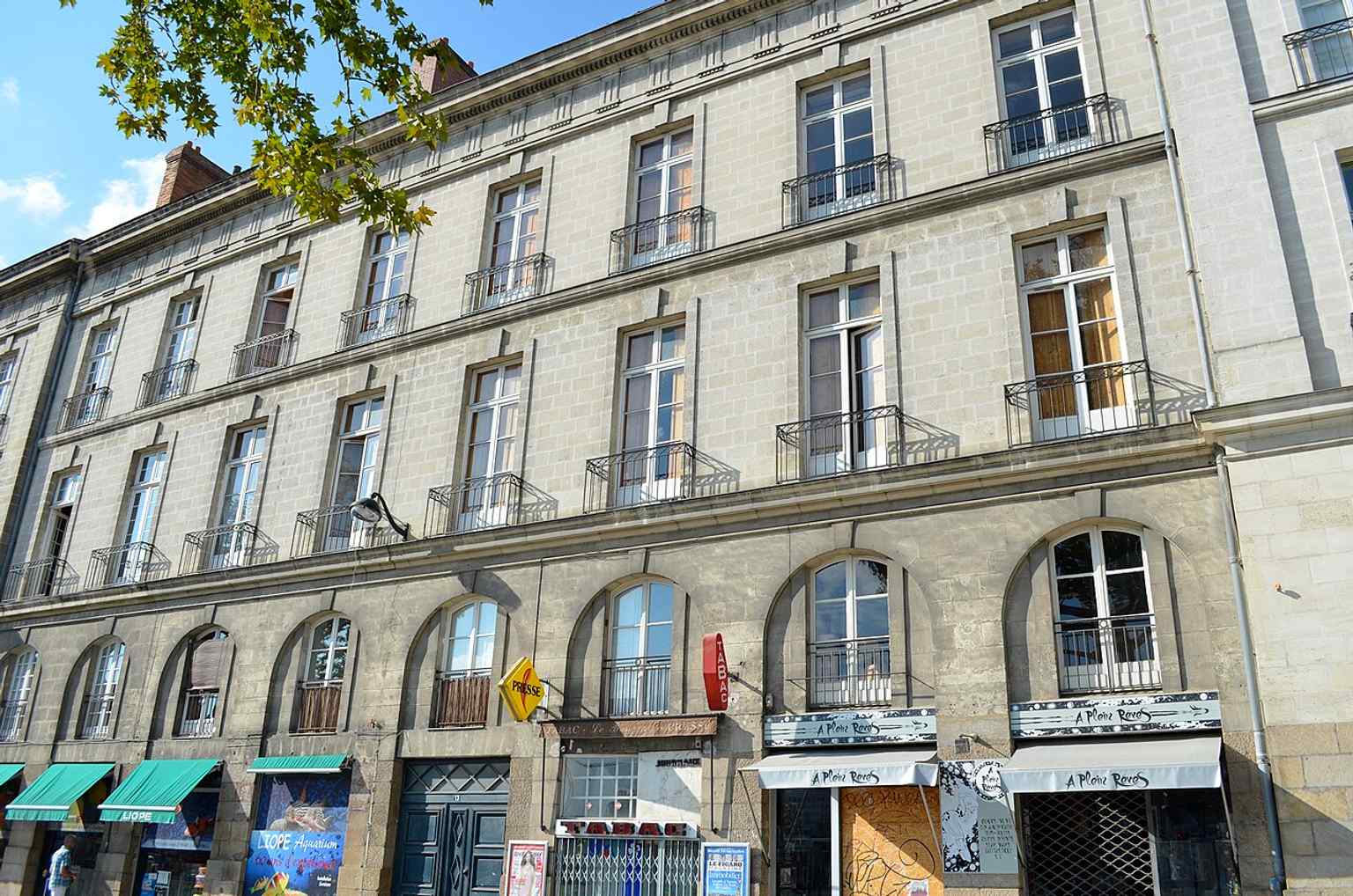
A street-facing view of No. 13 Allée du Port-Maillard, showing the historic urban fabric that replaced the old quay as the Loire was gradually filled in.Photo: Selbymay, Wikimedia Commons, CC BY-SA 3.0. Cropped & resized. 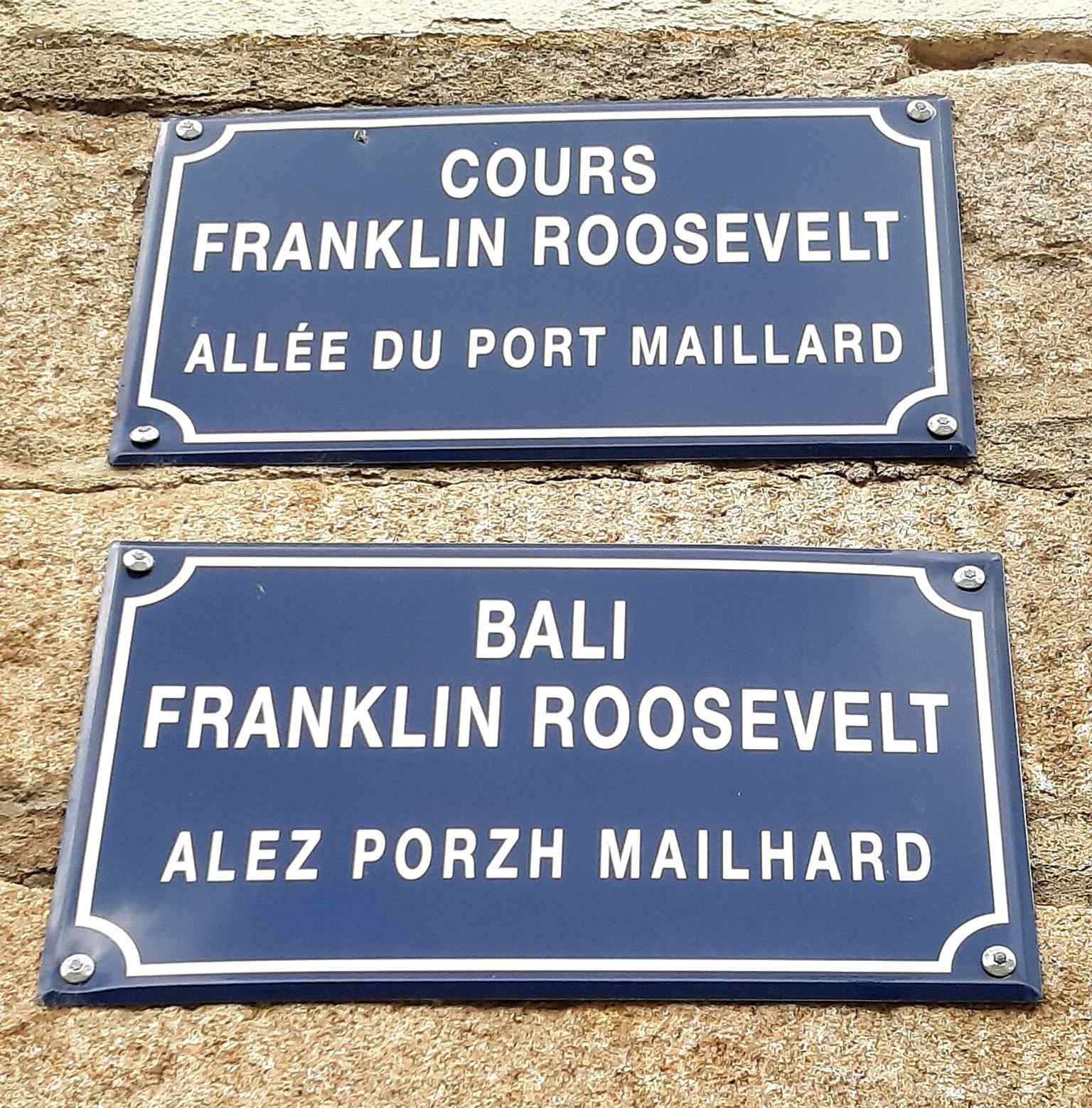
The street sign for Allée du Port-Maillard — a reminder that this pedestrian route once followed the edge of the former Loire arm and port area.Photo: Jibi44, Wikimedia Commons, CC BY-SA 4.0. Cropped & resized. On your right, what you’re looking for is not a standing fortress but a broad paved footprint, traced in dark stone bands with angular tower shapes that mark the castle’s vanished…Read moreShow less
Open dedicated page →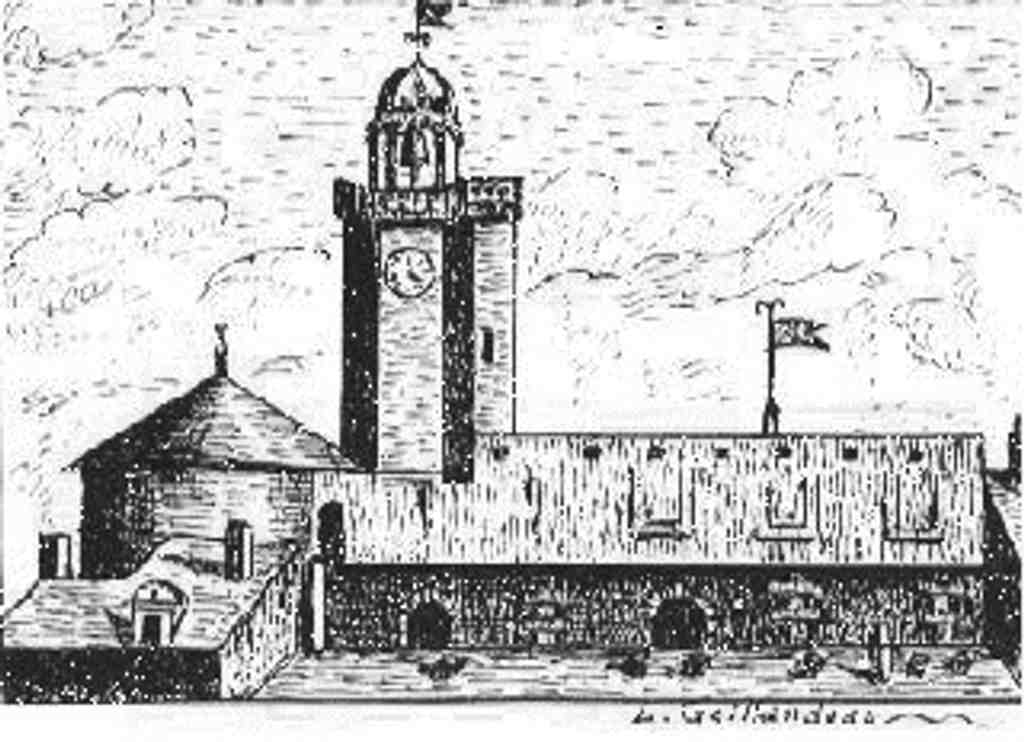
Bouffay CastlePhoto: Gillardeau, Wikimedia Commons, Public domain. Cropped & resized. On your right, what you’re looking for is not a standing fortress but a broad paved footprint, traced in dark stone bands with angular tower shapes that mark the castle’s vanished outline.
This is one of Nantes’ strangest places... a castle that ruled the city for centuries, and then slipped so completely from view that you have to rebuild it in your mind.
Long before the medieval fortress, this ground was probably fortified in the Gallo-Roman era, around two seventy-six, as Roman cities tightened their defenses under pressure from raids and rebellion. But the Bouffay that mattered most to Nantes rose later, after the Viking terror that scarred this city in eight forty-three. That wound never really left memory. So when Alain Barbetorte and Conan the Crooked strengthened Nantes in the tenth century, they acted with urgency. They raised ramparts fast, and here, at the southwest edge of the old city near the river’s former meeting point, they created a stronghold that protected Nantes... and controlled it.
That second part matters.
Conan le Tort, count of Rennes, seized Nantes in nine ninety. He did not build here out of simple caution. He built to prove who held power. The first castle may have been wood, but its message was hard as iron: the river could be watched, the city could be locked, and a resistant population could be kept in line. For a long while, this enclosure was the political heart of the place. Money was struck here. Councils met here. Justice spoke here.
And sometimes justice arrived wearing a cruel face.
In thirteen forty-three, after the king condemned Olivier the Third of Clisson for supposed treason, his severed head came to Nantes and, according to later accounts, was displayed on a lance atop these battlements. His widow, Jeanne de Belleville, saw that outrage and swore revenge. Grief turned her into the Lioness of Brittany. She sold her possessions, armed ships, and attacked the king’s vessels at sea. That is the kind of memory this place kept: private heartbreak sharpened into public history.
Later, when the dukes shifted power to the newer castle, Bouffay did not fall silent. It became a prison, then the seat of local administration, then a law court. Gilles de Rais passed through its jail. During the Revolution, Jean-Baptiste Carrier packed prisoners in so tightly that disease tore through the cells, and carts rolled out from here toward the drownings of Nantes. Four young sisters - Gabrielle, Marguerite, Claire, and Olympe La Métairie - went to execution supporting one another, refusing to be separated.
And yet the fortress itself disappeared. Workers demolished it in eighteen forty-three. Its last clock tower, polygonal and crowned with an open gallery and dome, survived only until eighteen forty-eight. Even that loss hurt the city. People protested. They lost the tower anyway. Even after the stones were gone, one echo of Bouffay survived above Sainte-Croix.
That may be the deepest truth here: Nantes can erase a fortress and still keep its shape in memory.
From this absent center, let’s head toward the riverfront edge of the old city, where trade, punishment, and remembrance meet once more at Flesselles Alley, about a one-minute walk away. As a small practical note, nearby heritage spaces generally open from ten in the morning to six in the evening Tuesday through Sunday, and close on Monday.
This place looks like a long stone promenade edged by a calm row of pale classical facades, with a deep central passageway cut through the buildings like a hidden doorway.…Read moreShow less
Open dedicated page →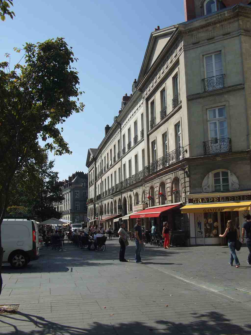
Flesselles AlleyPhoto: Pj44300, Wikimedia Commons, CC BY-SA 4.0. Cropped & resized. This place looks like a long stone promenade edged by a calm row of pale classical facades, with a deep central passageway cut through the buildings like a hidden doorway.
Flesselles Alley asks you to trust what your eyes cannot see... because this was not born as an alley at all. You are standing on a former quay of the Loire. Most visitors read it as an ordinary city lane, but the ground under your feet used to be the river’s edge, part of the Bourse branch of the Loire, before the great infill works of the nineteen twenties and nineteen thirties buried the water and left a promenade in its place. If you glance at the image on your screen, you can see archaeologists uncovering that lost waterfront, like a memory rising through the pavement.
Its name carries another buried story. Jacques de Flesselles, killed on the fourteenth of July, seventeen eighty-nine, became one of the Revolution’s first victims in Paris. But in Nantes, people remembered him for something older: as Intendant of Brittany, from seventeen sixty-five to seventeen sixty-seven, he helped push forward the major urban works that reshaped this riverfront. So the quay took his name... then the Revolution stripped it away and renamed it for the Gardes-Françaises... and in eighteen fifteen, the Restoration gave Flesselles his place back. Even a street name here keeps arguing with history.
Before that, people called this stretch Quai de la Poterne, after a poterne, a small gate in the old wall. Then architect Jean-Baptiste Ceineray dreamed bigger. He aligned quays and facades from the city center toward the castle, turning this river edge into a kind of formal urban stage. That tidy front still hides messier truths: older parcels, damaged wartime interiors, and at number three, an eighteenth-century staircase protected as a historic monument, though you would never know it from the street.
Human lives rushed through here too. In seventeen seventy-seven, Charles Mangin set up his son, Louis Victor Mangin, with Nantes’s first “little post,” a private local mail service. Letters dropped into boxes around the city arrived by uniformed carriers several times a day. It feels touching, doesn’t it? On this quay of merchants and movement, Nantes learned to send news house to house.
Then came rails, trams, and near disaster. A railway reached this quay in the eighteen fifties. Nantes’s first tram line rolled through in eighteen seventy-nine. In nineteen oh five, a tram derailed at the nearby Pont de la Poissonnerie and plunged into the Loire. Miraculously, the passengers survived. In nineteen ten, floodwater rose so high it covered the tram tracks.
Look along the allée for a moment and try replacing pavement with dark moving water. That is Nantes, really: a city that keeps covering, renaming, cutting through, and rebuilding... yet never quite erases what came before.
Thank you for walking with me.
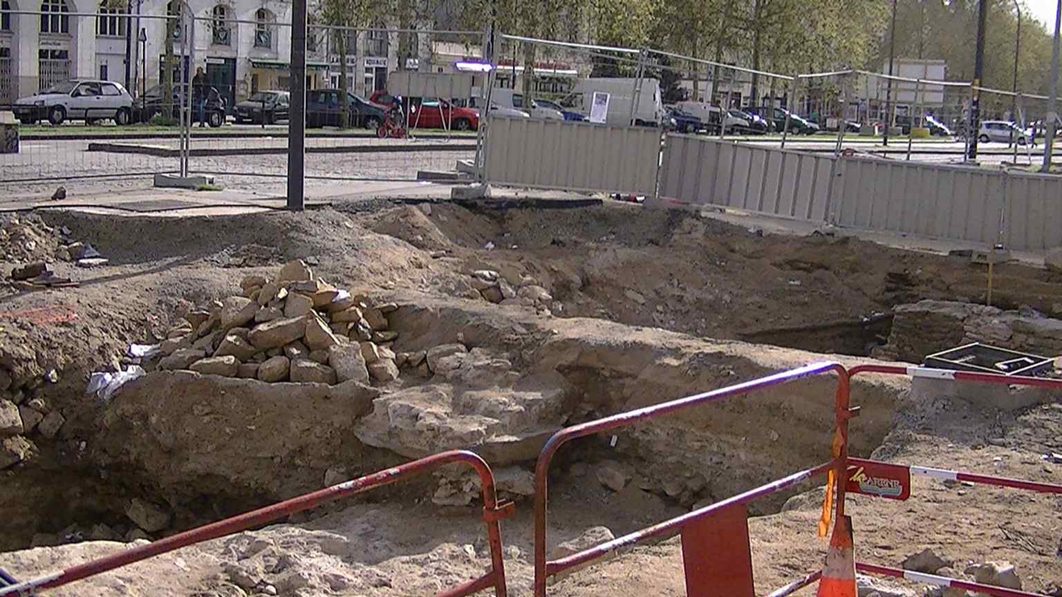
Archaeologists uncover the old Loire waterfront beneath Allée Flesselles, echoing the street’s origin as a quay before the river was filled in.Photo: Adam Bishop, Wikimedia Commons, CC BY-SA 3.0. Cropped & resized. 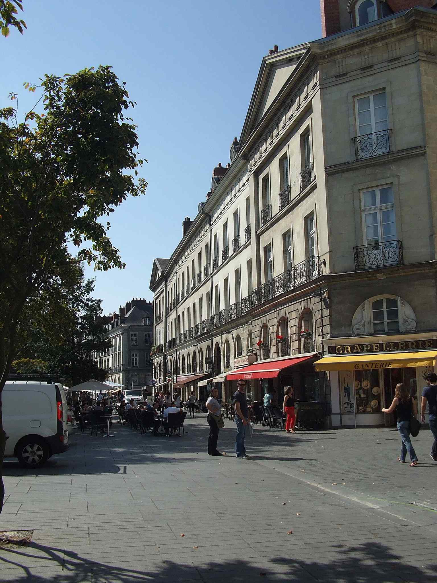
A street-level view of Allée Flesselles, the pedestrian lane that once carried tramway and railway traffic along Nantes’s former riverfront.Photo: Pj44300, Wikimedia Commons, CC BY-SA 4.0. Cropped & resized. 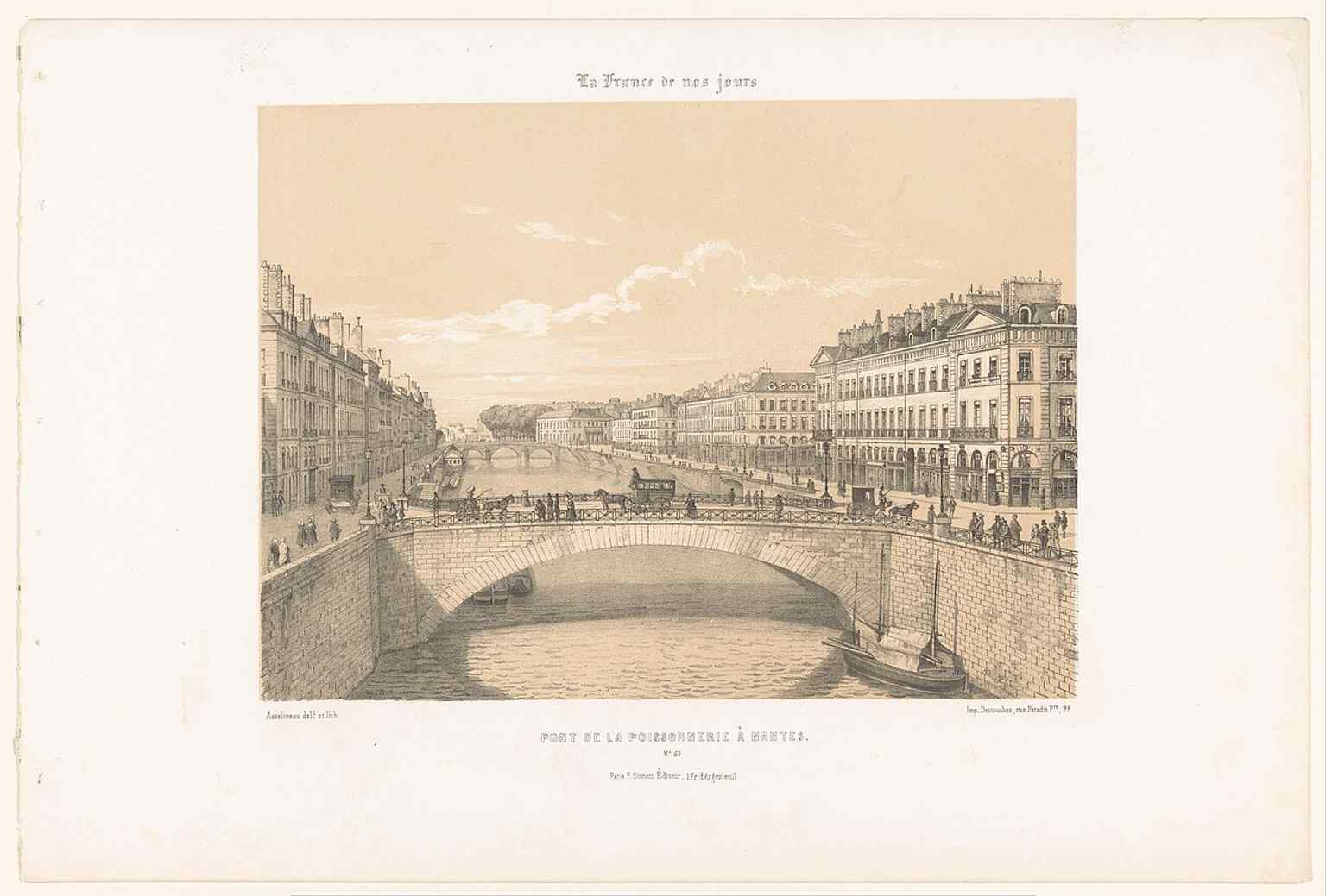
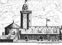
An 1853 view of the Pont de la Poissonnerie near Allée Flesselles, one of the bridges that once connected this quay to Île Feydeau.Photo: Rijksmuseum, Wikimedia Commons, CC0. Cropped & resized.
Frequently asked questions
How do I start the tour?
After purchase, download the AudaTours app and enter your redemption code. The tour will be ready to start immediately - just tap play and follow the GPS-guided route.
Do I need internet during the tour?
No! Download the tour before you start and enjoy it fully offline. Only the chat feature requires internet. We recommend downloading on WiFi to save mobile data.
Is this a guided group tour?
No - this is a self-guided audio tour. You explore independently at your own pace, with audio narration playing through your phone. No tour guide, no group, no schedule.
How long does the tour take?
Most tours take 60–90 minutes to complete, but you control the pace entirely. Pause, skip stops, or take breaks whenever you want.
What if I can't finish the tour today?
No problem! Tours have lifetime access. Pause and resume whenever you like - tomorrow, next week, or next year. Your progress is saved.
What languages are available?
All tours are available in 50+ languages. Select your preferred language when redeeming your code. Note: language cannot be changed after tour generation.
Where do I access the tour after purchase?
Download the free AudaTours app from the App Store or Google Play. Enter your redemption code (sent via email) and the tour will appear in your library, ready to download and start.
If you don't enjoy the tour, we'll refund your purchase. Contact us at [email protected]
Checkout securely with 






%2001.jpg)

%20-%202022-09-19%20-%203.jpg)
%20-%202022-09-19%20-%201.jpg)
%20-%202022-09-19%20-%202.jpg)


.JPG)
%20Hedendaags%20Frankrijk%20(serietitel)%20La%20France%20de%20nos%20jours%20(serietitel%20op%20object)%2C%20RP-P-1907-4389.jpg)