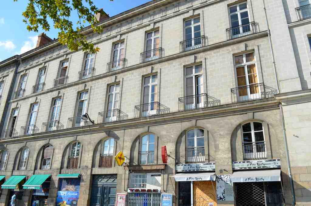
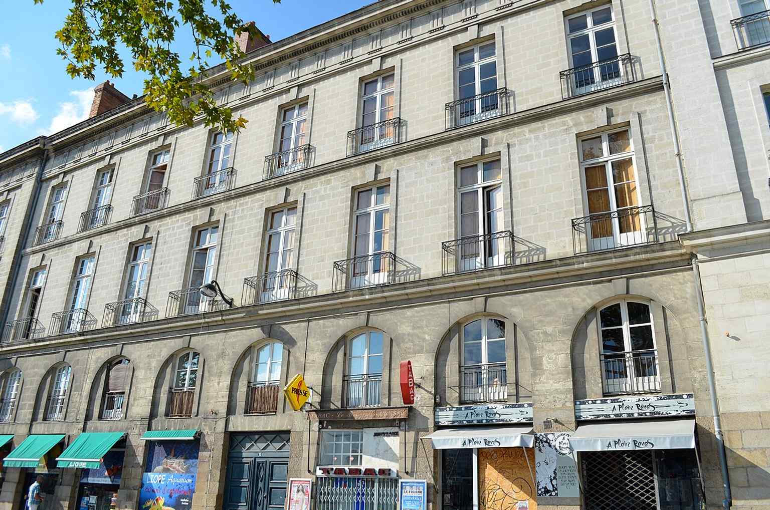
On your right, look for a straight paved pedestrian allée lined with stone-and-plaster façades, marked by a blue enamel Port-Maillard street sign fixed to the buildings.
This quiet strip of ground asks you to imagine something missing... water. Most people pass here and never realize that this calm pedestrian way follows the line of an old quay on a vanished arm of the Loire. The river has gone, but the port still tells your feet where to walk.
Long before Nantes looked anything like it does now, this edge of the city worked hard. Near here, around the Roman port district close to today’s Bouffay, cargo moved in and out beyond the old defensive wall. Wine came through. Timber came through. Lime and building stone came through. It was practical, noisy, essential life... the kind that keeps a city breathing.
And then there is the man whose name survived when so much else changed: Briand Maillard. In the early thirteenth century, he served as seneschal - a senior official managing the count’s affairs - for Nantes, Rezé, and Le Pallet. But one record from twelve twenty gives him an unusual title for the age: engineer. That matters. He was not only a noble administrator; he was a technical mind, someone trusted to solve the physical problems of a port city. Duke Pierre Mauclerc relied on him when Nantes needed crucial bridges to the island of the Saulzaie, the area that later became Île Feydeau. Briand Maillard used a sandy strip in the river to make that crossing possible. Eight centuries later, his name still clings to the ground beneath you.
This waterfront had to be clever. The city wall dropped straight into the Loire, so nobody could simply pull boats along the bank. Workers set up a huge wooden winch - a machine for hauling weight - to drag boats against the current or pull them onto the shore. A small fortified gate opened in the wall nearby, and a covered bridge crossed a boire, a little side-channel, before reaching the port zone. It was engineering shaped by defense, trade, and constant improvisation.
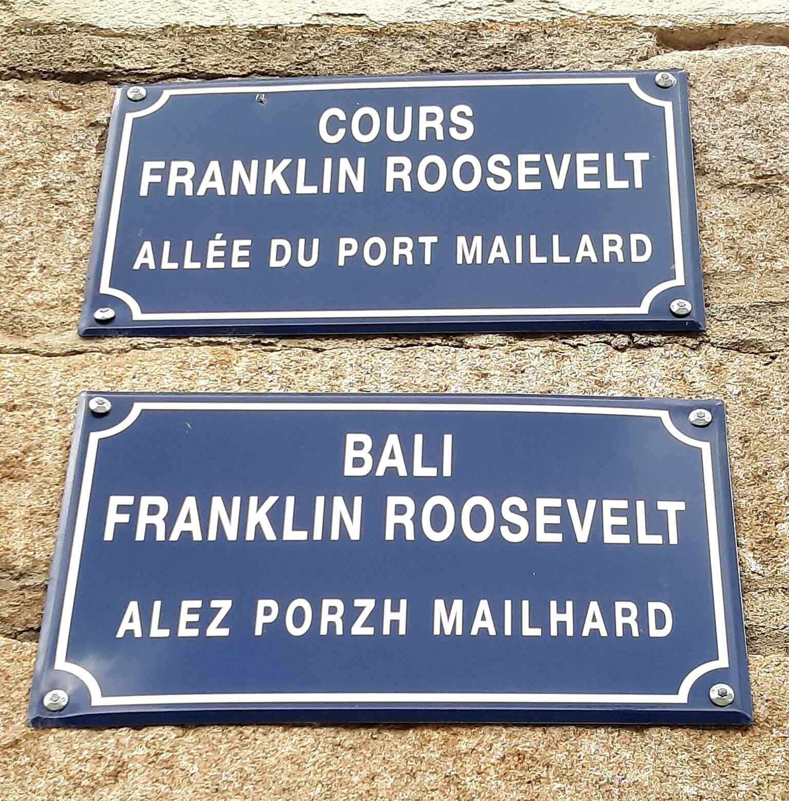
If you peek at the sign in the app, you’ll see how modest the name looks now, but this line once carried much heavier ambitions. In the seventeen twenties, officials renamed the rebuilt quay after Mayor Gérard Mellier. He pushed urban improvements, but he also defended the slave trade in writing, which tells you something painful about how prosperity reached Nantes. The new official name never truly stuck. People kept saying Port-Maillard, and the older memory won.
By the nineteenth century, this quay had another life. Workers strengthened it for the railway to Saint-Nazaire. In June of eighteen forty-eight, a young schoolboy named Jules Vallès stood here and led a student protest against the repression of Parisian workers. He later remembered these stones as the place where his political conscience first woke up.
Glance at the image on your screen and notice the ordinary urban frontage. That is the point. Nantes keeps building over itself without quite erasing what came before. A quay becomes a road, a road becomes a promenade, and yet the old waterside logic survives.
Next, we tighten the lens. All this movement of goods, labor, and power needed a fortified center to guard it, tax it, and control it. We’re heading toward the Château du Bouffay, where the port’s restless edge met the city’s clenched fist.

