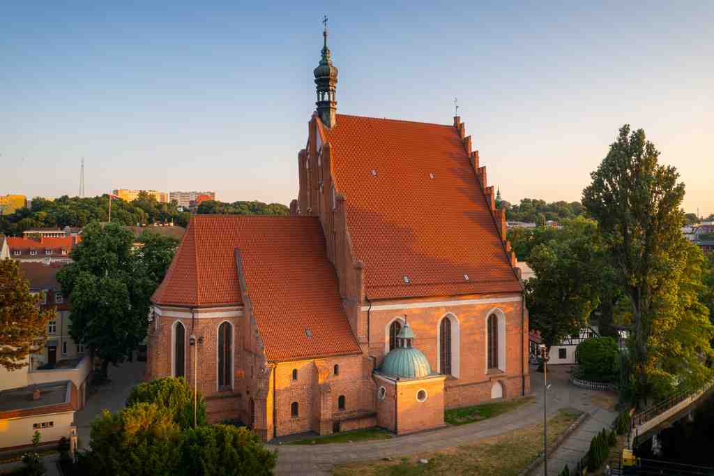
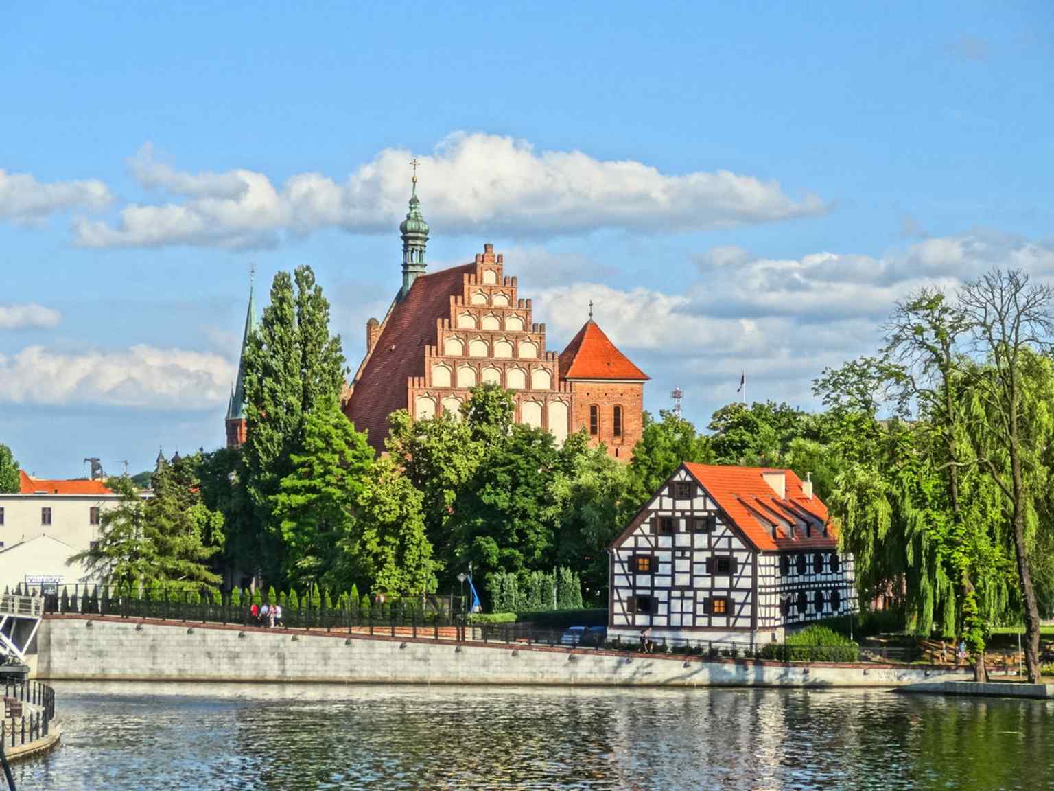
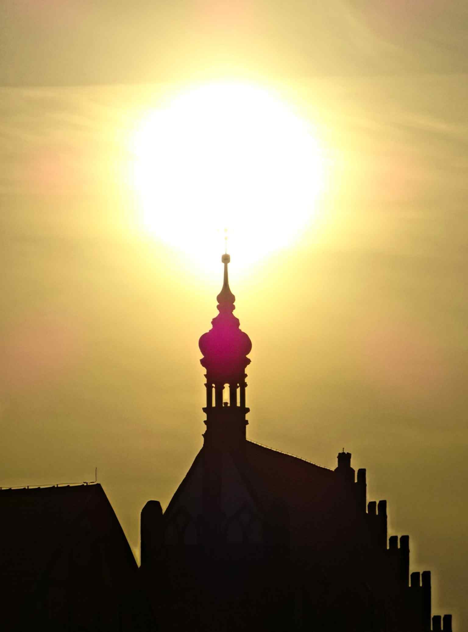
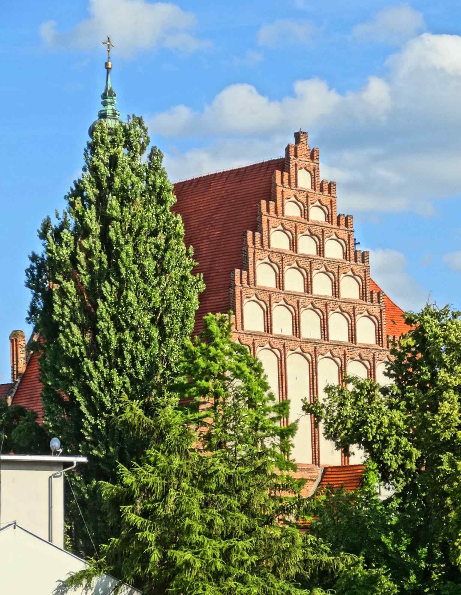
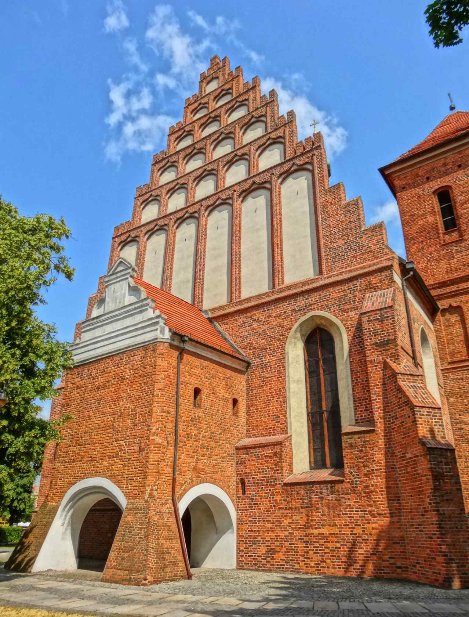
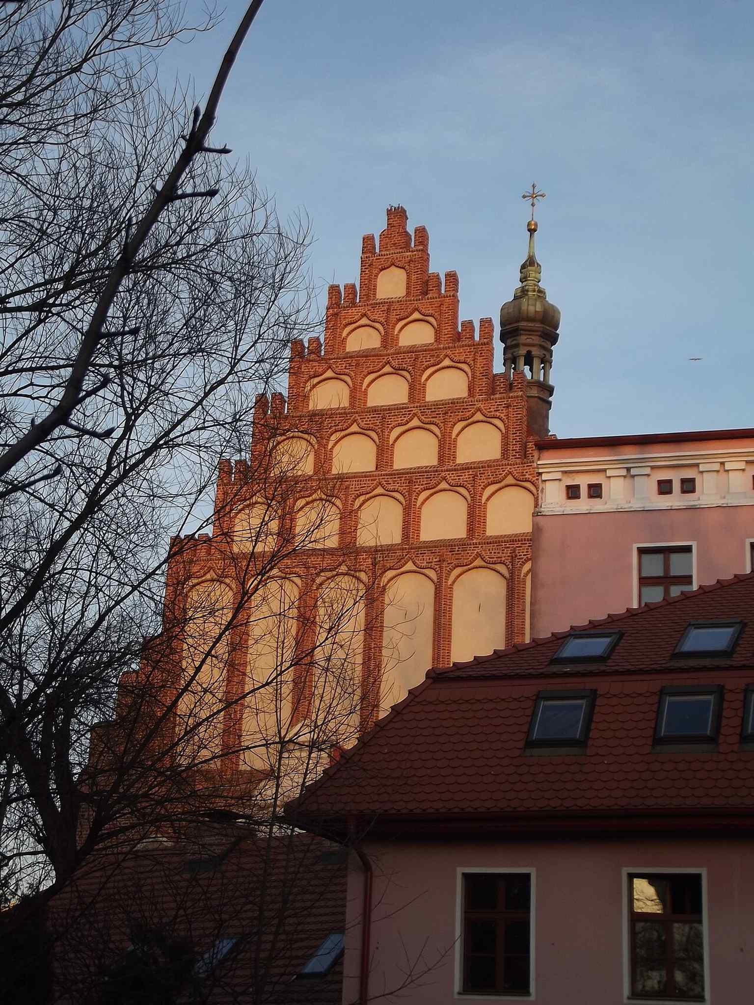
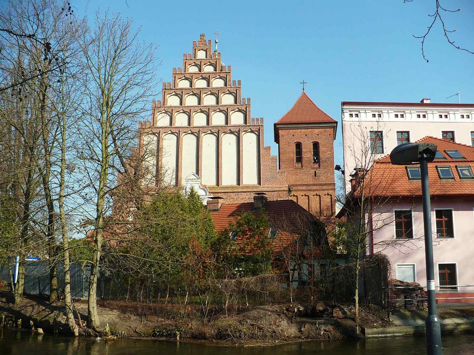
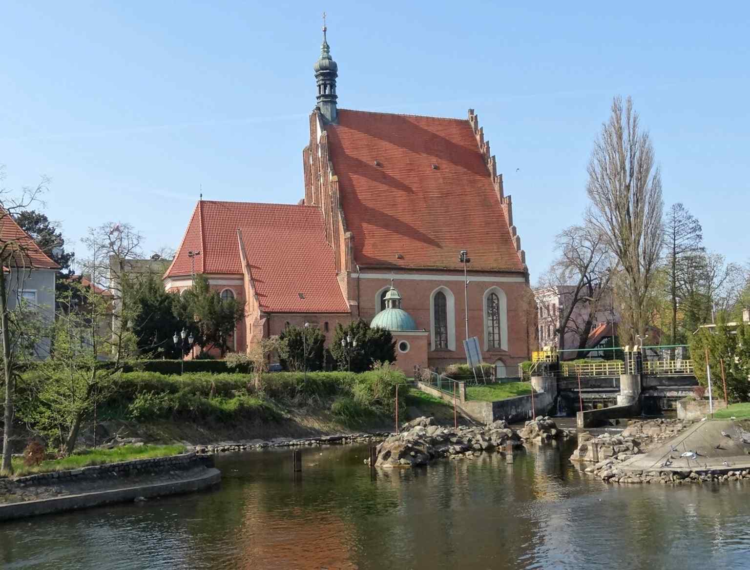
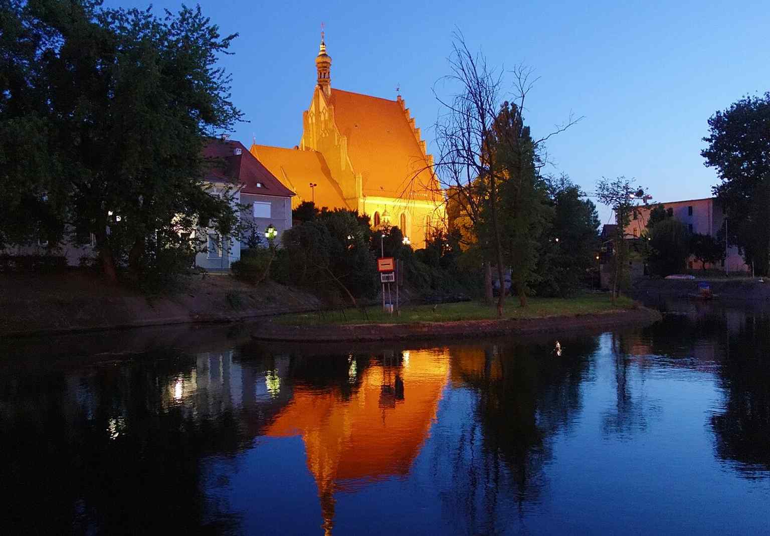
Halten Sie zu Ihrer Linken Ausschau nach einer hohen gotischen Kirche aus rotem Backstein mit Spitzbogenfenstern, einem breiten Treppengiebel und einem kleinen achteckigen Türmchen direkt auf dem Dachfirst. Dies ist die Kathedrale St. Martin und Nikolaus, und sie besitzt jene seltene Eigenschaft, die manche Gebäude ganz ohne Anstrengung ausstrahlen: Gravität. Über Jahrhunderte nannten die Menschen sie hier einfach die Fara, was so viel wie Hauptpfarrkirche bedeutet. Bydgoszcz wies dieses Grundstück aus, als die Stadt 1346 ihre Stadtrechte erhielt, direkt am Rande der Altstadt in der Nähe der Brda und des Mühlenkanals. Die Kirche war also schon immer mit dem Rhythmus der Stadt am Flussufer verbunden. Wenn Sie einen Blick auf Ihr Handy werfen, zeigt die weitere Flussansicht, wie natürlich sich die Kathedrale in das Panorama am Wasser einfügt.
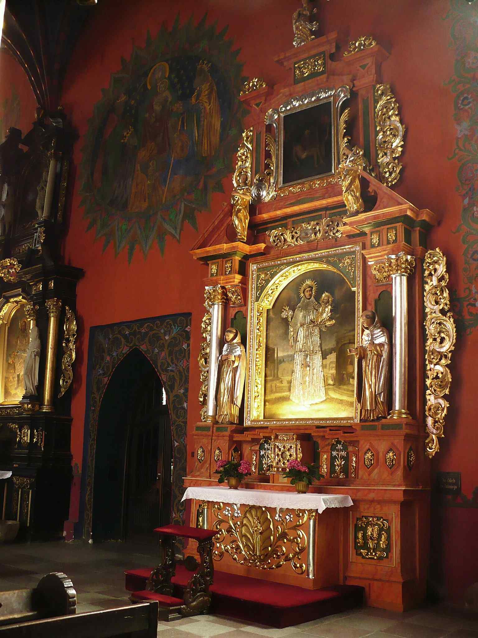
Im Inneren befindet sich das emotionale Zentrum des Gebäudes: die Madonna mit der Rose, ein Bild aus dem späten 15. Jahrhundert, das später als Muttergottes von der Schönen Liebe verehrt wurde. Gläubige hängten silberne Votivgaben daneben als Dank für erhaltene Gunstbezeugungen. 1966 krönte Kardinal Stefan Wyszyński das Bild, und 1999 krönte es Papst Johannes Paul II. erneut. Ein zweites wertvolles Mariengemälde, die Muttergottes vom Skapulier, kam nach der Auflösung der Klöster durch die preußischen Behörden aus der alten Karmeliterkirche hierher. Diese Kirche hat auch schwere Zeiten durchlebt. Soldaten nutzten sie während der napoleonischen Ära, der Krieg beschädigte sie 1945, und doch kehrte sie immer wieder zurück. Im Jahr 2004 wurde sie schließlich zur Kathedrale der neu geschaffenen Diözese Bydgoszcz. Nicht schlecht für eine Kirche, die Feuer, Teilungen, Besatzung und das übliche menschliche Chaos überlebt hat. Und ein letztes erstaunliches Detail: 2018 fanden Archäologen unter dem Boden ein verstecktes Depot, darunter Schmuck aus dem 17. Jahrhundert und 486 Goldmünzen, die wahrscheinlich während der Schwedenkriege versteckt wurden. Dieser Ort fühlt sich weniger wie ein Denkmal an, sondern eher wie ein langer, sturer Herzschlag. Werfen Sie noch einen Blick auf das Mauerwerk, und wenn Sie bereit sind, können wir weiter in Richtung Jezuicka-Straße schlendern.
Eine Tagesansicht der Kathedrale St. Martin und Nikolaus, das wichtigste Außenporträt des Wahrzeichens.

