Boston Audio Tour: Boston's Landmark Odyssey
Lightning once split the steeple of Park Street Church as revolution thundered through Boston’s streets. Under your feet, secrets lie—graves of fiery rebels and silent witnesses to history’s most turbulent hours. Set out on this self-guided audio tour to trace legends and hidden tales scattered from the shadowy corners of Granary Burying Ground to the soaring heights of Custom House Tower. Go beyond the tourist track to discover stories that most will never hear. Why did an infamous duel echo near these sacred tombs? Who was caught in a midnight conspiracy at the Custom House? Which long-forgotten Boston scandal began with a whispered conversation on this very street? Wander through bustling squares and hushed burial grounds. Feel the pulse of rebellion. See Boston reveal its true face as each turn uncovers another fragment of drama and discovery. History hides in plain sight—press play and let the city confess its secrets.
Tour preview
About this tour
- scheduleDuration 100–120 minsGo at your own pace
- straighten4.3 km walking routeFollow the guided path
- location_onLocationBoston, United States
- wifi_offWorks offlineDownload once, use anywhere
- all_inclusiveLifetime accessReplay anytime, forever
- location_onStarts at Piazza Postale, Boston
Stops on this tour
lock_open 3 free previews · 12 unlock with purchase
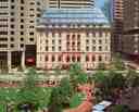
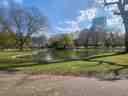
Look for the rectangular green lawn, pale stone walkways, and the long pergola that frames this compact park in the middle of the Financial District. Post Office Square is one of…Read moreShow less
Open dedicated page →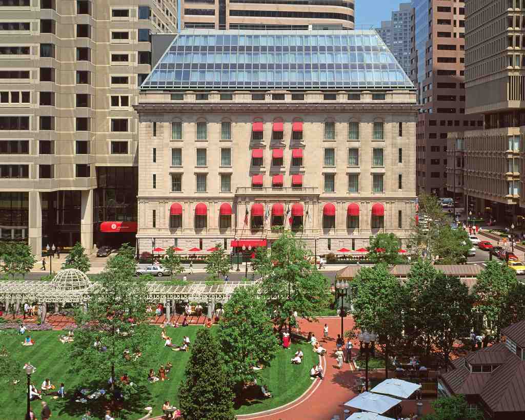
Post Office Square, BostonPhoto: The Langham, Boston, Wikimedia Commons, CC BY-SA 3.0. Cropped & resized. Look for the rectangular green lawn, pale stone walkways, and the long pergola that frames this compact park in the middle of the Financial District.
Post Office Square is one of those Boston places that quietly reinvented itself. Back in the eighteenth century, rope makers worked this area. Then homes moved in, then businesses, and after the Great Boston Fire of eighteen seventy-two tore through the neighborhood, rebuilding gave the square a new identity. People started calling it Post Office Square in eighteen seventy-four because the United States Post Office and Sub-Treasury faced it here. Today, that role belongs to the John W. McCormack Post Office and Courthouse nearby.
What you’re standing beside now is Norman B. Leventhal Park, a private park that welcomes the public like an open hand. It stretches across about one point seven acres, with fountains, a café, a pergola, and a central lawn softened by one hundred twenty-five species of plants. But here’s the sneaky part... beneath your feet sits a parking garage dropping about eighty feet underground, once one of the deepest excavations in Boston. Cars down below help pay for the calm up here; the garage revenue funds the park’s upkeep.
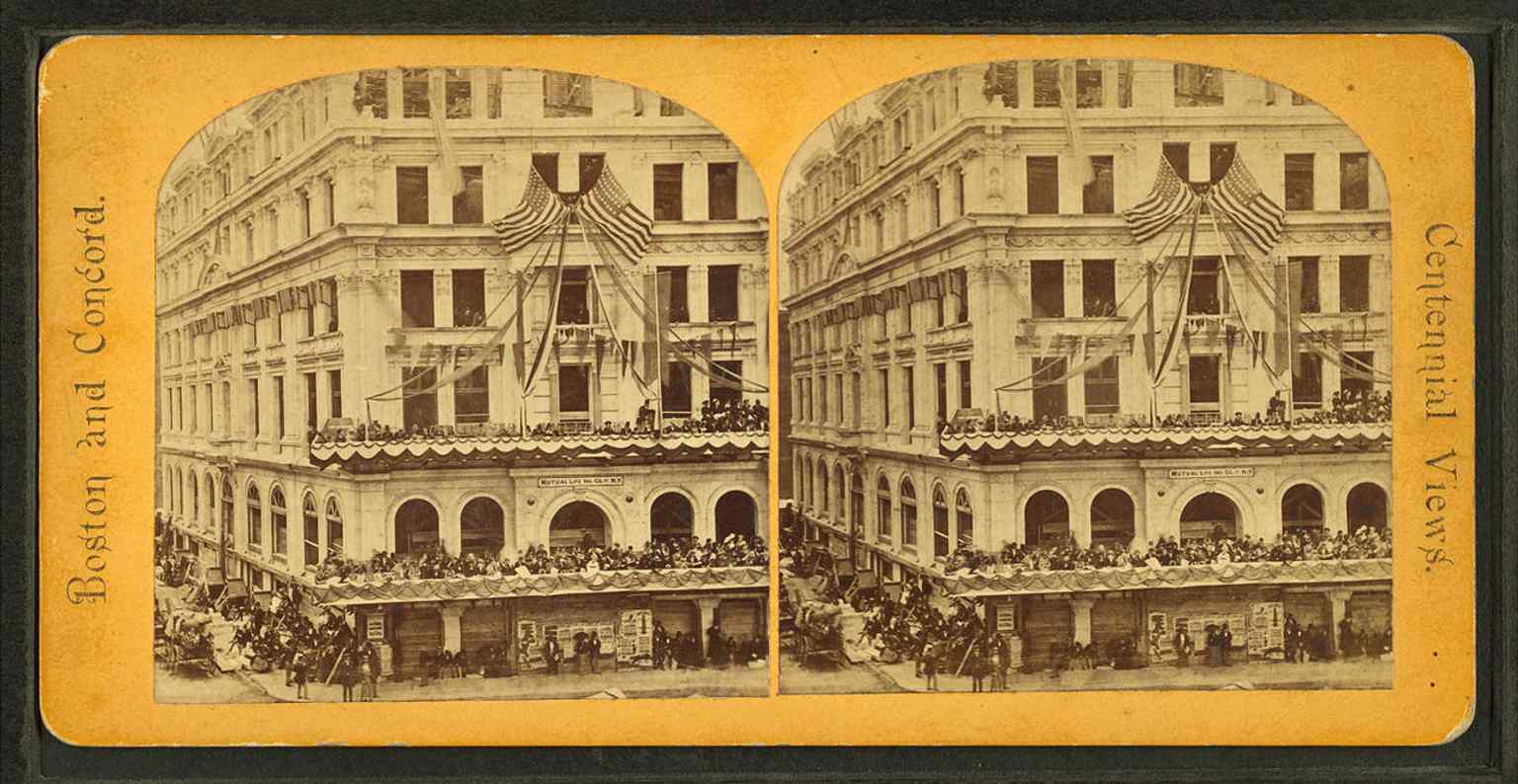
That idea took a while to arrive. In eighteen seventy-four, architect Nathaniel Bradlee designed the headquarters of the New England Mutual Life Insurance Company on this site. That building came down in nineteen forty-five, and by nineteen fifty-four a hulking above-ground garage had swallowed the square. Then the city flipped the script: workers demolished that garage in nineteen eighty-eight, opened the underground garage in nineteen ninety for eighteen million dollars, and finished the park above in nineteen ninety-two. If you want to see just how dramatic that swap was, take a quick peek at the before-and-after image in the app.
The square has seen its share of history, too, from a Lyndon B. Johnson speech in nineteen sixty-four to the aftermath of a nineteen eighty-six transformer explosion and fire in One Post Office Square.
So this place is really a Boston magic trick: a hard-working garage below, a soft green pause above, and it stays open twenty-four hours a day.
Take a moment to soak it in... and when you’re ready, we can head on to Custom House Tower.
An 1861 view of Post Office Square, before today’s park and underground garage reshaped the block.Photo: Unknown artistUnknown artist, Wikimedia Commons, Public domain. Cropped & resized. 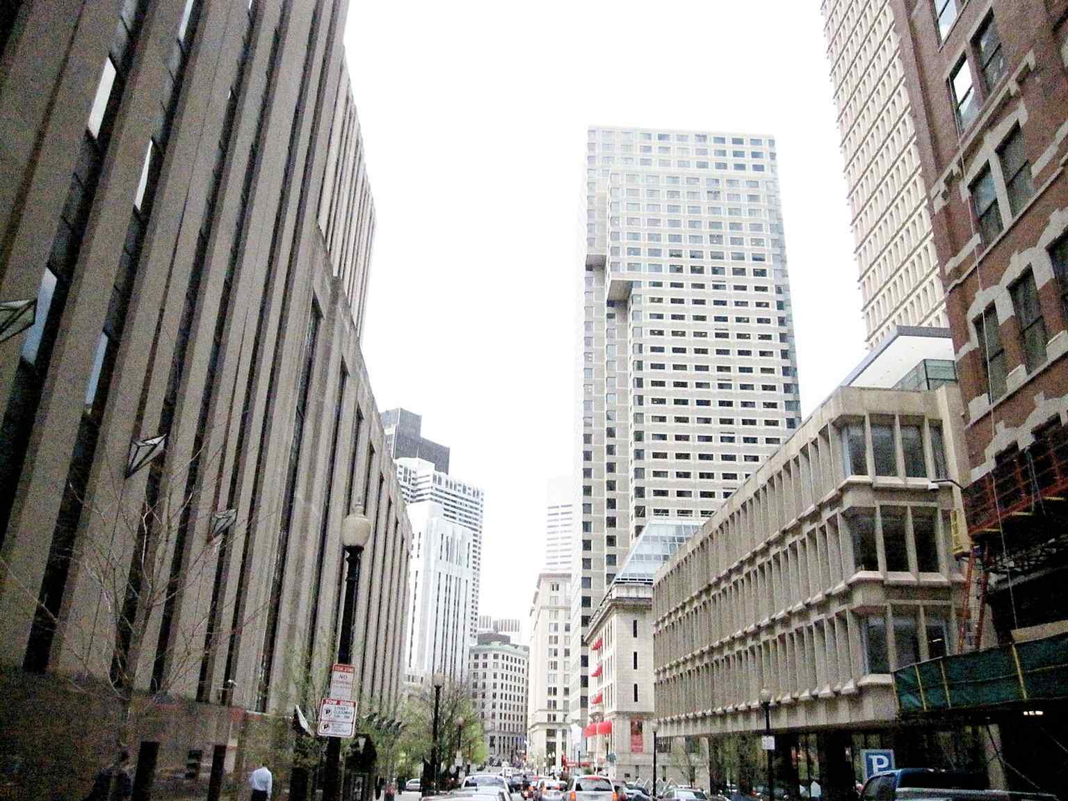
A broad city-view of Post Office Square in downtown Boston, useful for showing its position in the financial district.Photo: M2545, Wikimedia Commons, Public domain. Cropped & resized. 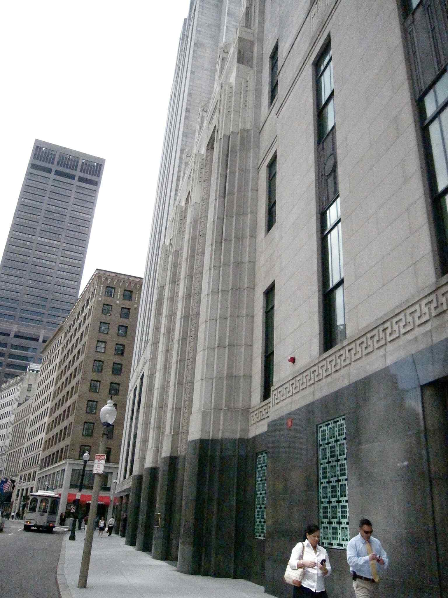
The John W. McCormack Post Office and Courthouse, the modern government building that fronts the square.Photo: M2545, Wikimedia Commons, Public domain. Cropped & resized. 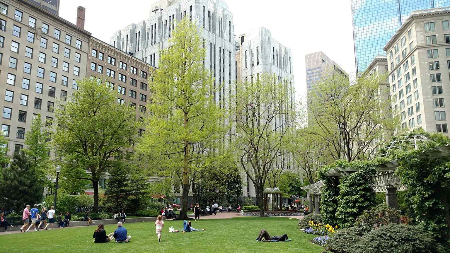
Post Office Square today, with the public park at the center of the financial district.Photo: NewtonCourt, Wikimedia Commons, CC BY-SA 4.0. Cropped & resized. 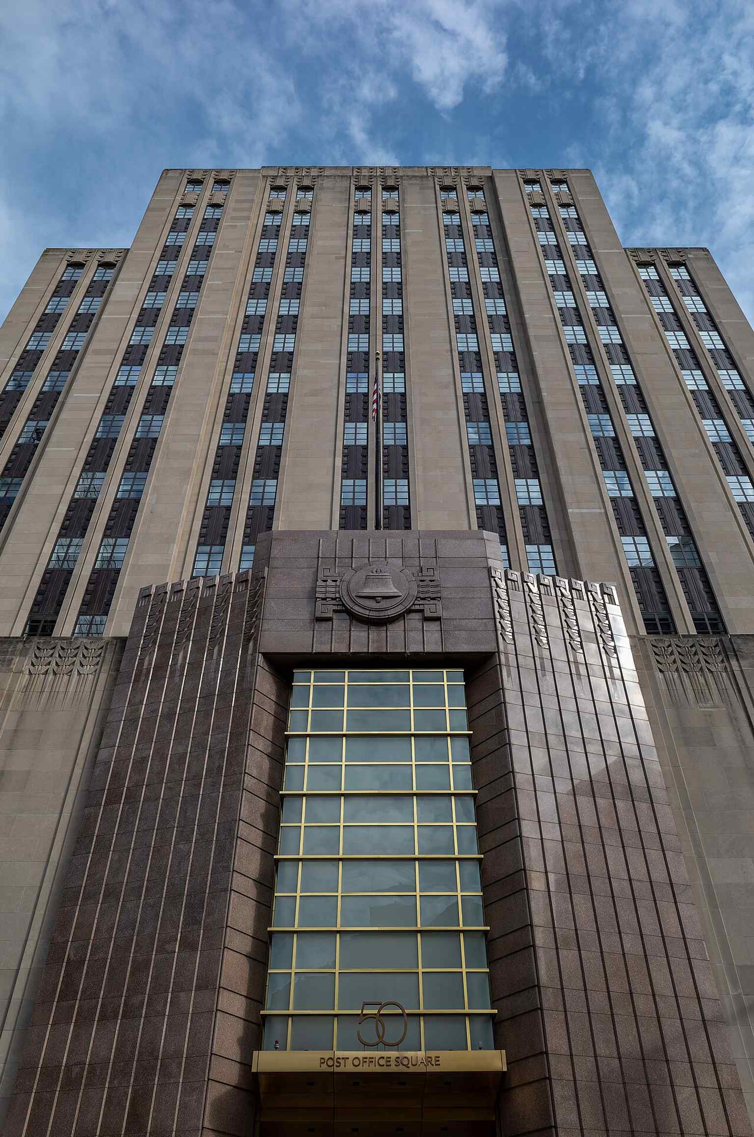
50 Post Office Square, the former New England Telephone building where the first telephone laboratory was reconstructed.Photo: Jules Verne Times Two, Wikimedia Commons, CC BY-SA 4.0. Cropped & resized. In front of you is a pale granite base shaped like a classical temple, ringed with thick fluted columns and topped by a tall narrow tower with a huge clock face near the…Read moreShow less
Open dedicated page →In front of you is a pale granite base shaped like a classical temple, ringed with thick fluted columns and topped by a tall narrow tower with a huge clock face near the top.
This building is basically Boston wearing two different centuries at once. Down low, you’ve got the original Custom House, which architect Ammi Burnham Young designed in the late eighteen thirties in the Greek Revival style - meaning he borrowed the muscle and calm symmetry of ancient temples. Then, rising out of it, comes that tower from nineteen thirteen to nineteen fifteen, when Peabody and Stearns gave the old customs building a skyscraper spine.
That older granite base was no small flex. Young used thirty-six Doric columns - the plain, sturdy kind from classical architecture - and each one came from Quincy granite, carved from a single piece of stone. Each weighed about forty-two tons. Only half of them actually carry weight; the rest stand there for pure authority, which honestly feels very Boston. The whole project cost about one million seventy-six thousand dollars when it opened in eighteen forty-nine... roughly forty million today.
And here’s the wild part: when officials chose this site in eighteen thirty-seven, this was basically the edge of the harbor. Before Boston filled in more land, ships tied up at Long Wharf so close that the building’s eastern side nearly touched the working waterfront. Customs officers stood here to inspect cargo and collect maritime duties, the taxes that flowed in with the age of sailing ships. If you pull up the aerial image on your screen, you can really see how close this place sat to the old shoreline.
The whole structure stands on about three thousand wooden piles driven down through fill to bedrock. So yes, this giant temple-and-tower combo is resting on a hidden forest of timber.
By the early nineteen hundreds, Boston needed more room for shipping business, and the federal government had a handy advantage: it did not have to obey the city’s one hundred and twenty-five foot height limit. So up went this four hundred ninety-six foot tower, and for a while it ruled the skyline as Boston’s tallest building. If you want a quick little time warp, the image on your screen shows how much this corner has changed.
Now look up at that clock. Its face measures twenty-two feet across. When workers started it in nineteen sixteen, the hands were made of gold-leaf-painted California redwood and weighed one hundred one and one hundred forty-one pounds. Gorgeous idea... not the smoothest machine. An undersized motor meant the clock struggled through much of the twentieth century, and crews finally replaced the hands with carbon fiber in twenty twenty.
The customs agents moved out in nineteen eighty-six. After years of debate, Marriott converted the building in nineteen ninety-seven into a vacation club hotel, somehow fitting four or five suites onto each tiny tower floor with custom built-in furniture. Peregrine falcons have also claimed the tower since nineteen eighty-seven, which feels right for a place that has always liked altitude.
So this landmark is part port, part temple, part early skyscraper... and all attitude.
Take one more look up, and when you’re ready, we can wander over to Faneuil Hall.
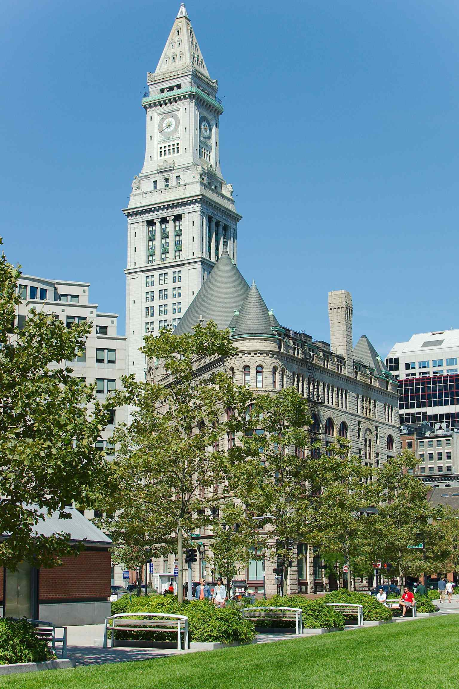
The Custom House Tower rising above the Rose Kennedy Greenway — a 1913–15 addition to the original 1840s Custom House.Photo: Fletcher6, Wikimedia Commons, CC BY 3.0. Cropped & resized. 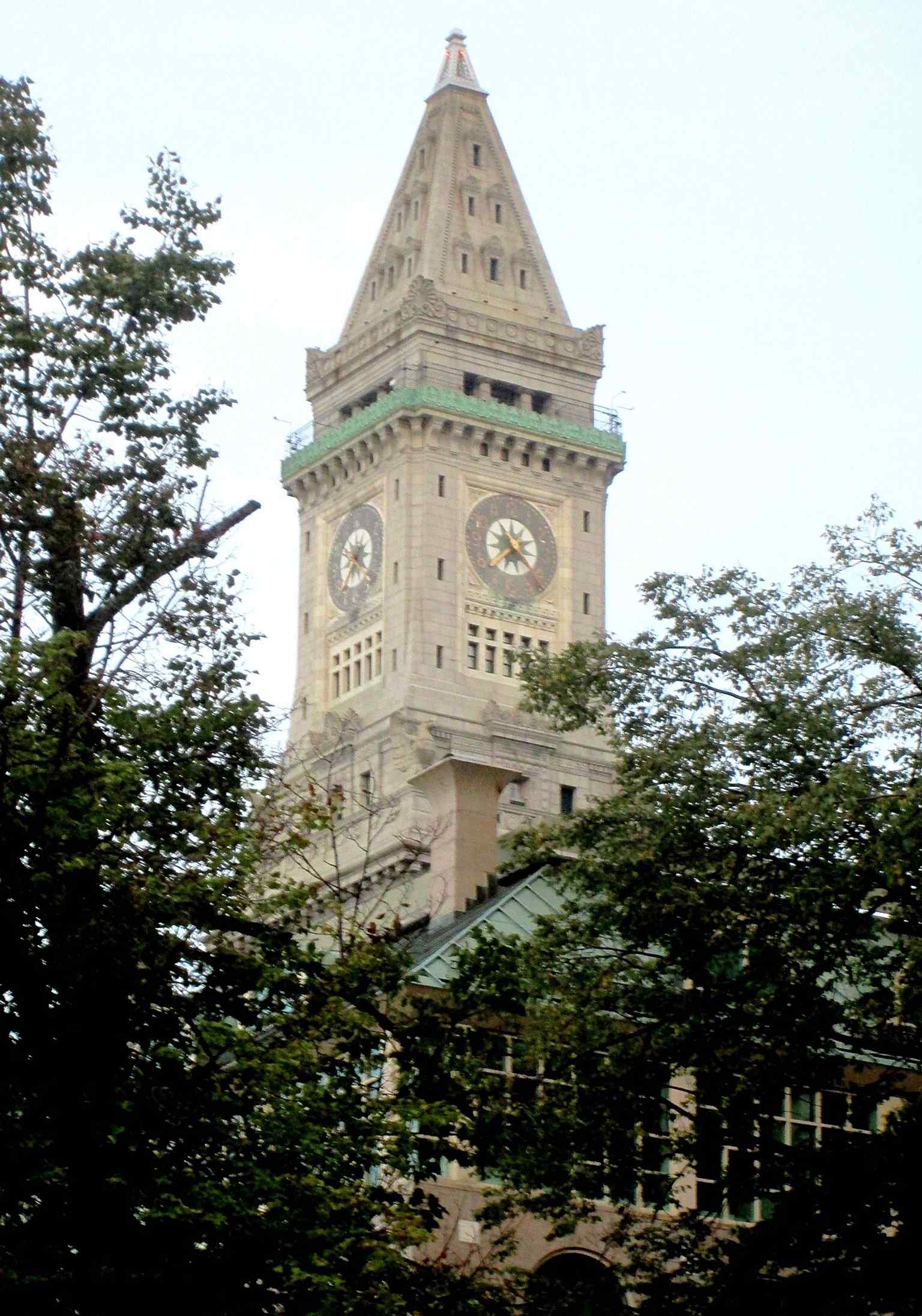
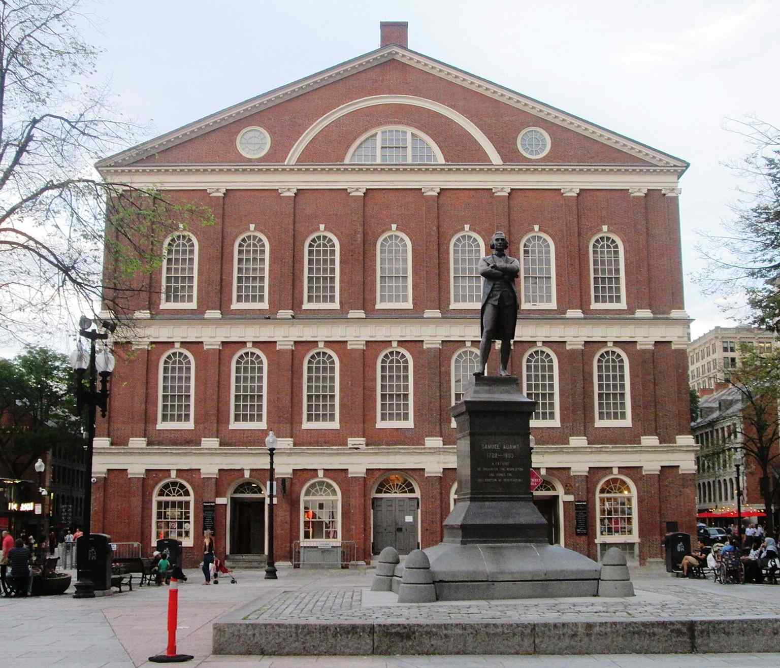
A clear street-level view of the tower in Boston’s Financial District, the 496-foot skyscraper that was once the city’s tallest.Photo: Beyond My Ken, Wikimedia Commons, CC BY-SA 4.0. Cropped & resized. On your left, Faneuil Hall is a long red-brick market hall with tall arched ground-floor openings, a slate gable roof, and a little cupola topped by a gilded grasshopper. This…Read moreShow less
Open dedicated page →On your left, Faneuil Hall is a long red-brick market hall with tall arched ground-floor openings, a slate gable roof, and a little cupola topped by a gilded grasshopper.
This place looks steady now, but it started as an argument. In seventeen forty, merchant Peter Faneuil offered Boston a public market and meeting hall, and the town accepted by just seven votes. That close. There was always a catch in the grain, though: Faneuil’s wealth included profits from the slave trade, and that history still shadows the building’s name.
The first version opened in seventeen forty-two as both a market below and a public hall above. People bought produce and meat downstairs, then climbed up to argue about taxes, rights, and power. That mix is kind of the genius of Faneuil Hall... food for the body underneath, food for public outrage upstairs. In seventeen sixty-one, fire gutted the place, leaving mostly brick walls behind. Boston rebuilt it, and in seventeen sixty-three James Otis Junior rededicated it to the “Cause of Liberty.” Not long after, patriots like Samuel Adams turned the hall into a pressure chamber for revolution. Protests over British taxes thundered here, and the meetings that fed into the Boston Tea Party gathered in this orbit.
That’s why people started calling it the “Cradle of Liberty,” which is a pretty tender nickname for a building that spent so much of its life hosting fierce arguments. And it kept going. Abolitionists spoke here in the nineteenth century. Frederick Douglass spoke here. William Lloyd Garrison spoke here. The building held debates about slavery, suffrage, labor, war, and who got to belong in the American story.
A lot of what you see comes from architect Charles Bulfinch, who reshaped the hall in eighteen oh six. He doubled its width, added another floor and an attic, and gave it the larger, more composed form standing in front of you now. Up top, that gold grasshopper matters too. It’s one of America’s best-known weathervanes, made in seventeen forty-two by Shem Drowne, and Boston legends say locals once used it as a kind of trick question to spot impostors who pretended to know the city. Miss the grasshopper, and maybe you weren’t from around here after all.
If you want a quick time-jump, the image in the app shows how the hall barely budges while the whole city around it reinvents itself.
And if you glance at your screen, the Great Hall image gives you the real payoff upstairs: a big neoclassical meeting room with a gallery, a rostrum for speakers, portraits all around, and the feeling that any sentence said there ought to matter.
Faneuil Hall has kept adapting ever since, through fireproofing, restoration, and modern accessibility work, but it never quite stopped being what it was at the start: a place where commerce, conflict, and civic theater all share the same roof.
If you want to step inside later, it’s free, usually open from ten in the morning to nine at night, with shorter hours on Sunday.
For all its fame, this building still feels like Boston thinking out loud.
Take a moment with it, and when you’re ready, we can head on to the next stop.
A classic full view of Faneuil Hall, the 1742 meeting hall nicknamed the “Cradle of Liberty” for the revolutionary speeches held inside.Photo: Beyond My Ken, Wikimedia Commons, CC BY-SA 4.0. Cropped & resized. 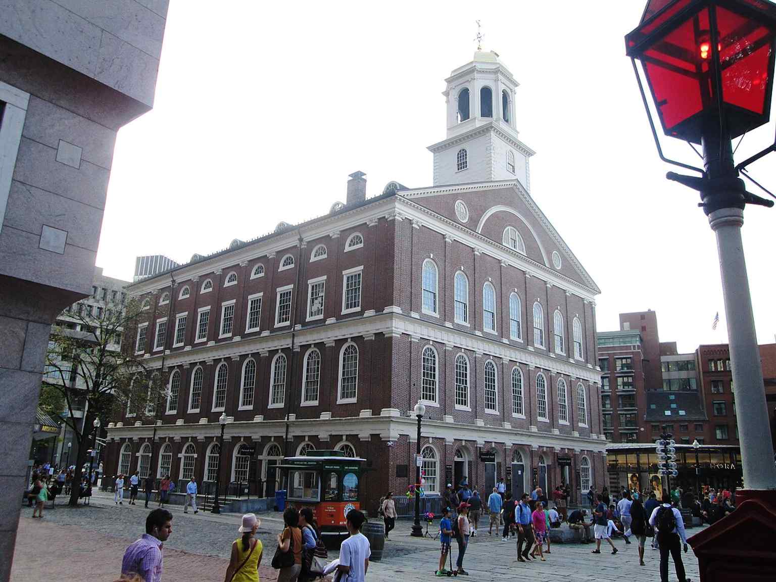
Faneuil Hall from the southeast, showing the red-brick Bulfinch-era facade that later housed both a market and a public forum.Photo: Beyond My Ken, Wikimedia Commons, CC BY-SA 4.0. Cropped & resized. 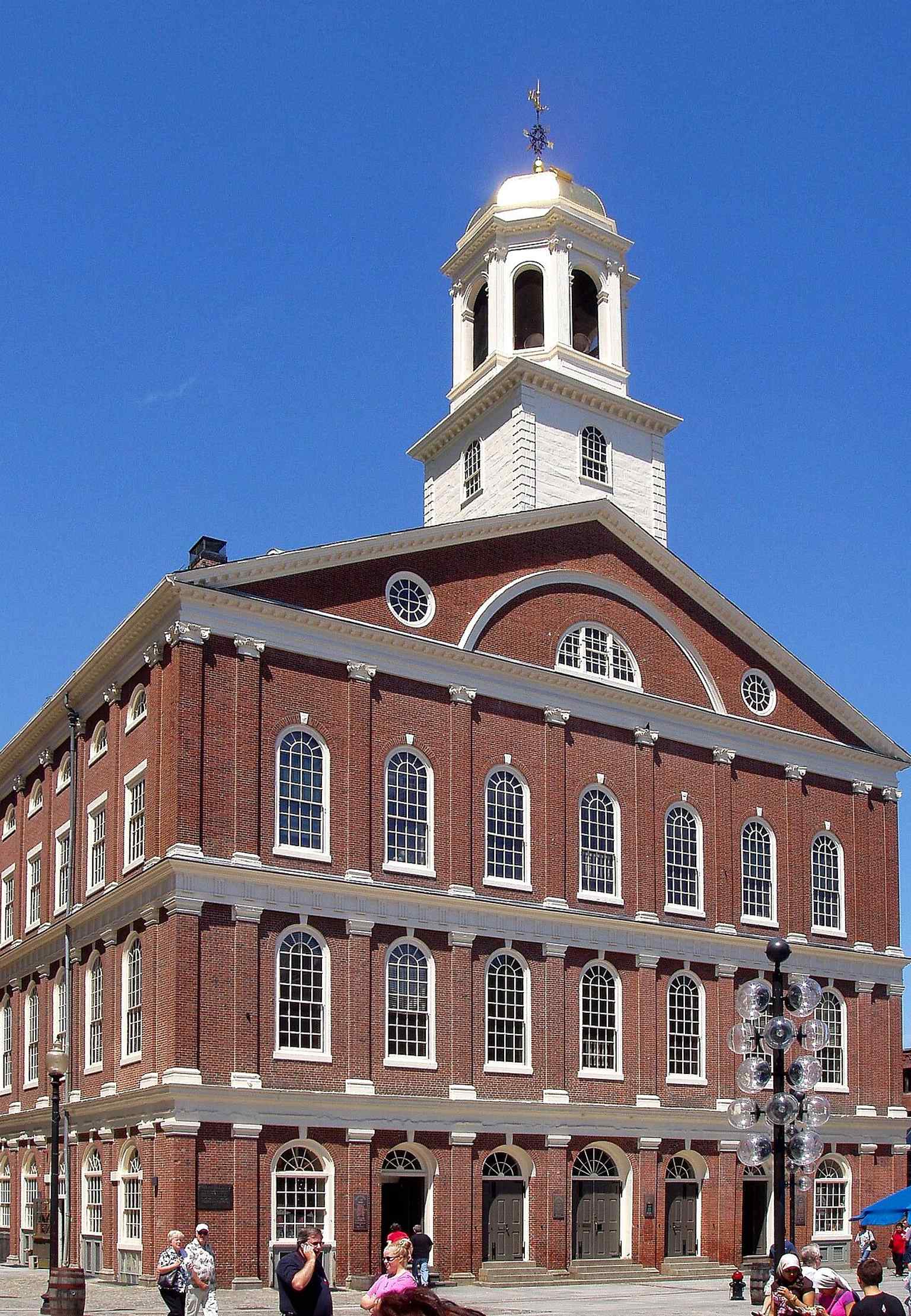
An early-2000s view of the historic building, useful for showing the Hall’s main massing and roofline in the modern marketplace setting.Photo: en:User:Daderot, Wikimedia Commons, CC BY-SA 3.0. Cropped & resized. 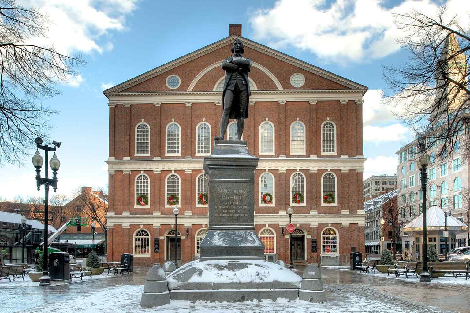
A clean exterior portrait of the National Historic Landmark, helping show the hall as a preserved landmark within downtown Boston.Photo: Bestbudbrian, Wikimedia Commons, CC BY-SA 4.0. Cropped & resized. 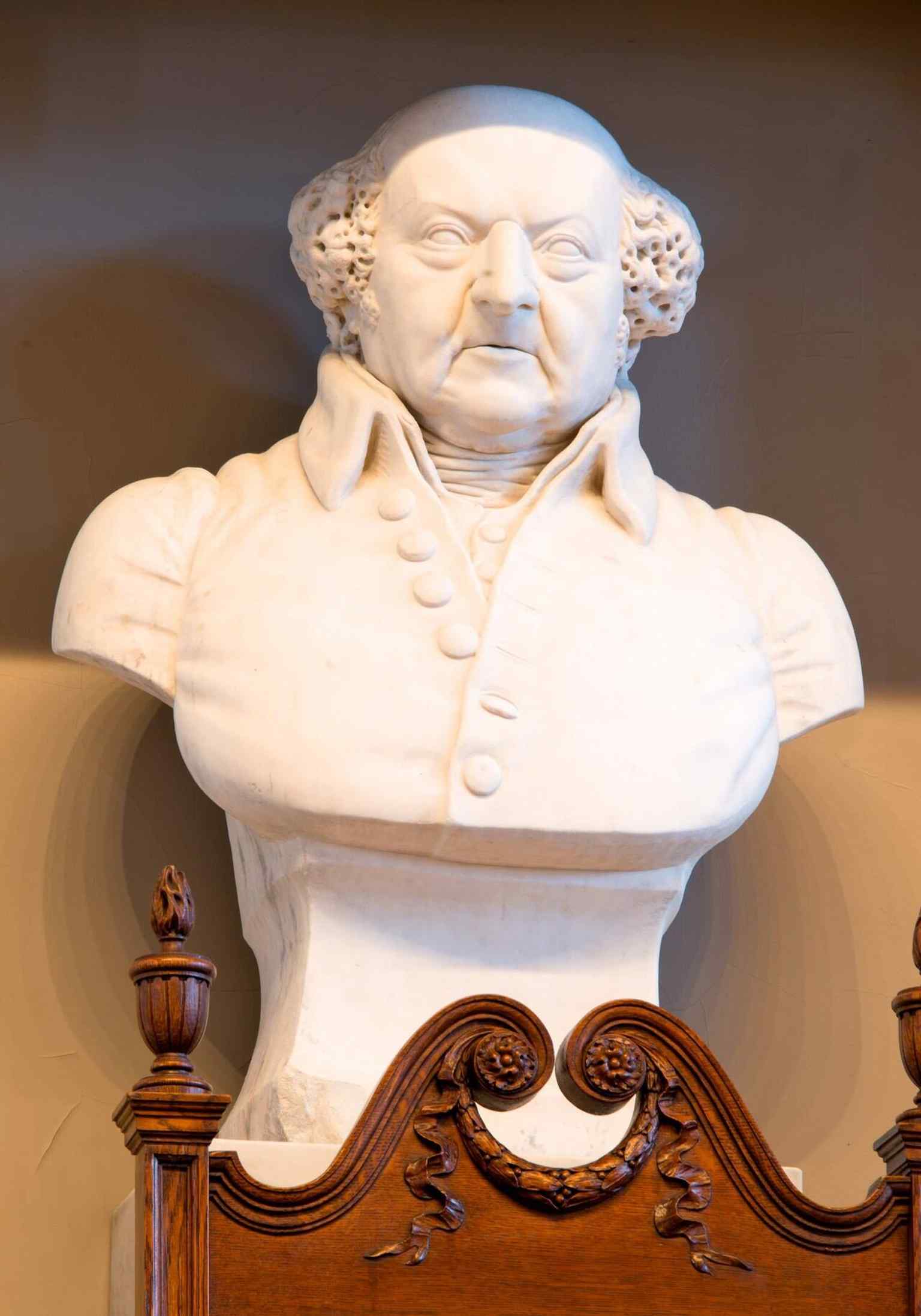
The Samuel Adams bust outside Faneuil Hall, echoing the site’s role as a center of patriotic debate before the Revolution.Photo: Bestbudbrian, Wikimedia Commons, CC BY-SA 4.0. Cropped & resized. 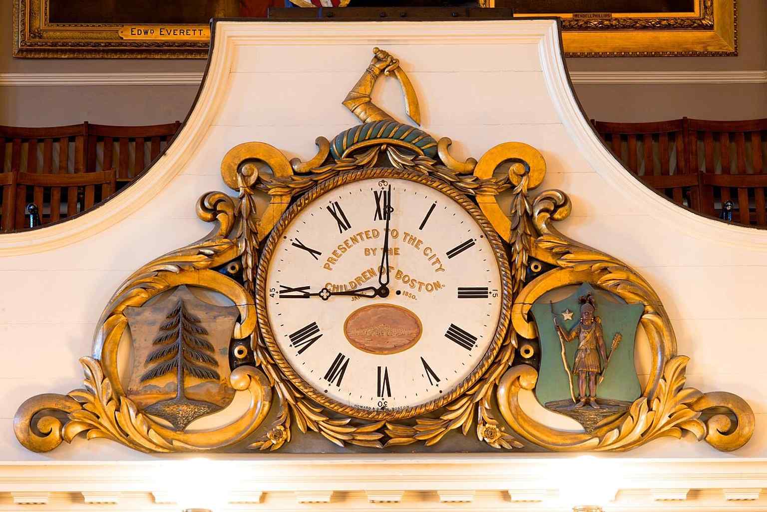
The 1850 clock detail from the Great Hall, part of the building’s long interior history and later 19th-century renovations.Photo: Bestbudbrian, Wikimedia Commons, CC BY-SA 4.0. Cropped & resized. 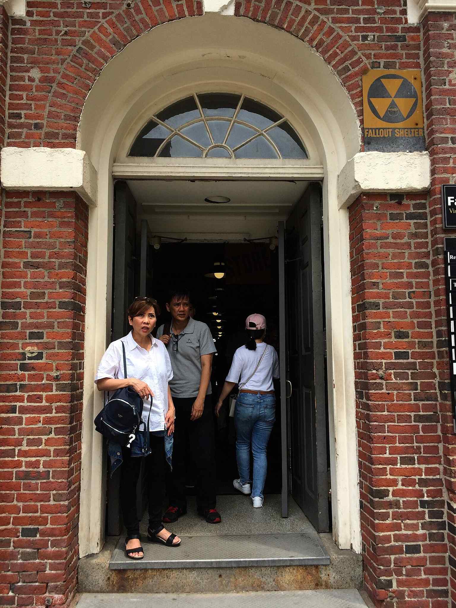
A modern entrance detail with a fallout-shelter sign — a small reminder that Faneuil Hall kept adapting through the 20th century.Photo: Andre Carrotflower, Wikimedia Commons, CC BY-SA 4.0. Cropped & resized. 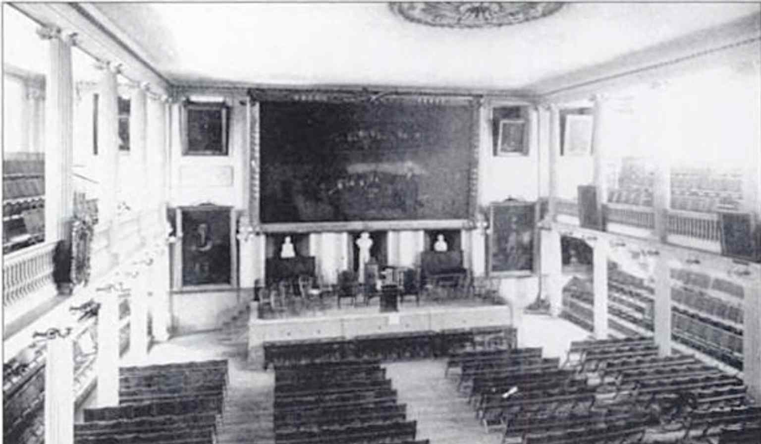
A 19th-century interior view that captures the older market-and-meeting-hall character before later fireproofing and restoration work.Photo: Author unknown, Wikimedia Commons, Public domain. Cropped & resized. 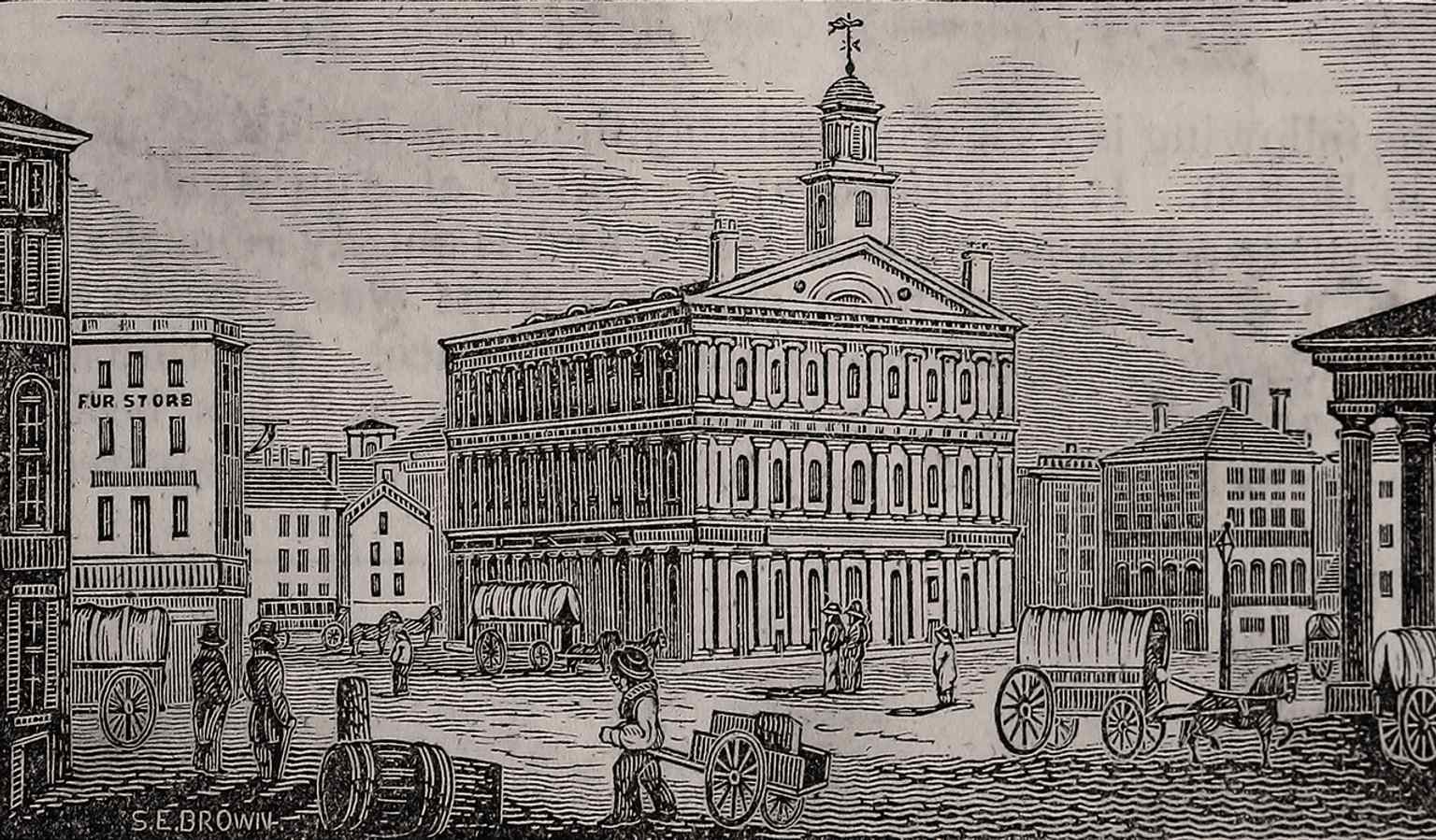
An 1839 street view of Faneuil Hall, showing how prominent the hall already was in Boston’s civic life.Photo: John Warner Barber, Wikimedia Commons, Public domain. Cropped & resized.

Show 12 more stopsShow fewer stopsexpand_moreexpand_less
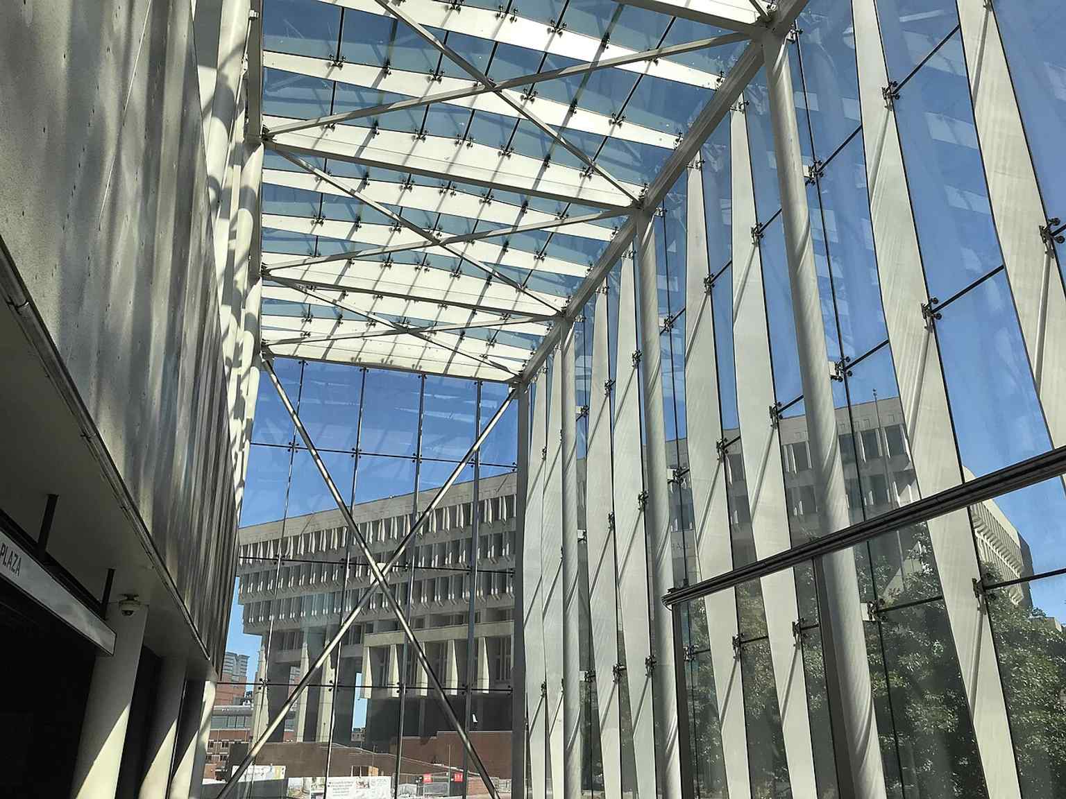
On your left, Government Center station appears as a steel-and-glass headhouse, all sharp angles and transparent walls, with escalators dropping through the middle like a bright…Read moreShow less
Open dedicated page →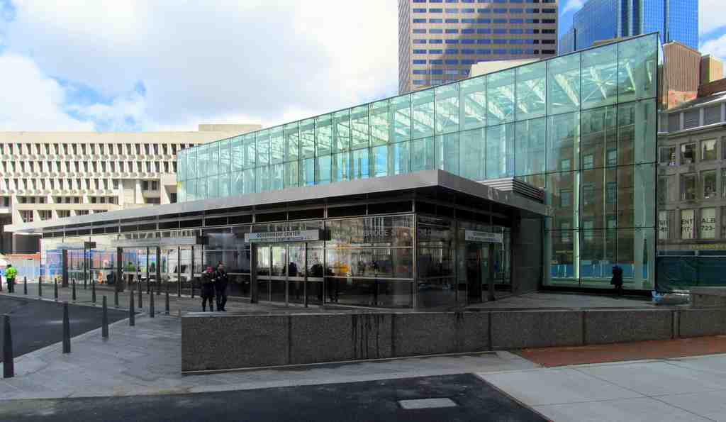
Government Center stationPhoto: Pi.1415926535, Wikimedia Commons, CC BY-SA 3.0. Cropped & resized. On your left, Government Center station appears as a steel-and-glass headhouse, all sharp angles and transparent walls, with escalators dropping through the middle like a bright cut in the plaza.
This station is Boston transit wearing its whole weird biography out in public. Today, people switch here between the Green Line and the Blue Line, but the story starts in eighteen ninety-eight, when the Green Line level opened as Scollay Square station in the Tremont Street Subway. That makes it the third-oldest subway station still operating in the Massachusetts Bay Transportation Authority, the M-B-T-A system, and one of its oldest major hubs.
Back then, Scollay Square worked like a knot in a shoelace: horsecars, then streetcars, then elevated trains all tugged through the same spot. The original station had a wonderfully odd setup, with a three-sided platform and something called the Brattle Loop, a curved turnaround track that let streetcars swing in, unload, and head back out without reversing. If you want a peek at that surviving curl of track, there’s a detail image in the app.
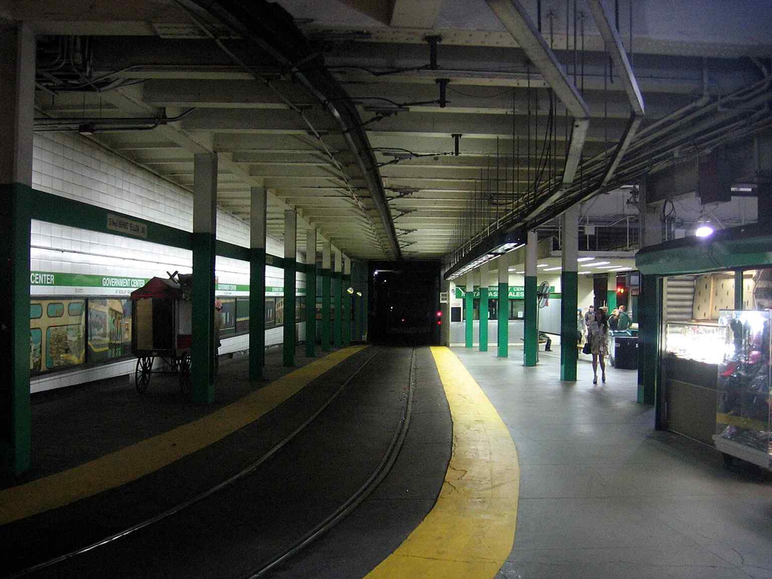
The Brattle Loop track, a reminder of the station’s streetcar heritage and the old turning loop used by Green Line service.Photo: Pi.1415926535, Wikimedia Commons, CC BY-SA 3.0. Cropped & resized. The station kept changing because Boston kept rearranging the city above it. In December of nineteen oh four, the East Boston Tunnel opened next door at Court Street and connected into this station. That first terminal turned out to be cramped and awkward. In nineteen oh six, a conductor was crushed between two streetcars there while readying his trolley pole for the return trip, and the station’s design flaws became impossible to ignore. So in March of nineteen sixteen, officials opened “Scollay Under,” a lower level linked to the older station. A few years later, in nineteen twenty-four, crews converted that tunnel from streetcars to rapid transit trains with high platforms and third-rail power... basically, the station switched species.
Then came the big rewrite. In the early nineteen sixties, Boston demolished old Scollay Square to create City Hall Plaza. The station got rebuilt, renamed Government Center, and fitted with a low brick entrance that even M-B-T-A managers admitted looked like a bunker, or maybe a cave. Critics had been roasting this station’s entrances for decades anyway; one earlier headhouse, meaning the little entrance building above the stairs, got compared to an enlarged soda fountain.
If you want a quick visual jolt, the old entrance photo in the app makes the contrast obvious.
The version in front of you arrived after a full shutdown from March of two thousand fourteen to March twenty-first of two thousand sixteen. The rebuild added elevators, escalators, wider fare areas, better lighting, new electrical systems, and real accessibility at last. During demolition, workers uncovered old mosaic signs reading “Scollay Under” and “Scollay,” plus an original faregate, a ticket booth, and ceiling arches. Even the station’s old layers refused to stay buried. The nineteen seventies murals along the Brattle Loop couldn’t return because painted plywood no longer met fire code, so the renovation carried the past forward in other ways.
So this glass entrance is more than a subway portal. It’s Boston finally giving one of its oldest stations a face that feels open instead of defensive.
Take a moment with that transformation. When you’re ready, we can head along to the next stop.
The new glass headhouse rising from City Hall Plaza — the 2016 rebuild replaced the old bunker-like entrance with this lighter, fully accessible entrance.Photo: The Boston Railfan, Wikimedia Commons, CC BY-SA 4.0. Cropped & resized. 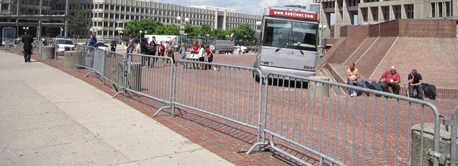
City Hall Plaza and the Government Center entrance together show how the station sits in the heart of Boston’s civic center, built over the former Scollay Square area.Photo: M2545, Wikimedia Commons, Public domain. Cropped & resized. 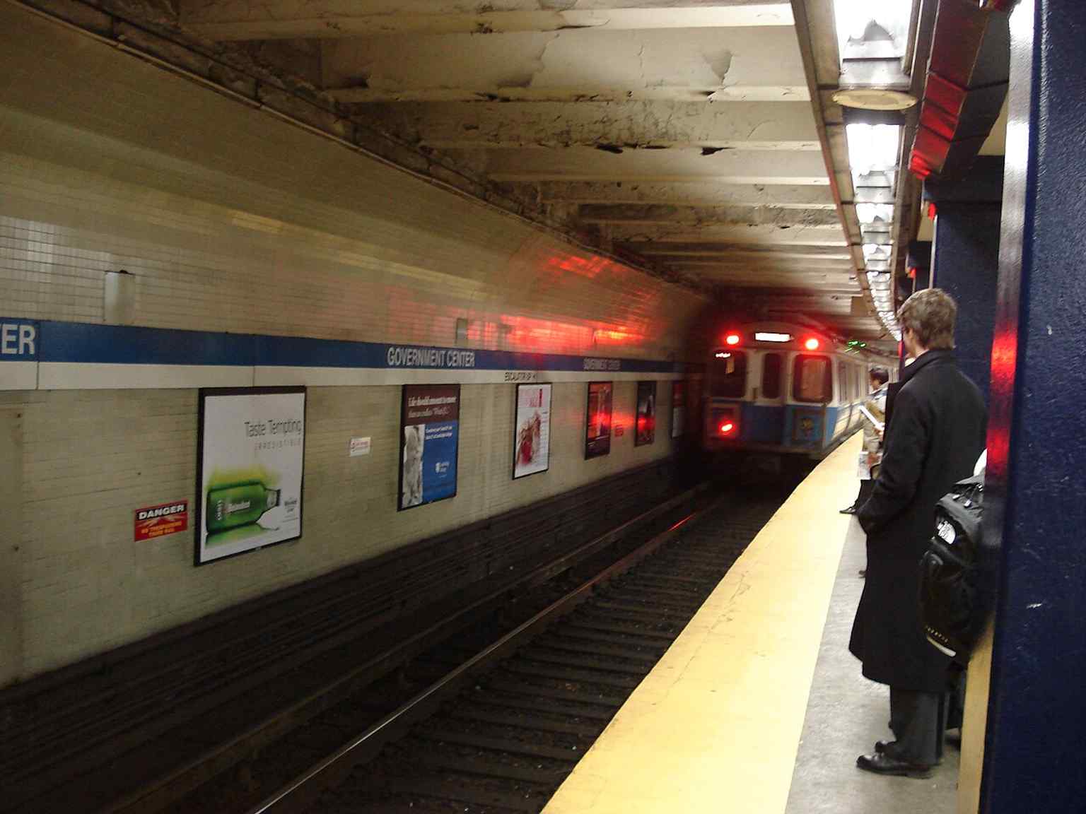
A Blue Line train at the station before the renovation — this is one of the MBTA’s key transfer points between the Blue and Green Lines.Photo: Palffy at English Wikipedia, Wikimedia Commons, Public domain. Cropped & resized. 
Looking across the Brattle Loop from the platform — the loop survived long after streetcar use ended and was later revived for temporary service and storage.Photo: Pi.1415926535, Wikimedia Commons, CC BY-SA 3.0. Cropped & resized. 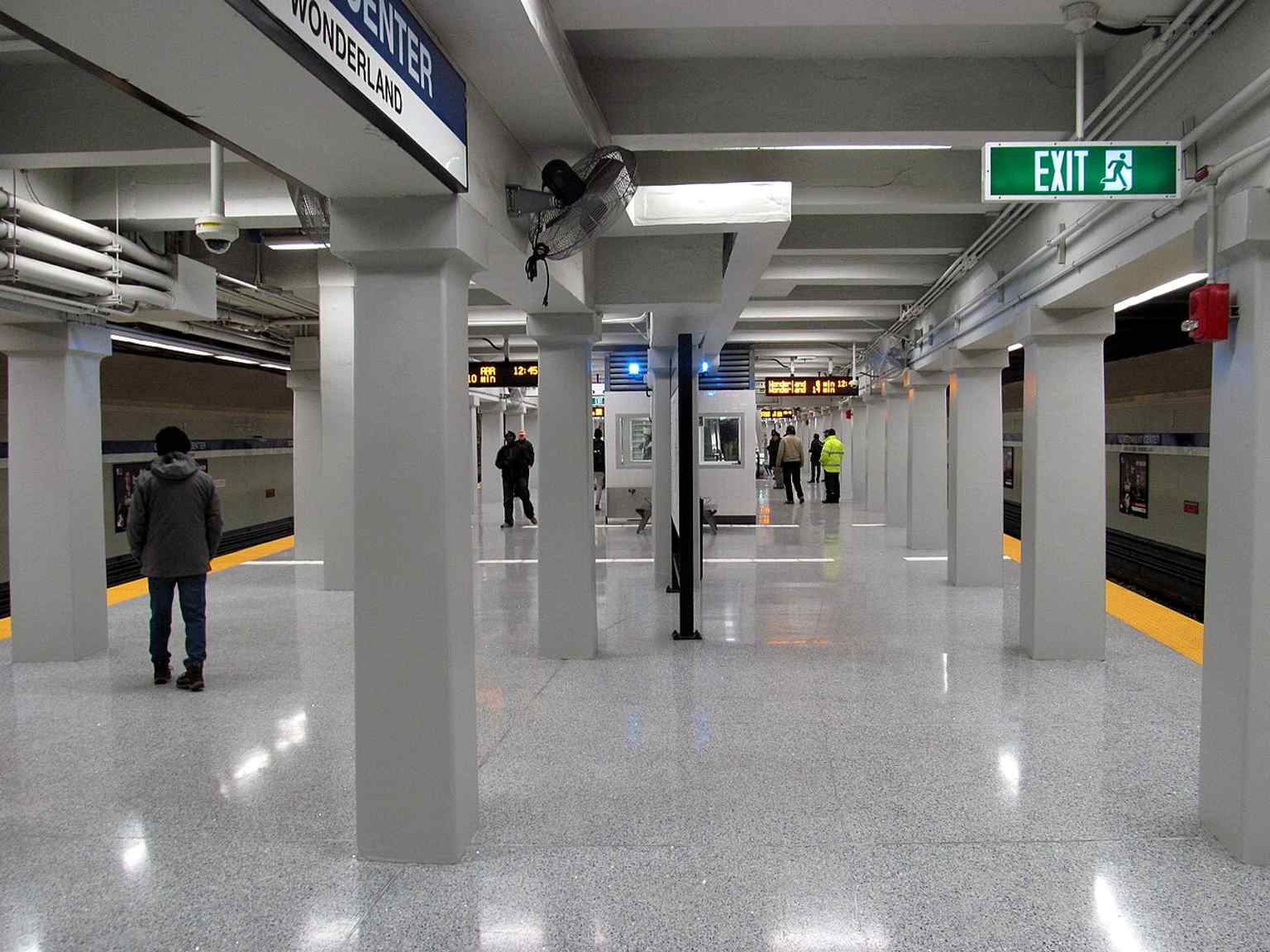
The Blue Line platform on reopening day in March 2016, when Government Center returned as a fully accessible station after two years of construction.Photo: Pi.1415926535, Wikimedia Commons, CC BY-SA 3.0. Cropped & resized. 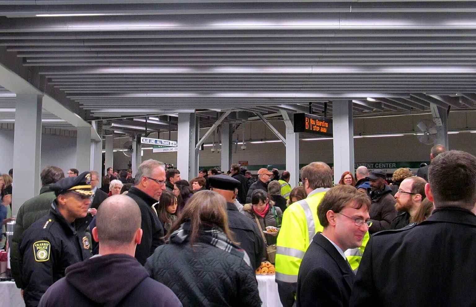
Crowds moving onto the Green Line level on reopening day, showing how important Government Center is as a downtown transfer station.Photo: Pi.1415926535, Wikimedia Commons, CC BY-SA 3.0. Cropped & resized. 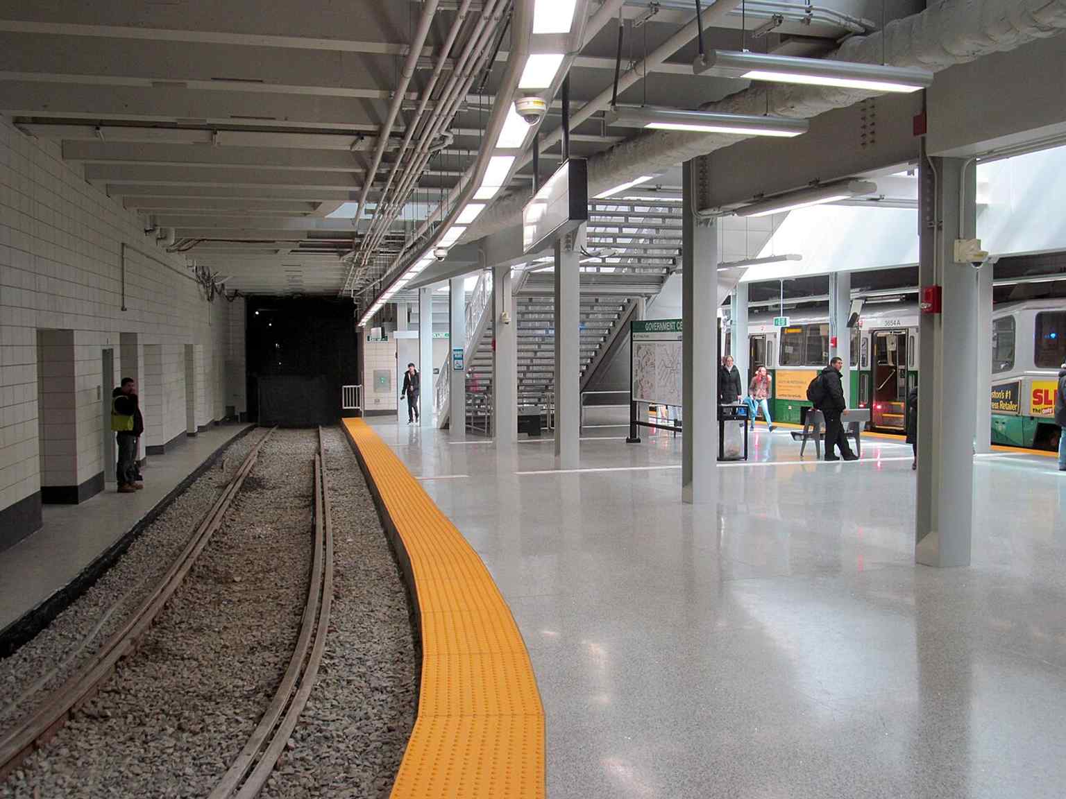
A train and the Brattle Loop on reopening day — the loop has been kept for occasional turnbacks and storage, not just everyday service.Photo: Pi.1415926535, Wikimedia Commons, CC BY-SA 3.0. Cropped & resized. 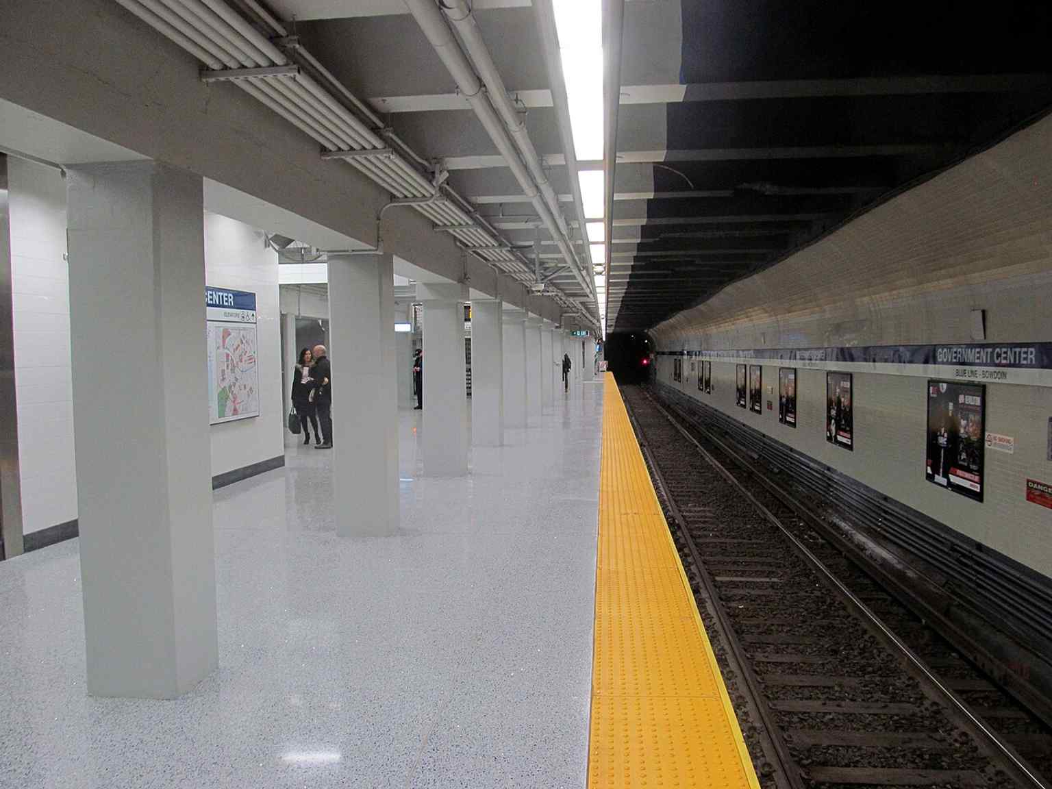
The eastbound Blue Line track on reopening day, part of the rebuilt station that reopened in March 2016 with new lighting and finishes.Photo: Pi.1415926535, Wikimedia Commons, CC BY-SA 3.0. Cropped & resized. On your right, look for a red-brick building with a steep gabled roof and a slender central tower, topped by royal lion-and-unicorn figures that make this old public landmark easy…Read moreShow less
Open dedicated page →On your right, look for a red-brick building with a steep gabled roof and a slender central tower, topped by royal lion-and-unicorn figures that make this old public landmark easy to spot.
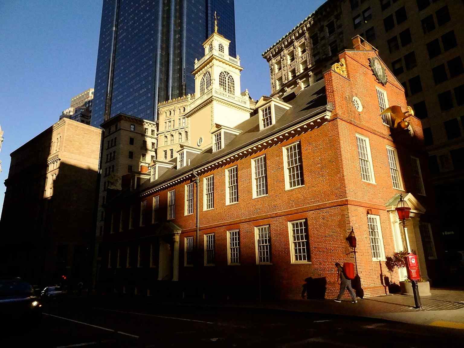
Here it is... the Old State House, finished in seventeen thirteen, and still holding its ground as Boston’s oldest surviving public building. It’s kind of amazing, honestly. Surrounded by tall glass and steel neighbors, this place still carries itself like it knows it used to run the whole town... because it did.
For much of the seventeen hundreds, this was the nerve center of Massachusetts. The judicial branch worked here, the legislative branch met here, and the executive branch worked here too. All three branches of government under one roof, stacked inside a building only about sixty-five feet tall. Back then, that made it the tallest building in Boston until seventeen forty-five. Not bad for a structure that started life after the first Town House on this site burned in seventeen eleven.
The building you’re looking at is a survivor, but not a delicate one. Fire gutted it again in seventeen forty-seven. The brick outer walls held on, the inside was rebuilt, and the structure came back with some of the features that still define it now: the gable roof, the square central tower, and that eastern balcony where officials announced laws to the public below. It’s a stage set for government, really - one part architecture, one part public theater.
And then the mood changed. In the seventeen sixties, tensions with Britain got sharp. Samuel Adams pushed for a public gallery inside the Representatives’ Chamber, so more people could watch lawmakers at work - one of the earliest public legislative galleries in what became the United States. Then, in seventeen sixty-eight, British troops arrived in Boston and pointed their weapons at this building’s front door. That wasn’t symbolic. It was a direct show of force, and the legislature refused to meet here while soldiers occupied the space.
If you want a peek inside, take a glance at the app’s image of the Council Chamber - one of the big second-floor rooms where colonial power got negotiated face-to-face.
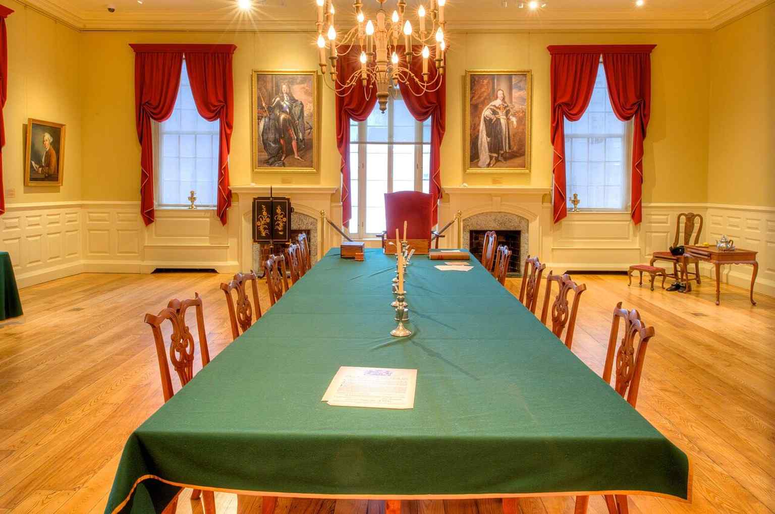
Inside the Council Chamber of the Royal Governor, one of the three major second-floor rooms where colonial government once operated.Photo: Bestbudbrian, Wikimedia Commons, CC BY-SA 4.0. Cropped & resized. Just east of the building sits the memorial marker for the Boston Massacre, another reminder that this crossroads wasn’t some quiet administrative address. It was a pressure point. Decisions came out of these windows, arguments spilled into the street, and history turned on very human tempers.
Later, the state legislature moved to the New State House in seventeen ninety-eight. This old place became Boston’s city hall, then commercial space, and for a while it came dangerously close to demolition. In the eighteen eighties, George Clough renovated it, the Bostonian Society stepped in, and the building shifted from workplace to memory-keeper.
If you feel like seeing that change in one glance, the image in the app really shows how this colonial survivor now sits in a canyon of modern towers.
If you want to go inside another time, the museum is generally open daily from ten in the morning to five in the afternoon.
This building feels less like a relic and more like Boston still speaking in its original voice.
Take a moment with it... and when you’re ready, we can wander on to the next stop.
A classic full view of Boston’s oldest surviving public building, showing the Old State House as it stands amid the modern downtown skyline.Photo: Rizka, Wikimedia Commons, CC BY-SA 3.0. Cropped & resized. 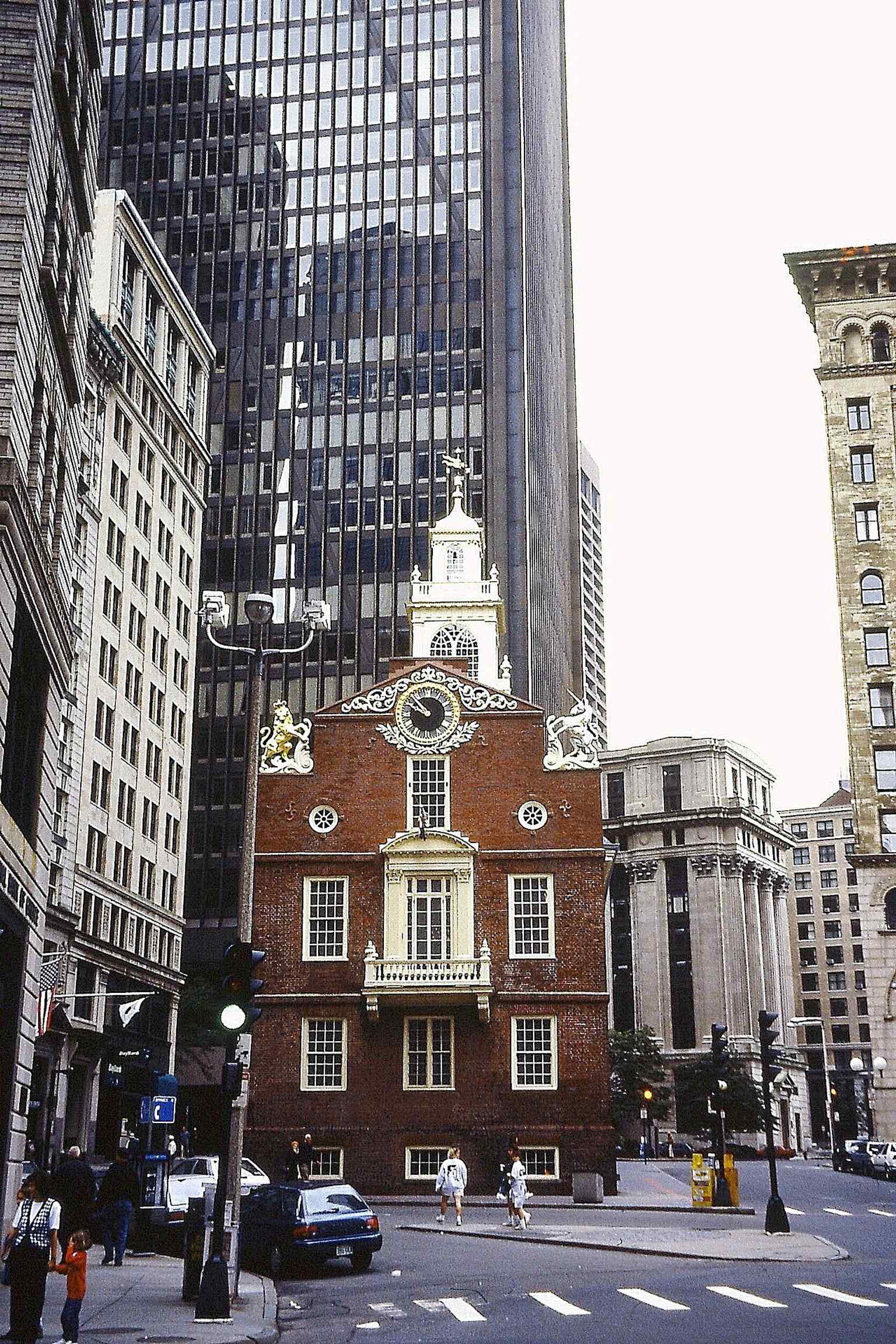
An east-facing view from 1994, useful for showing the building’s historic street presence before later downtown changes.Photo: Karlunun, Wikimedia Commons, CC BY-SA 4.0. Cropped & resized. 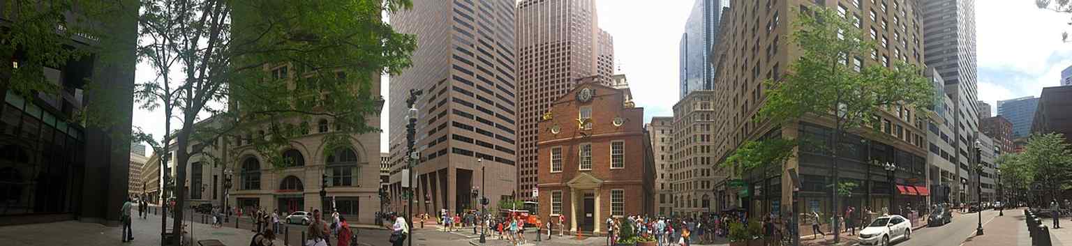
A wide panorama that places the Old State House in the dense financial district, echoing its long life at the heart of Boston’s public square.Photo: Andre Carrotflower, Wikimedia Commons, CC BY-SA 4.0. Cropped & resized. 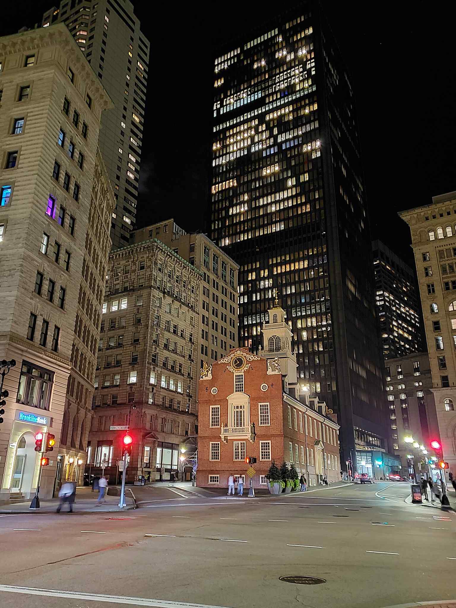
Night view of the Old State House, with the inscription tying the site to the July 18, 1776 proclamation of independence in Boston.Photo: Vernon Burton, Wikimedia Commons, CC BY-SA 4.0. Cropped & resized. 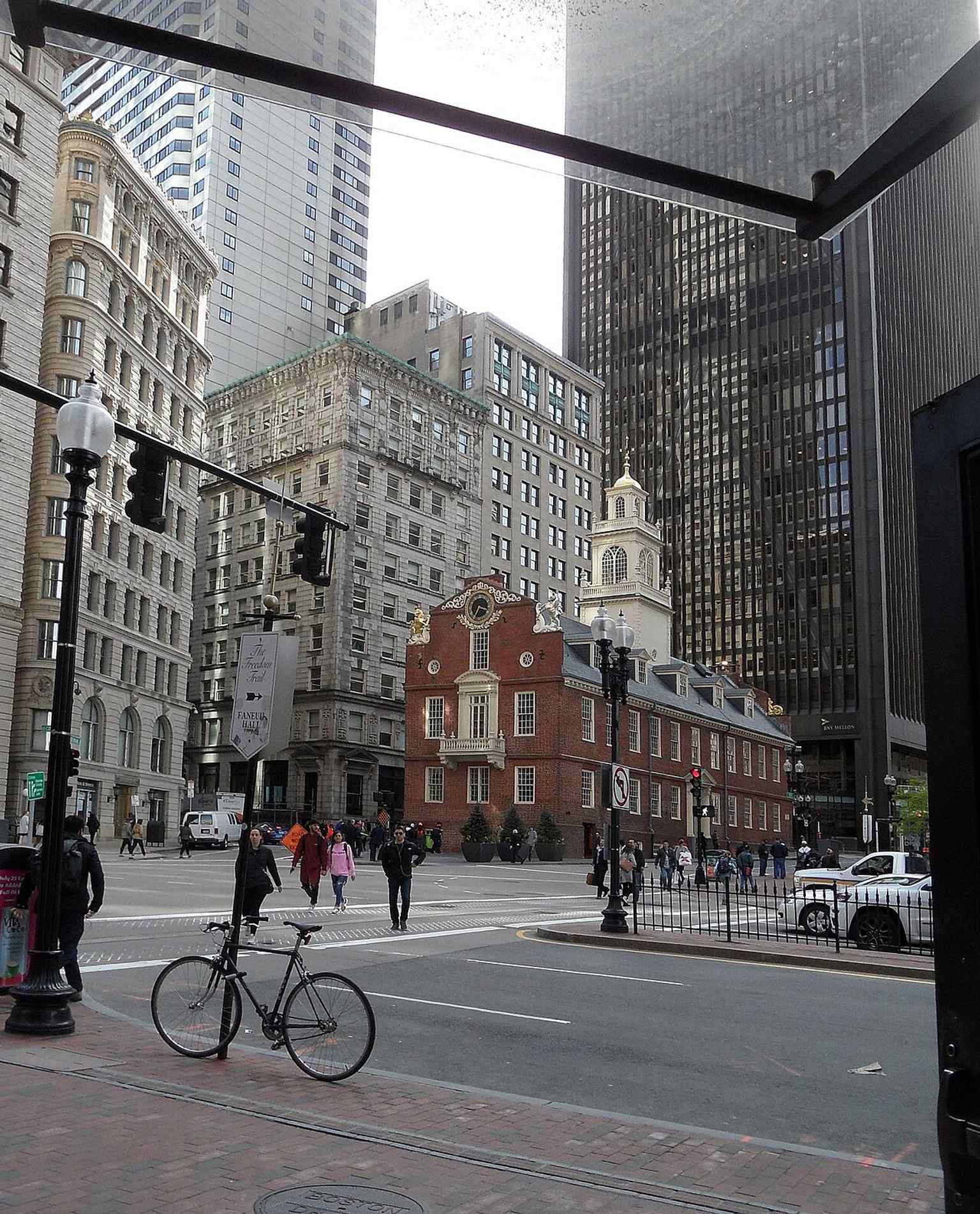
Northeast corner view from State and Congress streets, a strong angle for understanding the building’s role at a busy historic crossroads.Photo: Karlunun, Wikimedia Commons, CC BY-SA 4.0. Cropped & resized. 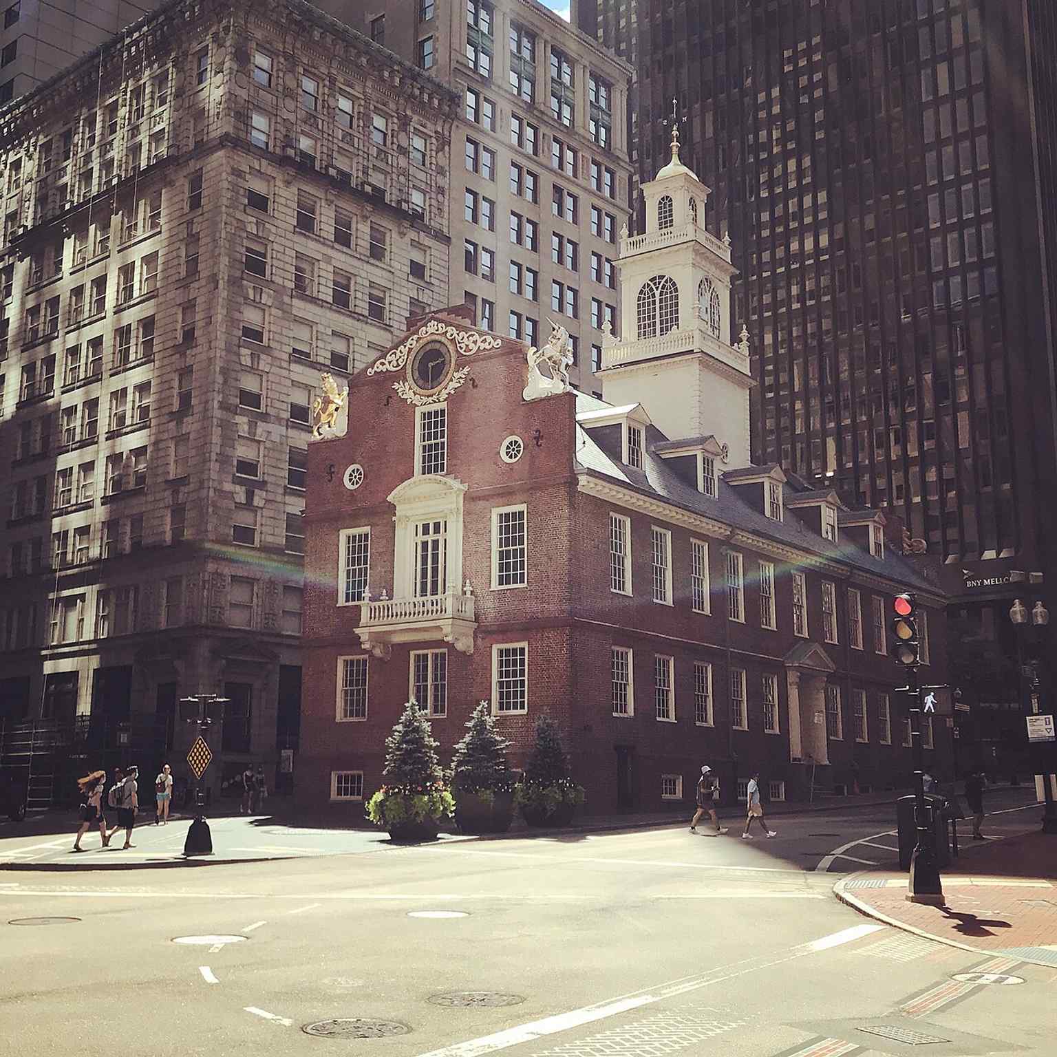
The Boston Massacre memorial marker stands just east of the Old State House, linking the building directly to one of the city’s defining Revolutionary events.Photo: Brian-R-Phillips, Wikimedia Commons, CC BY-SA 4.0. Cropped & resized. 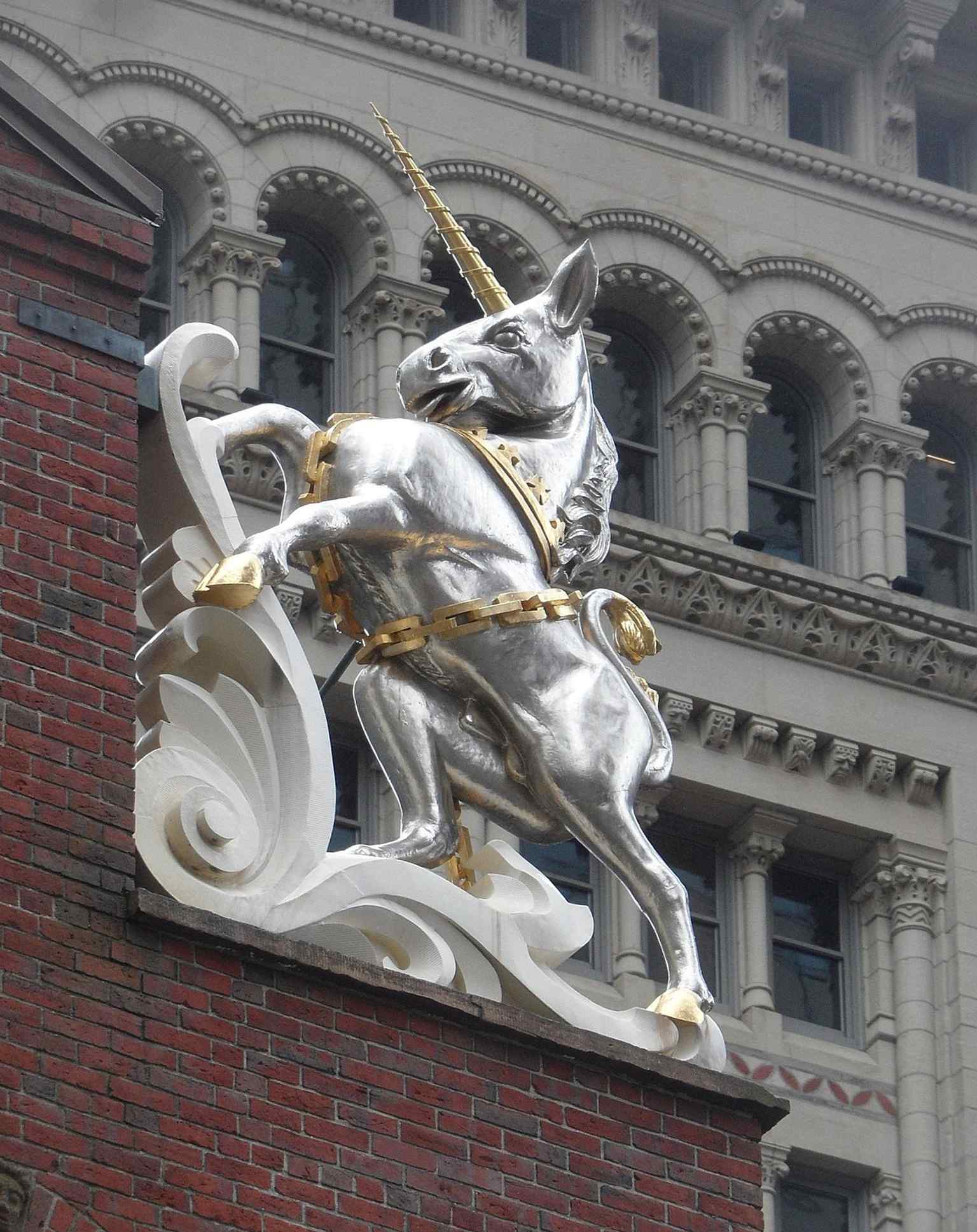
The heraldic unicorn on the facade recalls the British royal symbols added to the rebuilt building in the 1740s.Photo: Matthias Nonnenmacher, Wikimedia Commons, CC BY-SA 4.0. Cropped & resized. 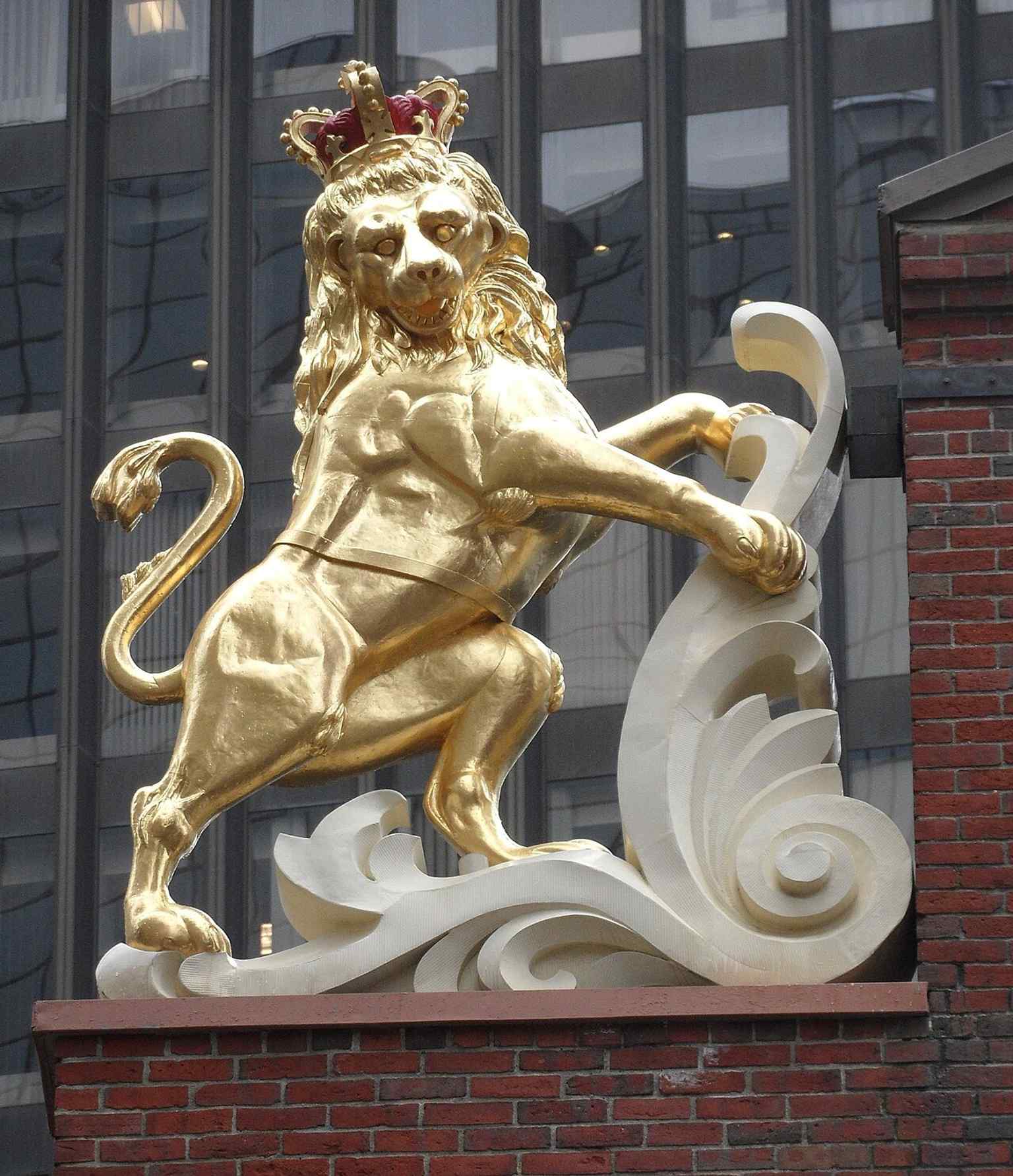
The lion motif on the Old State House facade pairs with the unicorn as a reminder of the building’s colonial-era decoration.Photo: Karlunun, Wikimedia Commons, CC BY-SA 4.0. Cropped & resized. 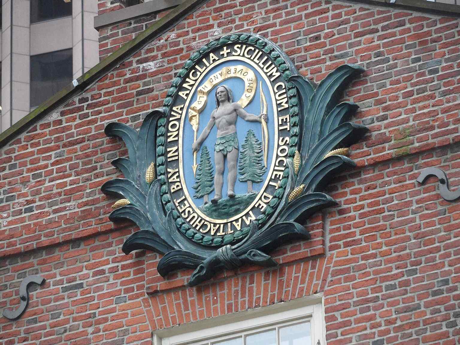
A close look at the Massachusetts state seal on the Old State House, reflecting the building’s later political identity.Photo: Karlunun, Wikimedia Commons, CC BY-SA 4.0. Cropped & resized. 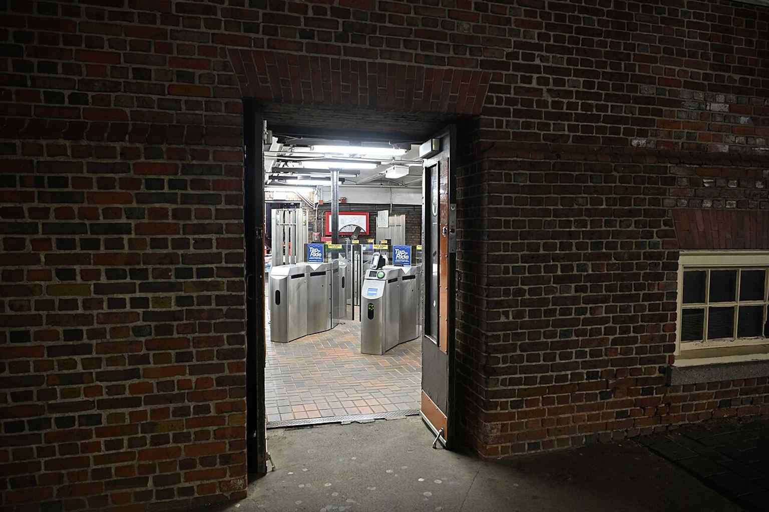
The basement entrance to State station shows how the Old State House’s lower level now connects historic Boston with the modern subway.Photo: 4300streetcar, Wikimedia Commons, CC BY 4.0. Cropped & resized. 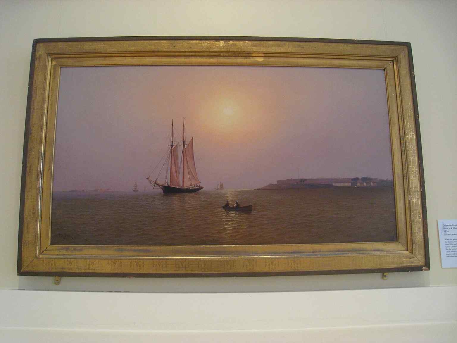
A museum artwork held by the Old State House Museum, offering a period image from the building’s collection rather than the building itself.Photo: Francis A. Silva, Wikimedia Commons, Public domain. Cropped & resized. On your right, look for a red-brick meeting house with tall arched windows and a white, layered steeple shooting above the roofline. This is Old South Meeting House, and for a…Read moreShow less
Open dedicated page →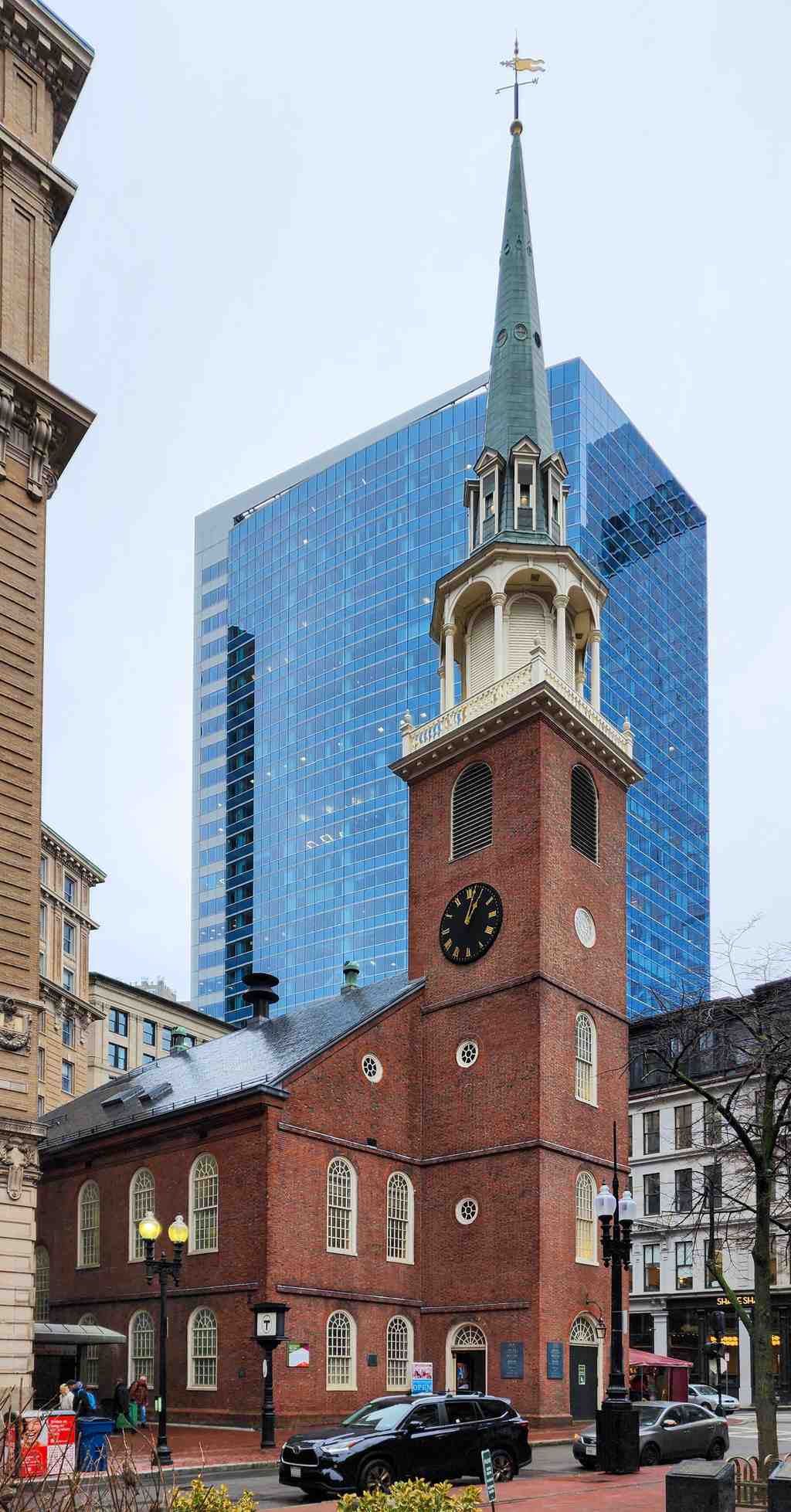
Old South Meeting HousePhoto: Crisco 1492, Wikimedia Commons, CC BY-SA 4.0. Cropped & resized. On your right, look for a red-brick meeting house with tall arched windows and a white, layered steeple shooting above the roofline.
This is Old South Meeting House, and for a place that looks so composed, it has lived a wild life. Old South’s congregation took shape in sixteen sixty-nine after breaking away from Boston’s First Church, the one John Winthrop had helped found, and in seventeen twenty-nine they opened this new home right here at Milk and Washington Streets. Its steeple climbs one hundred and eighty-three feet, and back then this was the biggest building in town... which meant if Boston needed to argue about something, people naturally drifted here.
And argue they did. After the Boston Massacre, crowds gathered here year after year to mark the anniversary, with speakers like John Hancock and Doctor Joseph Warren. Then came the sixteenth of December, seventeen seventy-three. Somewhere between five thousand and seven thousand people packed this place to debate British taxes on tea. Imagine that pressure inside one room. Bostonians even called it a “mouth-house,” meaning a place where people came to speak their minds out loud. When the meeting finally broke, a group headed for Griffin’s Wharf and turned protest into the Boston Tea Party.
If you want, take a quick look at the before-and-after image in the app... it shows how this old meeting house kept its footing while the city grew taller and tighter around it.
The Revolution hit this building hard in seventeen seventy-five. Lieutenant Colonel Samuel Birch and the Seventeenth Dragoons took it over because it had become so tied to the patriot cause. They gutted the inside, dumped in dirt, and used the sanctuary like an indoor riding ring for horses. They also stole valuables, including William Bradford’s Of Plymouth Plantation, a one-of-a-kind Pilgrim manuscript that had been hidden up in the tower. After the British left Boston, Thomas Dawes drew the plans to rebuild the interior.
And then, somehow, Old South survived again. In the Great Boston Fire of eighteen seventy-two, firefighters battled for twelve straight hours to save it. The congregation later moved to a quieter neighborhood and opened the “new” Old South Church in Back Bay, but a determined group of twenty women stepped in to preserve this place. Mary Hemenway alone gave one hundred thousand dollars, roughly three million dollars today, and helped rescue the building from demolition. If you peek at the interior image on your screen, you can see the open space where those famous debates once thundered.
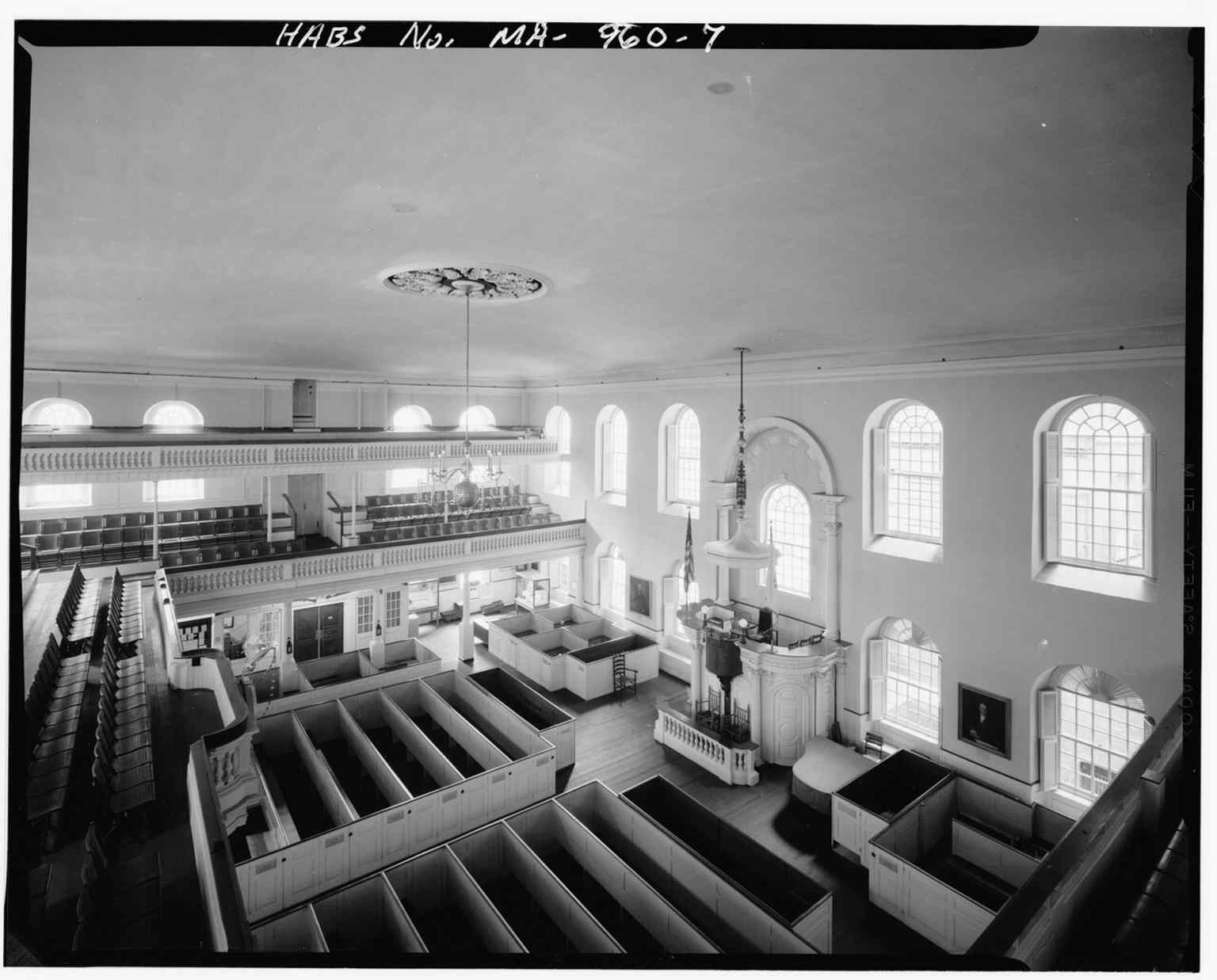
Inside the meeting house, where a capacity crowd gathered in 1773 before the Boston Tea Party.Photo: Hubbard, Cortlandt V., Wikimedia Commons, Public domain. Cropped & resized. Today it works as a museum, and since twenty twenty, Revolutionary Spaces has cared for it along with the Old State House. If you want to come back inside later, it’s generally open every day from ten in the morning to five in the afternoon.
This place reminds you that freedom often starts as a room full of voices.
Take your time here, and when you’re ready, we can head on to the next stop.
The Old South Meeting House steeple rises above Downtown Boston, recalling the 1729 church that became the rallying point for the Boston Tea Party.Photo: Beyond My Ken, Wikimedia Commons, CC BY-SA 4.0. Cropped & resized. 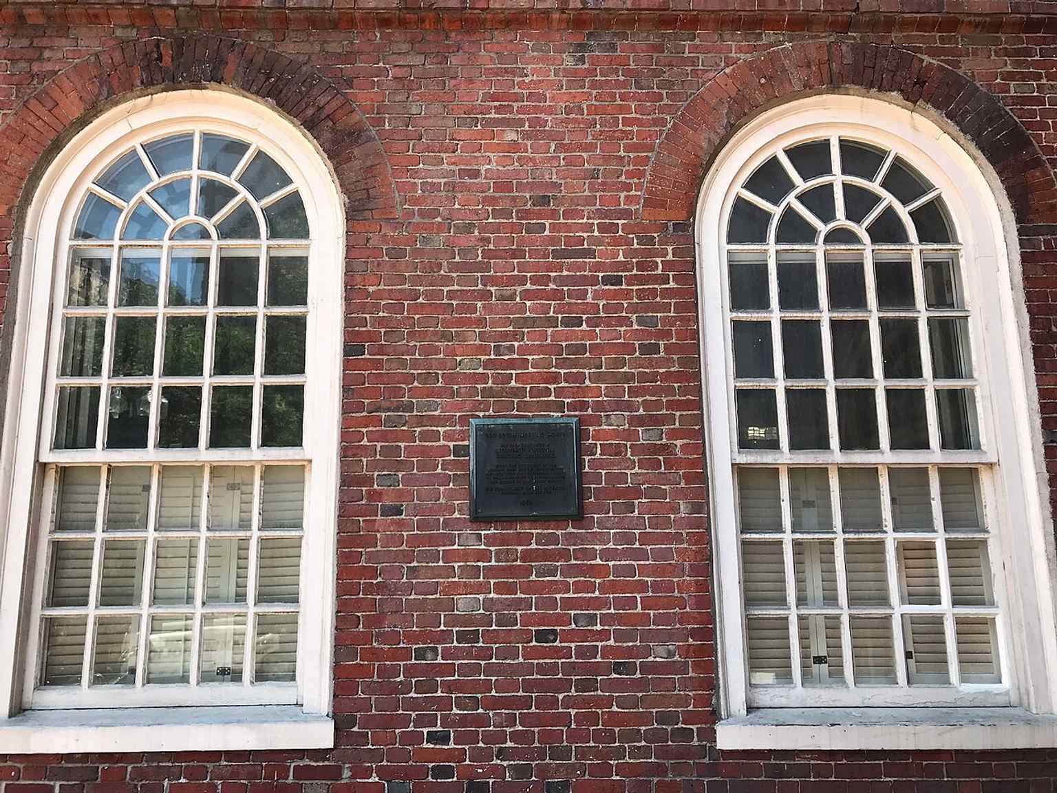
A clear modern view of the historic meeting house, still standing at Washington and Milk Streets in the heart of Boston.Photo: Brian-R-Phillips, Wikimedia Commons, CC BY-SA 4.0. Cropped & resized. 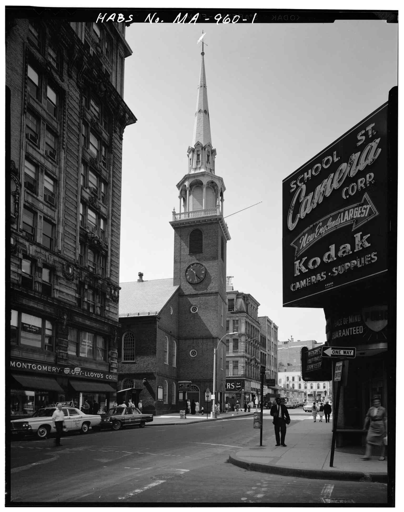
This 1933 streetscape shows the Meeting House on Washington Street, where thousands once gathered to debate British taxation.Photo: Hubbard, Cortlandt V., Wikimedia Commons, Public domain. Cropped & resized. 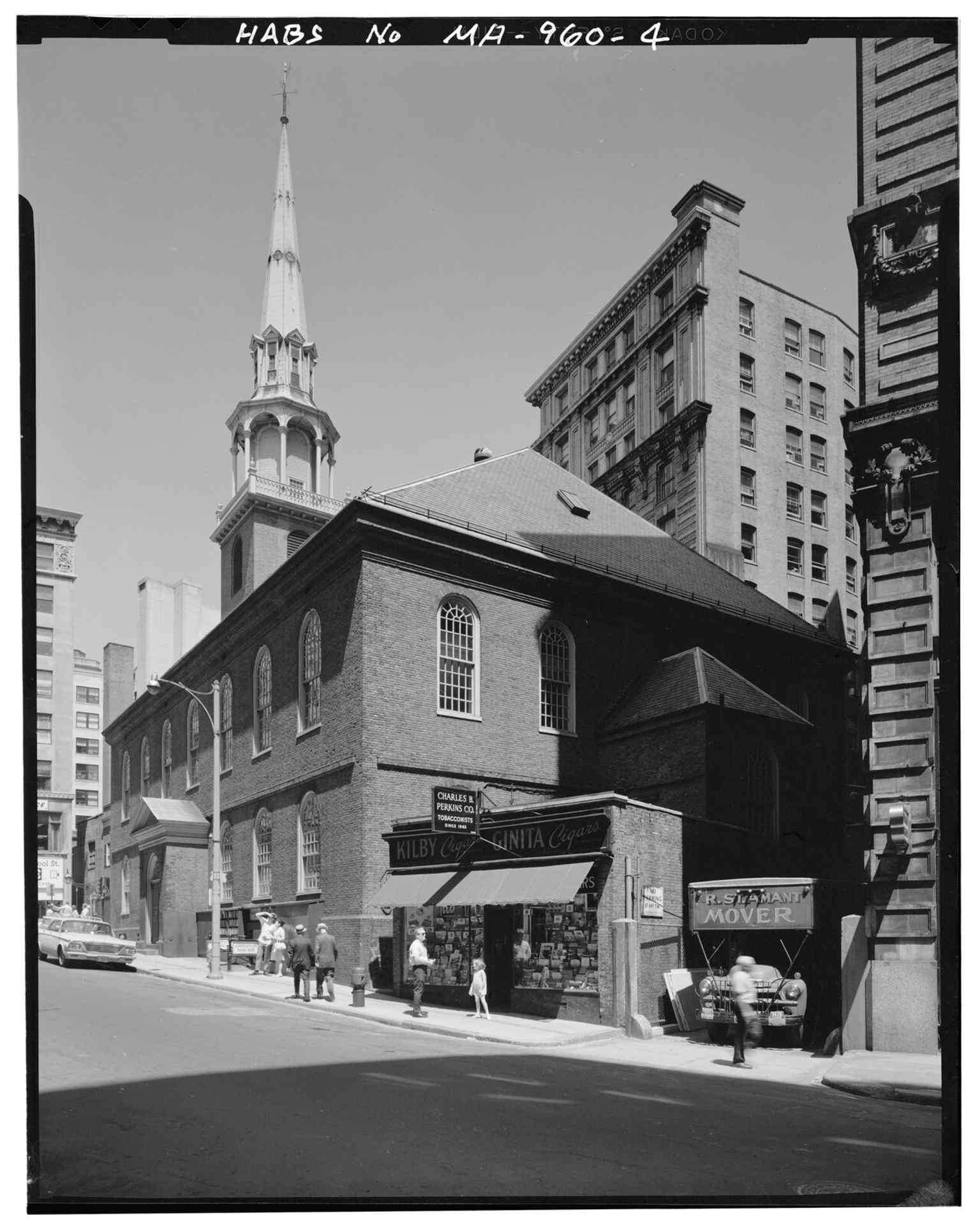
The east and south sides of the building, helping show the scale of the largest building in Boston at the time of the Tea Party.Photo: Hubbard, Cortlandt V., Wikimedia Commons, Public domain. Cropped & resized. 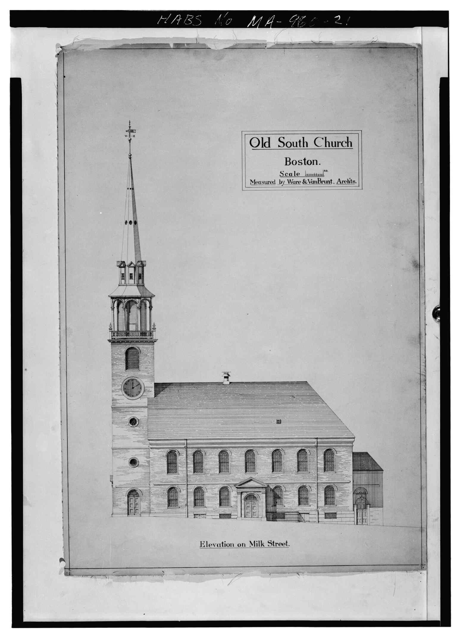
Milk Street elevation of the church, tying the landmark to its exact corner at Milk and Washington Streets.Photo: Hubbard, Cortlandt V., Wikimedia Commons, Public domain. Cropped & resized. 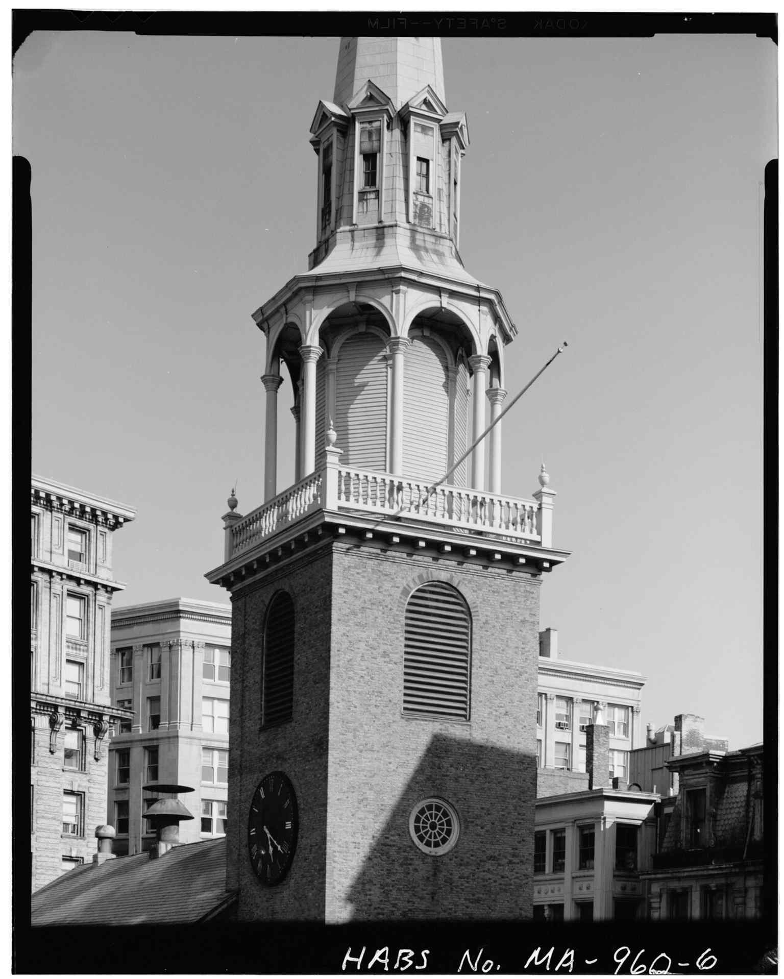
A close look at the tower’s central stage, part of the 183-foot steeple that made the meeting house a Boston landmark.Photo: Hubbard, Cortlandt V., Wikimedia Commons, Public domain. Cropped & resized. 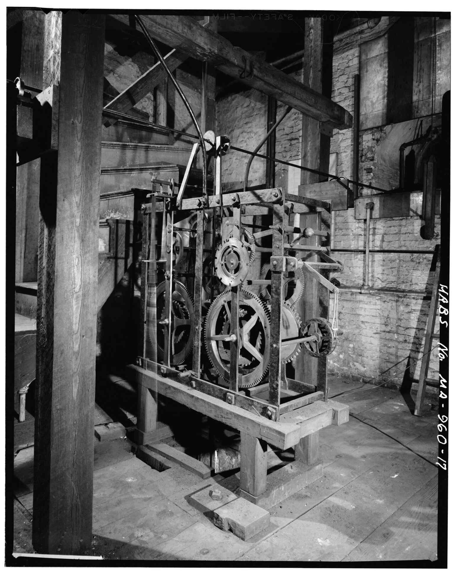
The tower clock mechanism highlights the building’s historic steeple and its role as a civic gathering place.Photo: Hubbard, Cortlandt V., Wikimedia Commons, Public domain. Cropped & resized. 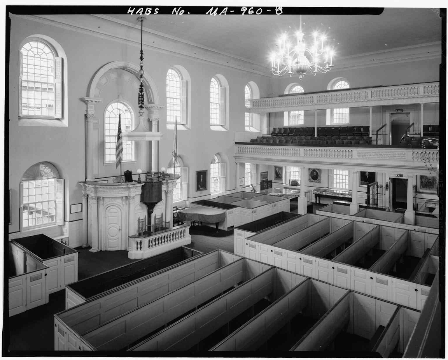
Another wide interior view, showing the open worship space that later hosted revolutionary anniversary meetings after the Boston Massacre.Photo: Hubbard, Cortlandt V., Wikimedia Commons, Public domain. Cropped & resized. 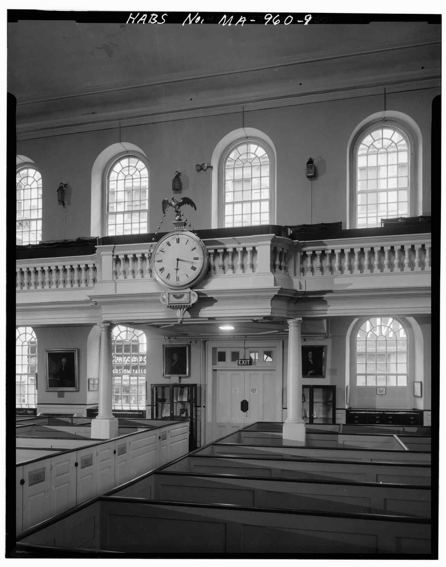
The south gallery opposite the pulpit shows the seating layout of the old church interior.Photo: Hubbard, Cortlandt V., Wikimedia Commons, Public domain. Cropped & resized. 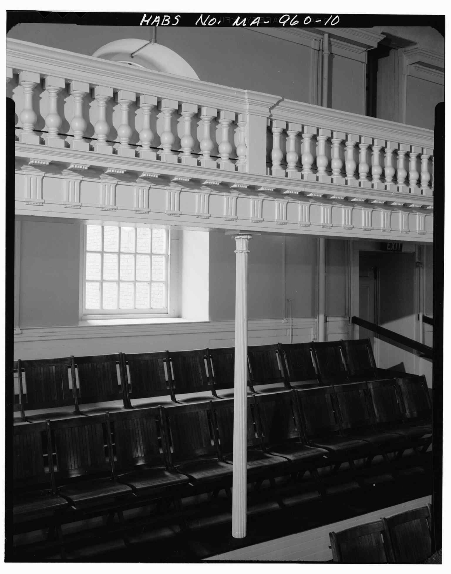
A cast-iron support and gallery balustrade detail, revealing later preservation work inside the historic sanctuary.Photo: Hubbard, Cortlandt V., Wikimedia Commons, Public domain. Cropped & resized. 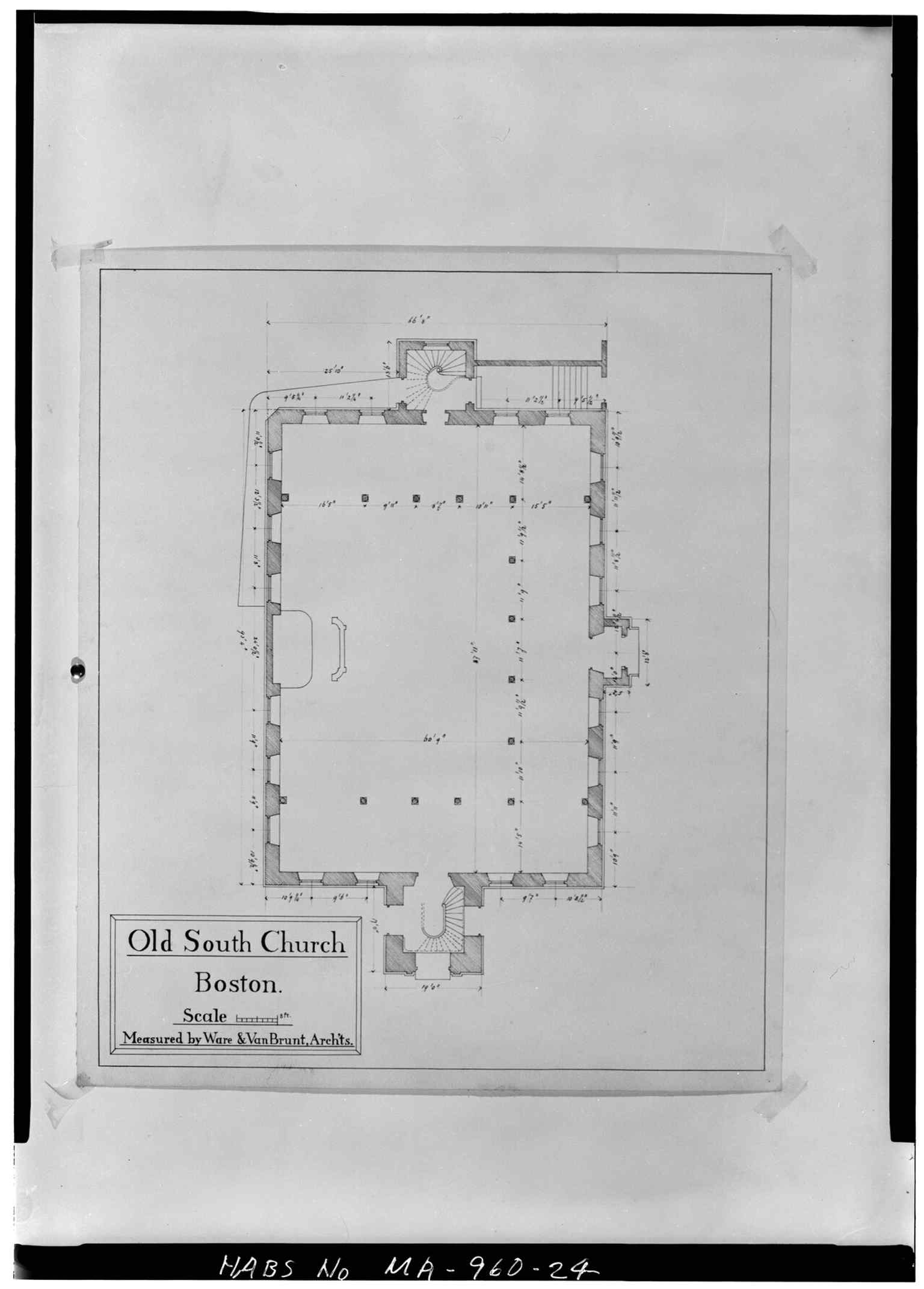
The first-floor plan gives a floor-by-floor look at the meeting house’s original church layout.Photo: Hubbard, Cortlandt V., Wikimedia Commons, Public domain. Cropped & resized. 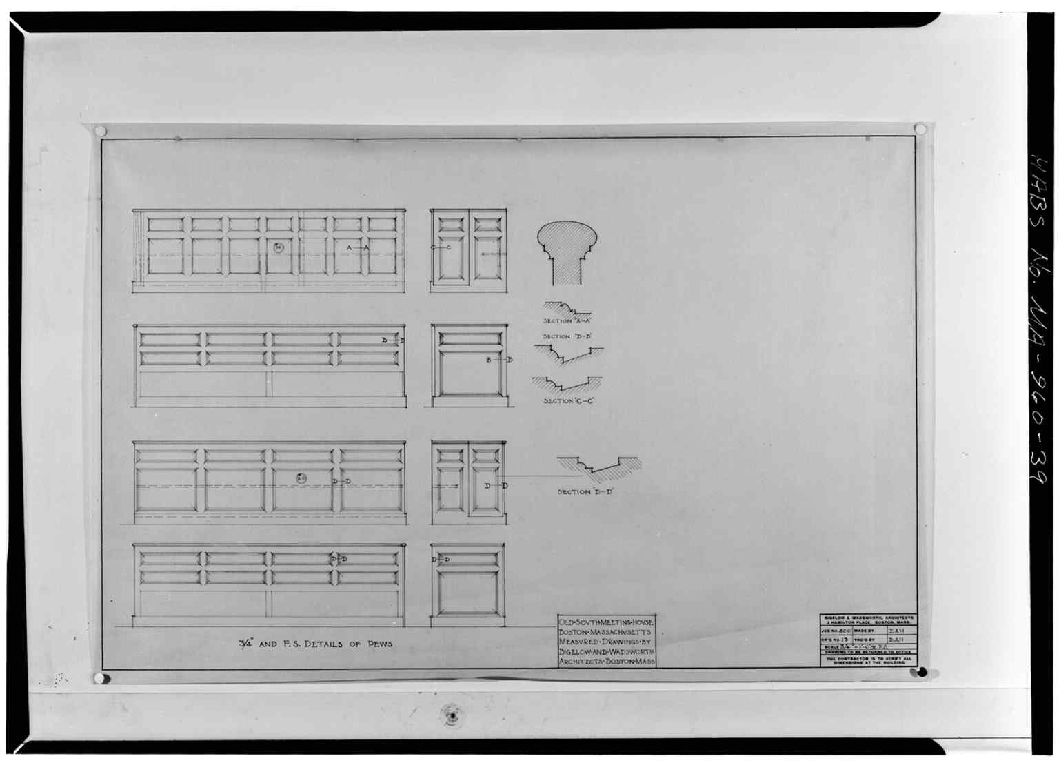
Detail drawings of the pews connect to the packed meetings that turned this church into Boston’s famous "mouth-house".Photo: Unknown, Wikimedia Commons, Public domain. Cropped & resized. On your left, look for a low red-brick block with a flat roofline and long bands of windows-the restrained modern shell that now occupies the old Jordan Marsh site. This spot…Read moreShow less
Open dedicated page →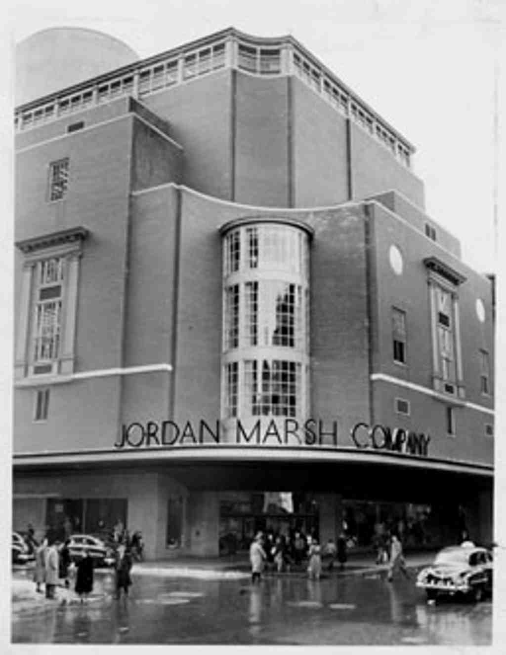
Jordan MarshPhoto: Bob Bruennig, Wikimedia Commons, Public domain. Cropped & resized. On your left, look for a low red-brick block with a flat roofline and long bands of windows-the restrained modern shell that now occupies the old Jordan Marsh site.
This spot carries one of Boston’s biggest retail stories... and one of its sharpest heartbreaks. Jordan Marsh began in eighteen forty-one, when Eben Dyer Jordan left his job in a dry goods store and struck out on his own. Ten years later, he teamed up with Benjamin L. Marsh. At first they sold linen, silk, and imported dry goods wholesale, mostly to other merchants. Then, in eighteen sixty-one, they grabbed a brownstone at four hundred fifty Washington Street and started selling straight to the public.
That move changed the game. After the Civil War, Jordan Marsh spread into neighboring buildings and created what many people call the nation’s first departmentalized store, meaning one giant shop broken into separate sections for different kinds of goods. It wasn’t just efficient... it felt like a whole indoor city of shopping. Jordan Marsh made that city elegant too: fashion shows, art exhibitions, afternoon concerts, and a bakery that became famous for blueberry muffins. Not a bad way to sell a coat.
If you want a glimpse of the old world they built, check the image on your screen of Washington Street. That stretch helped define Downtown Crossing as Boston’s department-store district.
Jordan Marsh also treated shopping like a kind of invention lab. The store offered charge accounts, pushed the idea that the customer is always right, and backed purchases with money-back guarantees. It adopted electrical lighting, glass display cases, telephones, and elevators early on. It even used pneumatic tubes, little pressurized pipes that shot cash and credit slips from one department to another overhead like retail bloodstream.
After World War Two, the company went even bigger. Management replaced the patchwork of older buildings with a massive new store that filled a whole city block, covered more ground than Harvard Stadium, dropped two stories underground, and rose fourteen stories above the street. It had air conditioning, automatic doors, block-long display windows, and even sidewalks warmed by radiant heat.
Then came the turn that still stings. The original ornate brownstone flagship, with its corner clock tower designed by Nathaniel J. Bradlee in the eighteen sixties, came down in nineteen seventy-five along with the annex buildings. Some furious shoppers cut up their store cards in protest. Preservationists rallied so hard that their fight helped spark the creation of the Boston Landmarks Commission. So in a strange way, Jordan Marsh disappeared... and helped Boston save other buildings afterward.
The chain stretched across New England and beyond. One suburban branch in Framingham became famous for its huge white dome, so visible that pilots used it as a landmark while approaching Logan Airport. You can see that wild piece of retail ambition in the app. But ownership kept changing hands, from Hahn to Allied to Federated, and by nineteen ninety-six the Jordan Marsh name gave way to Macy’s.
So this corner is really a lesson in Boston memory: what a city chooses to build, and what it regrets losing.
Take a moment here, and when you’re ready, we can head along to Park Street Church.
On your right, look for a red-brick church with a tall white steeple, a square tower, and a sharp spire that shoots high above the corner. Here it is: Park Street Church, one of…Read moreShow less
Open dedicated page →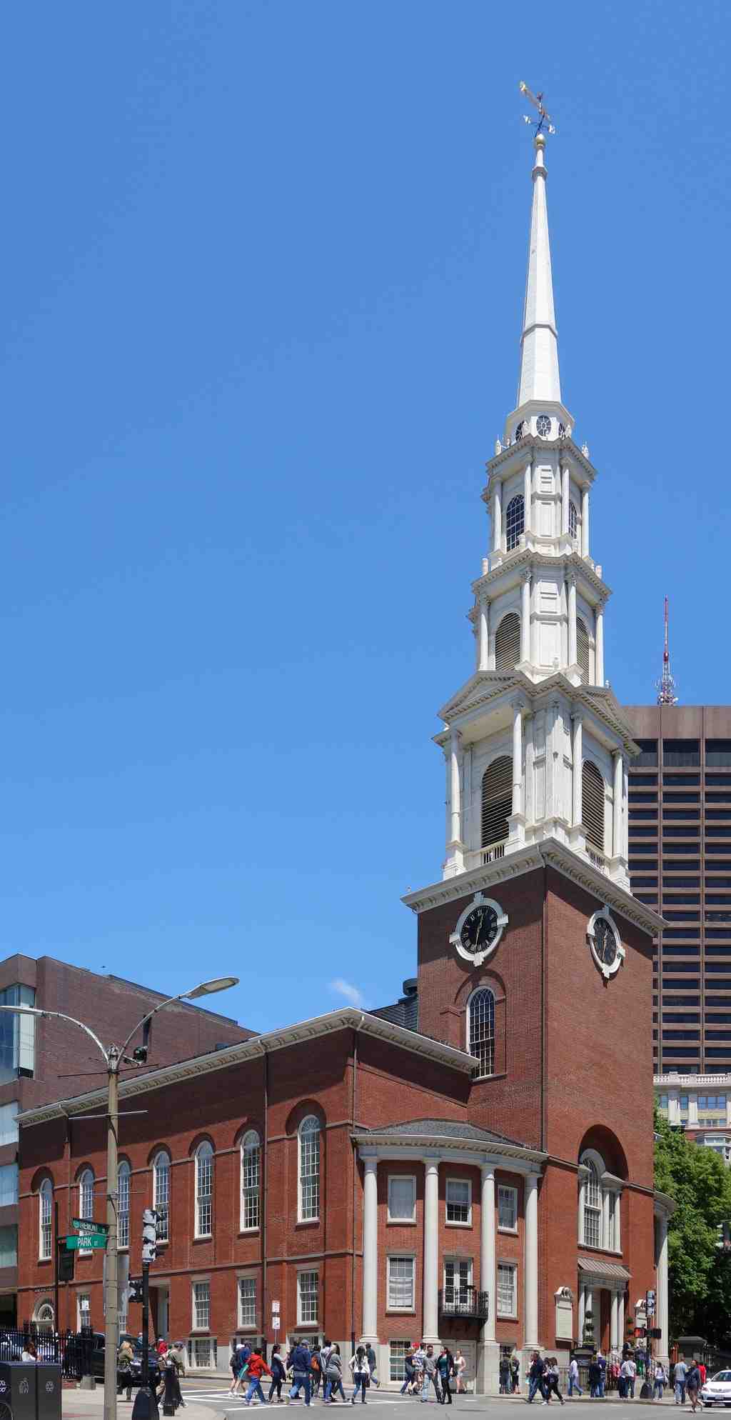
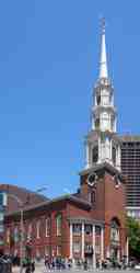
Park Street ChurchPhoto: Daderot, Wikimedia Commons, CC0. Cropped & resized. On your right, look for a red-brick church with a tall white steeple, a square tower, and a sharp spire that shoots high above the corner.
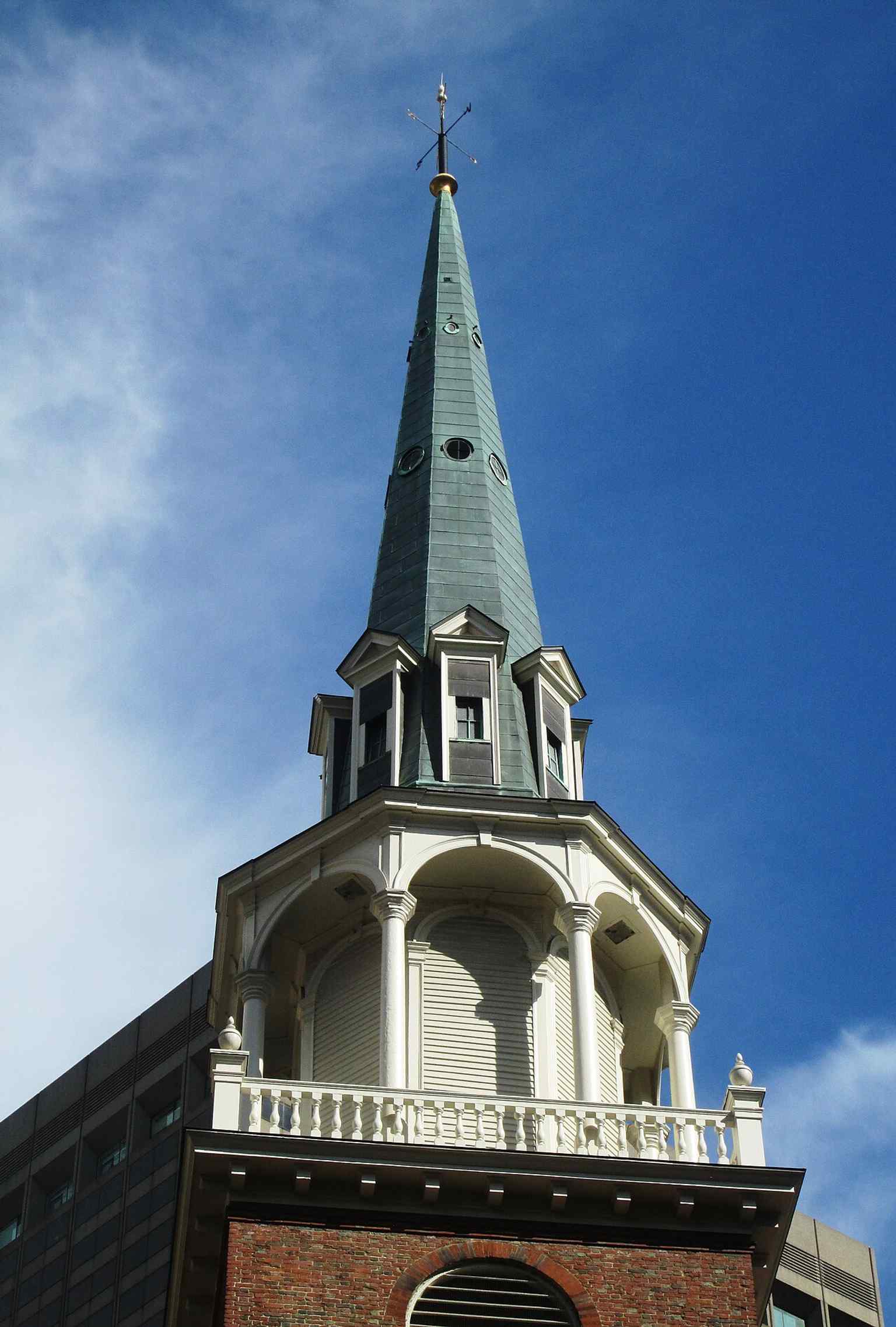
Here it is: Park Street Church, one of those buildings that seems to stand with its back straight. It has that effect on people. The church took shape in eighteen oh nine, when twenty-six Bostonians, many of them from Old South Meeting House, decided they wanted a congregation rooted in orthodox Trinitarian belief... meaning the traditional Christian idea of one God in three persons, Father, Son, and Holy Spirit.
Peter Banner designed it, chief mason Benajah Young handled the stonework, and Solomon Willard carved the wood details. Banner borrowed ideas from architectural pattern books and from the work of Christopher Wren in London, so what you’re seeing is Boston speaking with a little English accent. And that steeple? It rises two hundred seventeen feet. From eighteen ten to eighteen twenty-eight, this was the tallest building in the United States. For years, travelers coming toward Boston spotted this spire first, like the city had planted an exclamation point on the skyline.
The first service happened on the tenth of January, eighteen ten. Not long after, the place picked up the nickname “Brimstone Corner.” Partly because the preaching had real fire-and-thunder energy, especially around missions, and partly because gunpowder got stored here during the War of eighteen twelve. That is a very Boston combination: theology and explosives sharing the same address.
Park Street never stayed quiet. In eighteen sixteen, it joined with Old South to create the City Mission Society, serving Boston’s urban poor. In eighteen twenty-nine, William Lloyd Garrison came here and delivered one of his first major public arguments against slavery. Two years later, this church hosted the debut of “My Country, ’Tis of Thee,” sung here for the first time on the fourth of July, eighteen thirty-one. Lowell Mason, one of the giants of American church music, served as choirmaster and organist around then too. So this corner has carried sermons, protest, charity, and song... all in one stream.
If you want a neat visual of how long this steeple has ruled the scene, glance at the old bird’s-eye image on your screen.
And the city around it really did transform. Streetcars came, subways carved underneath, towers rose, retail surged, and the church kept holding the corner. You can check the old image on your screen to see that shift in one glance.
Park Street is still an active congregation now, with members from more than sixty countries, and it still ties faith to practical work through English classes, ministries for people experiencing homelessness, and education projects like Boston Trinity Academy. In the nineteen seventies, the church even added a sharply modern ministries building beside the historic sanctuary... concrete, glass, and brick in conversation with the old red walls.
If you’d like to come back inside another day, the church is generally open on Sundays from eight AM to six PM.
Park Street Church feels like a lighthouse for conviction, pointed straight up through two centuries of Boston change.
Take a moment with that steeple, and when you’re ready, we can wander on to the next stop.
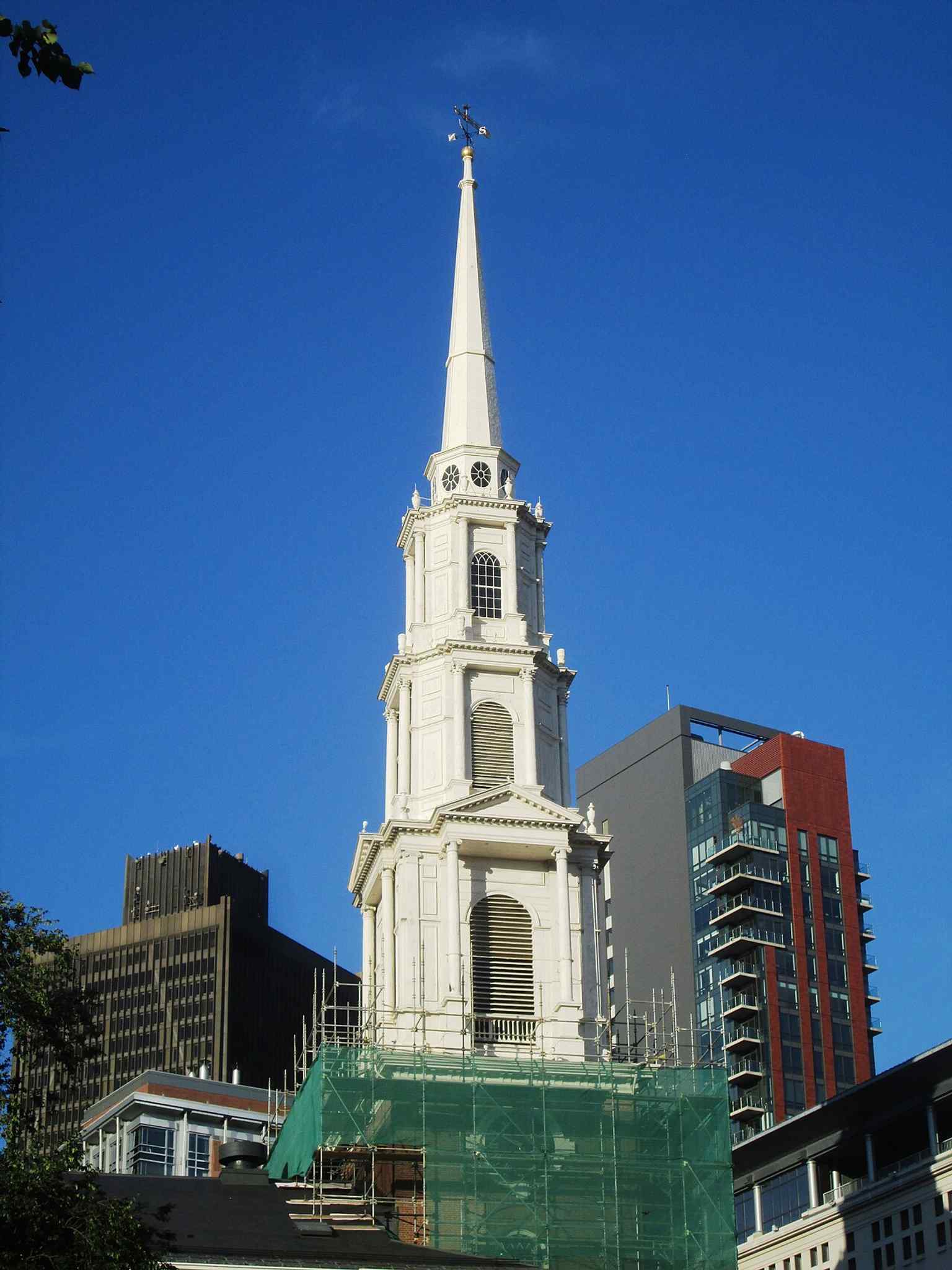
The steeple rising above Boston Common in 2017—an enduring landmark that once made Park Street Church the tallest building in the United States.Photo: Beyond My Ken, Wikimedia Commons, CC BY-SA 4.0. Cropped & resized. 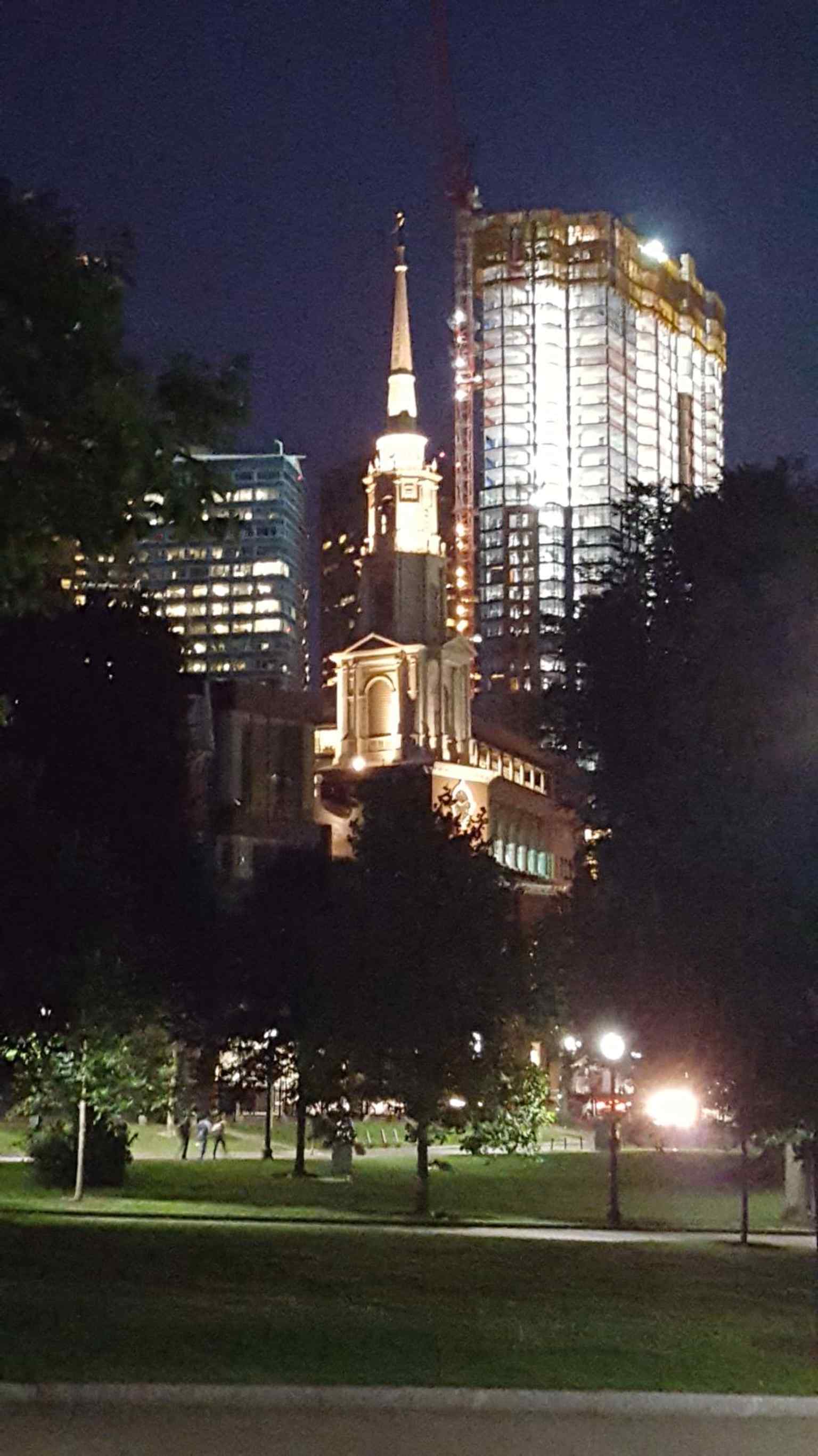
A straightforward 2015 view of the historic church, a National Register landmark on the Freedom Trail.Photo: Upstateherd, Wikimedia Commons, CC BY-SA 4.0. Cropped & resized. Look for the black iron fence and the stone Egyptian Revival gateway, with rows of slate and granite grave-markers packed behind it like a tilted little forest of stone. This is…Read moreShow less
Open dedicated page →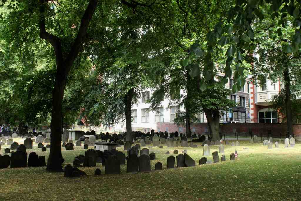
Granary Burying GroundPhoto: Miguel Hermoso Cuesta, Wikimedia Commons, CC BY-SA 4.0. Cropped & resized. Look for the black iron fence and the stone Egyptian Revival gateway, with rows of slate and granite grave-markers packed behind it like a tilted little forest of stone.
This is Granary Burying Ground, Boston’s third-oldest cemetery, and it has that rare talent of making a loud city go quiet in your head. People started burying Bostonians here in sixteen sixty, when the older cemetery at King’s Chapel no longer had enough room for a growing town. Back then, this land actually belonged to Boston Common, before the city kept slicing the block into new uses. For years the place went by South Burying Ground, then in seventeen thirty-seven people started calling it Granary after the grain storage building that stood where Park Street Church rises now.
What gets me is the numbers. You can see about two thousand three hundred forty-five grave-markers... but historians think as many as five thousand people rest here. So this place is part cemetery, part puzzle, part crowded memory palace.
And the cast of characters? Absolutely stacked. Samuel Adams, John Hancock, and Robert Treat Paine, three signers of the Declaration of Independence, lie here. Paul Revere is here too, along with Peter Faneuil, whose money helped shape the market hall we visited earlier. Near the Tremont Street entrance lie the victims of the Boston Massacre, including Crispus Attucks, buried in a common grave. Benjamin Franklin is not here, though people often assume he is; instead, this ground holds his parents, Josiah Franklin and Abiah Folger, honored by a granite obelisk set up in eighteen twenty-seven.
If you look at your screen, image five shows one of the oldest stones here, carved with the Latin phrase tempus edax rerum, which means “time devours all things.” That line feels almost unfairly perfect for this place.
Early Boston’s Puritans kept churches plain and stripped of religious imagery, so families poured feeling into the gravestones instead. That is why you’ll find “soul effigies” here - winged skull carvings, basically a death’s head with wings - meant to show the soul flying upward. It’s grim, sure, but also strangely tender.
The entrance itself tells another chapter. In eighteen forty, architect Isaiah Rogers designed this iron fence and gate in Egyptian Revival style, meaning he borrowed the heavy, ancient look of Egyptian temples for a nineteenth-century cemetery. The project cost five thousand dollars, which would be roughly like spending around one hundred eighty thousand dollars today. Rogers even made a twin gate for Touro Cemetery in Newport. If you want, the comparison image in the app shows this gate going from opening onto a quieter Victorian graveyard to standing in a canyon of downtown Boston.
And here’s one more Boston-style twist: in two thousand and nine, a tourist on a self-guided visit stepped on an old slate slab and dropped into a hidden stairway leading to an intact crypt below. She was fine, no human remains were disturbed, and the crypt may belong to Jonathan Armitage, a Boston selectman from the seventeen thirties. Even the ground here keeps secrets.
If you want to go inside later, the burying ground generally opens daily from nine in the morning to four in the afternoon.
Granary Burying Ground feels like Boston compressed into stone: rebellion, family, vanity, grief, and the stubborn urge to be remembered.
Take a beat with it, and when you’re ready, we can wander on to King’s Chapel.
On your left, King's Chapel is a hefty gray stone church with a broad rectangular body, tall arched windows, and a square tower carrying its famous bell. This place has a calm,…Read moreShow less
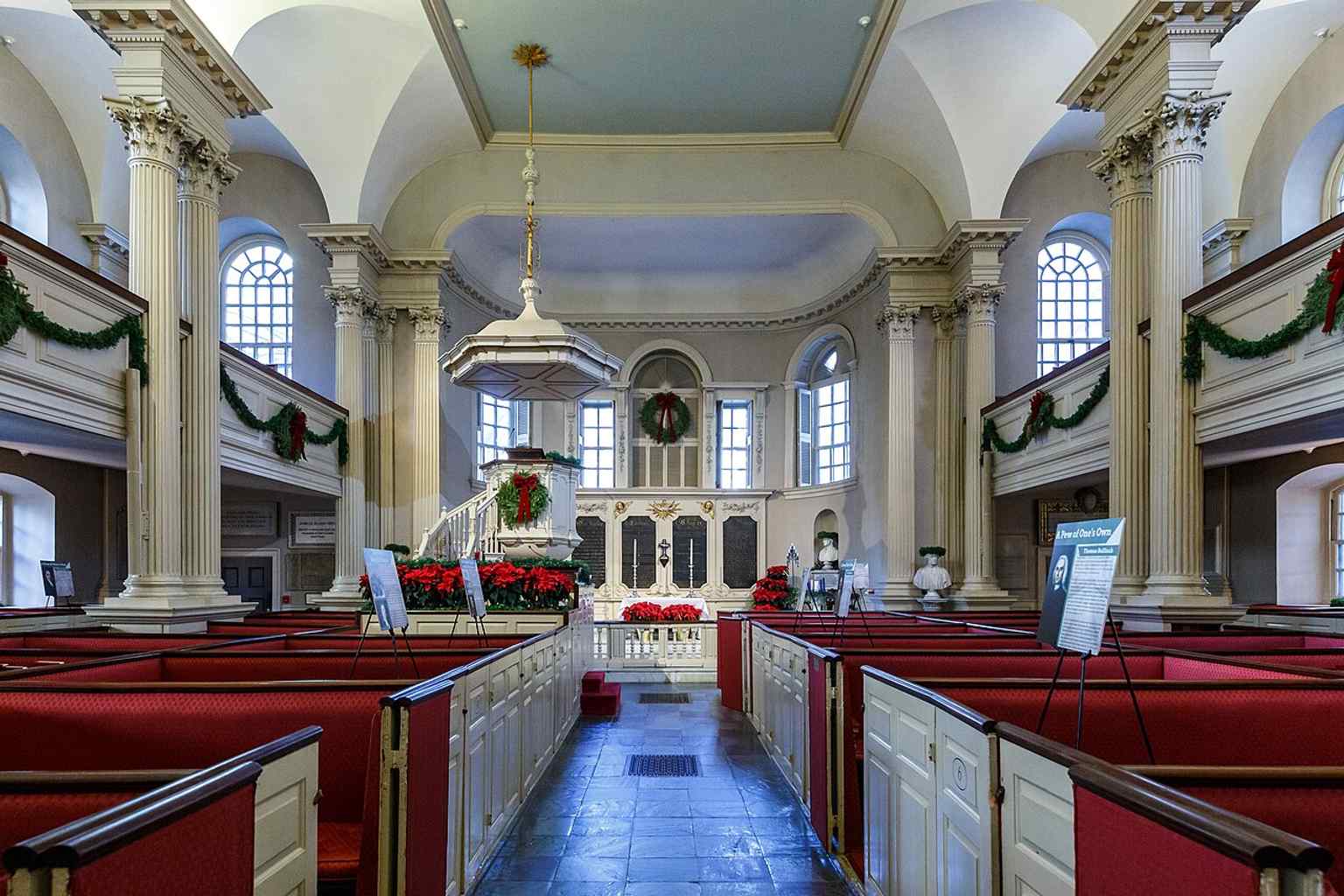
Open dedicated page →On your left, King's Chapel is a hefty gray stone church with a broad rectangular body, tall arched windows, and a square tower carrying its famous bell.
This place has a calm, stubborn presence... like it decided centuries ago that it belonged on this corner and never bothered to argue about it again. King’s Chapel began in sixteen eighty-six, when Royal Governor Sir Edmund Andros started the first Anglican church in colonial New England during the reign of King James the Second. That did not make him popular here. In fact, no local resident wanted to sell land for a church that wasn’t Congregationalist, the official faith of Massachusetts at the time. So the congregation set its first chapel, a wooden one, right on the public burying ground beside it.
Then the story takes a wonderfully strange turn. In seventeen forty-nine, architect Peter Harrison designed this stone chapel, and builders raised it around the older wooden church like a shell growing around a smaller creature. When the new building was done in seventeen fifty-four, workers took the wooden church apart piece by piece and passed it out through the windows. That timber sailed all the way to Lunenburg, Nova Scotia, where it became Saint John’s Anglican Church.
The building in front of you was meant to have a steeple, but money ran short, so the tower stopped where you see it now. Somehow that unfinished note works. It gives the chapel a grounded, no-nonsense look, even though it was one of the finest colonial designs in Boston and later earned National Historic Landmark status.
During the American Revolution, this place stood empty and people simply called it the Stone Chapel. Many Loyalist families left for Nova Scotia or England. When the church reopened in seventeen eighty-two, James Freeman pushed it in a new direction. He rewrote the Book of Common Prayer, the set form of worship, along Unitarian lines in seventeen eighty-five. An Episcopal bishop named Samuel Seabury refused to ordain him... and King’s Chapel basically shrugged and kept going anyway. That independent streak still defines it: Unitarian in belief, Anglican in worship style, and governed by its own congregation.
If you want a quick side-by-side of that staying power, the image in the app shows how the chapel barely changes while the city around it keeps changing costumes.
Look up at that tower and think about the bell. England cast the first one, workers hung it in seventeen seventy-two, and when it cracked in eighteen fourteen, Paul Revere and Sons recast it. That bell is the largest one the Revere foundry ever made, and the last they cast during Paul Revere’s lifetime.
And if you glance at the interior photo on your screen, you’ll see the old pulpit and altar panels carried over from the earlier wooden chapel... the first church still living inside the second.
A look toward the pulpit inside King's Chapel, where the old pulpit and altar pieces recall the earlier wooden church.Photo: Kenneth C. Zirkel, Wikimedia Commons, CC BY 4.0. Cropped & resized. If you want to come back inside later, King’s Chapel is generally open Monday through Saturday from ten in the morning to five in the afternoon, and closed on Sunday.
King’s Chapel feels like Boston in miniature: loyalist roots, revolutionary disruption, and a stubborn talent for reinventing itself without losing its shape.
Take a minute here, and when you’re ready, we can head on to the next stop.
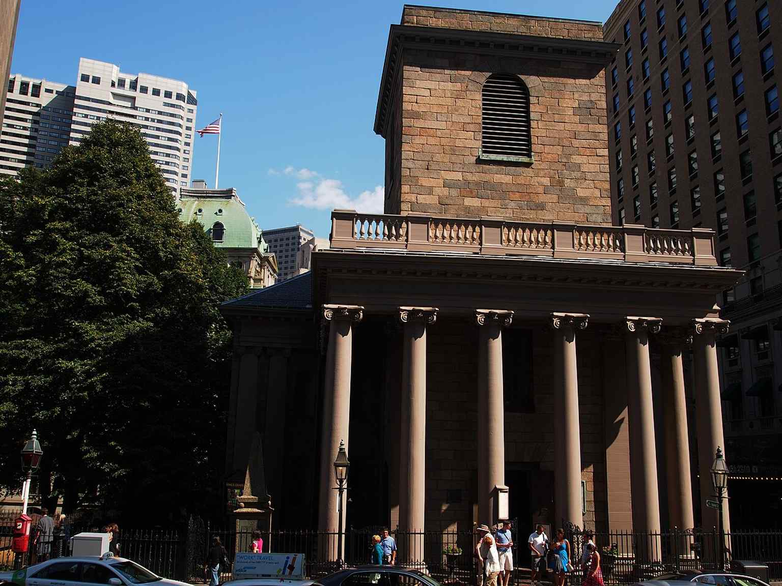
The stone chapel’s classic front façade, the 1754 building designed by Peter Harrison after the earlier wooden church was dismantled inside it.Photo: Fenwik, Wikimedia Commons, CC BY-SA 3.0. Cropped & resized. 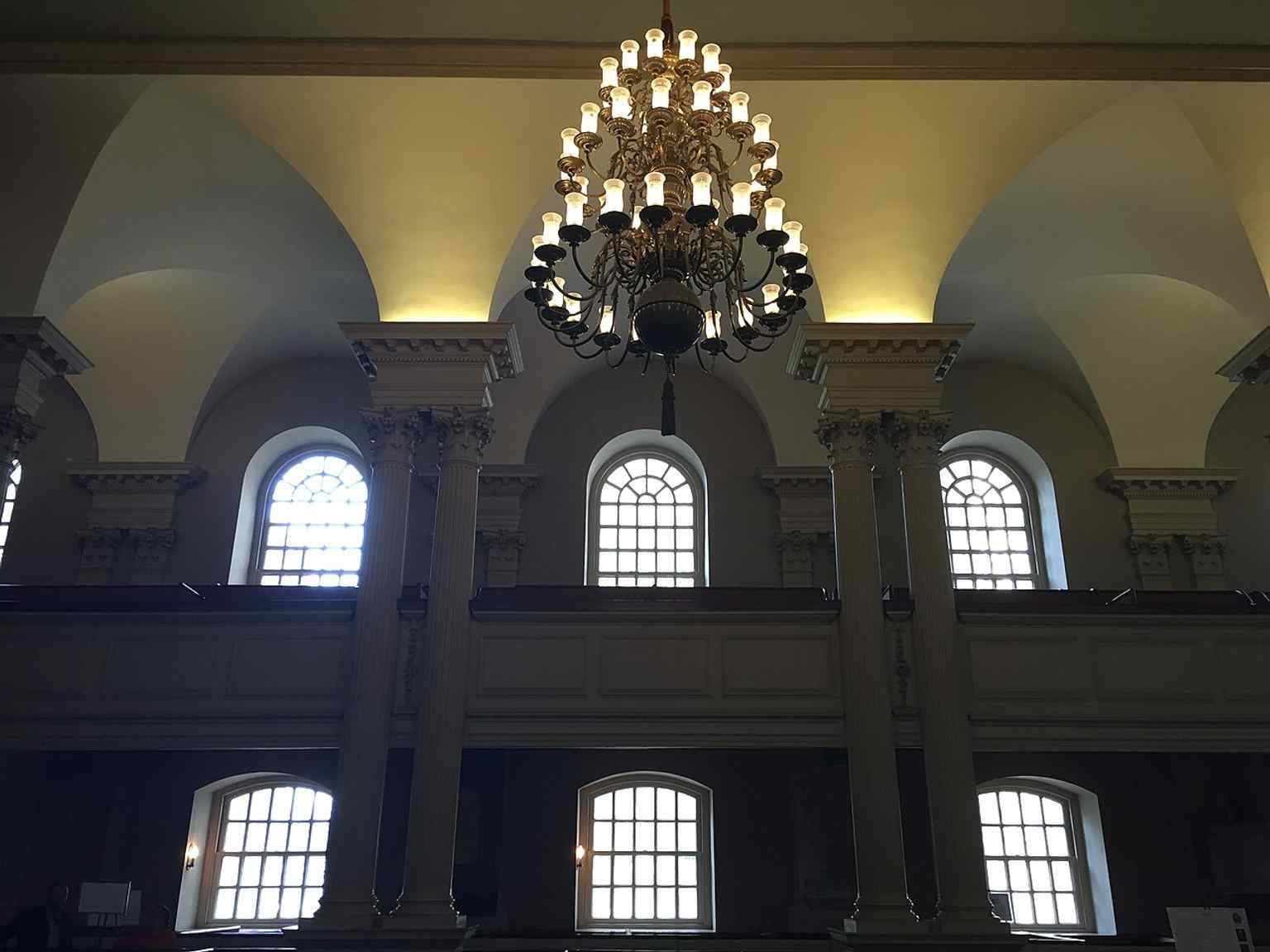
The chapel interior with its groin-vaulted ceiling and chandelier, reflecting the elegant colonial worship space that survived the Revolution.Photo: Ario Barzan, Wikimedia Commons, CC BY-SA 4.0. Cropped & resized. 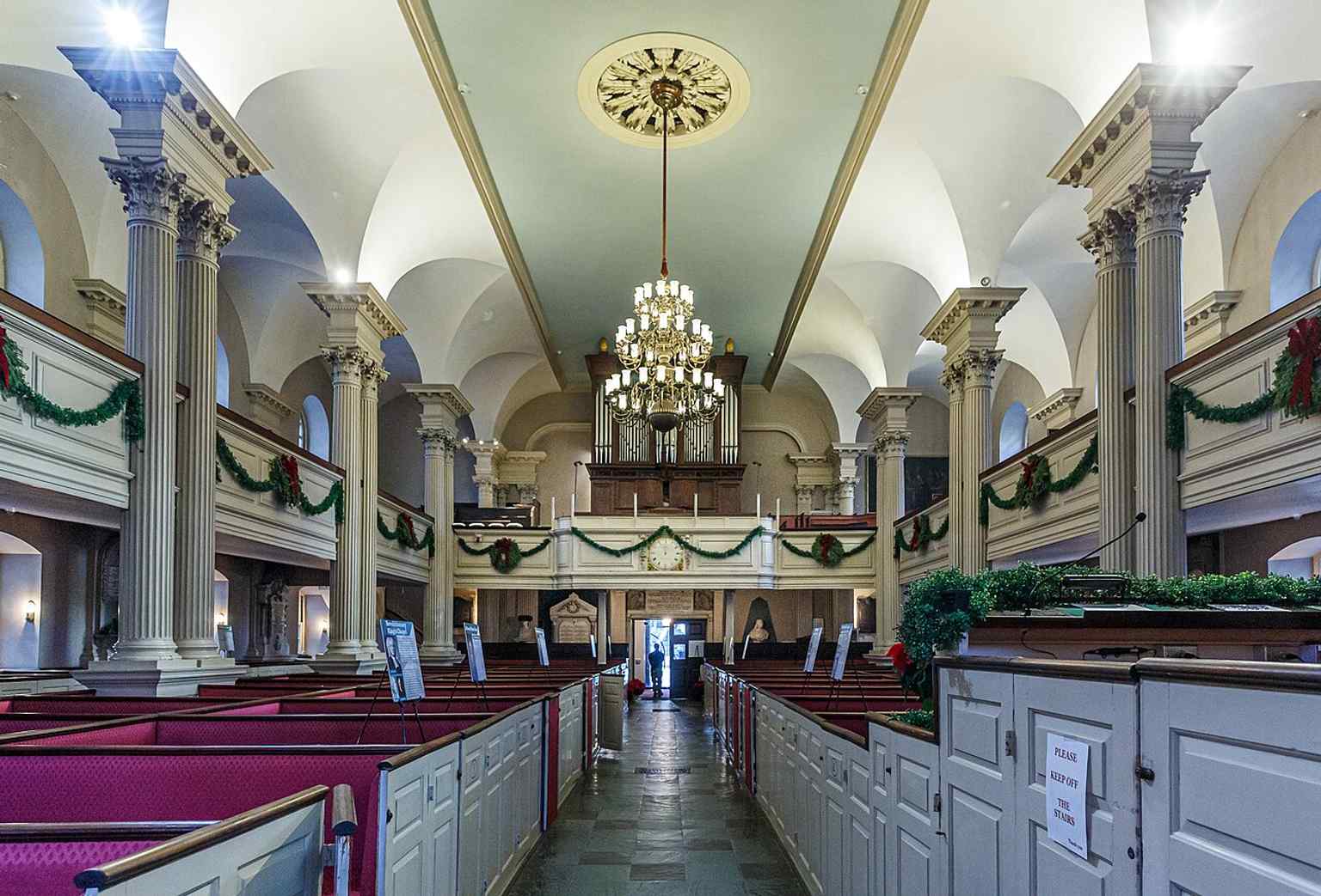
The rear of the sanctuary, showing the box-pew layout and balcony arrangement that once reflected family ownership and pew rent.Photo: Kenneth C. Zirkel, Wikimedia Commons, CC BY 4.0. Cropped & resized. 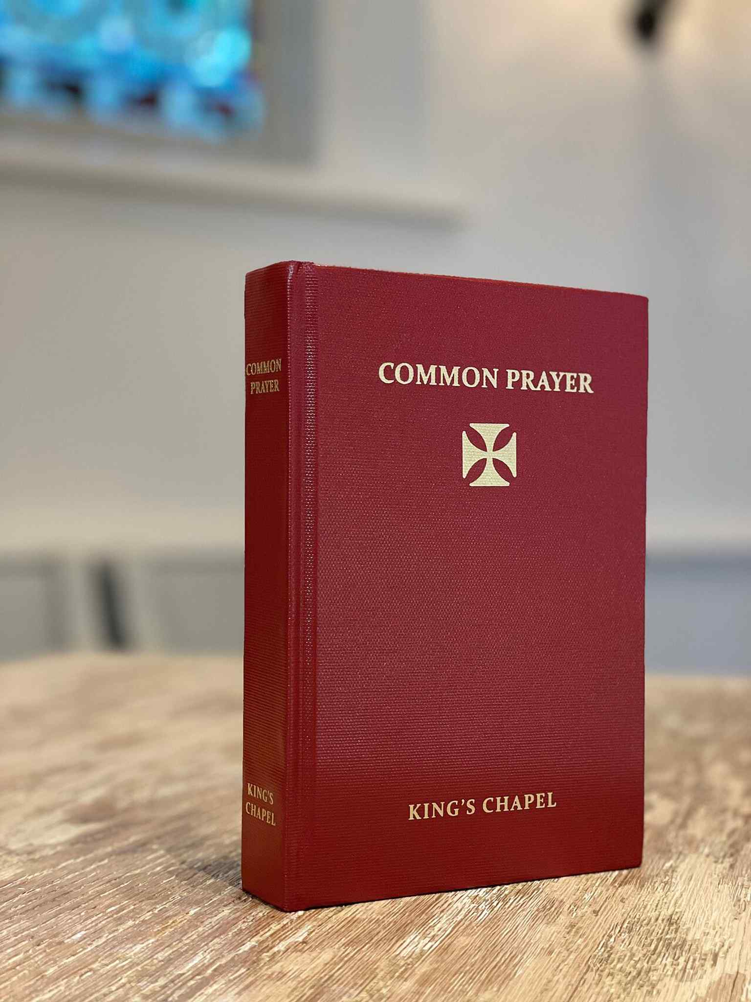
A copy of King's Chapel’s Unitarian Book of Common Prayer, showing the distinctive liturgy first revised by James Freeman in 1785.Photo: Pbritti, Wikimedia Commons, CC BY-SA 4.0. Cropped & resized. 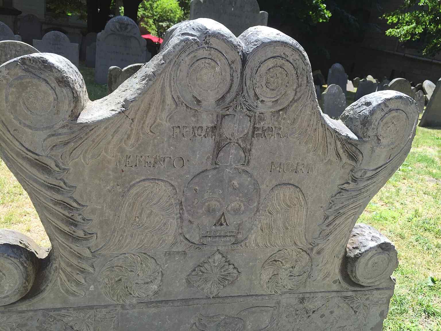
A grave marker in the adjacent King's Chapel Burying Ground, which predates the present church by more than a century and is not part of the congregation.Photo: j_m_d_imagery, Wikimedia Commons, CC BY-SA 4.0. Cropped & resized. On your right, look for the pale stone courthouse with a broad rectangular front, tall arched windows, and carved classical detailing around the entrance. This is the John Adams…Read moreShow less
Open dedicated page →
Massachusetts Supreme Judicial CourtPhoto: Swampyank, Wikimedia Commons, CC BY 3.0. Cropped & resized. On your right, look for the pale stone courthouse with a broad rectangular front, tall arched windows, and carved classical detailing around the entrance.
This is the John Adams Courthouse at One Pemberton Square, home to the Massachusetts Supreme Judicial Court, the highest court in the Commonwealth. And yeah, that name is a mouthful, so people often call it the S-J-C. It is an appellate court, which just means it reviews decisions from lower courts instead of running everyday trials. The court likes to claim a pretty bold title: the oldest continuously functioning appellate court in the Americas. Pennsylvania disputes that, because of course it does, but Massachusetts can trace this court straight back to sixteen ninety-two, when Governor Sir William Phips created the old Superior Court of Judicature under the provincial charter.
John Adams is not just decoration on the building’s name. As a young lawyer, he defended Captain Thomas Preston after the Boston Massacre. The jury could not decide whether Preston had ordered the soldiers to fire, so he walked free. In the related trial, Rex v. Wemms and others, six soldiers were found not guilty, while two were convicted of manslaughter, meaning they killed without the legal finding of deliberate murder.
What makes this court fascinating is that it has pushed justice forward in some moments... and fumbled badly in others. In Commonwealth v. Nathaniel Jennison in seventeen eighty-three, it helped end slavery’s legal standing in Massachusetts by allowing enslaved people to sue for freedom. Boston lawyer John Lowell had promised he would work for any enslaved person for free, and that promise suddenly mattered. In Commonwealth v. Hunt in eighteen forty-two, the court ruled that labor unions were not automatically criminal conspiracies if they used lawful, nonviolent pressure. That gave workers room to organize without being treated like outlaws. But then, in Roberts v. Boston in eighteen fifty, the court upheld segregated schools, feeding the toxic idea later called “separate but equal.”
Then came Goodridge in two thousand three. The court ruled, by a four to three vote, that denying marriage licenses to same-sex couples violated the Massachusetts Constitution. When lawmakers asked if civil unions would be enough, the court said no... civil marriage was required. Massachusetts began issuing those licenses on the seventeenth of May, two thousand four.
Today, seven justices sit here: one chief justice and six associate justices, all appointed by the governor with consent from the Governor’s Council, and all serving until age seventy. If you want a face for the modern court, check the portrait of Chief Justice Kimberly S. Budd in the app.
For all its formal stone and measured language, this place has helped decide who gets power, protection, and dignity.
Take a moment here, and when you’re ready, we can head on to the next stop.
Look for the small bronze plaque set into a black iron wall beneath the white marble west wing of the State House. Easy to miss, right? But this little marker points to one of…Read moreShow less
Open dedicated page →
Hancock ManorPhoto: Christian Remick, Wikimedia Commons, Public domain. Cropped & resized. Look for the small bronze plaque set into a black iron wall beneath the white marble west wing of the State House.
Easy to miss, right? But this little marker points to one of Boston’s lost giants. Right here stood Hancock Manor, the home John Hancock inherited from his uncle Thomas Hancock, one of the richest merchants in the province. Thomas hired Joshua Blanchard between seventeen thirty-four and seventeen thirty-seven to raise a three story granite mansion on Beacon Hill, and for a while it stood nearly alone on the western side of the hill, staring out over the open pasture of Boston Common.
This place was more than a house. The estate spread from today’s Joy Street to Park Street, with gardens, orchards, nurseries, pasture, outbuildings, a coach house, and a stable. Enslaved people lived and worked here too, which is part of the story that grandeur often tries to hide. The mansion itself had hefty Quincy granite walls, a balcony over the front door, curled baroque details above it, and a gambrel roof - that classic old New England roof with two slopes on each side - with three dormer windows peeking out.
Inside, visitors stepped into a grand paneled hall split by a broad staircase with twisted balusters, the carved upright pieces along the railing. One wing held a ballroom. Another handled the kitchen and household work. This was colonial Boston showing off.
Then the Revolution shoved its way in. In seventeen seventy-five, British soldiers pillaged the grounds, chopped up fences for firewood, and broke windows. Officers took over the mansion, General Henry Clinton used it as headquarters, and some wounded men from Bunker Hill ended up in the house and stables. Still, the manor survived the occupation better than you might expect.
Hancock kept living here as governor and entertained a wild guest list: Lafayette, George Washington, Jacques Pierre Brissot, and the French admiral d’Estaing. At one dinner, so many French officers showed up that servants reportedly milked cows on Boston Common to keep the table supplied.
If you glance at the image in the app, you can catch the mansion in its final years on Beacon Street. And that’s where the story turns. In eighteen sixty-three, even after people proposed saving the house as a governor’s mansion or a museum, the state refused to fund its move, and the manor came down. People grabbed souvenirs as it fell. That loss helped spark the preservation movement that later saved places like Old South Meeting House and the Old State House.
So this plaque marks more than a vanished address... it marks the moment Boston learned that history can disappear while people are still debating its value.
If you’re curious about nearby access, the venue hours here are generally Wednesday through Monday from ten in the morning to four in the afternoon, and it’s closed on Tuesdays.
Sometimes the quietest marker tells the loudest story.
Take a moment here, and when you’re ready, we can wander on to the Sacred Cod.
A rare 1859 view of Hancock House on Beacon Street, showing the mansion just a few years before its demolition in 1863.Photo: Unknown artistUnknown artist, Wikimedia Commons, Public domain. Cropped & resized. On your right, look for the Massachusetts State House: a red-brick building with a broad pale-stone front and a gleaming gold dome lifting above it. Inside that building hangs…Read moreShow less
Open dedicated page →
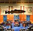
Sacred CodPhoto: Liberma, Wikimedia Commons, CC BY-SA 4.0. Cropped & resized. On your right, look for the Massachusetts State House: a red-brick building with a broad pale-stone front and a gleaming gold dome lifting above it.
Inside that building hangs one of Boston’s strangest little monarchs... a four-foot carved wooden Atlantic cod, painted to look alive, watching over the House of Representatives. Lawmakers kept it there as a memorial to the cod fishery, because cod didn’t just feed Massachusetts, it helped bankroll the whole place. The fish became so central to the state’s identity that Massachusetts still calls cod its historic and continuing symbol.
If you want a peek inside, take a glance at your screen: you can see the Sacred Cod hanging above the House chamber like a quiet referee for democracy.
Now here’s the wild part. This cod has lived several lives. A first version, if it truly existed, disappeared in a fire in seventeen forty-seven. A second vanished during the American Revolution. The one hanging there now arrived in seventeen eighty-four and just kept watching... session after session, argument after argument. The nickname “Sacred Cod” didn’t turn up until eighteen ninety-five, after a House committee called it “the sacred emblem” that had outlasted one administration after another. Not bad for a fish.
And yes, people stole it. In nineteen thirty-three, editors from the Harvard Lampoon cod-napped it, and police got so worked up they dragged the Charles River and searched an airplane in New Jersey. In nineteen sixty-eight, students from the University of Massachusetts Boston swiped it with a stepladder to protest how little attention legislators paid their new campus. Officials found it a few days later in a little-used hallway.
The Senate even has its own fishy sidekick, a brass casting nicknamed the Holy Mackerel, built into the chamber chandelier. You can spot that cousin on your phone too. During World War Two, when someone mistakenly thought the Sacred Cod was aluminum and asked for it as scrap for the war effort, the House Speaker basically said, wrong fish... try the mackerel.
If you ever want to go inside, the building generally opens Monday through Friday from nine to five and stays closed on weekends.
Boston knows how to turn a plain old fish into a state legend.
Take your time here, and when you’re ready, we can wander on toward Boston Common.
Look for the broad green sweep framed by black iron fencing and curved paved paths, with the tall stone Soldiers and Sailors Monument rising from the park like a marker pin in the…Read moreShow less
Open dedicated page →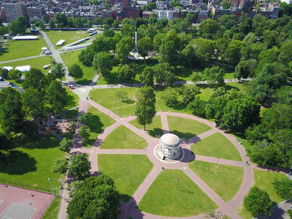
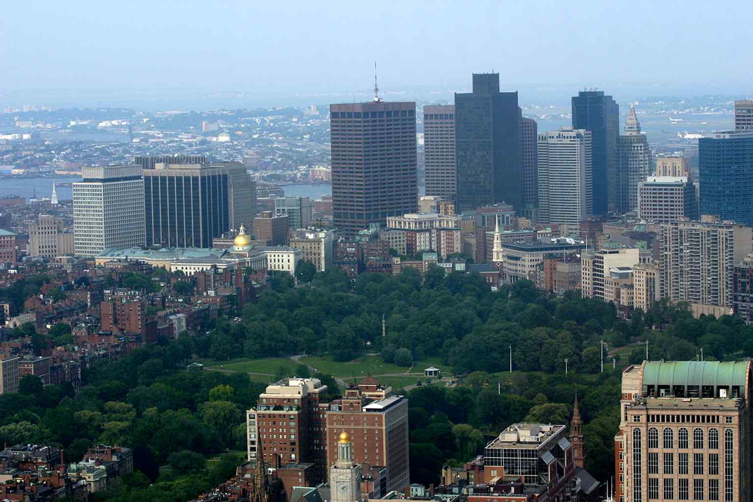
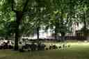
Boston CommonPhoto: AbhiSuryawanshi, Wikimedia Commons, CC BY-SA 4.0. Cropped & resized. Look for the broad green sweep framed by black iron fencing and curved paved paths, with the tall stone Soldiers and Sailors Monument rising from the park like a marker pin in the middle of the city.
This is Boston Common... fifty acres of open ground that somehow feels bigger than its size, maybe because so much of Boston has passed through it. It’s the oldest city park in the United States, but it didn’t begin as a park at all. Back in the seventeen twenties of Boston’s story... actually, even earlier... this land belonged to William Blaxton, the first European settler here, a solitary minister living on the Shawmut Peninsula before Boston properly existed. He invited the struggling Puritans over from Charlestown because this side had good fresh springs. Then, in sixteen thirty-four, tired of crowded neighbors and the hassle of holding so much land, he sold most of his fifty acres back to Governor John Winthrop for thirty pounds, about five thousand four hundred fifty-five dollars in today’s money. That sale became the town common.
At first, the Common worked like a shared backyard for livestock. Families grazed cows here until overgrazing chewed the place down, and officials finally banned cows altogether in eighteen thirty. So yes, one of America’s most famous public spaces spent nearly two centuries with a serious cow problem.
But this ground has a darker layer too. Boston used it for public hangings until eighteen seventeen. A huge oak stood here for generations, later remembered as the Great Elm. Authorities hanged Mary Dyer there in sixteen sixty for repeatedly returning to Boston as a Quaker, even after the Puritan government banned Quakers from the colony. That’s the kind of history the Common never lets you forget: this open space carried both freedom and punishment at the same time.
It also became Boston’s outdoor forum. In seventeen thirteen, angry residents launched the Boston Bread Riot here over food shortages. Before the American Revolution, British troops camped on this ground and marched out from here toward Lexington and Concord. Later came speeches, fireworks, protests, concerts, and massive public gatherings. If you glance at the app, there’s a striking photo of a nineteen seventy anti-war protest here, one chapter in the Common’s long life as Boston’s civic front porch.
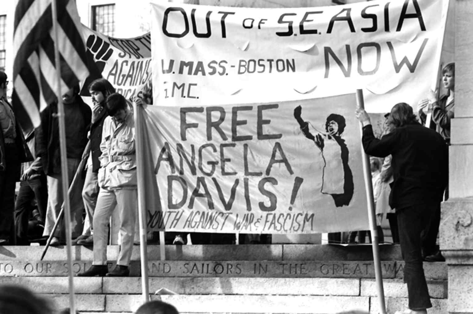
A 1970 anti–Vietnam War protest on Boston Common, echoing the park’s long history as a civic gathering ground.Photo: Nick DeWolf, Wikimedia Commons, CC BY-SA 3.0. Cropped & resized. The shape of the place changed too. By eighteen thirty-six, Boston enclosed the Common with an ornamental iron fence, helping turn rough-use land into a true public park. That same year, after long resistance from Boston’s Black community, the city finally lifted the rule that kept Black and Indigenous people out. And over on the Charles Street side, what had been a nasty dumping ground finally got repaired in eighteen ninety-five when workers reused soil dug from the new Tremont Street subway, the first subway in the U-S.
What I love is how the Common still refuses to be just one thing. It’s open and unstructured, made for gathering, unlike the more polished Public Garden next door. And if you want a quick visual of how the city grew up around this edge, check out the before-and-after image with Park Street Church holding its ground while the skyline swells behind it.
The Common is free, and it’s generally open from six in the morning to eleven thirty at night.
Boston Common feels like Boston in its rawest form: public, messy, brave, and wide open.
Take your time here... and when you’re ready, we can ease over to the Public Garden.
A broad aerial view of Boston Common, showing the park’s huge open green space in downtown Boston.Photo: Jared C. Benedict, Wikimedia Commons, CC BY-SA 3.0. Cropped & resized. 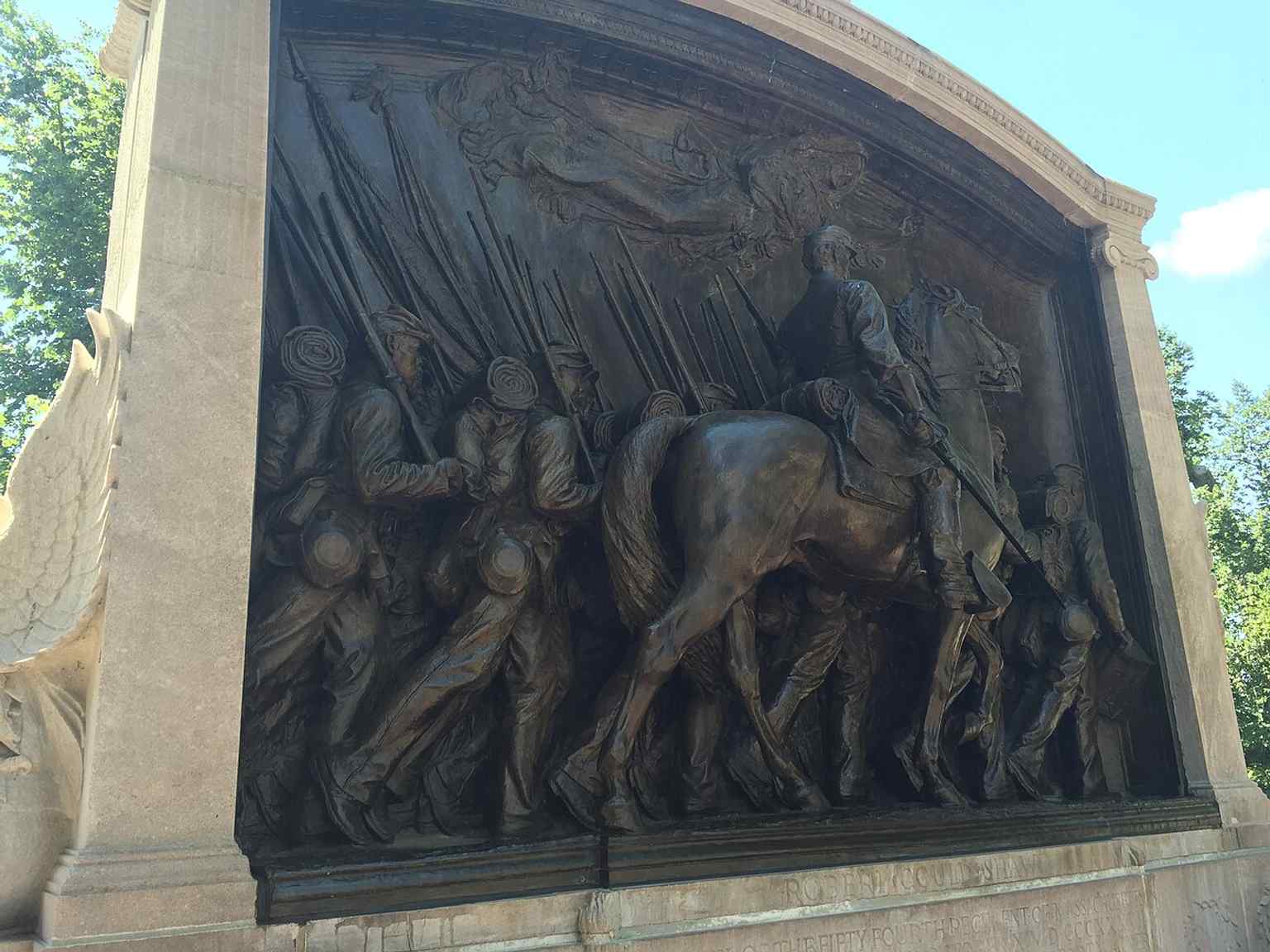
The Robert Gould Shaw Memorial at the northeast corner of the Common, honoring the 54th Massachusetts Volunteer Infantry.Photo: j_m_d_imagery, Wikimedia Commons, CC BY-SA 4.0. Cropped & resized. 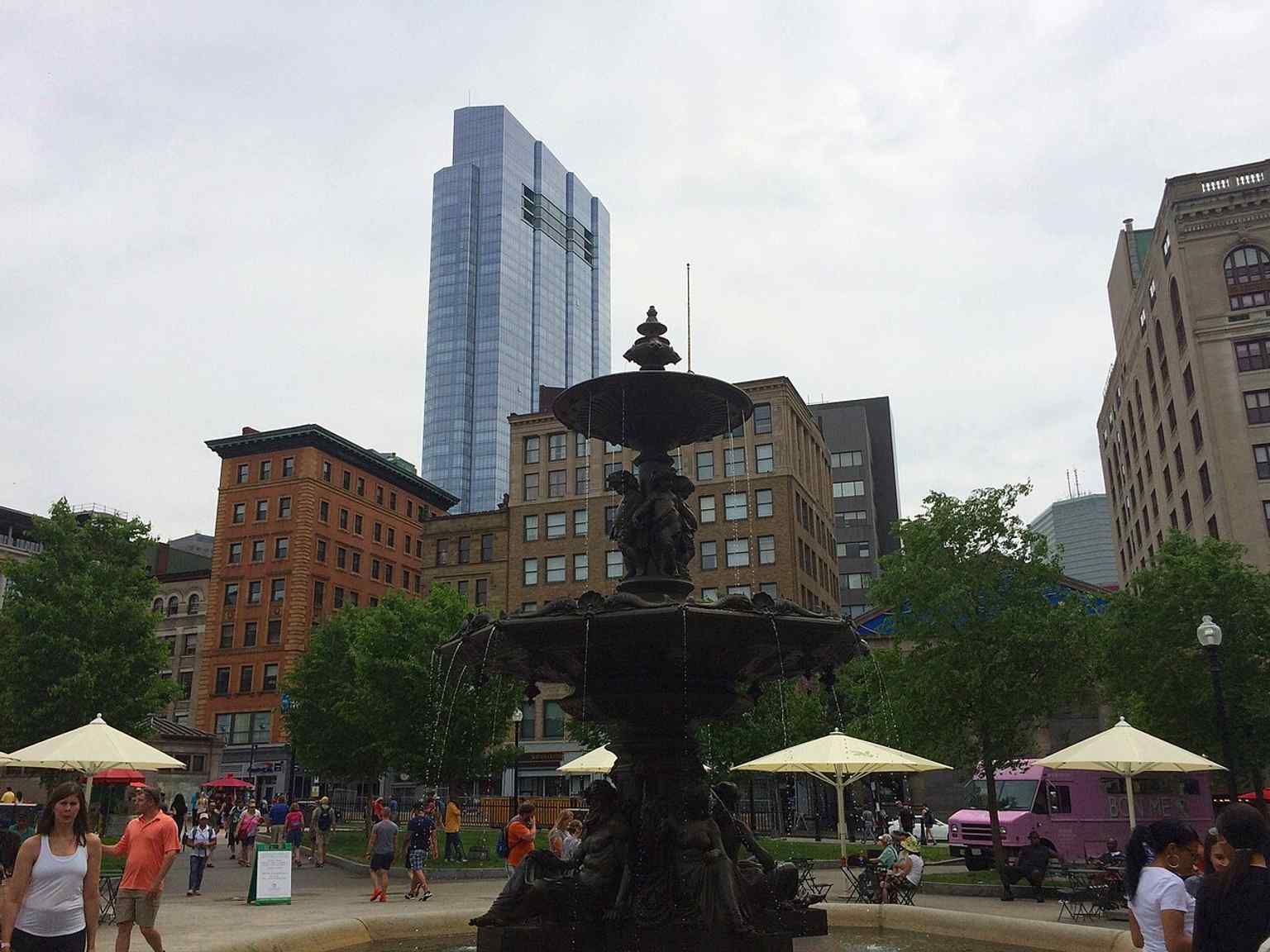
Brewer Fountain near Park and Tremont Streets, a landmark tied to the park’s civic center and subway entrance area.Photo: Andre Carrotflower, Wikimedia Commons, CC BY-SA 4.0. Cropped & resized. Look for the black wrought-iron fence, the broad oval pond, and the slim footbridge curving across the water like a little iron sketch. The wild thing is this garden started as…Read moreShow less
Open dedicated page →
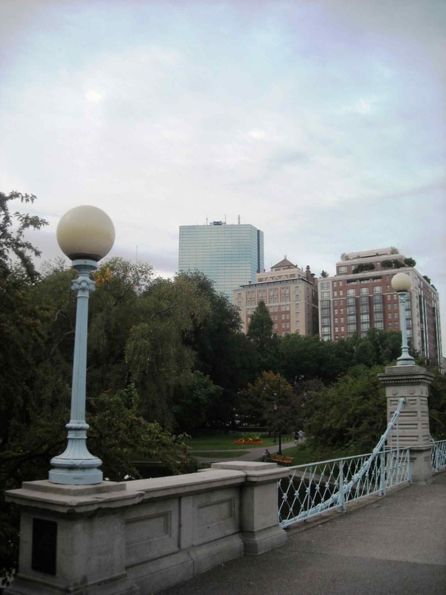
Boston Public GardenPhoto: Gaby Azeem, Wikimedia Commons, CC0. Cropped & resized. Look for the black wrought-iron fence, the broad oval pond, and the slim footbridge curving across the water like a little iron sketch.
The wild thing is this garden started as no garden at all. It began as Back Bay mudflats, a salty marshy edge of Boston where ropemakers set up a ropewalk after a fire pushed them out of a more crowded part of town. In seventeen ninety-four, the town let them use this land on one condition: build a seawall and start filling it. So Boston did something very Boston here... it argued with nature and then redesigned it.
A lot of that fill came from Mount Vernon, a hill on Beacon Hill that no longer exists because people literally carted it away. First they used handcarts. Then, by eighteen oh four, they built a gravity railroad, basically a track that let earth roll downhill into the marsh. A whole hill vanished so this calm patch of green could appear.
In eighteen twenty-four, the city bought the land back for fifty thousand dollars, well over a million in today’s money. One year later, voters rejected a plan to turn it into a graveyard. Then Horace Gray pushed for something bolder, and in eighteen thirty-seven Boston claimed this as the first public botanical garden in America.
If you want a quick peek behind the curtain, check the image on your screen; that old map shows how unfinished and improbable this place once looked.
The garden you see now took shape after an eighteen fifty-six political truce called the Tripartite Indenture. That agreement protected this land from private housing, and soon Alderman Crane’s plan moved forward. The pond came first in eighteen fifty-nine. The fence went up in eighteen sixty-two. George F. Meacham shaped the overall design, and James Slade with city forester John Galvin laid out the paths and flower beds. The style is called an English landscape garden, which means it tries to feel natural and loose even though every curve is carefully planned.
That’s why the place feels different from Boston Common. The Common is open and democratic, a big shared room. The Public Garden is more like a composed sentence. The paths bend. Trees frame views. Formal plantings sit inside a landscape pretending to be effortless.
The pond, though, had a rough start. Caretakers fed it with salt water, sewer water, and fresh water from Frog Pond, and the result was slime and a smell nobody wanted to linger around. So the city began draining and cleaning it every year. Even now, this four-acre pond is shallow, only about three feet at its deepest.
And that little bridge out there? Take a look at the app image if you want the classic angle. It opened in eighteen sixty-seven as the world’s shortest functioning suspension bridge, though the old suspension parts are decorative now. Nearby, the Swan Boats have circled the pond since eighteen seventy-seven, powered by a guide pedaling from inside the swan. Even the romance here has practical machinery hidden underneath.
The lagoon footbridge spans the pond, echoing the garden’s signature 1867 suspension bridge design.Photo: Elisa.rolle, Wikimedia Commons, CC BY-SA 3.0. Cropped & resized. That may be the real Boston trick. This garden looks gentle, but it took landfill, lawsuits, engineering, gardeners, donors, and generations of caretakers to make gentleness hold. For a city that often tells its story through speeches and battles, this place tells it through curves, water, and the stubborn decision to save room for beauty.
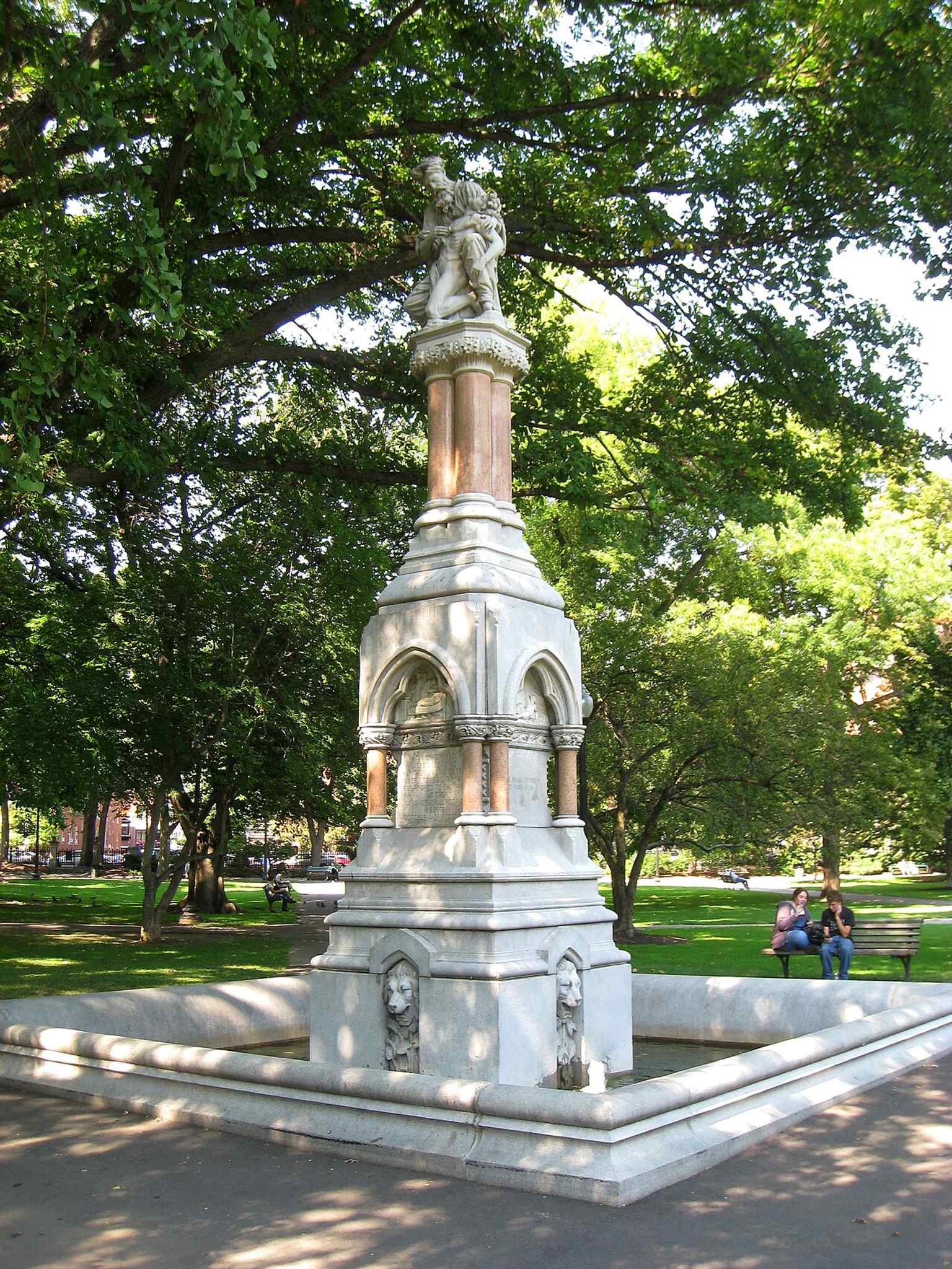
The Ether Monument honors the first public use of ether as an anesthetic and is the garden’s oldest monument.Photo: John Quincy Adams Ward (1830-1910); I took this photograph., Wikimedia Commons, Public domain. Cropped & resized. 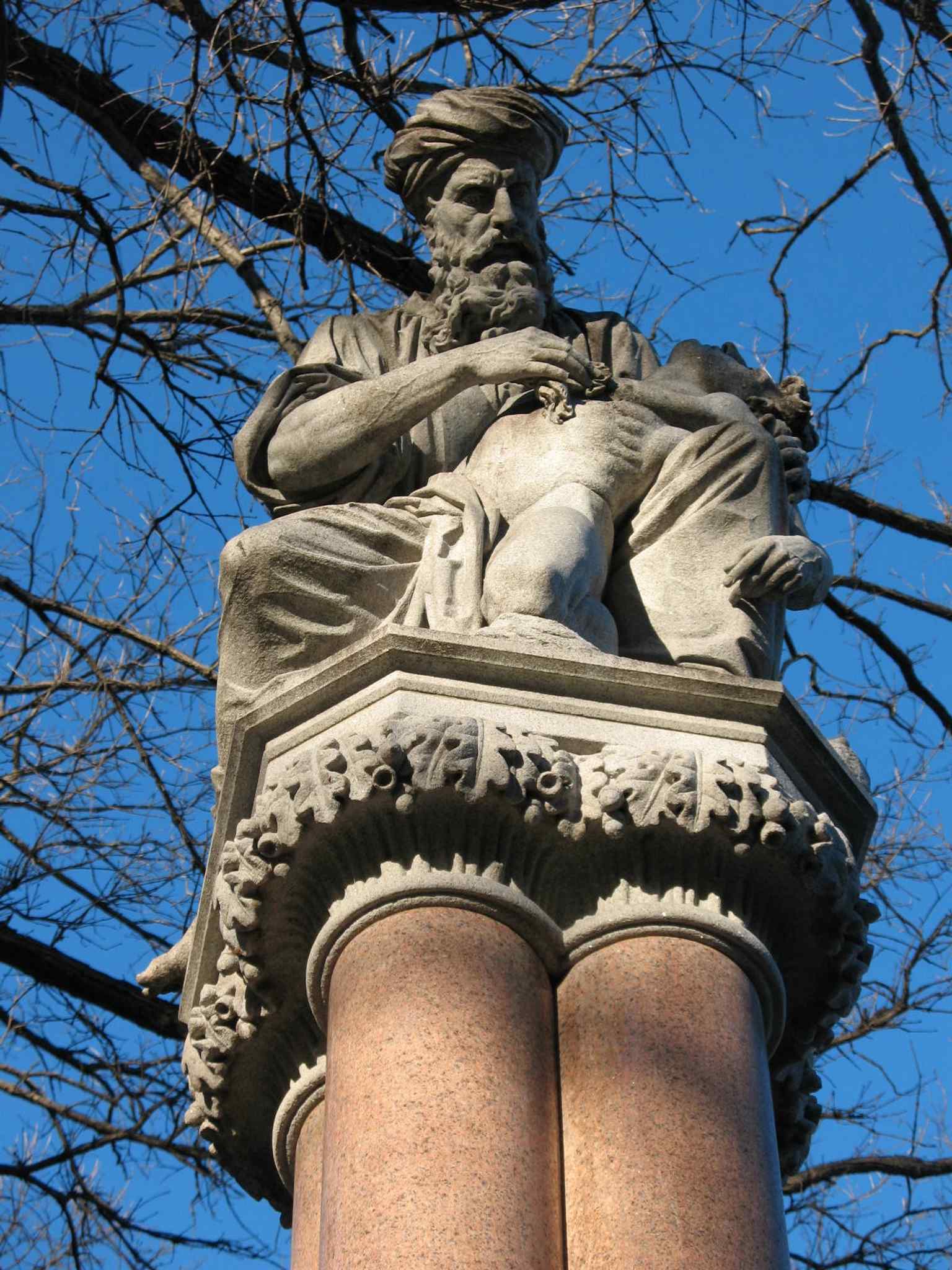
Close view of the Ether Monument’s Good Samaritan relief, one of the Public Garden’s most important 19th-century sculptures.Photo: Celerity26, Wikimedia Commons, CC BY-SA 3.0. Cropped & resized. 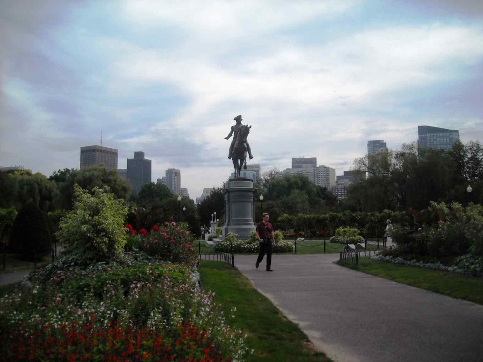
George Washington on horseback stands at the Arlington Street entrance, the garden’s best-known statue and a dominant western landmark.Photo: Elisa.rolle, Wikimedia Commons, CC BY-SA 3.0. Cropped & resized. 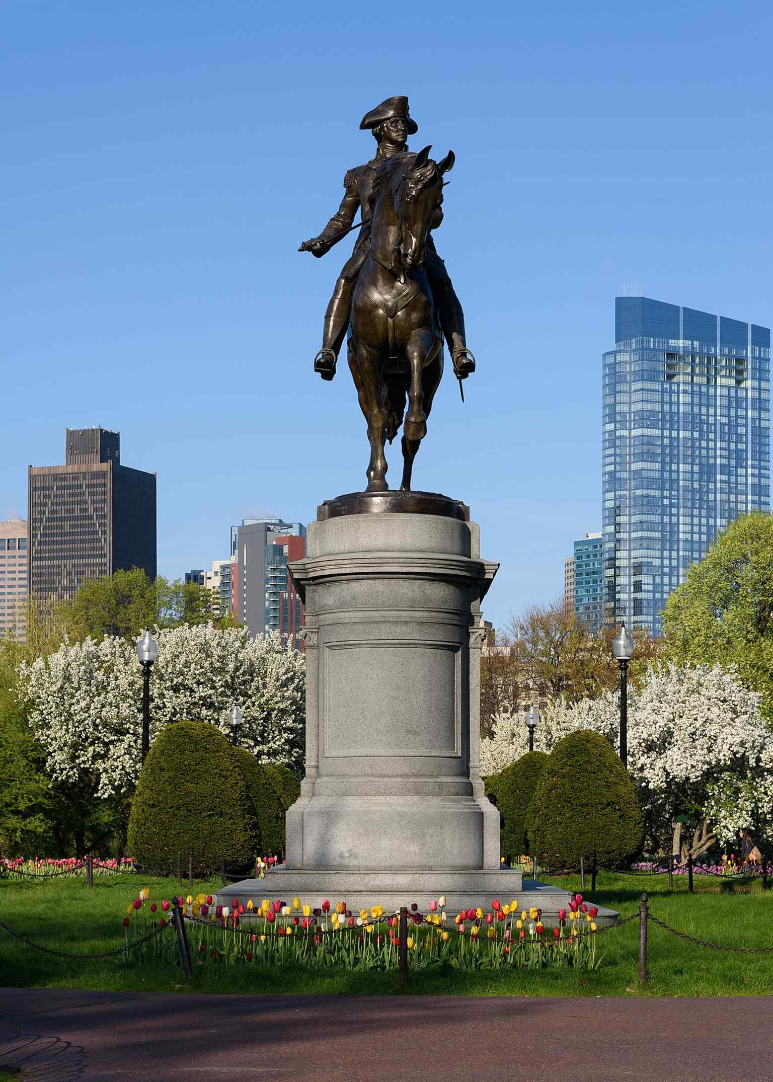
A modern view of the George Washington statue, showing how it anchors the Public Garden’s formal western entrance.Photo: King of Hearts, Wikimedia Commons, CC BY-SA 4.0. Cropped & resized. 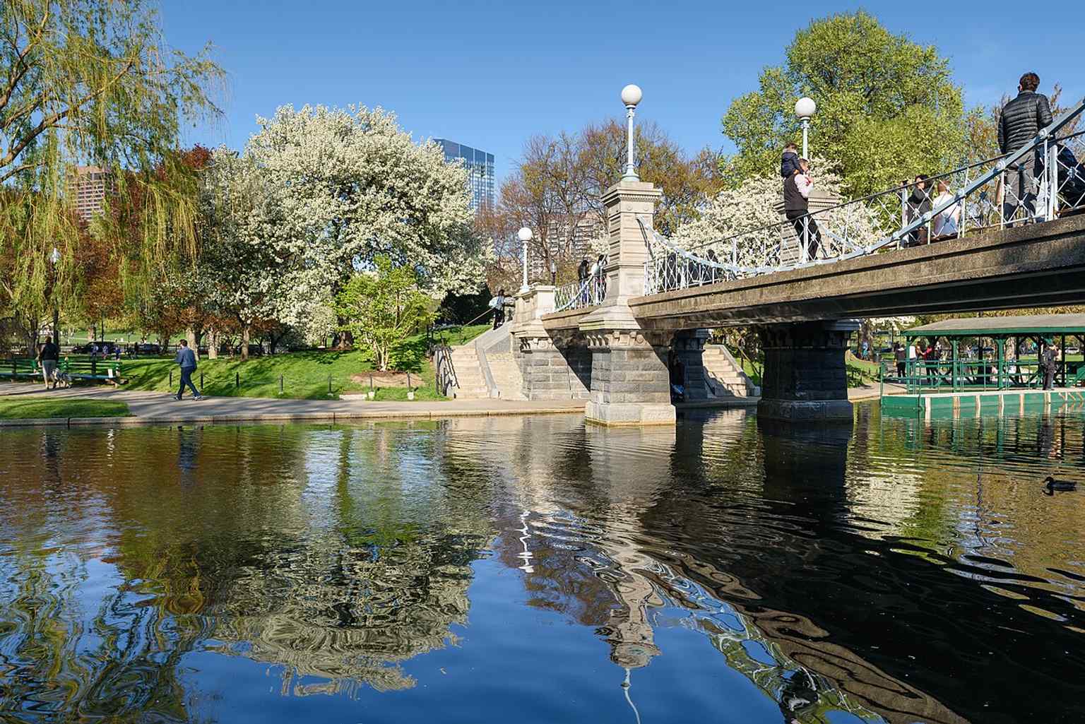
A scenic view of the pond and footbridge captures the garden’s winding paths and English landscape-garden style.Photo: King of Hearts, Wikimedia Commons, CC BY-SA 4.0. Cropped & resized.


Frequently asked questions
How do I start the tour?
After purchase, download the AudaTours app and enter your redemption code. The tour will be ready to start immediately - just tap play and follow the GPS-guided route.
Do I need internet during the tour?
No! Download the tour before you start and enjoy it fully offline. Only the chat feature requires internet. We recommend downloading on WiFi to save mobile data.
Is this a guided group tour?
No - this is a self-guided audio tour. You explore independently at your own pace, with audio narration playing through your phone. No tour guide, no group, no schedule.
How long does the tour take?
Most tours take 60–90 minutes to complete, but you control the pace entirely. Pause, skip stops, or take breaks whenever you want.
What if I can't finish the tour today?
No problem! Tours have lifetime access. Pause and resume whenever you like - tomorrow, next week, or next year. Your progress is saved.
What languages are available?
All tours are available in 50+ languages. Select your preferred language when redeeming your code. Note: language cannot be changed after tour generation.
Where do I access the tour after purchase?
Download the free AudaTours app from the App Store or Google Play. Enter your redemption code (sent via email) and the tour will appear in your library, ready to download and start.
If you don't enjoy the tour, we'll refund your purchase. Contact us at [email protected]
Checkout securely with 


%20julesvernex2.jpg)
%2C%20Faneuil%20Hall%2C%20Boston.jpg)
%20-%20%2220th%20Century%22.jpg)
.jpg)
%20-%20%22City%20of%20Perspectives%2C%20No.%201%22.jpg)