AudaTours logoAudaTours

Stop 5 of 17

Government Center

headphones 03:41 Buy tour to unlock all 19 tracks
Government Center
Government Center station
Government Center stationPhoto: Pi.1415926535, Wikimedia Commons, CC BY-SA 3.0. Cropped & resized.

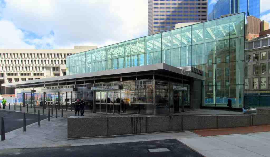
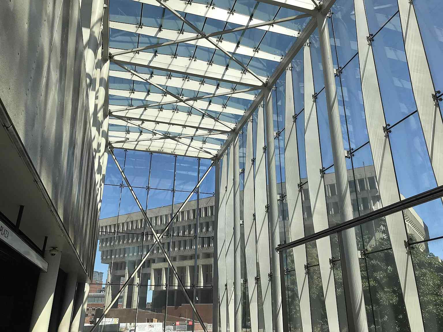
On your left, Government Center station appears as a steel-and-glass headhouse, all sharp angles and transparent walls, with escalators dropping through the middle like a bright cut in the plaza.

This station is Boston transit wearing its whole weird biography out in public. Today, people switch here between the Green Line and the Blue Line, but the story starts in eighteen ninety-eight, when the Green Line level opened as Scollay Square station in the Tremont Street Subway. That makes it the third-oldest subway station still operating in the Massachusetts Bay Transportation Authority, the M-B-T-A system, and one of its oldest major hubs.

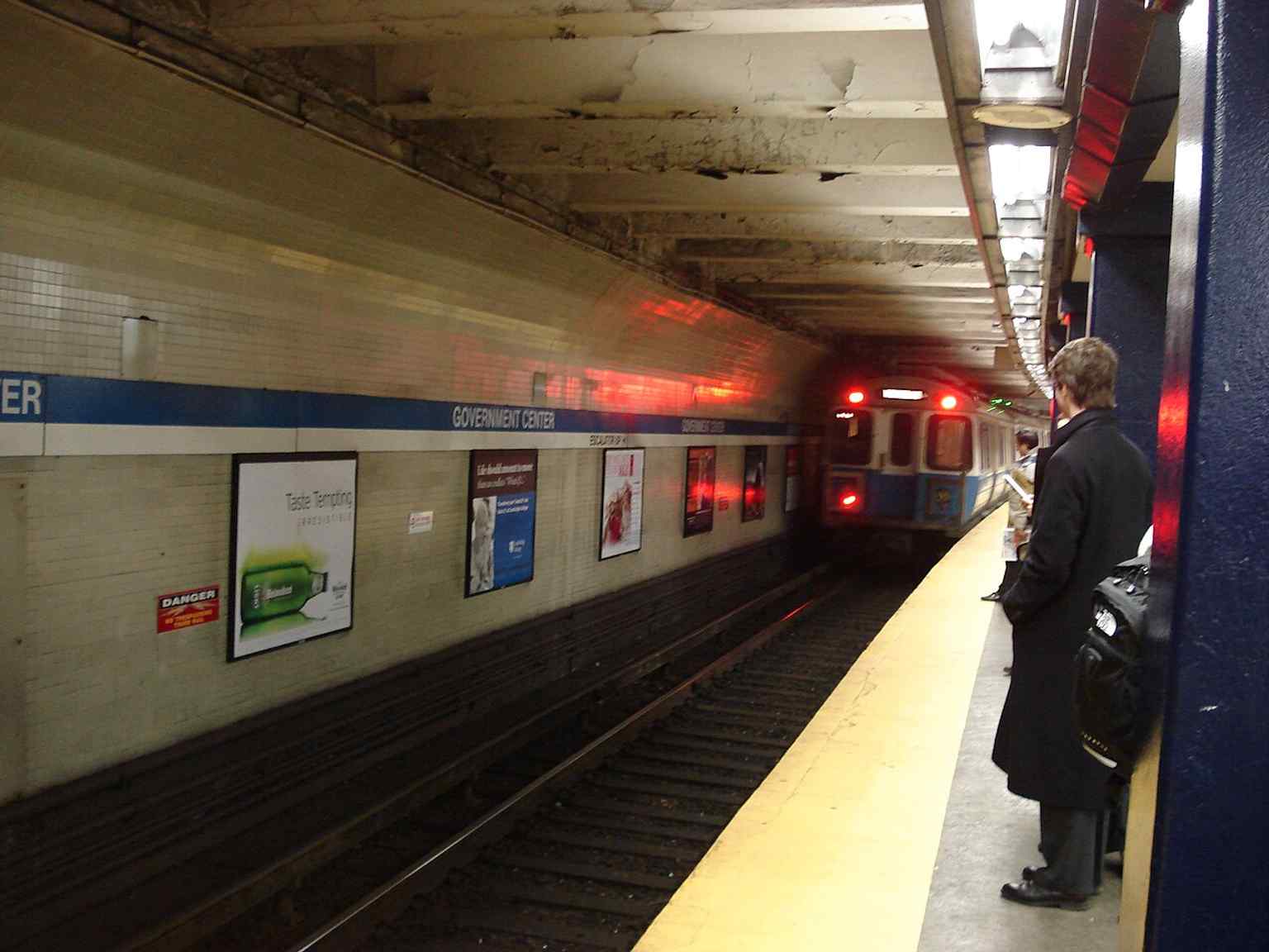
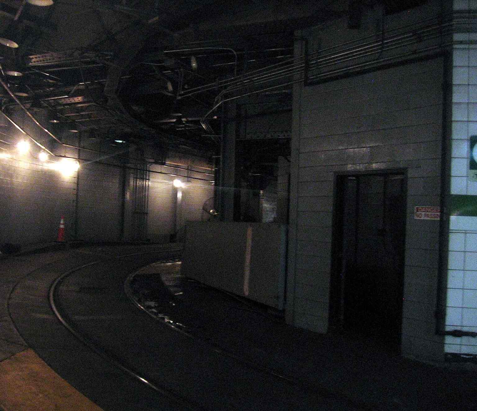
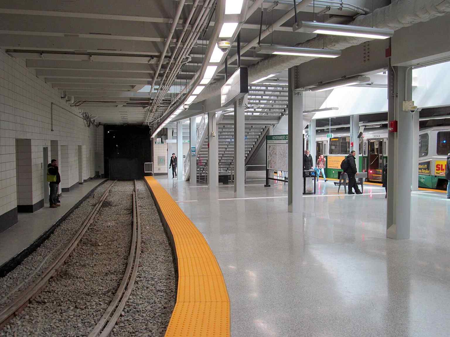
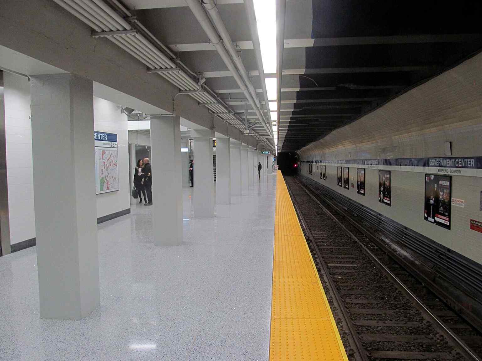
Back then, Scollay Square worked like a knot in a shoelace: horsecars, then streetcars, then elevated trains all tugged through the same spot. The original station had a wonderfully odd setup, with a three-sided platform and something called the Brattle Loop, a curved turnaround track that let streetcars swing in, unload, and head back out without reversing. If you want a peek at that surviving curl of track, there’s a detail image in the app.

The Brattle Loop track, a reminder of the station’s streetcar heritage and the old turning loop used by Green Line service.
The Brattle Loop track, a reminder of the station’s streetcar heritage and the old turning loop used by Green Line service.Photo: Pi.1415926535, Wikimedia Commons, CC BY-SA 3.0. Cropped & resized.

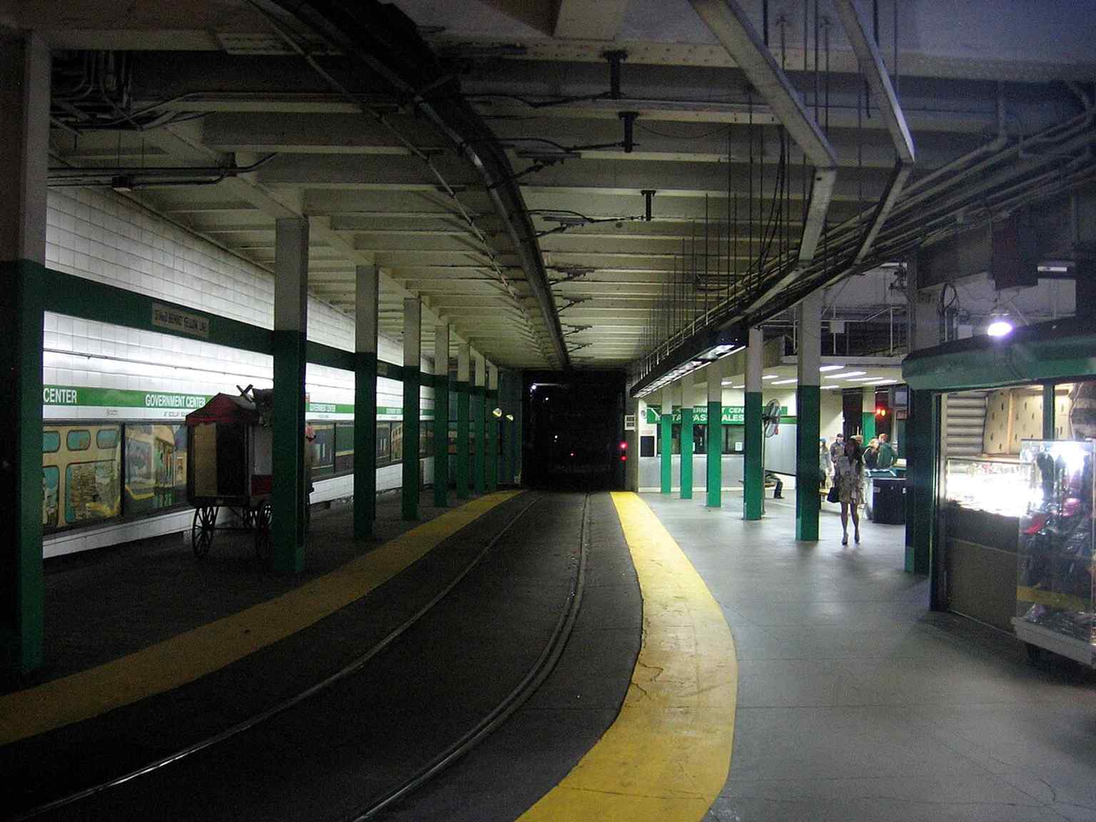
The station kept changing because Boston kept rearranging the city above it. In December of nineteen oh four, the East Boston Tunnel opened next door at Court Street and connected into this station. That first terminal turned out to be cramped and awkward. In nineteen oh six, a conductor was crushed between two streetcars there while readying his trolley pole for the return trip, and the station’s design flaws became impossible to ignore. So in March of nineteen sixteen, officials opened “Scollay Under,” a lower level linked to the older station. A few years later, in nineteen twenty-four, crews converted that tunnel from streetcars to rapid transit trains with high platforms and third-rail power... basically, the station switched species.

Then came the big rewrite. In the early nineteen sixties, Boston demolished old Scollay Square to create City Hall Plaza. The station got rebuilt, renamed Government Center, and fitted with a low brick entrance that even M-B-T-A managers admitted looked like a bunker, or maybe a cave. Critics had been roasting this station’s entrances for decades anyway; one earlier headhouse, meaning the little entrance building above the stairs, got compared to an enlarged soda fountain.

If you want a quick visual jolt, the old entrance photo in the app makes the contrast obvious.

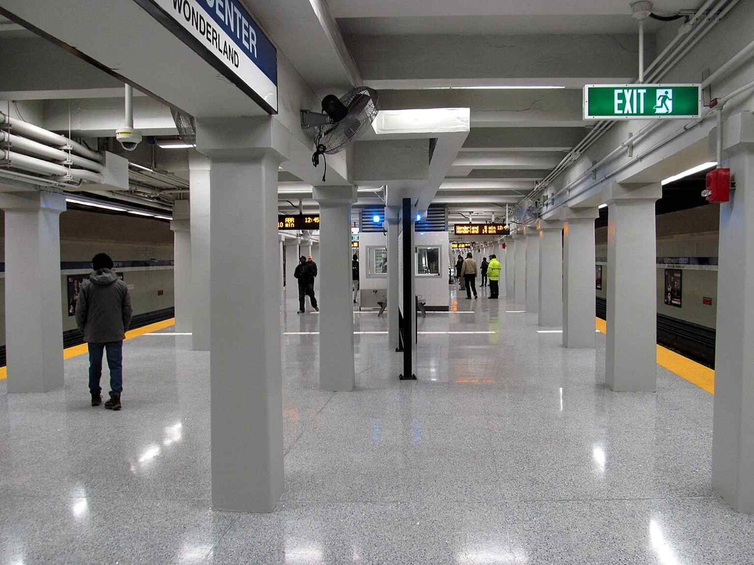
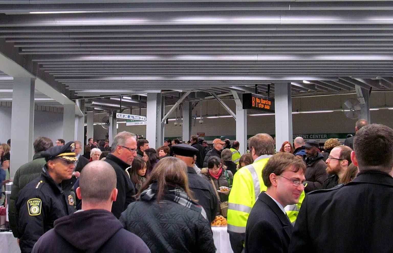
The version in front of you arrived after a full shutdown from March of two thousand fourteen to March twenty-first of two thousand sixteen. The rebuild added elevators, escalators, wider fare areas, better lighting, new electrical systems, and real accessibility at last. During demolition, workers uncovered old mosaic signs reading “Scollay Under” and “Scollay,” plus an original faregate, a ticket booth, and ceiling arches. Even the station’s old layers refused to stay buried. The nineteen seventies murals along the Brattle Loop couldn’t return because painted plywood no longer met fire code, so the renovation carried the past forward in other ways.

So this glass entrance is more than a subway portal. It’s Boston finally giving one of its oldest stations a face that feels open instead of defensive.

Take a moment with that transformation. When you’re ready, we can head along to the next stop.

The new glass headhouse rising from City Hall Plaza — the 2016 rebuild replaced the old bunker-like entrance with this lighter, fully accessible entrance.
The new glass headhouse rising from City Hall Plaza — the 2016 rebuild replaced the old bunker-like entrance with this lighter, fully accessible entrance.Photo: The Boston Railfan, Wikimedia Commons, CC BY-SA 4.0. Cropped & resized.
City Hall Plaza and the Government Center entrance together show how the station sits in the heart of Boston’s civic center, built over the former Scollay Square area.
City Hall Plaza and the Government Center entrance together show how the station sits in the heart of Boston’s civic center, built over the former Scollay Square area.Photo: M2545, Wikimedia Commons, Public domain. Cropped & resized.
A Blue Line train at the station before the renovation — this is one of the MBTA’s key transfer points between the Blue and Green Lines.
A Blue Line train at the station before the renovation — this is one of the MBTA’s key transfer points between the Blue and Green Lines.Photo: Palffy at English Wikipedia, Wikimedia Commons, Public domain. Cropped & resized.
Looking across the Brattle Loop from the platform — the loop survived long after streetcar use ended and was later revived for temporary service and storage.
Looking across the Brattle Loop from the platform — the loop survived long after streetcar use ended and was later revived for temporary service and storage.Photo: Pi.1415926535, Wikimedia Commons, CC BY-SA 3.0. Cropped & resized.
The Blue Line platform on reopening day in March 2016, when Government Center returned as a fully accessible station after two years of construction.
The Blue Line platform on reopening day in March 2016, when Government Center returned as a fully accessible station after two years of construction.Photo: Pi.1415926535, Wikimedia Commons, CC BY-SA 3.0. Cropped & resized.
Crowds moving onto the Green Line level on reopening day, showing how important Government Center is as a downtown transfer station.
Crowds moving onto the Green Line level on reopening day, showing how important Government Center is as a downtown transfer station.Photo: Pi.1415926535, Wikimedia Commons, CC BY-SA 3.0. Cropped & resized.
A train and the Brattle Loop on reopening day — the loop has been kept for occasional turnbacks and storage, not just everyday service.
A train and the Brattle Loop on reopening day — the loop has been kept for occasional turnbacks and storage, not just everyday service.Photo: Pi.1415926535, Wikimedia Commons, CC BY-SA 3.0. Cropped & resized.
The eastbound Blue Line track on reopening day, part of the rebuilt station that reopened in March 2016 with new lighting and finishes.
The eastbound Blue Line track on reopening day, part of the rebuilt station that reopened in March 2016 with new lighting and finishes.Photo: Pi.1415926535, Wikimedia Commons, CC BY-SA 3.0. Cropped & resized.
arrow_back Back to Boston Audio Tour: Boston's Landmark Odyssey
Loved by travellers

Thousands of tours started.
Plenty of opinions.

4.8 across the App Store and Google Play. Here's a few we keep coming back to.

starstarstarstarstar
This was a solid way to get to know Brighton without feeling like a tourist. The narration had depth and context, but didn't overdo it.
Christoph
Christoph
Brighton Tour
starstarstarstarstar
Started this tour with a croissant in one hand and zero expectations. The app just vibes with you, no pressure, just you, your headphones, and some cool stories.
download Get the app

Pop your headphones in.
Step outside.

Free to download. Tours in every city. Start in 60 seconds — no account, no card.

Download on the App StoreGet it on Google Play
starstarstarstarstar_half
4.8
AudaTours app icon
headphones
~ 4 min until your first tour starts
public
1,000+ cities worldwide
all_inclusive
AudaTours
Unlimited

Every tour. Every city. One subscription.

3101 tours2271 cities138 countries50+ languages