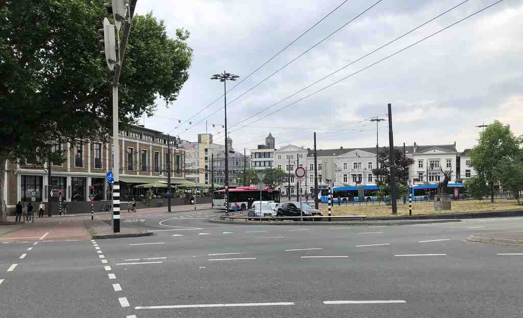
Willemsplein is a wide paved square with a long green median through the middle, broad lanes sweeping around it, and the dark brick railway edge marking its northern side.
This open spread of road and space may feel ordinary at first glance... but Arnhem made a very deliberate choice here. For centuries, this was a fortified town, tightened by walls, moats, and gates. Then the city decided to loosen that grip. Gates came down, stone defenses were broken up and thrown into the moat, and a threshold built to control entry slowly turned into a place that welcomed movement.
The vanished gate that matters most here was the Janspoort. It stood near this part of town and acted like a choke point for roads arriving from the north and west. In eighteen hundred eight, when King Louis Napoleon visited Arnhem, the city asked for permission to remove its decaying defenses and turn that hard military edge into something more graceful. He agreed, and the planner Johan David Zocher Senior drew up a redesign. Money interrupted the dream at first, but after the French period, Arnhem tried again. A royal decision in eighteen seventeen reopened the plan, and in eighteen twenty-five permission came to demolish the Janspoort itself.
That changed more than traffic. It changed the city’s self-image.
One man gives that change a human face: Hendrik Willem Fromberg. In eighteen fifty-three, with support from the municipality, he built seven imposing town houses on top of the old city wall remains nearby. He did it for status, of course, but also for stagecraft. Behind those elegant facades stood poor, ramshackle dwellings, and Fromberg helped hide that rough back edge from visitors arriving in Arnhem. The city was learning how to present itself differently.
Soon this place gained even more weight. A military barracks for the Gele Rijders, the Yellow Riders, stood here; later came schools, hotels, offices, trams, and constant flows of people. By the early twentieth century, Willemsplein had become one of Arnhem’s great switching points, where routes from the west and north converged and trams met every ten minutes until the war.
If you look at the image on your screen, you can see one of the square’s later masks: Willem Dudok’s former insurance headquarters on the north side, with its gently curved facade and glass cylindrical stair tower. That building arrived in nineteen thirty-eight, long after the old gate vanished, but it carries the same message: this edge of Arnhem no longer wanted to look defensive. It wanted to look confident, modern, and connected.
And still, the square kept changing. War shattered parts of Arnhem, trolleybuses replaced trams, tunnels and widened passages reshaped the flow again, and the city kept reworking this seam between center, station, and park. That pattern will follow us through Arnhem: nothing stays fixed for long, but memory keeps clinging to the ground.
From here, the city no longer feels enclosed. Once Arnhem changed its shape, its sacred buildings began answering that new shape too. In about three minutes, we’ll continue to the Koepelkerk, where faith and architecture learned to speak to a city opening outward.

