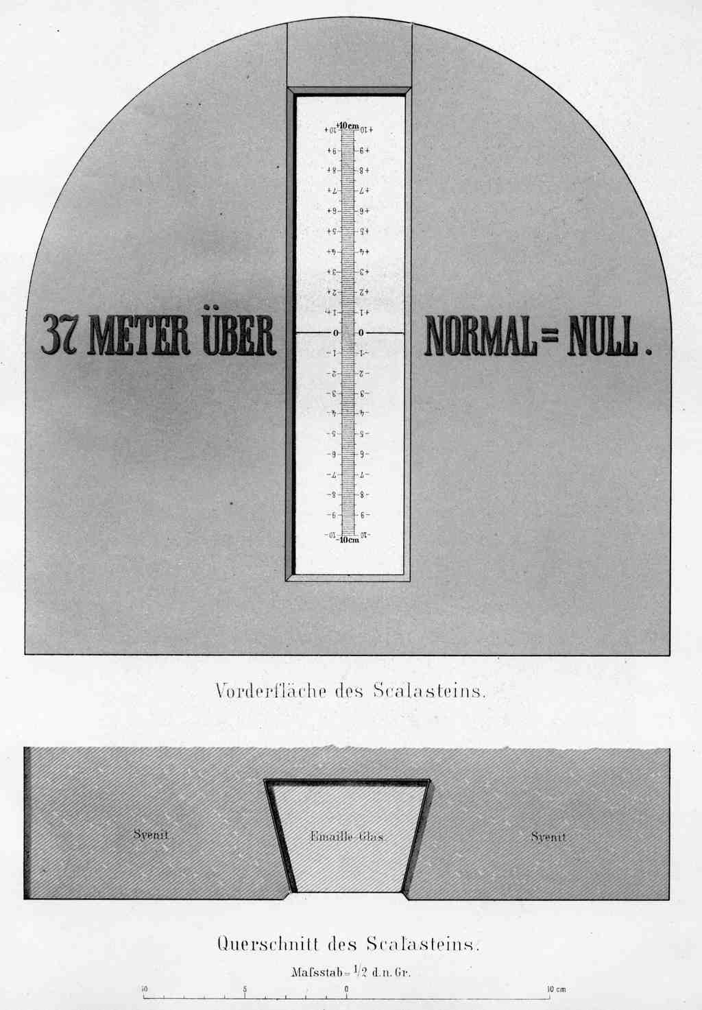
On your right, look for a small metal plaque, rectangular and set flush into the wall, marked with a sea-level reference that turns an ordinary street face into a piece of national infrastructure.
This is sea level, Berlin style: less crashing surf, more exact numbers. What you’re meeting here is the old German idea of Normalnull, the official zero for elevation from eighteen seventy-nine until nineteen ninety-two. In plain terms, it was the reference plane from which surveyors measured height. And in a city like Berlin, that matters more than it sounds. Measurement decides where streets drain, how rail lines align, how maps agree, and, quietly, what everyone accepts as solid and true.
The benchmark behind that system stood near the old Berlin Observatory. Surveyors transferred its height from the Amsterdam tide gauge by precision leveling, then fixed it on the twenty-second of March, eighteen seventy-eight. A year later, on Kaiser Wilhelm the First’s eighty-second birthday, officials formally presented it with ceremony. Because apparently even a datum needs a birthday party.
Wilhelm Foerster, the observatory director, pushed for this location because he wanted a central, geologically stable site, not a coastal gauge far from the capital. That choice tells you something important: standards are never just technical. They are political decisions wearing a lab coat.
And here’s the detail locals love because it makes the whole thing wonderfully strange: the famous zero was not actually here in any intuitive sense. Normalnull was defined through a theoretical point exactly thirty-seven meters below the Normalhöhenpunkt of eighteen seventy-nine. So Berlin’s “zero” was partly an invisible calculation... a shared fiction, just a very useful one.
If you glance at the image in the app, the Death Valley sign makes sea level look charmingly obvious. Berlin preferred a more Prussian approach: hide the concept inside mathematics and trust the paperwork.
The system did not stay still. When the New Berlin Observatory faced demolition in nineteen twelve, surveyors moved the key benchmark to Müncheberg-Hoppegarten, about forty-five kilometers east, and that replacement still belongs to Germany’s top leveling network. Then reunification forced another reset. In nineteen ninety-three, Germany replaced Normalnull with a new national height reference after merging eastern and western survey lines. In Berlin, the difference was only about one decimeter, but one decimeter is enough to make bureaucrats very emotional.
And the ground itself refused to cooperate. By two thousand, authorities reported yearly damage to several survey points, plus subsidence from mining. So crews remeasured the network with precision leveling, satellite positioning, and gravity observations. Even “fixed” ground, it turns out, has opinions.
Hold that thought as you look past the street and into the systems that let a whole city agree on up and down... then head on to the Berlin Observatory, about a two-minute walk away. If you want a pause first, this spot is moderately priced and usually stays open until around midnight, with later opening on weekends.