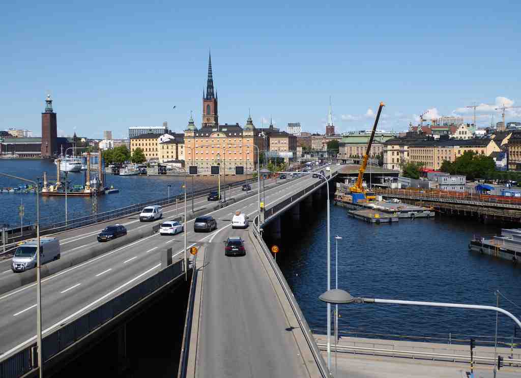
Directly in front of you is the Centralbron, a wide, modern bridge of smooth gray concrete and busy traffic stretching across the water, linking the city’s northern and southern districts-just follow the stream of cars to spot it.
Take a moment to watch the tide of vehicles and maybe even catch a whiff of engines; Centralbron is the pulsing artery of Stockholm! Now, let’s rewind time and discover how this mighty bridge came to be. Imagine yourself standing here almost a hundred years ago, when Stockholm was juggling ideas on how to cross this bustling spot. Back then, bridge proposals were swirling around like pigeons in a bread factory, with over twenty wild ideas scrapped before the plan of 1928 finally stuck.
But wait! As the city’s traffic blossomed and choked like a garden gone wild in the 1930s, planners built Västerbron to the west and a clover-shaped junction known as Slussen, which meant the pressure for a ‘central bridge’ faded a little. Instead, locals made do with a patchwork solution called Slingerbultsleden-the Dodge Route! This maze of makeshift streets and two temporary bridges created a zigzag path through Gamla stan, before ending rather ungraciously at Vasabron.
Fast forward to the 1950s. Stockholm needed something bigger and bolder. While the city’s brand-new metro was plotting its underground course, the clever Swedes built a quirky pontoon bridge as a temporary fix, bobbing atop the water, barely managing the daily grind of 20,000 cars. I can almost hear it creaking under the weight!
World War II slowed everything down, but by 1947, the city finally rolled up its sleeves and started building for real. The southern part of Centralbron began to take shape in 1950. It stretched across Söderström, with strong concrete pillars anchored deep into the earth. Six proud spans, sturdy as a Swedish moose, carried cars and bikes alike, while two more little spans stretched southward over Söder Mälarstrand, finally handing the road off to Söderledstunneln, the tunnel below. By 1959, they finished it-with a committee giving it an optimistic name, ‘Centralbron,’ and cheerfully assuming an ‘Eastern Bridge’ was just around the corner. Guess what? There still isn’t one, because the Royal City National Park to the east has put its big leafy foot down. So, Centralbron stays central!
But we’re not done yet! The city wanted the northern end to match up, but congestion at the notorious Tegelbacken intersection-known as the ‘Tegelbacken misery’-blocked the way. The only thing worse than Swedish winter is a Stockholm traffic jam, right? In 1967, they finally finished the northern bridge, connecting everything up in dramatic fashion. The sharp turn north carried commuters over thundering railway lines and onto Klarastrandsleden, replacing a painful old level crossing that kept locals stewing in their cars every day.
Even so, not everyone was a fan. With so many road and rail tracks-seven trains, six lanes-it’s a regular jungle gym for engineers and a jarring sight for lovers of old town charm. Some people dream of hiding all these lanes away in a tunnel, but the price tag for such a magic trick would bring tears to any accountant’s eyes. A new rail tunnel, Citybanan, did arrive in 2017, easing some pressure, but cars and trains above still rule the scene.
So, as you stand here, close your eyes and picture the roar of engines, the groan of old pontoon bridges, and the shuffle of history beneath your feet. Centralbron isn't just a route-it's a living memory of Stockholm’s endless battle between old elegance and modern motion. Now, which way to the next adventure?
Wondering about the background, the southern bridge or the the northern bridge? Feel free to discuss it further in the chat section below.